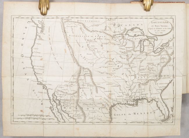
Subject: United States
Period: 1802 (published)
Publication:
Color: Black & White
Size:
5 x 8 inches
12.7 x 20.3 cm
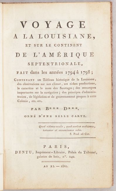
This uncommon French map was issued one year prior to the Louisiana Purchase. It presents the young United States extending to the Mississippi River, a large Louisiana extending to the Rocky Mountains, and a vast unknown region in the West. The map shows limited place names and instead emphasizes river systems, Indian tribes, and mountains, including a spurious range crossing the Dakotas and Minnesota. Drawn by L. Collin. The map serves as the frontispiece to the 382-page volume describing a four-year journey in Louisiana from 1794-98. According to Streeter, the book title is misleading as "the text contains a rambling history of the French occupation of Louisiana." Rebound in stiff paper boards with gilt title on the spine.
References: Howes #B-243; Sabin #3979; Streeter #1571.
Condition: B+
The folding map has light offsetting, minor foxing, and a 2.75" binding tear at right that has been closed on verso with archival materials. Text is clean and bright. Modern binding is pristine.