Subject: Exploration & Surveys
Period: 1798 (published)
Publication:
Color: Black & White
Size:
11.1 x 17.2 inches
28.2 x 43.7 cm
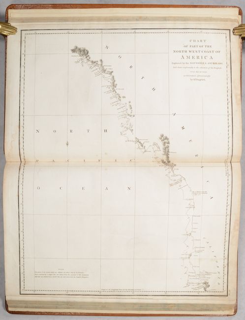
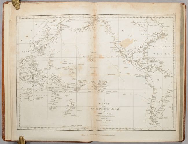
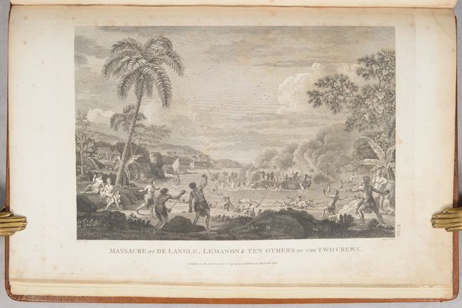
Jean-Francois de Galoup, Comte de La Perouse commanded a French scientific expedition to the Pacific in 1785-88. Recognized as one the foremost naval commanders and navigators in France, he was selected by King Louis XVI to complete Captain James Cook's exploration of the western Pacific. The British Admiralty provided scientific equipment to measure variations in magnetic compass readings and with the latest instruments for determining longitude. La Perouse explored the coasts of the Gulf of Alaska and northwestern North America in search of the fabled Northwest Passage. After leaving America his expedition continued on to Asia where he explored from Macao to Kamchatka and the Solomon Islands in the South Pacific. La Perouse was meticulous in sending copies of his extensive logs, maps and surveying information via other ships as well as overland. La Perouse's last contact was in the spring of 1788 with a British ship in Botany Bay, Australia. The expedition was never heard from again. Considered one of the greatest French voyages, the French Government decided to publish the story of the expedition when it became clear they had been lost. An English edition was published in London.
This is the first English edition atlas volume to La Perouse’s A Voyage Round the World…, one of the greatest of all French voyages. Jean-Francois de Galaup, Comte de La Perouse commanded a French scientific expedition to the Pacific in 1785-88. Recognized as one the foremost naval commanders and navigators in France, he was selected by King Louis XVI to complete Captain James Cook's exploration of the western Pacific. The British Admiralty provided scientific equipment to measure variations in magnetic compass readings and with the latest instruments for determining longitude. La Perouse explored the coasts of the Gulf of Alaska and northwestern North America in search of the fabled Northwest Passage. After leaving America his expedition continued on to Asia where he explored from Macao to Kamchatka and the Solomon Islands in the South Pacific. La Perouse was meticulous in sending copies of his extensive logs, maps and surveying information via other ships as well as overland. La Perouse's last contact was in the spring of 1788 with a British ship in Botany Bay, Australia. The expedition was never heard from again. The French Government decided to publish the story of the expedition when it became clear they had been lost.
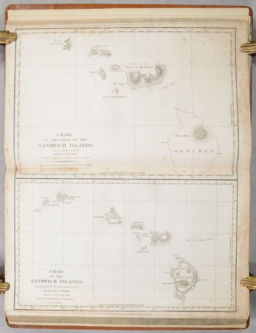
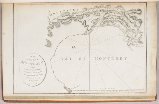
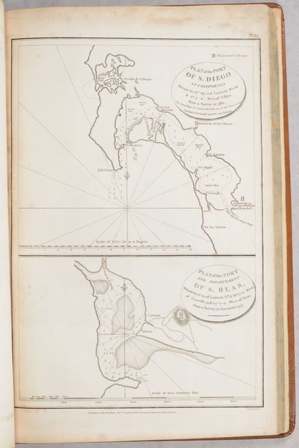
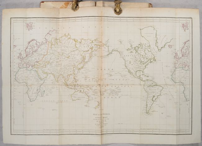
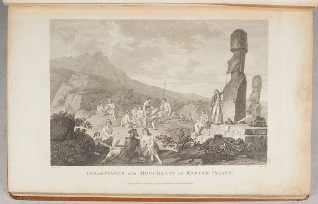
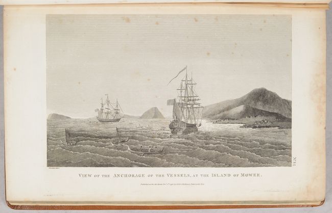
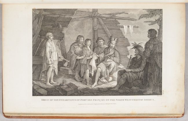
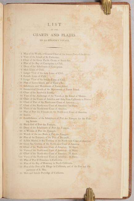
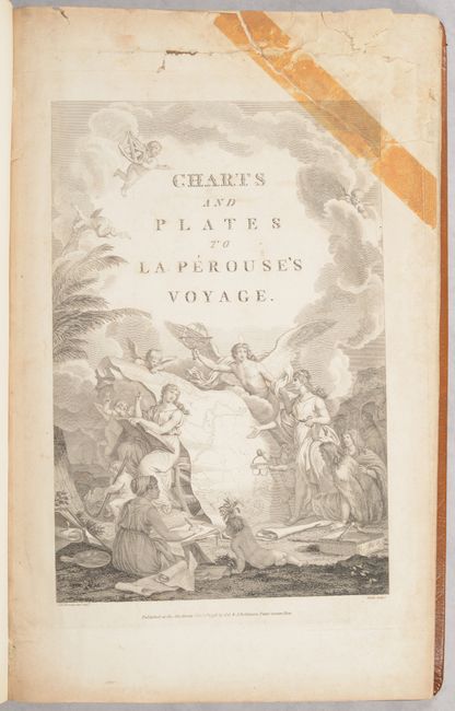
Some of the more interesting charts included are those of the Hawaiian islands and some of the earliest obtainable printed maps of San Francisco Bay, Monterey Bay and San Diego. The allegorical title page centers on a map of the world that shows the route of the expedition with classical muses, an angel, putti and Native Americans gathered around the map. Drawn by Jean-Michel Moreau le Jeune and engraved by Heath. Atlas with title page (no portrait), 31 charts, 36 (of 38) plates, and list of charts/plates. The missing plates are "Black-bird of Port des Francais" (#22) and "Views of the North-west Coast of America: 3d Sheet" (#32). Published by G.G. & J. Robinson in London. Rebound in full leather.
References: Phillips (Atlases) #693; Sabin #38962; cf. Shirley (BL Atlases) G.LPR-1a.
Condition: B
The maps and other engravings are good to very good with light to occasionally moderate foxing and a light dampstain almost entirely in the top margin throughout. The chart of Korea (#44) has a few pencil notations and a sheet of profile views (#30) has a long repaired tear. The title page has an old masking tape repair at top right and there a few other tears and chips in the upper margin. Modern binding is near fine.