Filtered by Category:United States(Show All Categories)
Showing results for:Auction 187
Catalog Archive
181 lots
Page 1 of 4
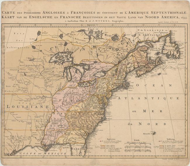
Auction 187, Lot 122
Subject: Colonial Eastern United States & Canada
Ottens, Reiner and Joshua
Carte des Possessions Angloises & Francoises du Continent de l'Amerique Septentrionale / Kaart van de Engelsche en Fransche Bezittingen in het Vaste Land van Noord America, 1755
Size: 22.4 x 16.3 inches (56.9 x 41.4 cm)
Estimate: $1,400 - $1,700
Dutch Version of an Important Map Showing Territorial Claims at the Outset of the French and Indian War
Sold for: $1,300
Closed on 4/27/2022
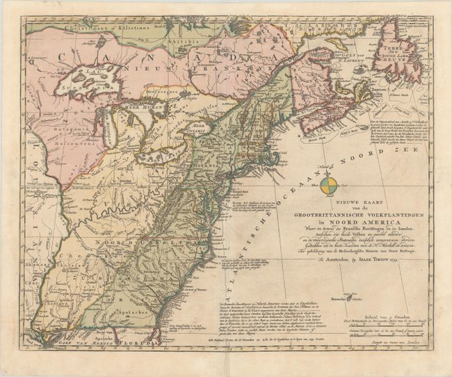
Auction 187, Lot 123
Subject: Colonial Eastern United States & Canada
Tirion, Isaac
Nieuwe Kaart van de Grootbrittannische Volkplantingen in Noord America waar in Tevens de Fransche Bezittingen en de Landen..., 1755
Size: 17.4 x 14.2 inches (44.2 x 36.1 cm)
Estimate: $550 - $700
Sold for: $275
Closed on 4/27/2022
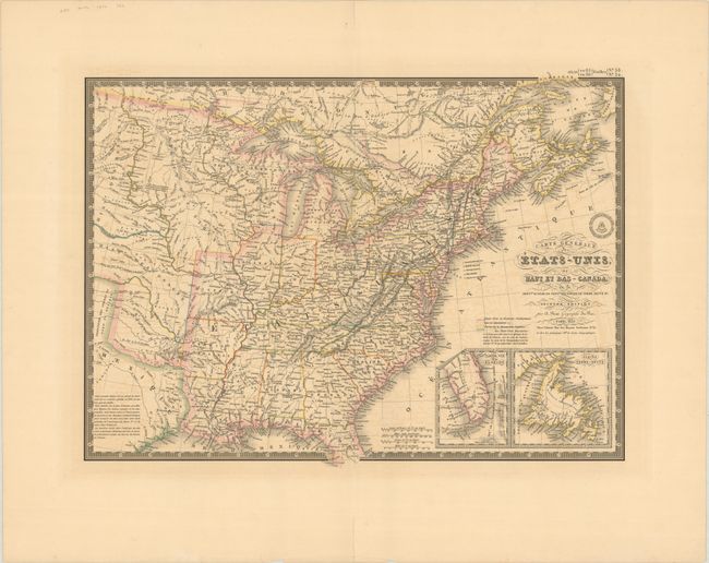
Auction 187, Lot 124
Subject: Eastern United States & Canada
Brue, Adrien Hubert
Carte Generale des Etats-Unis, du Haut et Bas-Canada, de la Nouvle. Ecosse du Nouvau Brunswick de Terre Neuve &a. , 1832
Size: 20.3 x 14.8 inches (51.6 x 37.6 cm)
Estimate: $180 - $220
Sold for: $200
Closed on 4/27/2022
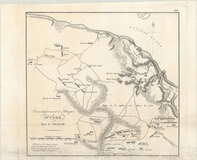
Auction 187, Lot 125
Subject: Eastern United States & Canada, Revolutionary War
Marshall, John
[Lot of 2] Investissement et Attaque d’York dans la Virginie [and] Theatre des Operations de l’Armee du Nord, et Desert que le General Arnold Traversa en Marchant Contre Quebec, 1807
Size: See Description
Estimate: $240 - $300
Sold for: $150
Closed on 4/27/2022
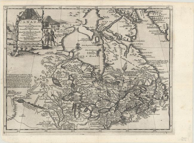
Auction 187, Lot 126
Subject: Colonial Northeastern United States & Canada
Aa, Pieter van der
Canada ou Nouvelle France, Suivant les Nouvelles Observations de Messrs. de l'Academie Royale des Sciences, Etc..., 1714
Size: 11.8 x 8.9 inches (30 x 22.6 cm)
Estimate: $475 - $600
Sold for: $375
Closed on 4/27/2022
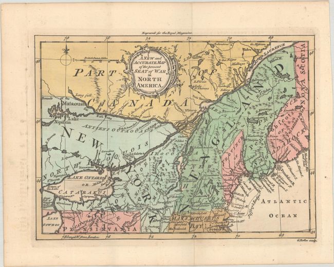
Auction 187, Lot 127
Subject: Colonial Northeastern United States & Canada
Rollos, George
A New and Accurate Map of the Present Seat of War in North America, 1759
Size: 8.8 x 6.4 inches (22.4 x 16.3 cm)
Estimate: $375 - $450
Sold for: $275
Closed on 4/27/2022
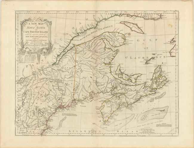
Auction 187, Lot 128
Subject: Colonial Northeastern United States & Canada
Jefferys/Sayer & Bennett
A New Map of Nova Scotia, and Cape Breton Island with the Adjacent Parts of New England and Canada, Composed from a Great Number of Actual Survey..., 1775
Size: 24.3 x 18.6 inches (61.7 x 47.2 cm)
Estimate: $475 - $600
Sold for: $350
Closed on 4/27/2022
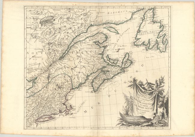
Auction 187, Lot 129
Subject: Colonial Northeastern United States & Canada
D'Anville/Santini
Partie Orientale du Canada, avec la Nouvelle Angleterre l'Acadie, et la Terre-Neuve, 1776
Size: 22.8 x 19.1 inches (57.9 x 48.5 cm)
Estimate: $500 - $650
Sold for: $325
Closed on 4/27/2022
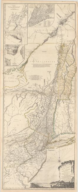
Auction 187, Lot 130
Subject: Colonial Northeastern United States & Quebec
Holland/Pownal
The Provinces of New York and New Jersey; with Part of Pensilvania, and the Province of Quebec, 1776
Size: 21.3 x 52.9 inches (54.1 x 134.4 cm)
Estimate: $4,000 - $4,750
Thomas Jefferys' Important Revolutionary War Period Map
Unsold
Closed on 4/27/2022
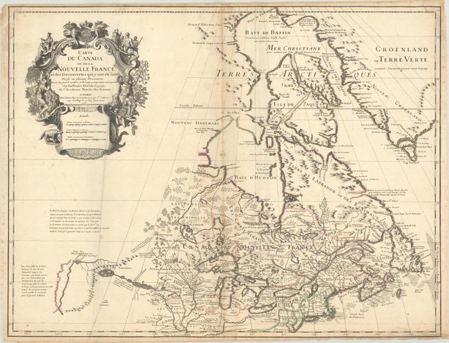
Auction 187, Lot 131
Subject: Colonial Northeastern United States & Canada, Great Lakes
Delisle, Guillaume
Carte du Canada ou de la Nouvelle France et des Decouvertes qui y ont ete Faites Dressee sur Plusieurs Observations et sur un Grand Nombre de Relations Imprimees ou Manuscrites, 1703
Size: 25.6 x 19.8 inches (65 x 50.3 cm)
Estimate: $3,000 - $3,750
Rare First State of Delisle's Seminal Map of Canada and the Great Lakes
Sold for: $4,750
Closed on 4/27/2022
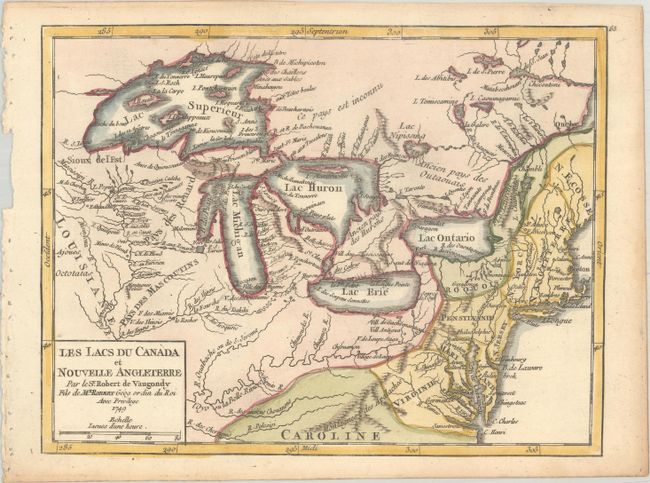
Auction 187, Lot 132
Subject: Colonial Northeastern United States & Canada, Great Lakes
Robert de Vaugondy, Didier
Les Lacs du Canada et Nouvelle Angleterre, 1749
Size: 8.5 x 6.5 inches (21.6 x 16.5 cm)
Estimate: $275 - $350
Sold for: $425
Closed on 4/27/2022
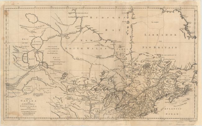
Auction 187, Lot 133
Subject: Colonial Northern United States & Canada, Great Lakes
Jefferys, Thomas
A Map of Canada and the North Part of Louisiana with the Adjacent Countrys, 1761
Size: 21.1 x 12.4 inches (53.6 x 31.5 cm)
Estimate: $400 - $475
Sold for: $400
Closed on 4/27/2022
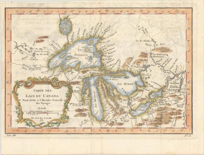
Auction 187, Lot 134
Subject: Colonial Central United States & Canada, Great Lakes
Bellin, Jacques Nicolas
Carte des Lacs du Canada pour Servir a l'Histoire Generale des Voyages, 1757
Size: 11.5 x 7.8 inches (29.2 x 19.8 cm)
Estimate: $375 - $450
Sold for: $350
Closed on 4/27/2022
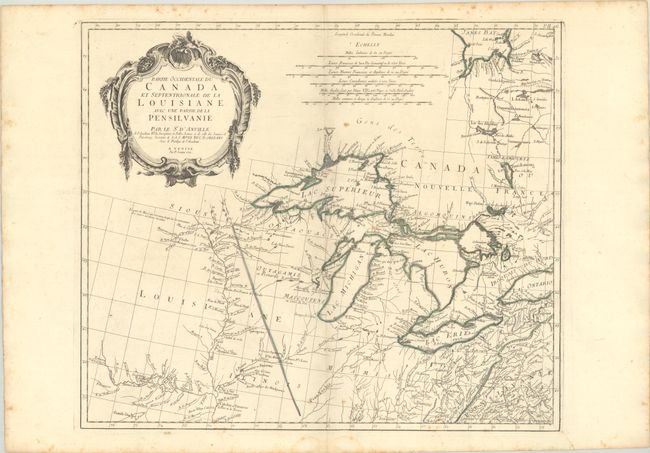
Auction 187, Lot 135
Subject: Colonial Central United States & Canada, Great Lakes
D'Anville/Santini
Partie Occidentale du Canada et Septentrionale de la Louisiane avec une Partie de la Pensilvanie, 1775
Size: 22.3 x 19 inches (56.6 x 48.3 cm)
Estimate: $900 - $1,100
Sold for: $575
Closed on 4/27/2022
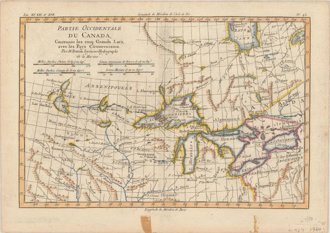
Auction 187, Lot 136
Subject: Colonial Central United States & Canada, Great Lakes
Bonne, Rigobert
Partie Occidentale du Canada, Contenant les Cinq Grands Lacs, avec les Pays Circonvoisins, 1780
Size: 12.5 x 8.3 inches (31.8 x 21.1 cm)
Estimate: $200 - $230
Sold for: $150
Closed on 4/27/2022
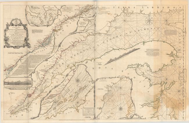
Auction 187, Lot 137
Subject: St. Lawrence River
Jefferys/Sayer
An Exact Chart of the River St. Laurence, from Fort Frontenac to the Island of Anticosti Shewing the Soundings, Rocks, Shoals &c with Views of the Lands and All Necessary Instructions for Navigating that River to Quebec..., 1771
Size: 37 x 23.6 inches (94 x 59.9 cm)
Estimate: $375 - $450
Sold for: $275
Closed on 4/27/2022
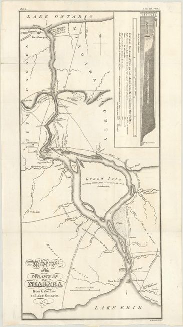
Auction 187, Lot 138
Subject: Niagara Falls
Map of the Straits of Niagara from Lake Erie to Lake Ontario, 1818
Size: 6.9 x 15 inches (17.5 x 38.1 cm)
Estimate: $275 - $350
Sold for: $180
Closed on 4/27/2022
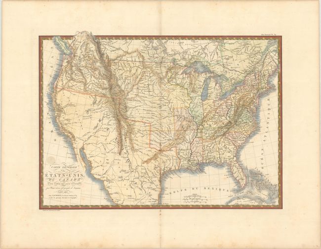
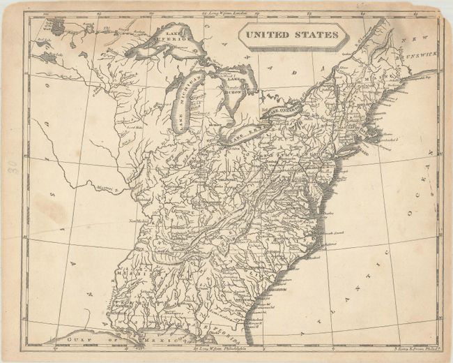
Auction 187, Lot 139
Subject: United States
Brue, Adrien Hubert
Carte Generale des Etats-Unis, du Canada et d'une Partie des Pays Adjacents, 1825
Size: 20.1 x 14.4 inches (51.1 x 36.6 cm)
Estimate: $350 - $425
Sold for: $350
Closed on 4/27/2022
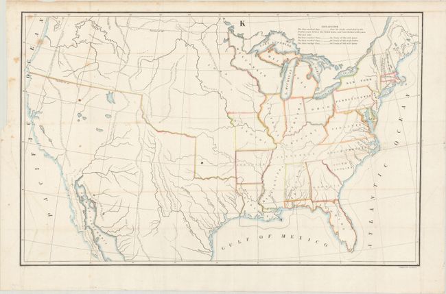
Auction 187, Lot 140
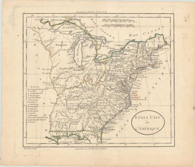
Subject: United States
U.S. Government
[Untitled - United States], 1843
Size: 21.4 x 13.6 inches (54.4 x 34.5 cm)
Estimate: $140 - $170
Sold for: $100
Closed on 4/27/2022
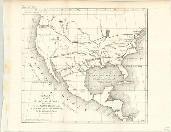
Auction 187, Lot 141
Subject: United States
U.S. Government
Mills' Map of the Several Routes Proposed to the Pacific Ocean from the Head Waters of the Missouri, to the Isthmus of Darien, 1848
Size: 9 x 8.2 inches (22.9 x 20.8 cm)
Estimate: $120 - $150
Sold for: $90
Closed on 4/27/2022
Auction 187, Lot 142
Subject: United States
Burr, David H.
Map of the United States Exhibiting the Several Collection Districts, 1854
Size: 49.3 x 31.4 inches (125.2 x 79.8 cm)
Estimate: $200 - $230
Sold for: $210
Closed on 4/27/2022
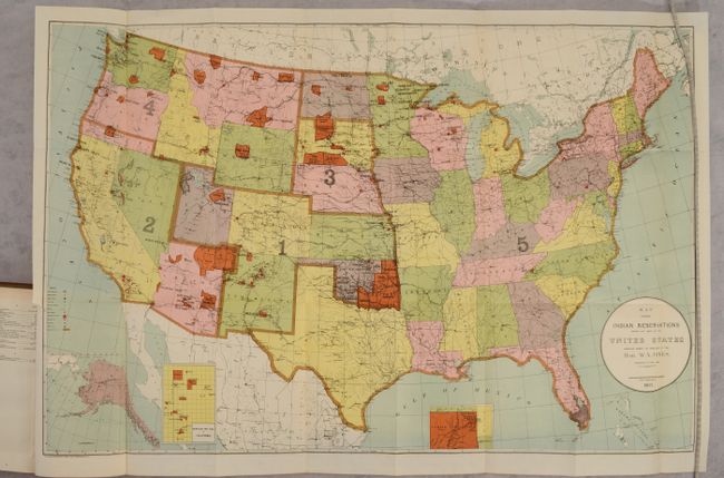
Auction 187, Lot 143
Subject: United States
U.S. Bureau of Indian Affairs
[Map in Report] Map Showing Indian Reservations Within the Limits of the United States... [in] Report of the Commissioner of Indian Affairs, 1903
Size: 33 x 21 inches (83.8 x 53.3 cm)
Estimate: $160 - $190
Sold for: $120
Closed on 4/27/2022
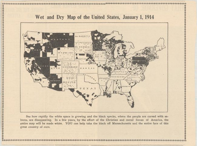
Auction 187, Lot 144
Subject: United States
Wet and Dry Map of the United States, January 1, 1914, 1914
Size: 8.9 x 6.8 inches (22.6 x 17.3 cm)
Estimate: $200 - $250
NO RESERVE
Sold for: $55
Closed on 4/27/2022
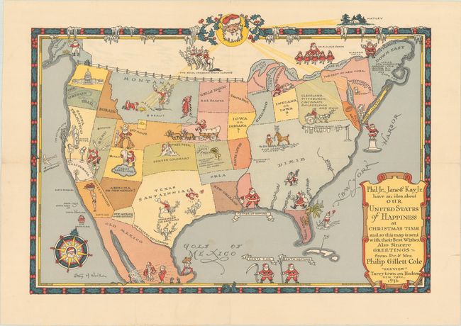
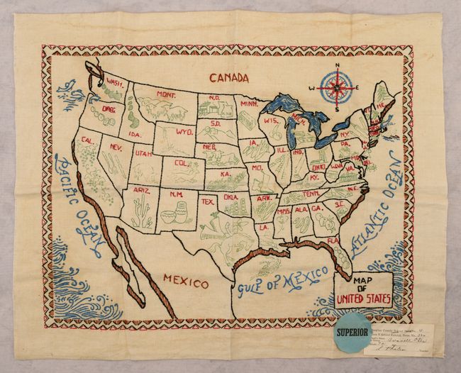
Auction 187, Lot 145
Subject: United States
Phil Jr., Jane & Kay Jr. Have an Idea About Our United States of Happiness at Christmas Time..., 1936
Size: 13.9 x 9.8 inches (35.3 x 24.9 cm)
Estimate: $600 - $800
Christmas Map Combining Santa and the American West, Commissioned by Philip Cole
Sold for: $475
Closed on 4/27/2022
Auction 187, Lot 146
Subject: United States
Map of United States, 1938-40
Size: 18.5 x 14 inches (47 x 35.6 cm)
Estimate: $160 - $190
Sold for: $70
Closed on 4/27/2022
Auction 187, Lot 147
Subject: United States, Atlases
Pageant of the States, 1939
Size: 11.5 x 9 inches (29.2 x 22.9 cm)
Estimate: $300 - $375
A Tribute to Democracy
Sold for: $350
Closed on 4/27/2022
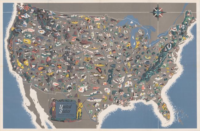
Auction 187, Lot 148
Subject: United States
Rand McNally & Co.
A Pictorial Map of the United States, 1944
Size: 36.8 x 24 inches (93.5 x 61 cm)
Estimate: $220 - $250
Sold for: $110
Closed on 4/27/2022
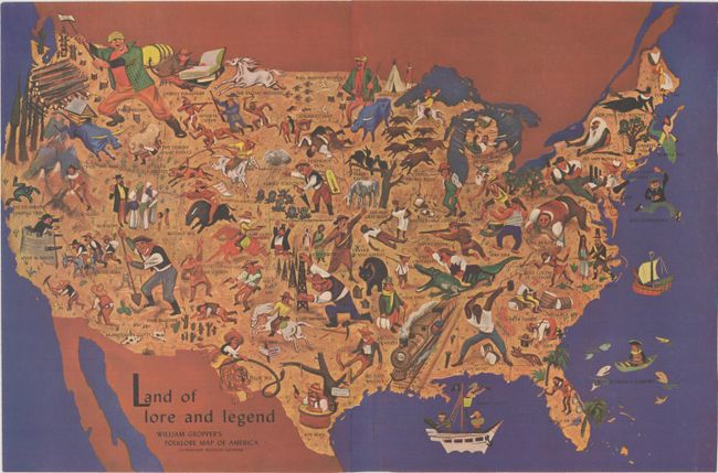
Auction 187, Lot 149
Subject: United States
Land of Lore and Legend - William Gropper's Folklore Map of America, 1946
Size: 20.6 x 13.7 inches (52.3 x 34.8 cm)
Estimate: $240 - $300
Sold for: $150
Closed on 4/27/2022
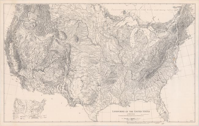
Auction 187, Lot 150
Subject: United States
Landforms of the United States, 1957
Size: 41 x 26 inches (104.1 x 66 cm)
Estimate: $100 - $130
NO RESERVE
Sold for: $210
Closed on 4/27/2022
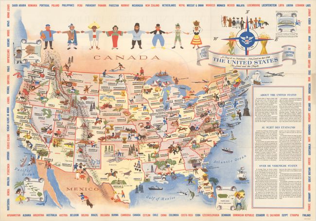
Auction 187, Lot 151
Subject: United States
The United States - The Land and the People, 1958
Size: 25.9 x 18.3 inches (65.8 x 46.5 cm)
Estimate: $160 - $190
Sold for: $150
Closed on 4/27/2022
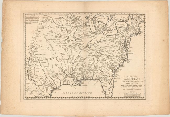
Auction 187, Lot 152
Subject: Colonial Eastern United States
Bellin, Jacques Nicolas
Carte de la Louisiane Cours du Mississipi et Pais Voisins Dediee a M. le Comte de Maurepas, Ministre et Secretaire d'Etat Commandeur des Ordres du Roy, 1744
Size: 21.8 x 15.5 inches (55.4 x 39.4 cm)
Estimate: $750 - $900
Sold for: $375
Closed on 4/27/2022
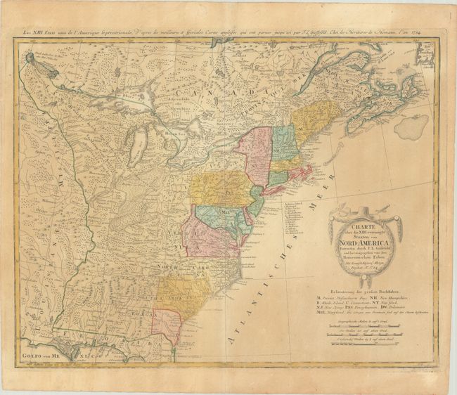
Auction 187, Lot 153
Subject: Eastern United States
Gussefeld/Homann Heirs
Charte uber die XIII Vereinigte Staaten von Nord-America…, 1784
Size: 22.6 x 17.6 inches (57.4 x 44.7 cm)
Estimate: $600 - $750
Sold for: $450
Closed on 4/27/2022
Auction 187, Lot 154
Subject: Eastern United States
[Lot of 2] Etats Unis de l'Amerique [and] United States, 1795-1854
Size: See Description
Estimate: $180 - $210
Sold for: $130
Closed on 4/27/2022
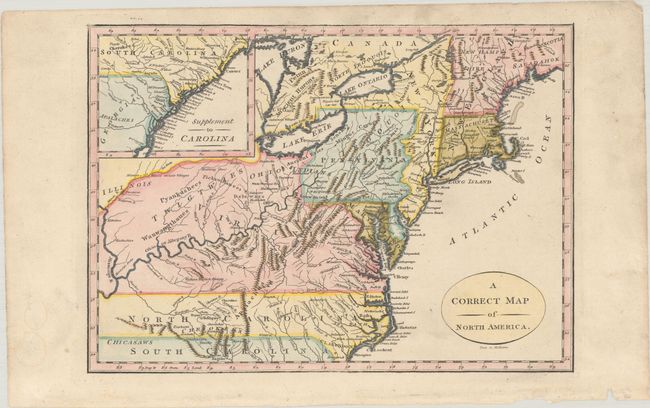
Auction 187, Lot 155
Subject: Eastern United States
A Correct Map of North America, 1800
Size: 11.5 x 8.3 inches (29.2 x 21.1 cm)
Estimate: $250 - $325
Sold for: $180
Closed on 4/27/2022
Auction 187, Lot 156
Subject: Eastern United States
Tardieu, Pierre Francois
[On 4 Sheets] United States of Nth America - Carte des Etats-Unis de l'Amerique Septentrionale Copiee et Gravee sur celle d'Arrowsmith..., 1802
Size: 55.2 x 49.2 inches (140.2 x 125 cm)
Estimate: $4,000 - $5,000
Rare French Edition of Arrowsmith's Influential Map of the United States
Sold for: $2,000
Closed on 4/27/2022
Auction 187, Lot 157
Subject: Eastern United States
[Lot of 2] United States [and] United States, 1804-15
Size: See Description
Estimate: $230 - $275
NO RESERVE
Sold for: $60
Closed on 4/27/2022
Auction 187, Lot 158
Subject: Eastern United States
Weimar Geographisches Institut
Charte von den Vereinigten Staaten von Nord-America mit Luisiana, 1806
Size: 16.5 x 12.2 inches (41.9 x 31 cm)
Estimate: $350 - $425
Sold for: $180
Closed on 4/27/2022
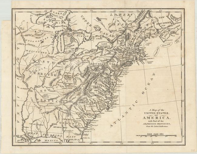
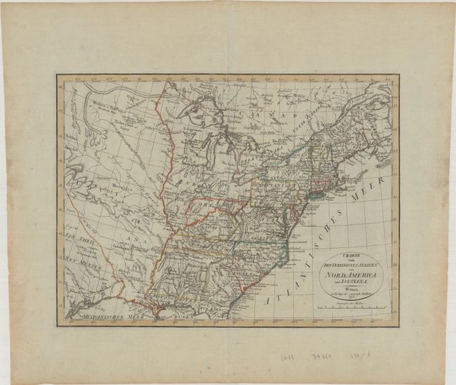
Auction 187, Lot 159
Subject: Eastern United States
Anon.
A Map of the United States, of America, with Part of the Adjoining Provinces, from the Latest Authorities, 1810
Size: 10.6 x 8.4 inches (26.9 x 21.3 cm)
Estimate: $160 - $190
Sold for: $120
Closed on 4/27/2022
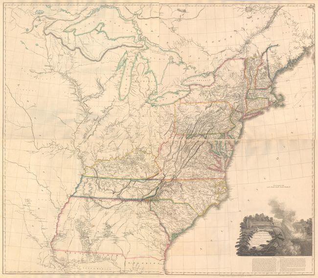
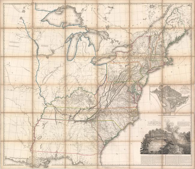
Auction 187, Lot 160
Subject: Eastern United States
Arrowsmith, Aaron, Sr.
[On 4 Sheets] A Map of the United States of North America Drawn from a Number of Critical Researches, 1815
Size: 27.8 x 24.3 inches (70.6 x 61.7 cm)
Estimate: $7,500 - $9,000
Large Format Map Used by Lewis & Clark
Unsold
Closed on 4/27/2022
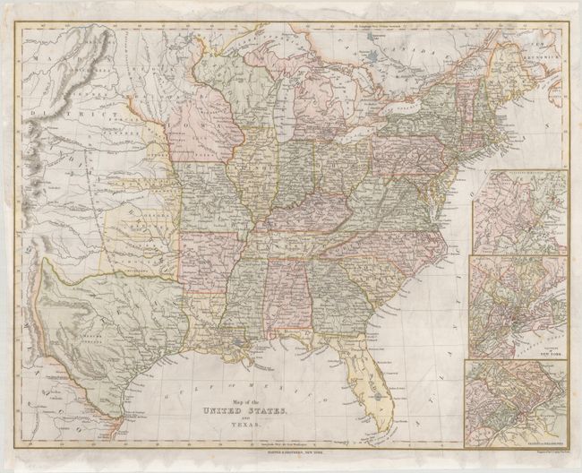
Auction 187, Lot 161
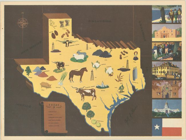
Subject: Eastern United States, Republic of Texas
Harper Bros.
Map of the United States, and Texas, 1844
Size: 22.9 x 17.7 inches (58.2 x 45 cm)
Estimate: $375 - $450
Sold for: $375
Closed on 4/27/2022
Auction 187, Lot 162
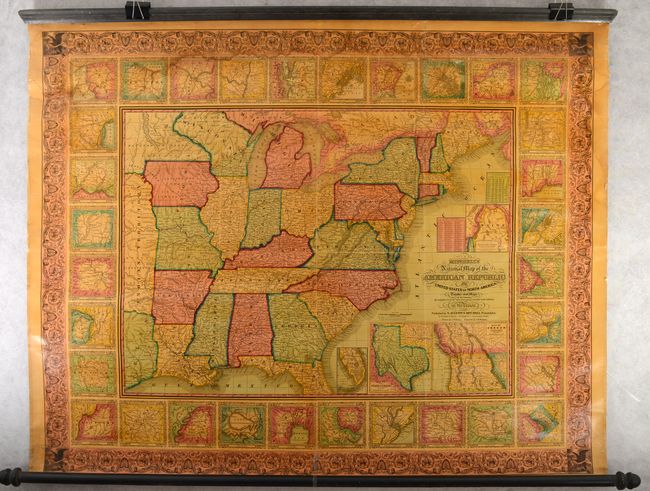
Subject: Eastern United States
Mitchell/Young
Mitchell's National Map of the American Republic or United States of North America. Together with Maps of the Vicinities of Thirty-Two of the Principal Cities and Towns in the Union, 1847
Size: 47.6 x 37.6 inches (120.9 x 95.5 cm)
Estimate: $800 - $950
Sold for: $600
Closed on 4/27/2022
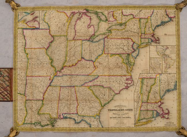
Auction 187, Lot 163
Subject: Eastern United States
Mitchell/Cowperthwait
Mitchell's New Traveller's Guide Through the United States, Showing the Rail Roads, Canals, Stage Roads &c…, 1850
Size: 28.6 x 21.4 inches (72.6 x 54.4 cm)
Estimate: $400 - $475
Sold for: $375
Closed on 4/27/2022
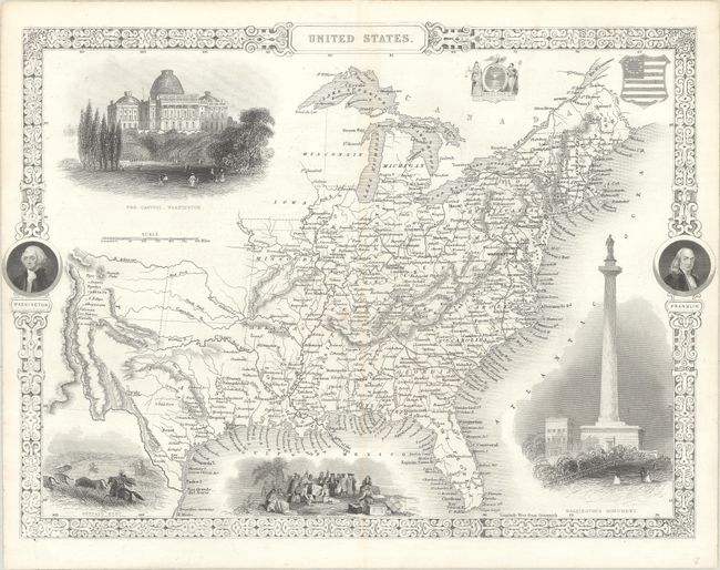
Auction 187, Lot 164
Subject: Eastern United States
Tallis, John
United States, 1850
Size: 13.4 x 9.8 inches (34 x 24.9 cm)
Estimate: $200 - $230
Sold for: $170
Closed on 4/27/2022
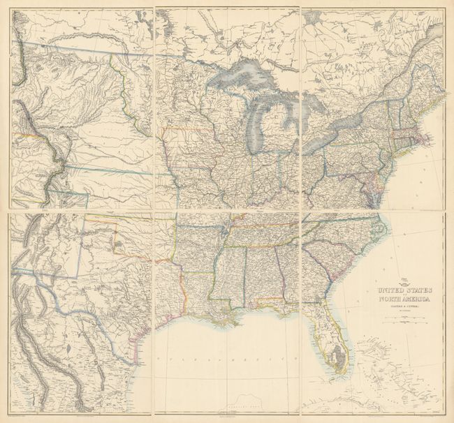
Auction 187, Lot 165
Subject: Eastern United States
Ettling, Theodor
[On 6 Sheets] United States of North America (Eastern & Central), 1855
Size: 12.1 x 16.9 inches (30.7 x 42.9 cm)
Estimate: $275 - $350
Sold for: $150
Closed on 4/27/2022
Auction 187, Lot 166
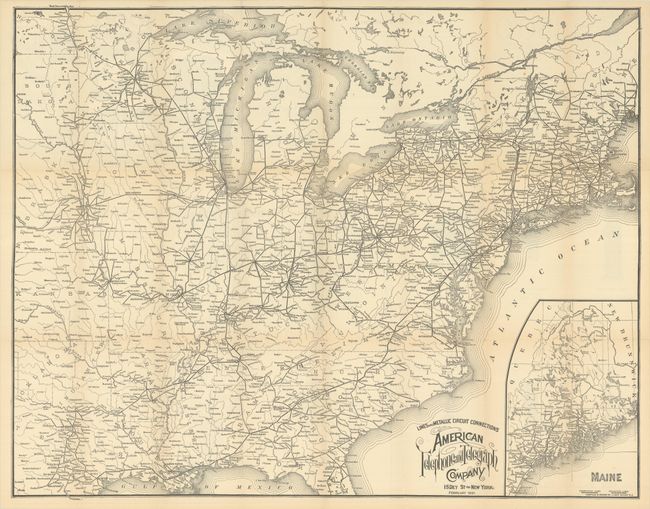
Subject: Eastern United States
Lines and Metallic Circuit Connections American Telephone and Telegraph Company, 1897
Size: 28.8 x 22.6 inches (73.2 x 57.4 cm)
Estimate: $180 - $220
Early Telephone Map and Advertisement
Sold for: $375
Closed on 4/27/2022
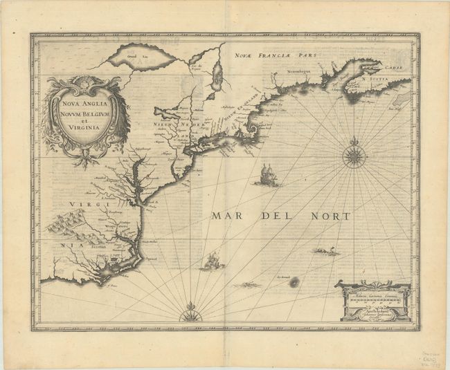
Auction 187, Lot 167
Subject: Colonial New England & Mid-Atlantic United States
Jansson, Jan
Nova Anglia Novum Belgium et Virginia, 1636
Size: 19.9 x 15.3 inches (50.5 x 38.9 cm)
Estimate: $1,100 - $1,400
Jansson's Influential Map of the East Coast
Sold for: $800
Closed on 4/27/2022
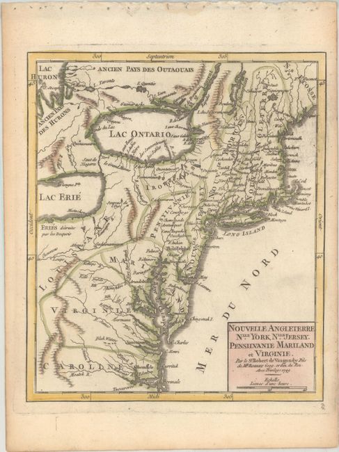
Auction 187, Lot 168
Subject: Colonial New England & Mid-Atlantic United States
Robert de Vaugondy, Didier
Nouvelle Angleterre Nlle. York, Nlle. Jersey, Pensilvanie Mariland et Virginie, 1749
Size: 6.4 x 7.6 inches (16.3 x 19.3 cm)
Estimate: $200 - $230
Sold for: $150
Closed on 4/27/2022
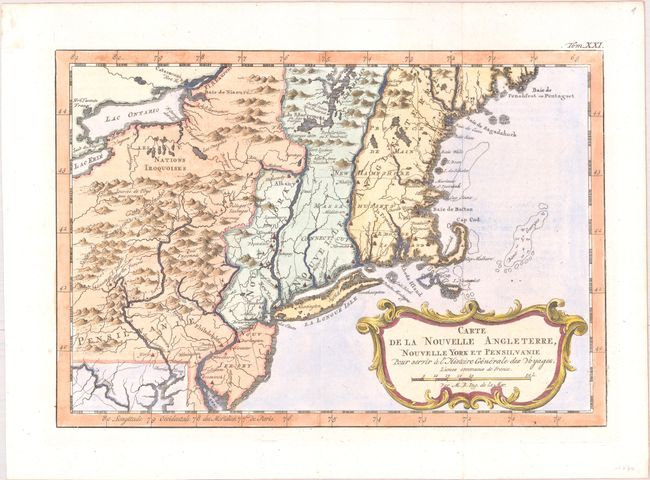
Auction 187, Lot 169
Subject: Colonial New England & Mid-Atlantic United States
Bellin, Jacques Nicolas
Carte de la Nouvelle Angleterre, Nouvelle York et Pensilvanie pour Servir a l'Histoire Generale des Voyages, 1757
Size: 11.6 x 7.9 inches (29.5 x 20.1 cm)
Estimate: $200 - $230
Sold for: $180
Closed on 4/27/2022
Auction 187, Lot 170
Subject: Colonial New England & Mid-Atlantic United States
Anon.
A Map of That Part of America Which Was the Principal Seat of War, in 1756, 1757
Size: 13 x 8.8 inches (33 x 22.4 cm)
Estimate: $350 - $425
Sold for: $180
Closed on 4/27/2022
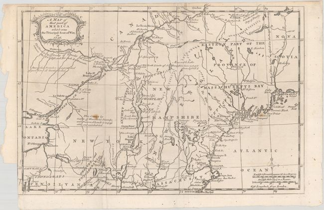
Auction 187, Lot 171
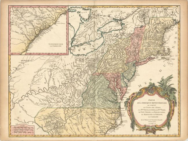
Subject: Colonial New England & Mid-Atlantic United States
Robert de Vaugondy, Didier
Partie de l'Amerique Septentrionale, qui Comprend le Cours de l'Ohio, la Nlle. Angleterre, la Nlle York, le New Jersey, la Pensylvanie, le Maryland la Virginie, la Caroline, 1755
Size: 24.5 x 18.8 inches (62.2 x 47.8 cm)
Estimate: $550 - $700
First State
Sold for: $425
Closed on 4/27/2022
181 lots
Page 1 of 4