Subject: Colonial Northeastern United States & Canada, Great Lakes
Period: 1749 (dated)
Publication: Atlas Portatif Universel et Militaire
Color: Hand Color
Size:
8.5 x 6.5 inches
21.6 x 16.5 cm
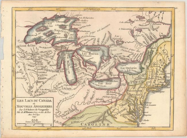
Superb map of the Great Lakes region illustrating strategic forts and the area claimed by the French just prior to the French and Indian War. This map is based on Bellin's map, Partie Occidentale de la Nouvelle France ou Canada, from 1745, which incorporated much new information from Charlevoix and other French explorers. While this map summarizes the latest in French knowledge of the region, it is also notable for two cartographic myths: the mountain range in Michigan and the appearance of four fictitious islands in Lake Superior, including the infamous I Philippeaux that continued to appear on maps and eluded explorers' searches for it, well into the 19th century. The map locates French forts, new settlements, Indian villages and includes an early appearance of Chicago, Checagou.
References: McCorkle #749.5; Pedley #457.
Condition: A
A crisp impression with light toning along the edges of the sheet.