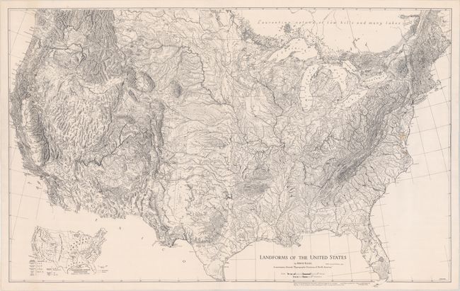
Subject: United States
Period: 1957 (dated)
Publication: Physiographic Provinces of North America
Color: Black & White
Size:
41 x 26 inches
104.1 x 66 cm
This incredibly detailed pen and ink-style map of the United States was drawn by Erwin Raisz. It presents topography with a dramatic three-dimensional perspective and uses symbols to convey land types including rolling land, plateaus, complex mountains, and volcanic forms to name a few (a legend with these symbols is typically found in a key at lower right, but is blank in the present example). An inset at bottom left defines the major physiographic divisions and the "province" subdivisions. This is the sixth and final edition of the Raisz map, which he first published in 1939.
Erwin Raisz was born in Hungary in 1893 and trained as a civil engineer. He emigrated to the United States after World War I and worked for the Ohman Map Company while pursuing a doctoral degree in geology from Columbia University. In 1931, he joined Harvard's Institute of Geographical Exploration and drew most of his maps over his 20 year tenure there, which also included curating Harvard's map collection.
References:
Condition: B+
A dark impression on a bright sheet that has been backed with linen. There are a couple of small spots around the Chesapeake Bay, otherwise fine.


