Subject: Colonial Eastern United States
Period: 1744 (dated)
Publication: Histoire et Description Generale de la Nouvelle France...
Color: Black & White
Size:
21.8 x 15.5 inches
55.4 x 39.4 cm
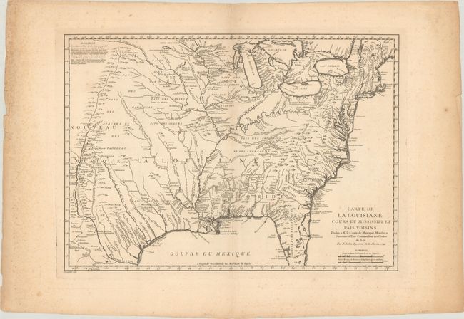
This interesting map first appeared in the journal of Pierre Francois Xavier Charlevoix, a French Jesuit historian and traveler who traveled throughout the French possessions in North America. The map covers from the Great Lakes through all but the tip of Florida, and from New Mexico and the Rocky Mountains through the eastern seaboard. The information in the west includes the road from Mexico City to Santa Fe and the routes of St. Denis and De Soto through Texas. The Riviere du Nord (Rio Grande) has its headwaters in the upper left corner, only a few miles from the Missouri River. There is great detail of Indian villages, trading agencies, forts, mines, villages, and colonial settlements. Bellin based the map on Guillaume Delisle's landmark map of 1718. While covering the same area, Bellin's map incorporates much new information from Charlevoix and other French explorers, particularly in the depiction of lakes and rivers and additional place names. Sometimes overlooked because of its similarity to Delisle's map, this map occupies an important step in the cartographic history of North America.
References: McCorkle #744.1; MCC-96 #703.
Condition: B+
A crisp impression on a sheet with the watermark of a Maltese cross encircled in rosary beads. There is light foxing, most of it confined to the margins, and remnants of hinge tape on verso.