Subject: Eastern United States
Period: 1795-1854 (circa)
Publication:
Color: Hand Color
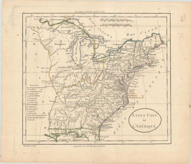
A. Etats Unis de l'Amerique, by Alexandre Blondeau, circa 1795 (8.0 x 7.1"). Nice view of the early United States with its western boundary on the Mississippi River and fifteen states listed in a numbered key at left. Tennessee is not yet listed, but a note in the map states "Gouvernement de Tennassee." Includes a large unnamed Northwest Territory that extends to the Mississippi and Ohio Rivers and includes Illinois. Everything west of the Mississippi is named as Louisiane. Good detail throughout including locating the several Army lands (Wabash, Illinois, Ohio, and New Jersey Companies) and numerous native tribes. Condition: Contemporary outline color, issued folding on a sheet with light soiling.
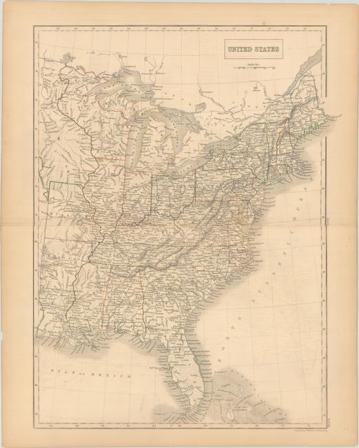
B. United States, by Sidney Hall, from General Atlas of the World, circa 1854 (15.1 x 19.8"). This map shows the eastern United States east of the 96th meridian. Iowa covers the area from the Missouri border north to Lake of the Woods, and Wisconsin extends to the Canadian border. Condition: Contemporary outline color on a lightly toned sheet with a bit of offsetting, a centerfold separation confined to the right blank margin, and a few tiny chips and tears along the edges of the sheet.
References:
Condition: B+
See description above.