Subject: Colonial Central United States & Canada, Great Lakes
Period: 1775 (dated)
Publication: Atlas Universel
Color: Hand Color
Size:
22.3 x 19 inches
56.6 x 48.3 cm
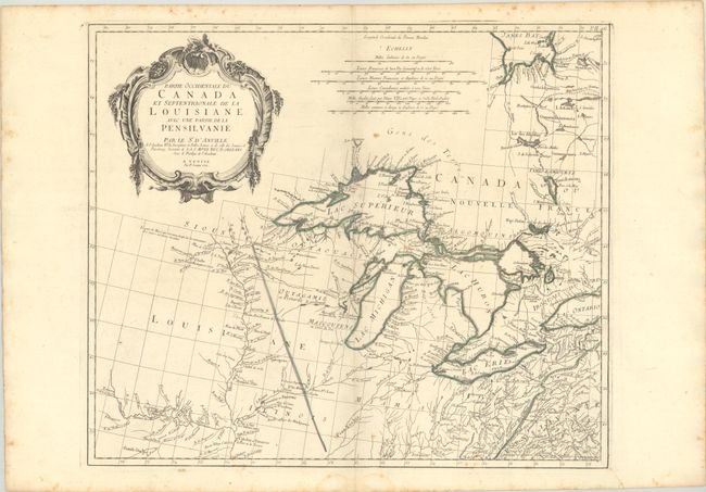
A very informative map of the Great Lakes and upper Mississippi River region based on d'Anville's influential map of North America (1746). The map extends from the upper Mississippi River valley east to include most of Lake Ontario, north to James Bay, and southeast to Philadelphia. Chicagon (Chicago) is named along with other early settlements, numerous French forts, and Indian villages. The map includes a fine depiction of the Missouri River to Kansez including Ft. d'Orleans. D’Anville influenced not only French, but also all contemporary geographers in the second half of the 18th century. According to Tooley "His representation of the Great Lakes is superior to that of his contemporary, John Mitchell." A large rococo title cartouche decorates the sheet. First state with page number in the top right corner. Published in Remondini's 1784 edition of Atlas Universel.
References: Kershaw #977; Phillips (A) #647-46; Tooley (Amer) p. 317.
Condition: B+
Issued on "R" watermarked paper with minor toning and light scattered foxing mostly in the blank margins. A small dampstain is confined to the bottom blank margin.