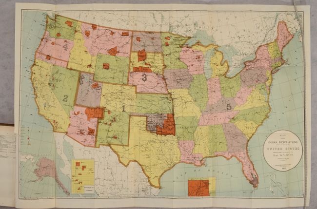
Subject: United States
Period: 1903 (published)
Publication:
Color: Printed Color
Size:
33 x 21 inches
83.8 x 53.3 cm
This large map of the United States focuses on the many Indian Reservations in the United States as of 1902. The reservations are named and shown in orange overprinting. The map also shows military stations, towns and villages, railroads, Indian agencies, and schools with a key at lower left. Includes insets of Alaska and reservations in California and Indian Territory at bottom. Compiled under the direction of W.A. Jones, Commissioner of Indian Affairs. The map is still bound into the rear of the 628-page annual report. Octavo, hardbound in full contemporary leather with title labels on the spine.
References:
Condition: A
Condition code is for the map, which is clean and bright with a tiny binding tear confined to the left blank margin. Report text is clean and tight with pleasant light toning. The rear board is detached and the front board is nearly detached. Binding is scuffed and worn and the spine labels are partially chipped off.