Subject: Colonial New England & Mid-Atlantic United States
Period: 1757 (published)
Publication: Gentleman's Magazine
Color: Black & White
Size:
13 x 8.8 inches
33 x 22.4 cm
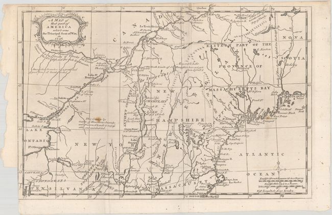
This map covers the northeastern part of the present-day United States. It shows the areas that were the theaters of the French & Indian War. A great deal of the conflict was focused around the upper Hudson and Lake Champlain, and the Mohawk River to Lake Ontario. The map includes good detail with several forts involved in the war including William Henry, Frontenac, Edward, and Frederick. All these details and topographical information were important to the contemporary reader following the war from across the Atlantic. In Lake Champlain the Is. of ye 4 Winds is located. Decorated with a scrollwork title cartouche and small compass rose. At bottom right there are two distance scales.
References: Jolly #GENT-102; McCorkle #757.4; Sellers & van Ee #78.
Condition: B+
Issued folding with a couple of small spots in the image and a short binding trim at bottom left.