Subject: Eastern United States
Period: 1810 (circa)
Publication:
Color: Black & White
Size:
10.6 x 8.4 inches
26.9 x 21.3 cm
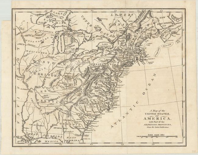
This map covers the region from the eastern seaboard to the Mississippi River. The Western Territory takes in all of the area north and west of the Ohio River with several Indian tribes located and an area of Extensive Meadows located in central Illinois. The Country of the Six Nations covers the region from unnamed Ohio into western New York. A large unnamed territory in the region of Mississippi and Alabama is the tribal territory of the Chickasaws, Cherokees, Choctaws and Muskogees. The western region of Kentucky and Tennessee are occupied by the lands of the Chickasaw and will remain so until the treaty of 1818. In the Northeast Main is noted as belonging to Massachusetts Bay. East and West Florida are well delineated. Very similar to maps by Wilkerson, Morse, and Russell, but this map carries no publisher's imprint or date, and includes an extra comma in the title after "United States."
References:
Condition: B+
A crisp impression, issued folding with light foxing and offsetting. There is a fold separation at top that has been closed on verso with archival tape and a binding trim that extends to the neatline at left.