Subject: Colonial Northeastern United States & Canada
Period: 1776 (dated)
Publication: Atlas Universel
Color: Hand Color
Size:
22.8 x 19.1 inches
57.9 x 48.5 cm
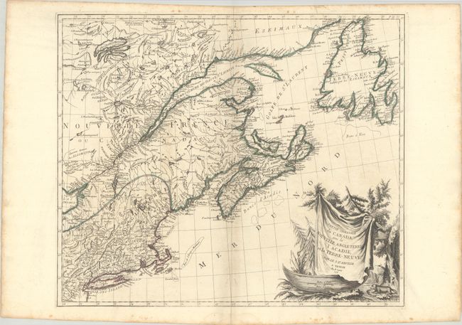
This large, attractive map covers New England, the St. Laurence River, Nova Scotia, and Newfoundland. It presents good detail of boundaries, towns and cities, harbors, bays, rivers and lakes, Indian tribal territory, and fishing grounds. Though crediting D'Anville, the map is also partially based on the cartography of Bellin and Robert de Vaugondy. The large cartouche, featuring a ferocious-looking beaver, is copied from Robert de Vaugondy's 1755 map of Canada and the Great Lakes. First state with page number in the top right corner. Published in Remondini's 1784 edition of Atlas Universel.
References: Kershaw #713; McCorkle #776.4; Phillips (A) #647-47; Sellers & Van Ee #138.
Condition: B+
Issued on "R" watermarked paper with minor soiling and light scattered foxing that is mostly in the blank margins. A small dampstain is confined to the bottom blank margin.