Filtered by Category:United States(Show All Categories)
Showing results for:Auction 106
Catalog Archive
125 lots
Page 1 of 3
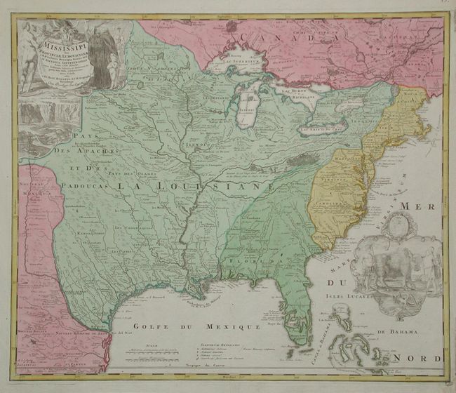
Auction 106, Lot 102
Subject: Colonial North America
Homann Heirs
Amplissimae Regionis Mississipi Seu Provinciae Ludovicianae…, 1730
Size: 22.8 x 19.2 inches (57.9 x 48.8 cm)
Estimate: $2,200 - $2,400
Sold for: $2,200
Closed on 3/3/2004
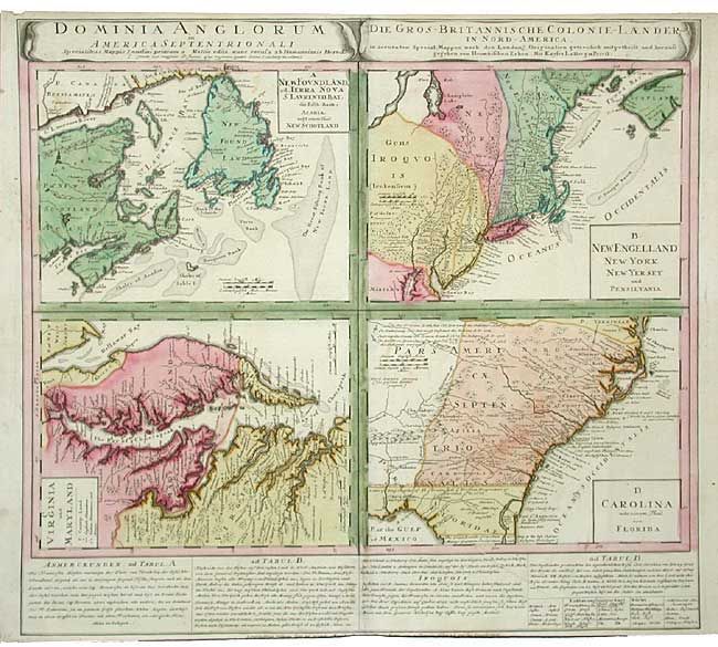
Auction 106, Lot 103
Subject: Colonial United States and Canada
Homann Heirs
Dominia Anglorum in America Septentrionali, 1740
Size: 21.8 x 19.7 inches (55.4 x 50 cm)
Estimate: $950 - $1,100
Sold for: $900
Closed on 3/3/2004
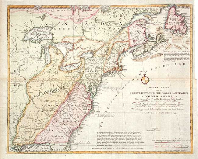
Auction 106, Lot 105
Subject: Colonial North America
Tirion, Isaac
Nieuwe Kaart van de Grootbrittannische Volkplantingen in Noord America…, 1755
Size: 17.8 x 14.4 inches (45.2 x 36.6 cm)
Estimate: $900 - $1,000
Sold for: $950
Closed on 3/3/2004
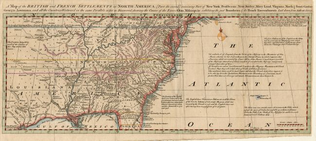
Auction 106, Lot 106
Subject: Colonial United States and Canada
Bowen, Thomas
A Map of the British and French Settlements in North America…, 1755
Size: 19.2 x 7.5 inches (48.8 x 19.1 cm)
Estimate: $400 - $450
Sold for: $400
Closed on 3/3/2004
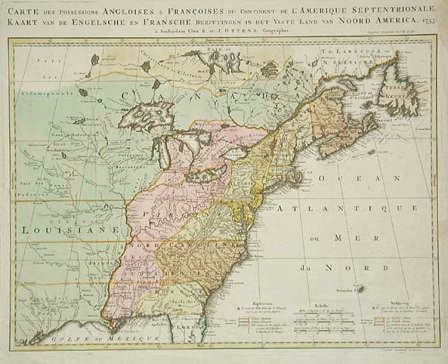
Auction 106, Lot 107
Subject: Colonial United States and Canada
Ottens, Reiner and Joshua
Carte des Possessions Angloises & Francoises du Continent de l'Amerique…, 1755
Size: 22.2 x 16 inches (56.4 x 40.6 cm)
Estimate: $2,000 - $2,200
Sold for: $1,700
Closed on 3/3/2004
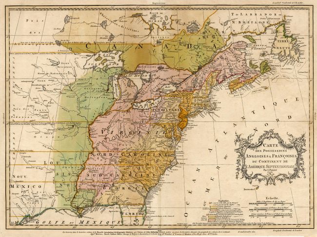
Auction 106, Lot 108
Subject: Colonial United States and Canada
Palairet, Jean
Carte des Possessions Angloises & Francoises du Continent de l'Amerique Septentrionale, 1756
Size: 22.5 x 16.7 inches (57.2 x 42.4 cm)
Estimate: $2,000 - $2,200
Sold for: $2,750
Closed on 3/3/2004
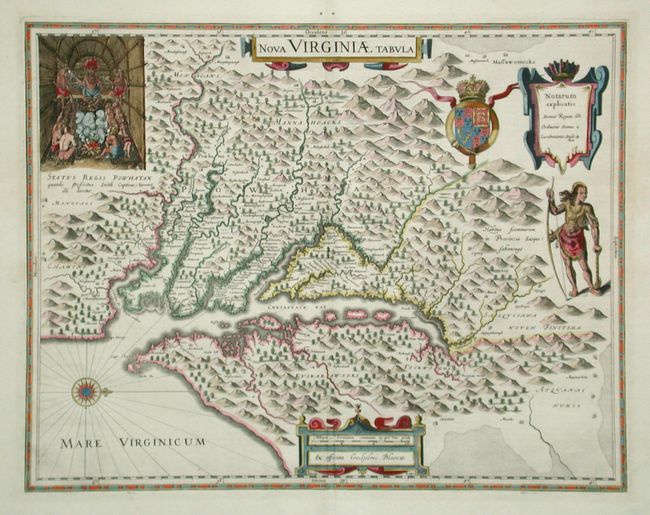
Auction 106, Lot 109
Subject: Colonial Virginia
Hondius/Blaeu
Nova Virginiae Tabula, 1642
Size: 18.8 x 14.6 inches (47.8 x 37.1 cm)
Estimate: $2,750 - $3,000
Sold for: $3,250
Closed on 3/3/2004
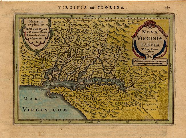
Auction 106, Lot 110
Subject: Colonial Virginia
Jansson, Jan
Nova Virginiae Tabula, 1631
Size: 7.3 x 5.1 inches (18.5 x 13 cm)
Estimate: $700 - $800
Sold for: $550
Closed on 3/3/2004
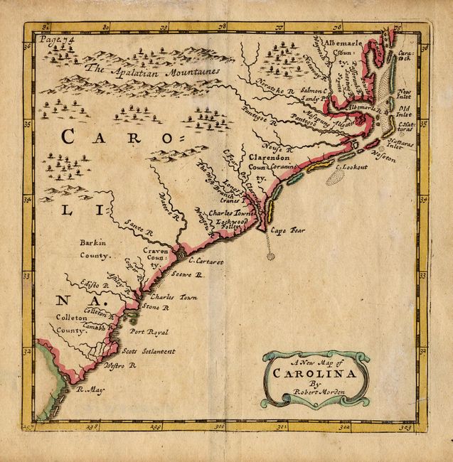
Auction 106, Lot 111
Subject: Colonial Carolinas
Morden, Robert
A New Map of Carolina, 1700
Size: 4.8 x 5 inches (12.2 x 12.7 cm)
Estimate: $350 - $400
Sold for: $250
Closed on 3/3/2004
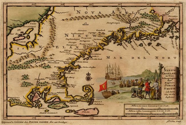
Auction 106, Lot 112
Subject: Colonial New England
Aa, Pieter van der
Nieuw Engeland in Twee Scheepstogten door Kapitein Johan Smith in de Jaren 1614 en 1615, 1707
Size: 9.2 x 6 inches (23.4 x 15.2 cm)
Estimate: $1,200 - $1,500
Sold for: $1,300
Closed on 3/3/2004
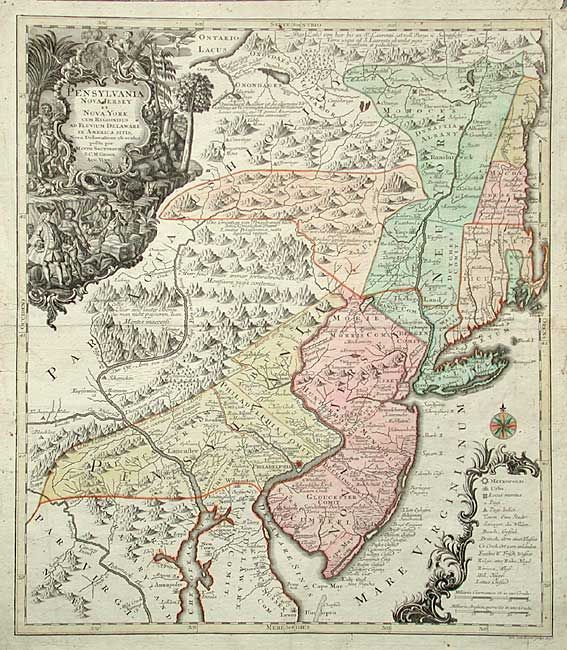
Auction 106, Lot 113
Subject: Colonial Mid Atlantic
Seutter/Lotter
Pensylvania Nova Jersey et Nova York cum Regionibus ad Fluvium Delaware in America Sitis…, 1750
Size: 19.4 x 22.5 inches (49.3 x 57.2 cm)
Estimate: $2,200 - $2,400
Sold for: $2,100
Closed on 3/3/2004
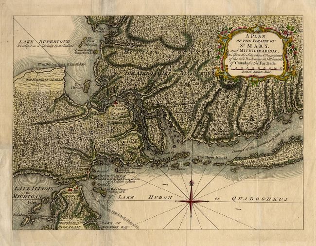
Auction 106, Lot 114
Subject: Colonial Great Lakes
Anon.
A Plan of the Straits of St. Mary, and Michilimakinac to Shew the Situation & Importance of the two Westernmost Settlements of Canada for the Fur Trade, 1761
Size: 12.7 x 9.2 inches (32.3 x 23.4 cm)
Estimate: $350 - $400
Sold for: $375
Closed on 3/3/2004
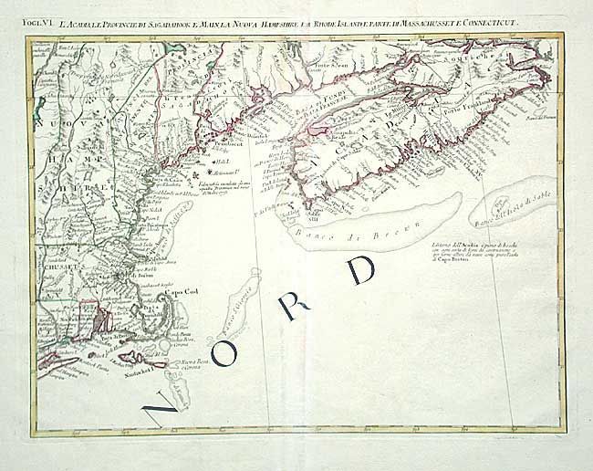
Auction 106, Lot 120
Subject: Canada & United States
Zatta, Antonio
L'Acadia, le Provincie di Sagadahook e Main, la Nuova Hampshire, la Rhode Island, e Parte di Massachusset e Connecticut, 1778
Size: 16.7 x 12.5 inches (42.4 x 31.8 cm)
Estimate: $450 - $500
Sold for: $230
Closed on 3/3/2004
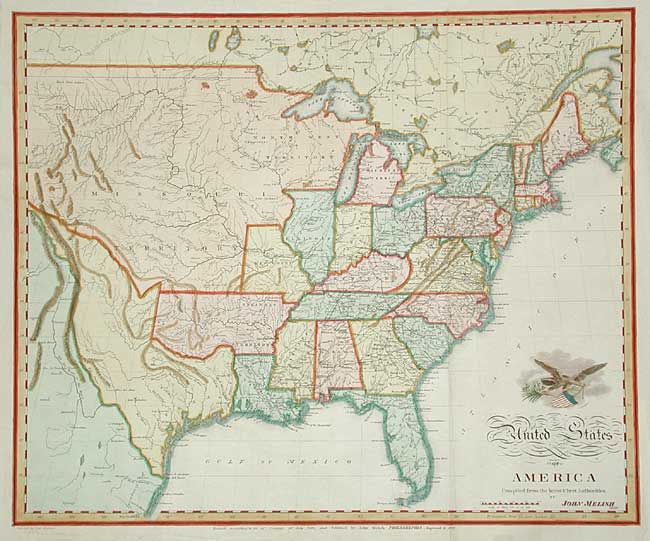
Auction 106, Lot 121
Subject: United States
Melish, John
United States of America Compiled from the latest & best Authorities, 1822
Size: 19.5 x 15.9 inches (49.5 x 40.4 cm)
Estimate: $1,000 - $1,200
Sold for: $950
Closed on 3/3/2004
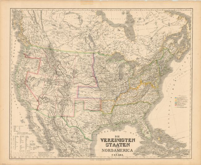
Auction 106, Lot 122
Subject: United States
Kiepert, Heinrich C.
Die Vereinigten Staaten von Nord America nebst Canada, 1868
Size: 25.2 x 20.7 inches (64 x 52.6 cm)
Estimate: $200 - $250
Unsold
Closed on 3/3/2004
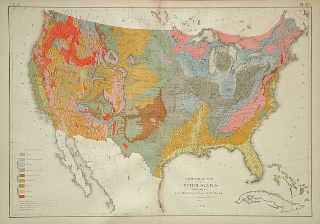
Auction 106, Lot 123
Subject: United States
Hitchcock, Charles Henry
Geological Map of the United States compiled by C.H. Hitchcock and W. P. Blake…, 1874
Size: 28 x 19.7 inches (71.1 x 50 cm)
Estimate: $200 - $250
Sold for: $220
Closed on 3/3/2004
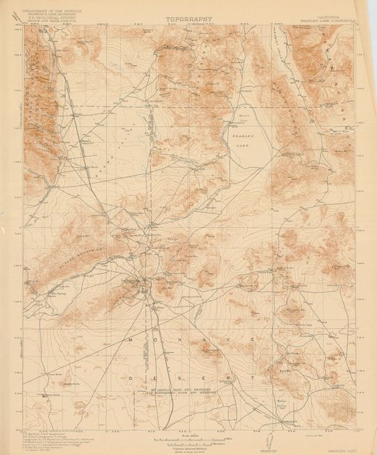
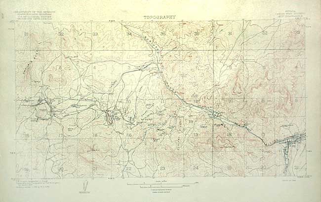
Auction 106, Lot 124
Subject: United States
U.S. Geological Survey (USGS)
[Lot of 25 - Topographic Maps], 1915-6
Size: 13.6 x 17.5 inches (34.5 x 44.5 cm)
Estimate: $150 - $180
Unsold
Closed on 3/3/2004
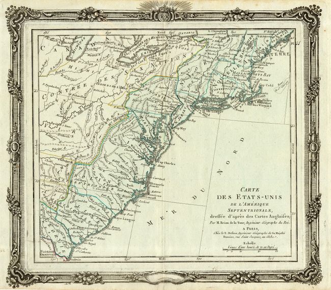
Auction 106, Lot 125
Subject: United States - Eastern
Brion de la Tour/Desnos
Carte des Etats-Unis de l'Amerique Septentrionale, dressee d'apres des Cartes Anglaises, 1780
Size: 12.2 x 11.4 inches (31 x 29 cm)
Estimate: $400 - $450
Sold for: $300
Closed on 3/3/2004
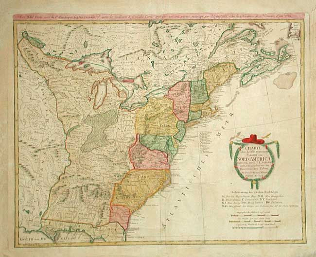
Auction 106, Lot 126
Subject: United States - Eastern
Gussefeld/Homann Heirs
Charte uber die XIII vereinigte Staaten von Nord-America…, 1784
Size: 22.5 x 17.5 inches (57.2 x 44.5 cm)
Estimate: $700 - $800
Sold for: $750
Closed on 3/3/2004
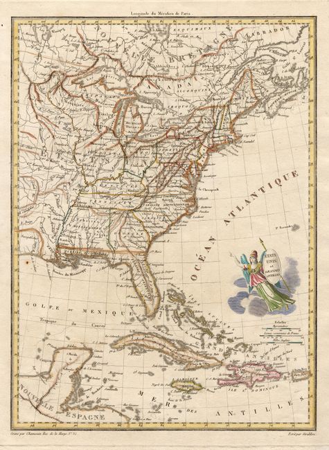
Auction 106, Lot 127
Subject: United States - Eastern
Chamouin, Jean Baptiste Marie
Etats Unis et Grandes Antilles, 1805
Size: 8.6 x 11.7 inches (21.8 x 29.7 cm)
Estimate: $200 - $240
Sold for: $250
Closed on 3/3/2004

Auction 106, Lot 128
Subject: United States - Eastern
Goodrich, Samuel Griswold
[Lot of 4] New-England [and] Middle States [and] Southern States [and] Western States, 1840
Size: 4.4 x 5.8 inches (11.2 x 14.7 cm)
Estimate: $100 - $150
Sold for: $50
Closed on 3/3/2004
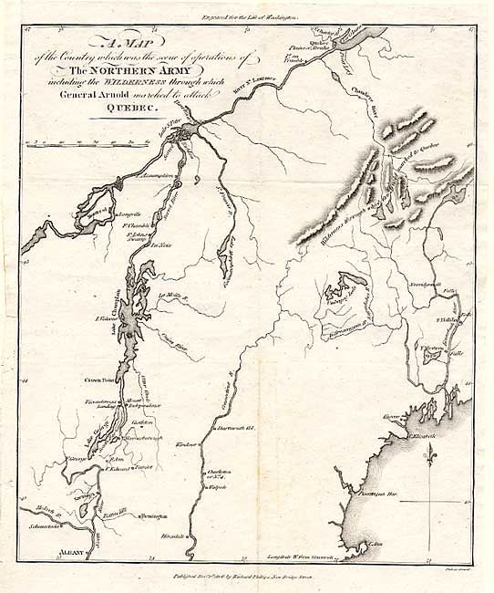
Auction 106, Lot 129
Subject: New England
Phillips, Richard (Sir)
A Map of the Country which was the scene of operations of The Northern Army; including the Wilderness through which General Arnold marched to attack Quebec, 1806
Size: 8.5 x 10 inches (21.6 x 25.4 cm)
Estimate: $120 - $160
Sold for: $120
Closed on 3/3/2004
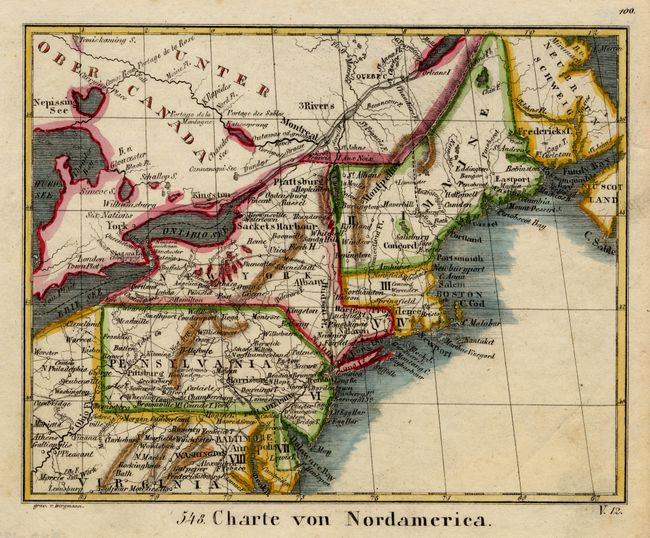
Auction 106, Lot 130
Subject: United States - Northeast
Anon.
Charte von Nordamerica, 1830
Size: 6.7 x 5.4 inches (17 x 13.7 cm)
Estimate: $70 - $90
Sold for: $50
Closed on 3/3/2004
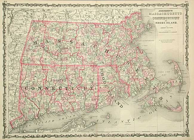
Auction 106, Lot 131
Subject: United States - Northeast
Johnson & Ward
Johnson's Massachusetts Connecticut and Rhode Island, 1863
Size: 24 x 17.2 inches (61 x 43.7 cm)
Estimate: $50 - $70
Sold for: $75
Closed on 3/3/2004
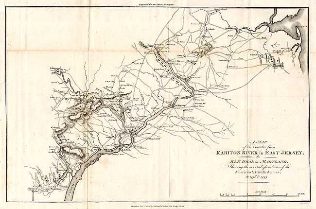
Auction 106, Lot 132
Subject: United States - Mid Atlantic
Phillips, Richard (Sir)
A Map of the Country from Rariton River in East Jersey, to Elk Head in Maryland, Shewing the several operations of the American & British Armies, in 1776 & 1777, 1806
Size: 15.4 x 9.8 inches (39.1 x 24.9 cm)
Estimate: $150 - $200
Sold for: $120
Closed on 3/3/2004
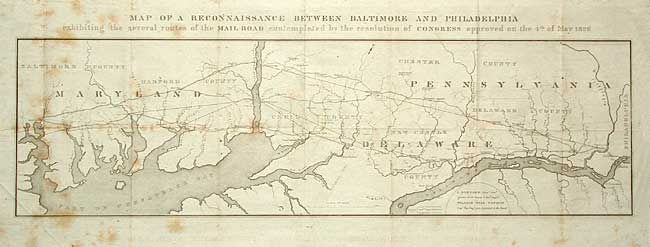
Auction 106, Lot 133
Subject: United States - Mid Atlantic
U.S. Corps of Engineers
Map of a Reconnaissance Between Baltimore and Philadelphia exhibiting the several routes of the Mail Road contemplated by the resolution of Congress approved on the 4th of May 1826, 1826
Size: 31 x 10 inches (78.7 x 25.4 cm)
Estimate: $275 - $325
Sold for: $250
Closed on 3/3/2004
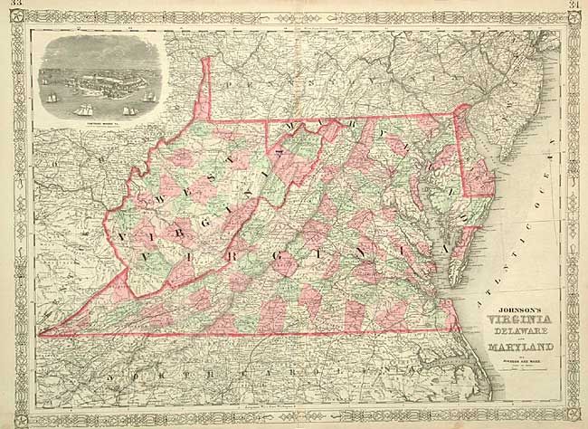
Auction 106, Lot 134
Subject: United States - Mid Atlantic
Johnson & Ward
Johnson's Virginia, Delaware and Maryland, 1864
Size: 23.7 x 17.3 inches (60.2 x 43.9 cm)
Estimate: $80 - $120
Sold for: $110
Closed on 3/3/2004
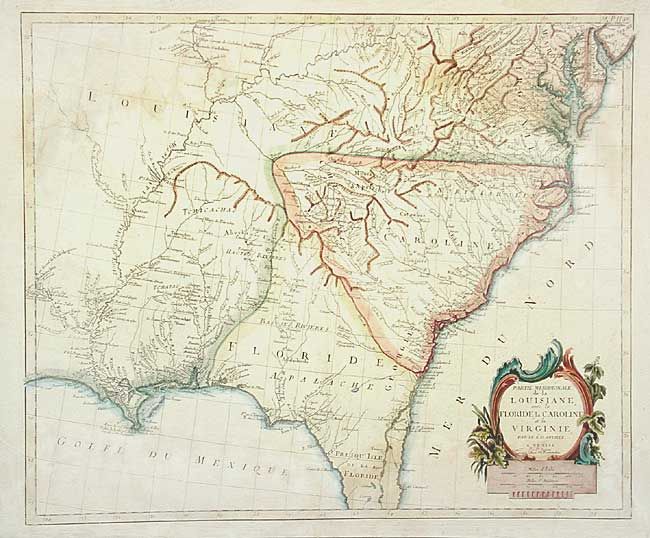
Auction 106, Lot 135
Subject: United States - Southeastern
D'Anville/Santini
Partie Meridionale de la Louisiane, avec la Floride, la Caroline et la Virginie…, 1784
Size: 22.5 x 19 inches (57.2 x 48.3 cm)
Estimate: $1,100 - $1,200
Sold for: $800
Closed on 3/3/2004
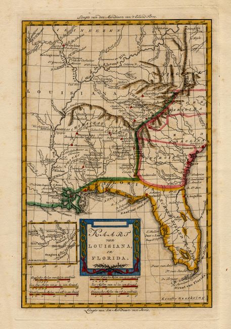
Auction 106, Lot 136
Subject: Southern United States
Bachiene, Willem Albert
Kaart van Louisiana, en Florida, 1785
Size: 8.2 x 12.5 inches (20.8 x 31.8 cm)
Estimate: $230 - $300
Sold for: $325
Closed on 3/3/2004
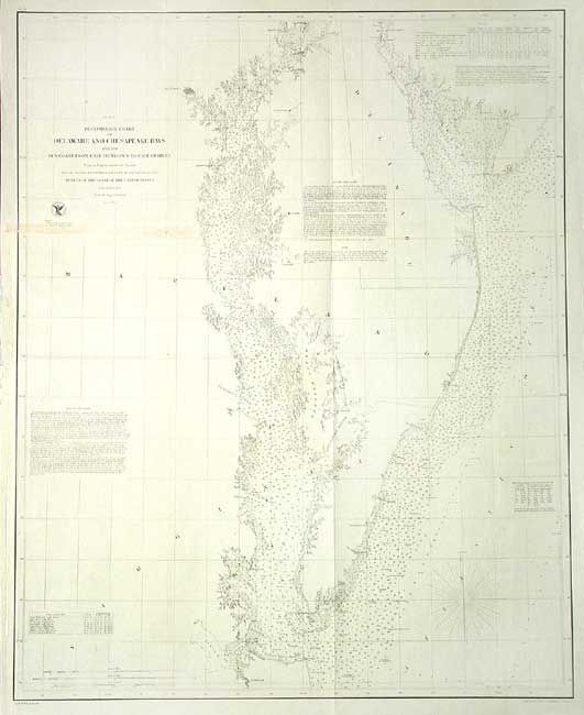
Auction 106, Lot 137
Subject: Mid-Atlantic
U.S. Coast Survey
Preliminary Chart of Delaware and Chesapeake Bays and the Sea Coast from Cape Henlopen to Cape Charles, 1855
Size: 25 x 31 inches (63.5 x 78.7 cm)
Estimate: $180 - $220
Sold for: $90
Closed on 3/3/2004
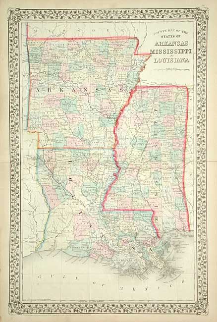
Auction 106, Lot 138
Subject: United States - Southern
Mitchell, Samuel Augustus
County Map of the States of Arkansas Mississippi and Louisiana, 1871
Size: 13.6 x 21 inches (34.5 x 53.3 cm)
Estimate: $70 - $90
Sold for: $50
Closed on 3/3/2004
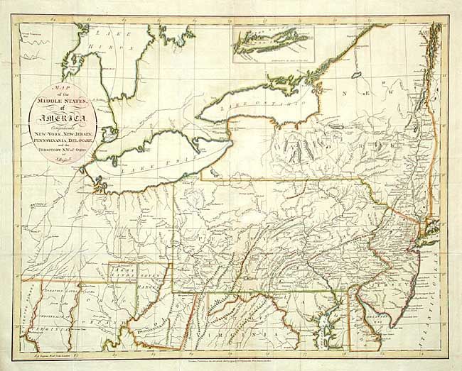
Auction 106, Lot 139
Subject: United States - Midwest and Mid Atlantic
Russell, John C.
Map of the Middle States of America. Comprehends New-York, New-Jersey, Pennsylvania, Delaware and the Territory N.W. of Ohio, 1794
Size: 18 x 14.2 inches (45.7 x 36.1 cm)
Estimate: $450 - $550
Sold for: $600
Closed on 3/3/2004
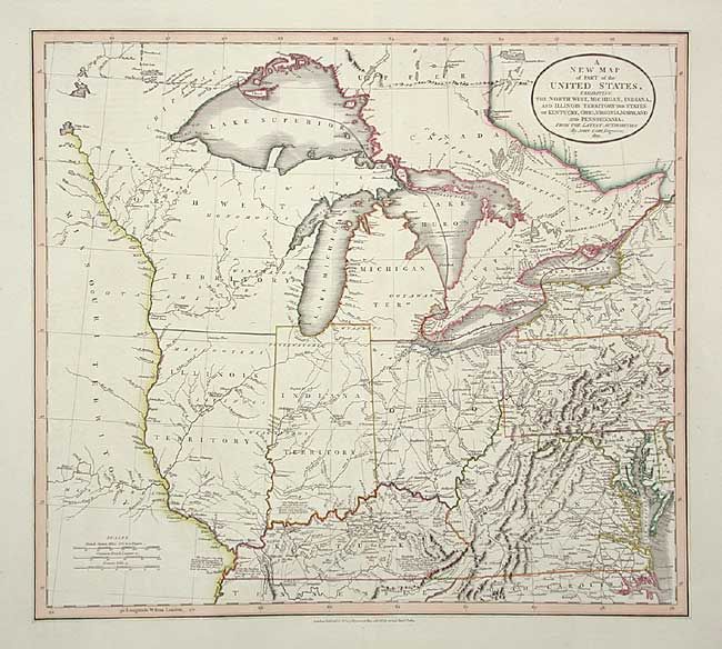
Auction 106, Lot 140
Subject: United States - Midwest and Mid Atlantic
Cary, John
A New Map of Part of the United States, exhibiting the North West, Michigan, Indiana, and Illinois Territory, the States of Kentucky, Ohio, Virginia, Maryland and Pennsylvania, 1821
Size: 20 x 18 inches (50.8 x 45.7 cm)
Estimate: $800 - $900
Sold for: $1,500
Closed on 3/3/2004
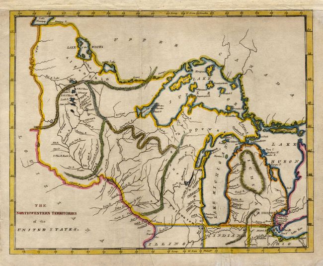
Auction 106, Lot 141
Subject: United States - Midwest
Brookes, Richard
The Northwestern Territories of the United States, 1812
Size: 9.6 x 7.6 inches (24.4 x 19.3 cm)
Estimate: $300 - $350
Sold for: $250
Closed on 3/3/2004
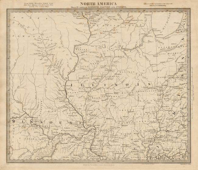
Auction 106, Lot 142
Subject: United States - Central
SDUK Society for the Diffusion of Useful Knowledge
North America Sheet IX Parts of Missouri, Illinois and Indiana, 1833
Size: 14.5 x 12 inches (36.8 x 30.5 cm)
Estimate: $100 - $140
Sold for: $75
Closed on 3/3/2004
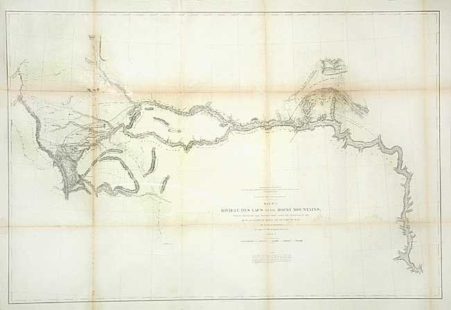
Auction 106, Lot 143
Subject: United States - Central
Stevens, Isaac Ingalls
Map No. 2 Riviere des Lacs to the Rocky Mountains…, 1853-4
Size: 36.7 x 24.5 inches (93.2 x 62.2 cm)
Estimate: $250 - $300
Sold for: $150
Closed on 3/3/2004
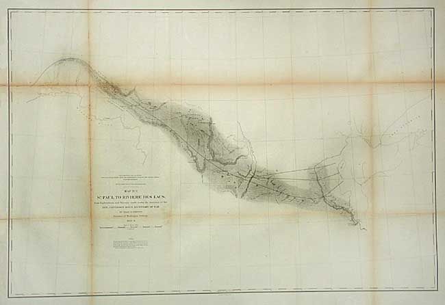
Auction 106, Lot 144
Subject: United States - Central
Stevens, Isaac Ingalls
Map No. 1 St. Paul to Riviere des Lacs…, 1853-4
Size: 36.7 x 24.5 inches (93.2 x 62.2 cm)
Estimate: $120 - $140
Sold for: $75
Closed on 3/3/2004
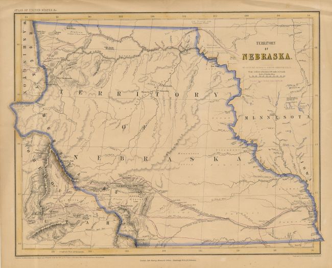
Auction 106, Lot 145
Subject: United States - Central
Rogers, Henry Darwin
Territory of Nebraska, 1857
Size: 16.6 x 13 inches (42.2 x 33 cm)
Estimate: $350 - $400
Sold for: $425
Closed on 3/3/2004
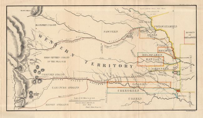
Auction 106, Lot 146
Subject: United States - Central
U.S. War Department
[Great Plains: Fort Leavenworth to Santa Fe], 1860
Size: 17.5 x 10 inches (44.5 x 25.4 cm)
Estimate: $200 - $250
Sold for: $230
Closed on 3/3/2004
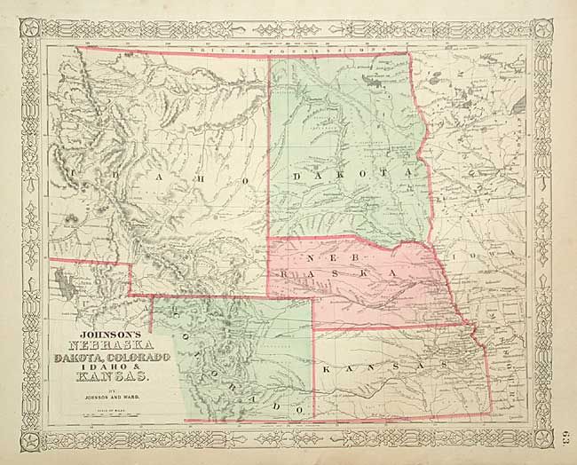
Auction 106, Lot 147
Subject: United States - Central
Johnson & Ward
Johnson's Nebraska, Dakota, Colorado, Idaho & Kansas, 1864
Size: 15.6 x 12.7 inches (39.6 x 32.3 cm)
Estimate: $120 - $140
Sold for: $65
Closed on 3/3/2004
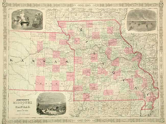
Auction 106, Lot 148
Subject: United States - Central
Johnson & Ward
Johnson's Missouri and Kansas, 1864
Size: 23.2 x 17.2 inches (58.9 x 43.7 cm)
Estimate: $80 - $100
Sold for: $80
Closed on 3/3/2004
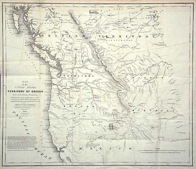
Auction 106, Lot 149
Subject: United States - Western
Abert/Hood
Map of the United States Territory of Oregon West of the Rocky Mountains Exhibiting the vaious Trading Depots or Forts occupied by the British Hudson Bay Company connected with the Western and Northwestern Fur Trade, 1838
Size: 20.5 x 17.4 inches (52.1 x 44.2 cm)
Estimate: $400 - $450
Sold for: $750
Closed on 3/3/2004
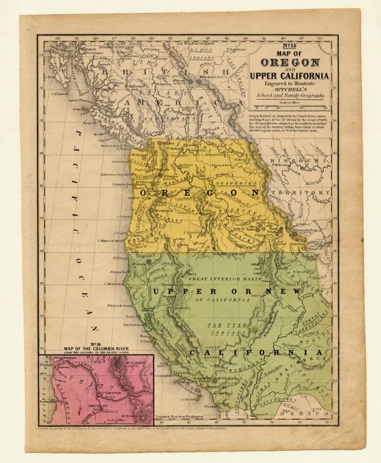
Auction 106, Lot 150
Subject: United States - Western
Thomas, Cowperthwait & Co.
No. 15 Map of Oregon and Upper California, 1846
Size: 8 x 10.2 inches (20.3 x 25.9 cm)
Estimate: $150 - $200
Sold for: $275
Closed on 3/3/2004
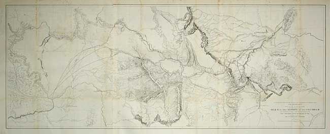
Auction 106, Lot 151
Subject: Northwestern United States
U.S. Railroad Surveys
Milk R. to the Crossing of the Columbia R…, 1853-5
Size: 60.5 x 23.5 inches (153.7 x 59.7 cm)
Estimate: $200 - $250
Sold for: $190
Closed on 3/3/2004
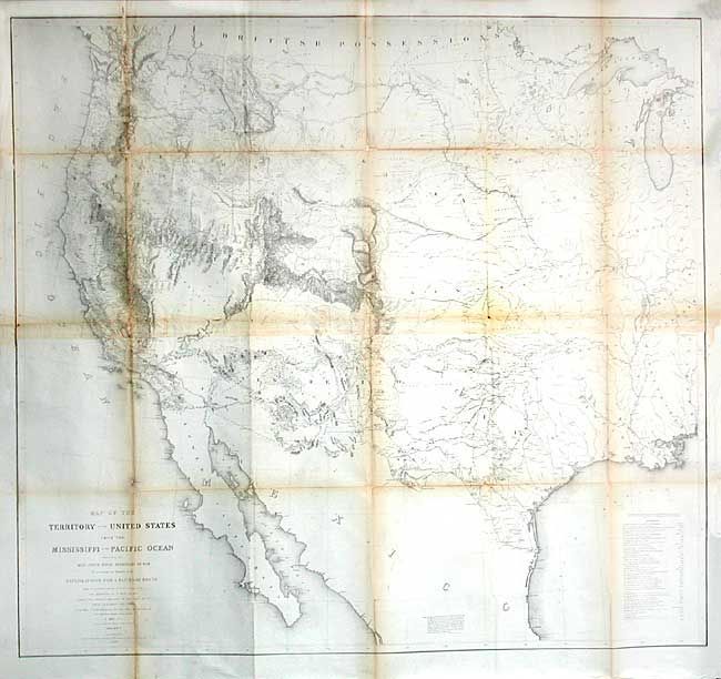
Auction 106, Lot 152
Subject: United States - Western
Warren, Lieut. G. K.
Map of the Territory of the United States from the Mississippi to the Pacific Ocean, 1854-7
Size: 46 x 42.4 inches (116.8 x 107.7 cm)
Estimate: $1,400 - $1,600
Sold for: $1,500
Closed on 3/3/2004
Auction 106, Lot 153
Subject: United States - Western
Gunnison, John William [Capt.]
Map No. 1 From the Western Boundary of Missouri to the Mouth of Trap Creek…, 1855
Size: 23.5 x 31 inches (59.7 x 78.7 cm)
Estimate: $120 - $140
Sold for: $60
Closed on 3/3/2004
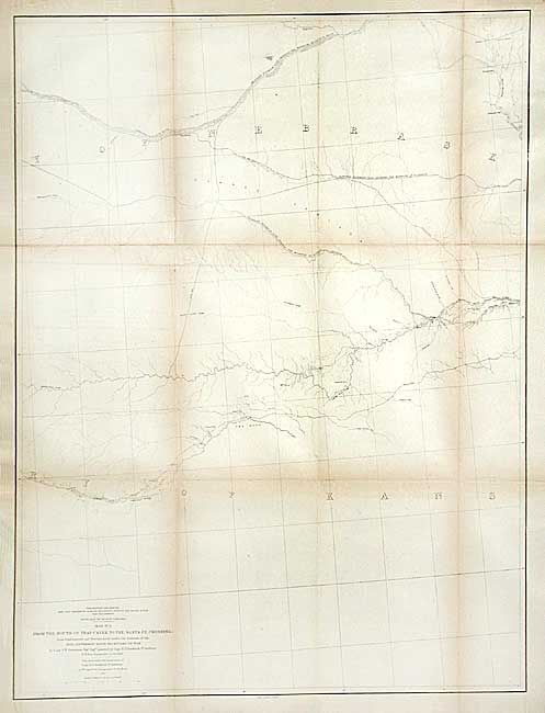
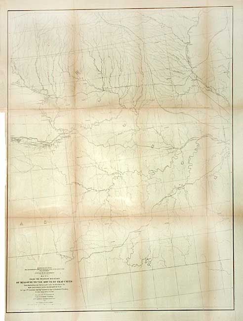
Auction 106, Lot 154
Subject: United States - Western
Gunnison, John William [Capt.]
Map No. 2 From the Mouth of Trap Creek to the Santa Fe Crossing…, 1855
Size: 24 x 32 inches (61 x 81.3 cm)
Estimate: $120 - $160
Sold for: $60
Closed on 3/3/2004
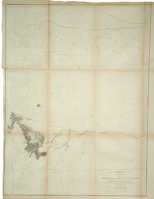
Auction 106, Lot 155
Subject: United States - Western
Gunnison, John William [Capt.]
Map No. 3 From the Santa Fe Crossing to the Coo-Che-To-Pa Pass…, 1855
Size: 23.7 x 31.5 inches (60.2 x 80 cm)
Estimate: $140 - $160
Sold for: $190
Closed on 3/3/2004
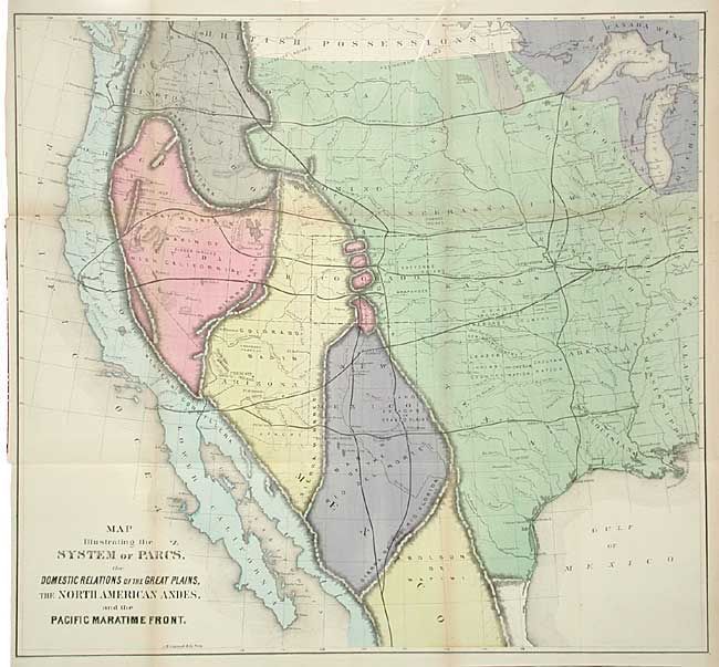
Auction 106, Lot 156
Subject: United States - Western
Gilpin, William
Map Illustrating the System of Parcs, the Domestic Relations of the Great Plains, the North American Andes, and the Pacific Maratime Front, 1873
Size: 22.7 x 21.2 inches (57.7 x 53.8 cm)
Estimate: $300 - $350
Sold for: $275
Closed on 3/3/2004
Auction 106, Lot 157
Subject: United States - Western
U.S. Geological Survey (USGS)
[Lot of 10 - Topographic Maps], 1915-16
Size: See Description
Estimate: $120 - $150
Sold for: $60
Closed on 3/3/2004
125 lots
Page 1 of 3