Catalog Archive
Auction 106, Lot 142

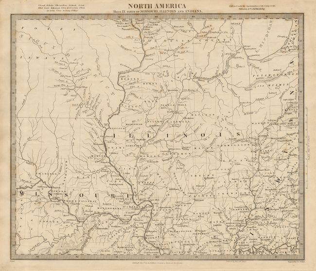
"North America Sheet IX Parts of Missouri, Illinois and Indiana", SDUK Society for the Diffusion of Useful Knowledge
Subject: United States - Central

Period: 1833 (dated)

Publication:

Color: Black & White

Size:
14.5 x 12 inches
36.8 x 30.5 cm
Download High Resolution Image
(or just click on image to launch the Zoom viewer)

Detailed map of the region covering from present-day Iowa (Sioux District) through northwestern Indiana (lands of the Putawatomies and Miamis) in the north, and from the Osage River to the Kentucky/Indiana boundary in the south. Large sections showing no settlement and others with early county configurations. A great map showing the extend of western emigration at this early point in U.S. history. Published by Baldwin and Cradock.

References:

Condition: A

Estimate: $100 - $140

Sold for: $75

Closed on 3/3/2004

Archived