Catalog Archive
Auction 106, Lot 150

"No. 15 Map of Oregon and Upper California", Thomas, Cowperthwait & Co.

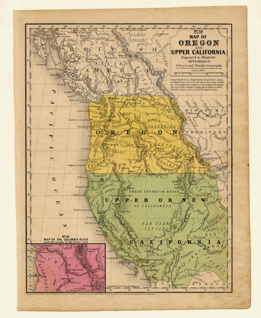
Subject: United States - Western

Period: 1846 (dated)

Publication: Mitchell's School Atlas…

Color: Hand Color

Size:
8 x 10.2 inches
20.3 x 25.9 cm
Download High Resolution Image
(or just click on image to launch the Zoom viewer)

This is a scarce school atlas map of Oregon Territory and what would become California, Nevada and parts of Arizona and Utah in a few years; here part of Mexico and labeled Upper California. Includes inset "No. 16 Map of the Columbia River from the Cascades to the Pacific Ocean." Names major rivers, mountains, Indian regions, forts, towns and pueblos. A very nice map produced during the J.C. Fremont explorations and utilizing some of his discoveries.

References:

Condition: A

A little toning or surface soiling in two margins, map very good.

Estimate: $150 - $200

Sold for: $275

Closed on 3/3/2004

Archived