Subject: Colonial Virginia
Period: 1642 (published)
Publication: Nieuwe Atlas
Color: Hand Color
Size:
18.8 x 14.6 inches
47.8 x 37.1 cm
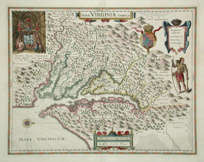
One of the most important 17th century maps of the Chesapeake Bay region. The map is a version of the one made in 1612 by Capt. John Smith, which was the first to depict the bay and its tributaries with any accuracy. In the upper left corner is an engraving of the great Indian chief Powhatan seated on his throne and surrounded by his subjects. A Susquehanna chief is depicted on the right under a coat of arms and cartouche. The plate was engraved by Jodocus Hondius Jr. and purchased by Willem Blaeu shortly after his death. Dutch text on verso.
References: Burden #193.
Condition: A
Pair of tiny wormholes in blank margin. Clean and crisp with fine later color.