Catalog Archive
Auction 106, Lot 125

"Carte des Etats-Unis de l'Amerique Septentrionale, dressee d'apres des Cartes Anglaises", Brion de la Tour/Desnos

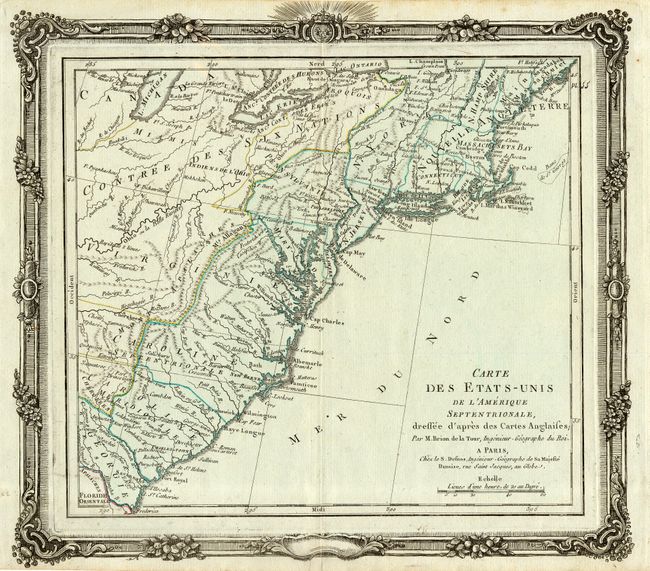
Subject: United States - Eastern

Period: 1780 (circa)

Publication:

Color: Hand Color

Size:
12.2 x 11.4 inches
31 x 29 cm
Download High Resolution Image
(or just click on image to launch the Zoom viewer)

Attractive map with light wash color to show the newly formed thirteen states. The United States extends west to the Mts. Allagany and beyond that are the Monts Apalache and the Contree des Six Nations. Numerous place names, Indian regions, forts, and rivers located on this relatively early chart of the United States. The map is surrounded by a bold and striking decorative border, which was printed from a separate copper plate.

References: Sellers & Van Ee #740.

Condition: A

Estimate: $400 - $450

Sold for: $300

Closed on 3/3/2004

Archived