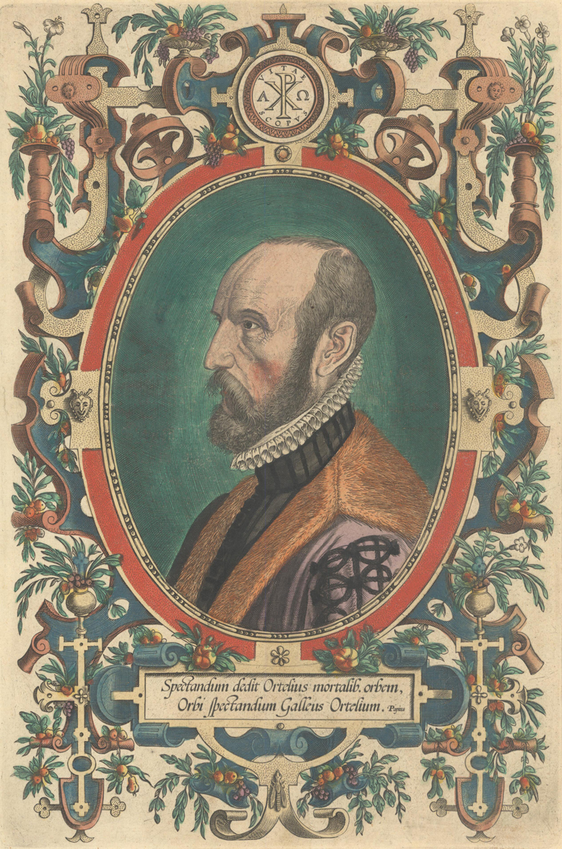
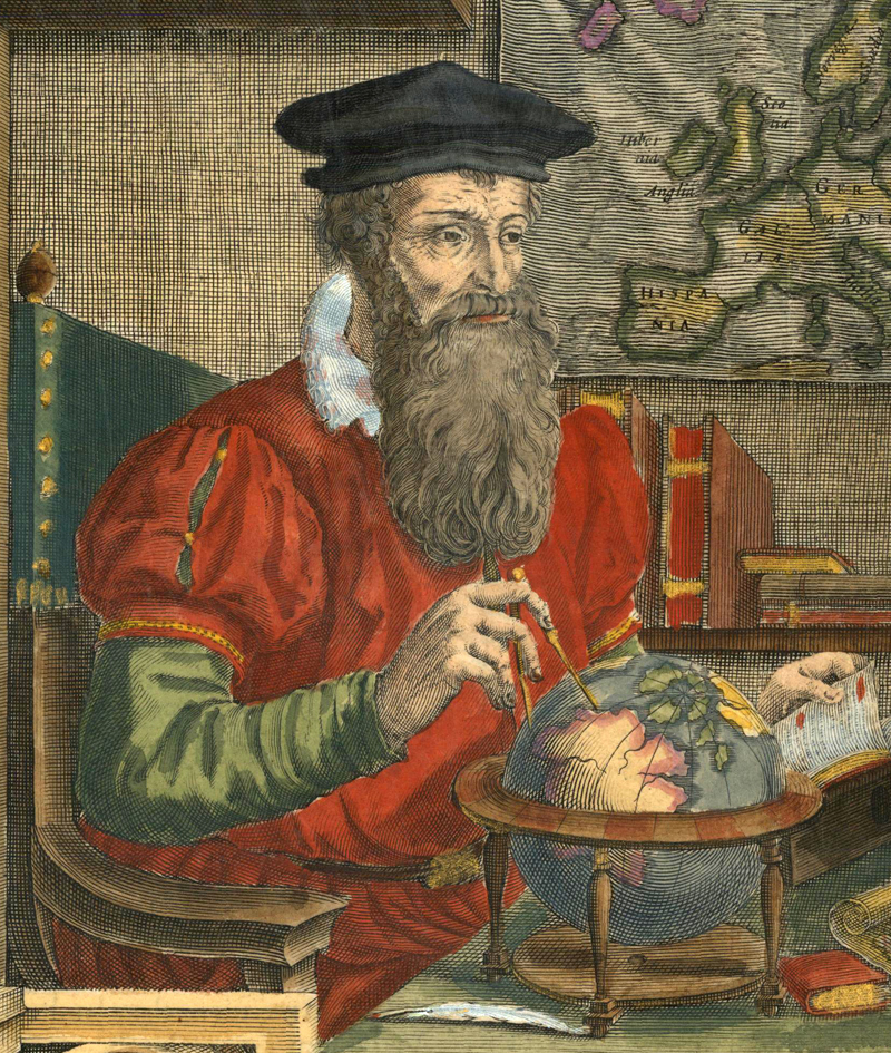
Portrait of Ortelius, engraved by Philip Galle (1579)
Abraham Ortelius and the Birth of the Modern Atlas
by Joe McAlhany
As the father of the modern atlas, few loom larger than Abraham Ortelius in the history of cartography. There were books with maps before Ortelius first published his Theatrum Orbis Terrarum in 1570, most notably 14th- and 15th-century compilations of portolan charts, the early printed editions of Ptolemy’s Geographia, Munster’s Cosmographia (1544), and the assembled-to-order composite collections issued by Antonio Lafreri in the mid-16th century. But the Theatrum was something different, something revolutionary. For the first time, readers could purchase, in a single volume, a collection of the finest available maps to date, uniform in size and aesthetic, with text on the versos that linked contemporary geography to classical sources. The Theatrum inaugurated a boom in atlas publishing in the Netherlands, paving the way for the atlases of Mercator, Hondius, Blaeu, and Jansson that defined the Golden Age of Dutch cartography. In order to understand how this groundbreaking work was created, we are going to survey Ortelius’s remarkable life and illuminate the unique historical circumstances and personal connections that made his atlas possible. We will then take a closer look at five of the key maps from the Theatrum.
Antwerp in an Era of Prosperity and Tumult
Before we dive into the details of Ortelius’s biography and the development of his atlas, it is necessary to establish some context on the time and place in which he lived. Abraham Ortelius was born in Antwerp on April 4, 1527, and died there on June 28th, 1598. In his 71 years, he lived through an extraordinary series of historical events: the religious tensions of the Reformation; the ascendance of the Holy Roman Empire under Charles V; ongoing conflict with the Ottoman Empire; and the first three decades of the Eighty Years’ War. From the European perspective, the world was rapidly expanding as major powers continued to explore and colonize new regions in the Americas and Asia. These political and religious revolutions were accompanied by a humanistic, intellectual revolution, leading to a more educated and cultured middle class - exactly the sort of audience that would value a work like the Theatrum.
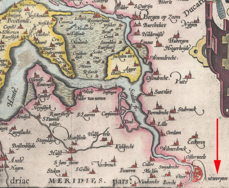
Antwerp and surroundings on Ortelius’s Zelandicarum Insularum Exactissima et Nova Descriptio (1603)
Living in Antwerp, one of the key cultural and trading hubs in Europe in the 16th century, provided Ortelius with an up-close vantage on all this change. Antwerp rose to prominence as trade shifted away from the old Mediterranean routes to the Atlantic routes to the Americas and Asia (sailing around Africa). By the middle of the century, the city was at the center of the global economy. Ortelius would have interacted with traders from all over the world and heard firsthand accounts of far-flung places. The city also had a thriving book and printing industry to meet the demand of the newly educated middle class, dominated by the Plantin printing house, with which Ortelius would form a strong relationship. There was no shortage of artists, printers, engravers, and other craftsmen in Antwerp.
But there were disadvantages to living in the city too, especially in the latter part of Ortelius’s life, when Antwerp was the scene of several explosive clashes between Catholics and Protestants. Throughout his life, Ortelius, who was born into a Catholic family, treaded carefully in religious matters. It is difficult to pin down his views, but his correspondences suggest that he was relatively broad-minded and tolerant; at the very least, he insisted on maintaining strong personal and business relationships with both Protestants and Catholics. He was certainly repulsed by the brutality of the Spanish Inquisition, and with good reason. When he was just 8 years old, he witnessed his father face the inquisitors while his aunt scurried to hide her forbidden Protestant literature. He saw several family members and key collaborators displaced by the Inquisition, and, in his later years, watched the Spanish Catholics decimate his beloved hometown.
Early Life and Career
With that historical context in mind, let us now examine Ortelius’s life and work. He was born Abraham Ortels in 1527, to parents Anne Herwayers and Leonard Ortels. (Abraham started using Ortelius, the Latinized version of his surname, around 1560.) Leonard was a devout and bookish man who dealt in antiquities. Recognizing that his son shared his serious and scholarly demeanor, Leonard began instructing young Abraham in Greek and Latin. This instilled in Abraham a facility with languages that later aided him in his travels and correspondences; he would go on to write the text for the Latin, Dutch, and French editions of the Theatrum, and possessed varying degrees of proficiency in Italian, German, Portuguese, and Spanish. After Leonard’s death in 1537, Abraham and his two sisters, Anne and Elisabeth, lived under the care of their uncle, Jacques van Meteren.
The earliest records of Ortelius’s professional career date back to when he was 19 years old, when he registered with the St. Luke guild of artists as an “afzetter van kaarten,” or map colorist. Both of his sisters worked as map colorists as well, and his sister Anne continued to practice the trade, eventually illuminating some examples of the Theatrum. (So it is possible that some of you out there may own Ortelius maps colored by his sister!) Ortelius supported his family by entering the same business as his father, dealing in antiquities, books, prints, and maps. This line of work (and an evident wanderlust) pushed him to travel extensively throughout Europe. Documents indicate that from 1550 to 1585, Ortelius traveled throughout the Low Countries, and to England, Italy (including Sicily), Germany, France, Switzerland, Austria, Silesia, Bohemia, Hungary, and Ireland. Travel in Ortelius’s day was a struggle: long, slow, physically arduous, and frequently dangerous, thanks to the risky roads and thieving highwaymen. Before the publication of the Theatrum, Ortelius was not a wealthy man, and therefore would have had to do much of his traveling by foot. On his trips, he would acquire maps to color and trade, as well as books, paintings, Greek and Roman coins, and other antiquities. Ortelius was a well-liked businessman and made many friends and contacts on his travels.
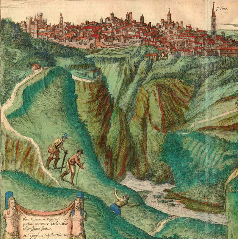
Ortelius is depicted traveling through Tivoli with Georg Hoefnagel on this city view by Braun and Hogenberg, titled Tiburtum Vulgo Tivoli (1598)
One of Ortelius’s most frequent destinations was the Frankfurt Book Fair. It was during a trip to the book fair in 1554 that he met a pivotal new friend: Gerard Mercator. The two men maintained a correspondence into their later years, and also traveled together through France in 1560, along with Frans Hogenberg and Philip Galle. Mercator was one of the key inspirations for the Theatrum Orbis Terrarum, providing critical information and support. Walter Ghim, Mercator’s first biographer, claims that Mercator had conceived of his own atlas before Ortelius, but deliberately waited until his friend had found success with the publication of the Theatrum before completing his own version. The more likely story is that Mercator’s progress was slowed down by the hunt for reliable sources and by his meticulous engraving process. Regardless, Mercator appears to have harbored no grudge against Ortelius for publishing his atlas first. There was mutual admiration between the two men. Mercator is credited in the Theatrum as the author of the atlas’s map of Flanders and is cited elsewhere as an important source on several other maps. Text on the verso of the world map describes Mercator as “the best geographer of our times,” and in their private letters, Ortelius praises Mercator’s rigorous, scientific approach. Mercator returned the compliment: his gushing appraisal of Ortelius’s work is reproduced in editions of the Theatrum from 1573 on.
Posthumous portrait of Gerard Mercator by Coletta Hondius (ca. 1613)
Before Ortelius started making his own maps, he had established himself as a great map collector and trader. In his travels, he accumulated a sizable cartographic collection and supplied the merchants and businesses of Antwerp with maps. “[Ortelius] was probably the greatest expert of his day in the bibliography of maps,” writes Dr. C. Koeman, author of The History of Abraham Ortelius and His Theatrum Orbis Terrarum. “He is not only the father of the atlas but also the ancestor of all cartophiles.” This background laid the groundwork for compiling the Theatrum. But before he endeavored to compile his atlas, Ortelius tried his hand at individual maps.
His earliest cartographic work was an 8-sheet map of the world, based primarily on Mercator’s globe of 1541. The map was published in 1564 by Gerard De Jode, who may also have been one of its engravers. Ortelius and De Jode met as members of the same St. Luke guild of artists. The relationship between the two men apparently soured after the collaboration. There is some evidence that suggests Ortelius sought to undermine De Jode’s own atlas, including attempts to delay its privilege (a proto-copyright) and remove unsold copies from the market. De Jode credits Ortelius on his reduced, separately issued world map of 1571, but the similar world map that appeared in his 1578 atlas omits Ortelius’s name.
Other Ortelius maps that preceded the Theatrum include a 2-sheet map of Egypt (1565) and an 8-sheet map of Asia (1567). These early maps fall short of the high-quality engravings of the Theatrum maps, and few copies exist today.
The Birth of the Theatrum Orbis Terrarum
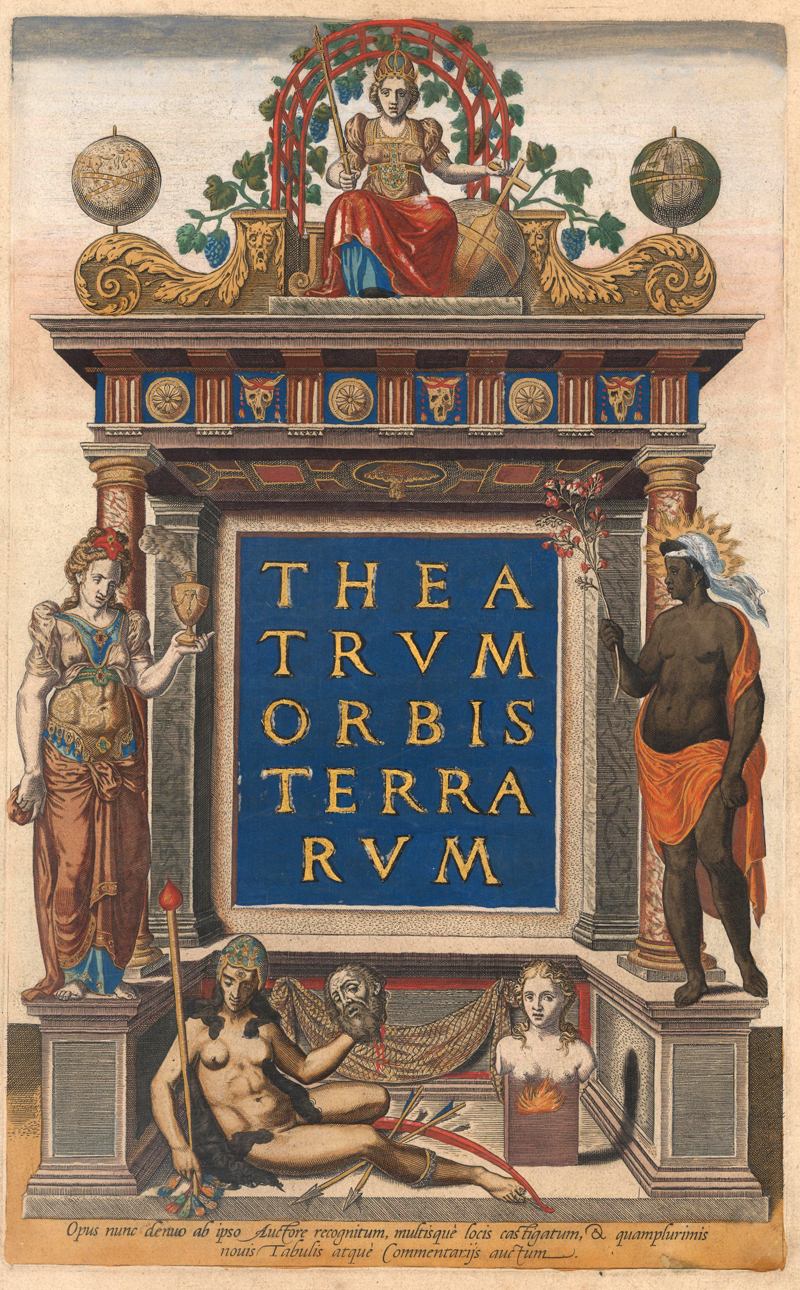
The title page for the Theatrum (1570)
Mercator may have been a major inspiration for the Theatrum, but there is another compelling narrative for its origins involving one of the most prominent citizens of Antwerp, the merchant, shipbuilder, and intellectual Gillis Hooftman. Through his work as a trader, Ortelius made contact with Hooftman and quickly earned his trust. Hooftman, one of the wealthiest men of his era, likely funded some of Ortelius’s travels in exchange for Ortelius checking in on his foreign business. Maps and charts were quite useful in Hooftman’s line of work, but the large, rolled maps of the era were too unwieldy for convenient consultation. Hooftman’s solution to this problem was to ask Ortelius to assemble a compilation of maps covering the coasts of Europe in a portable book format. The resulting book of some 38 maps is now lost, but it perhaps served as an important forerunner for the Theatrum.
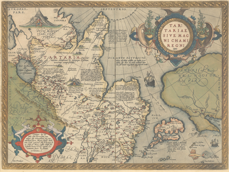
It is unknown when work on the Theatrum began, but according to Koeman, the labor of its principal engraver, Frans Hogenberg, took place around 1565. In his message to the reader in the 1570 Latin edition, Ortelius credits Hogenberg with engraving most of the maps “with a skillful hand and indefatigable attention.” The relationship between Hogenberg and Ortelius dated back several years. There is evidence that Ortelius may have connected Frans and his brother Remigius, both German Protestants, with his exiled cousin Emanuel van Meteren, so that they could relocate to London and escape religious persecution. Frans later returned to Flanders, but by the time the Theatrum was published in 1570, he had already moved to Cologne, where he revolutionized the city's printing and publishing industry by essentially bringing copperplate engraving to town. Two years after the publication of the Theatrum, Hogenberg and editor Georg Braun published the first volume of Civitates Orbis Terrarum, their landmark 6-volume city atlas.
Tartariae sive Magni Chami Regni Typus (1587), engraved by Frans Hogenberg
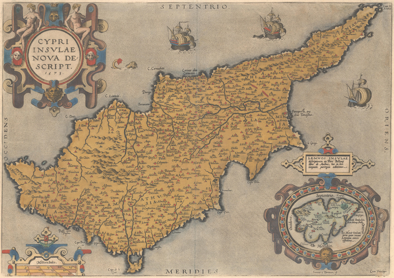
Hogenberg was assisted in his work on Ortelius’s atlas by the brothers Ferdinand and Ambrosius Arsenius, who are thanked in Ortelius’s message to readers. Jan van Doetechum, who also engraved for De Jode and Waghenaer with his brother Lucas van Doetechum, contributed maps of Cyprus and the Holy Land. Jan would later cut plates for the Epitome, an adaptation of the Theatrum for the pocket atlas format, but Ortelius disparaged his work as inferior. The only other credited engraver in the Theatrum during Ortelius’s lifetime was his old friend Philip Galle, a publisher who initially met Ortelius through the St. Luke guild. Galle’s striking portrait of Ortelius appeared in every edition of the Theatrum from 1579 on.
Cypri Insulae Nova Descript. (1573), engraved by Jan van Doetechum
In June 1570, the first edition of the Theatrum Orbis Terrarum was printed by Gillis Coppens van Diest, another member of the St. Luke guild. Ortelius financed the printing himself, although Hooftman may have also contributed some backing. The atlas initially included 53 maps. They were preceded by an allegorical frontispiece with five female figures representing the continents; the “Catalogus Auctorum,” a bibliography of the various cartographers used (87 in total for the first edition); a dedication to Philip II; a poem explaining the meaning of the frontispiece; and Ortelius’s note to the reader, wherein he explained his methodology.
Ortelius’s primary role in the construction of the atlas was compiler and editor. He relied on his deep knowledge of contemporary maps to select the very best for the Theatrum. As the “Catalogus Auctorum” indicates, Ortelius was scrupulous about citing his sources. On the maps where there were only slight tweaks made for format and legibility, Ortelius credits the author directly on the map. On other maps, drawn from multiple sources, Ortelius amended the cartography and added new features, pushing beyond the role of editor into the realm of mapmaker. No cartographer is directly credited on these maps. The maps were adapted and engraved to fit a unified format and aesthetic. It is a testament to Ortelius’s powerful editorial hand that the finished product, drawn from so many sources, forms a coherent whole.
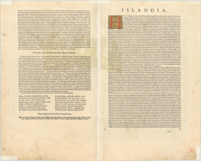
All of the maps featured text on verso (in Latin for the first edition), one of the key innovations that distinguished the Theatrum from other map books. Ortelius believed that readers would be disappointed if the versos were left blank. So he filled them with text listing any sources used in the creation of the map along with information about the area depicted. On maps of regions where Ortelius himself had visited, some of the information was derived from his own observations.
The verso of the 1595 Latin edition of Ortelius' map of Iceland
At the time of its publication, the Theatrum Orbis Terrarum was the most expensive book ever produced. Christophe Plantin, the humanist printer and publisher who ran Antwerp’s highly successful Plantin Press, bought a large number of copies and sold them in three price tiers: uncolored editions for 6 florins, 7 stuivers; editions on high quality paper for 7 florins, 10 stuivers; and illuminated editions for 16 florin. Despite its high price tag, the atlas was an enormous success. It had birthed a new type of book into the world, a cohesive collection of maps and accompanying text, beautifully designed and executed. Due to its popularity, two more Latin editions were published in 1570 alone. From 1570 to 1641, the work was republished in 35 editions by a succession of publishers, most notably Plantin, whose press produced 16 editions in 6 different languages between 1579 and 1641, and Jan Baptista Vrients, who purchased the rights from Ortelius’ heirs in 1601 and published 6 editions from 1602 to 1609. The best estimate is that 8,225 copies of the Theatrum were published overall.
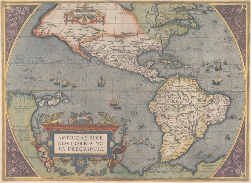
The atlas was constantly growing and changing. Ortelius asked readers to submit corrections and additional maps to improve and expand his atlas, perhaps inspired by a similar call Munster included in his Geographia Universalis. New plates were engraved to fix major geographical mistakes, such as the famous bulge in South America on the first plate of the maps of the world and Western Hemisphere, or to replace damaged or outmoded plates. More commonly, plates were amended when the time came for worn plates to be re-cut; areas that needed improvement would be polished and re-engraved with new information.
Corrected third plate of Ortelius’s Americae sive Novi Orbis, Nova Descriptio (1595), with the bulge removed from South America
Later editions often incorporated Ortelius’s Additamenta and Parergon, a series of maps focused on ancient history, most of which were designed by Ortelius himself. Koeman referred to the maps of the Parergon as “the most outstanding engravings depicting the wide-spread interest in classical geography in the 16th century.” The last edition of the Theatrum ballooned from the original 53 maps to 165 maps. (Cartographica Neerlandica, the online resource created by the late Dr. Marcel van den Broecke and his wife Dr. Deborah van den Broecke-Günzburgeris, is an essential resource for identifying the various plates, states, and editions of maps from the Theatrum.)
The Fruits of Success and the Fall of Antwerp
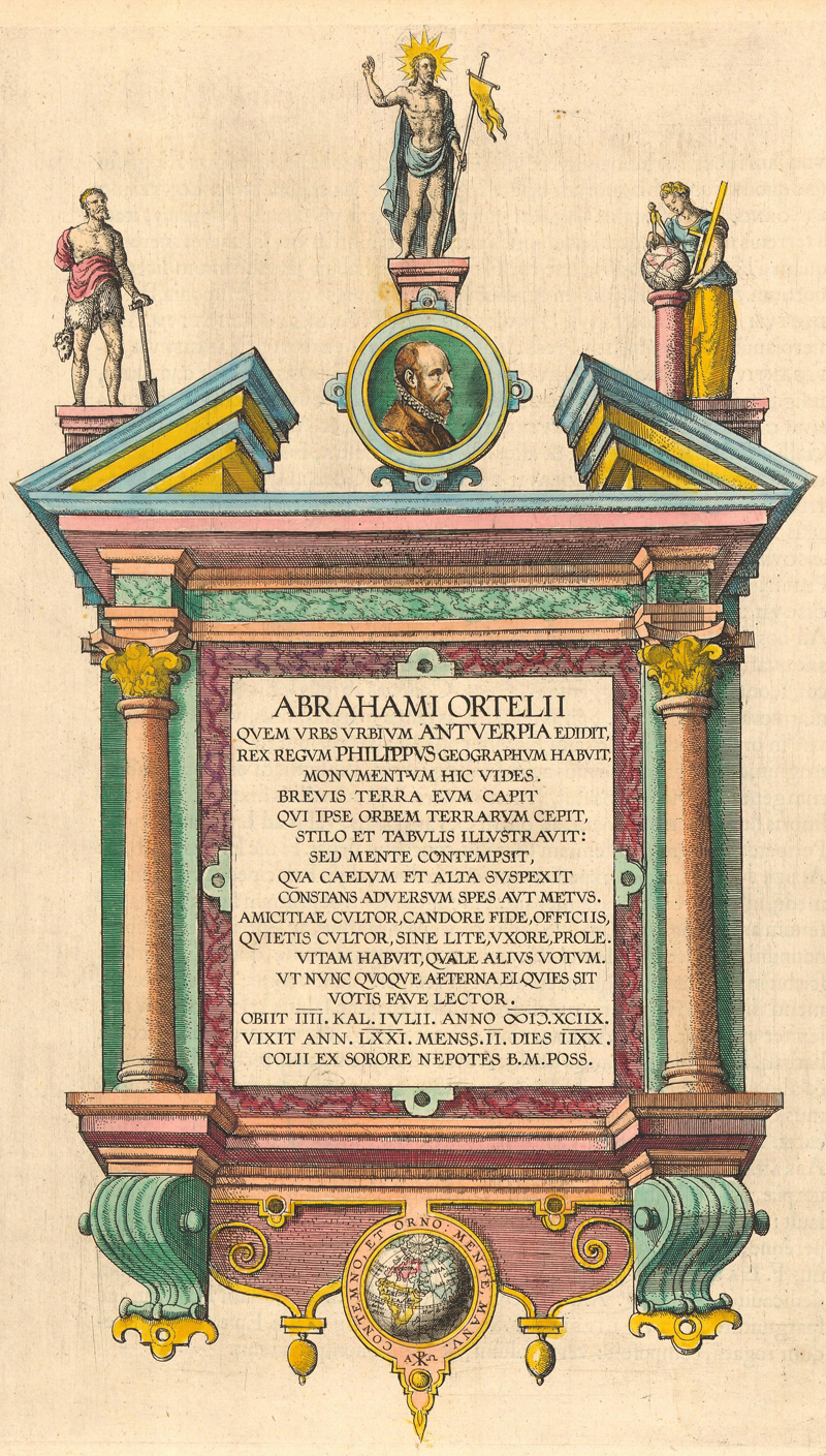
Frontispiece from a posthumous edition of the Theatrum (ca. 1609), featuring a portrait of Ortelius and a commemorative plaque showing the epitaph engraved on his tomb
In 1574, at the suggestion of friend and mapmaker Benito Arias Montano, Philip II, the Catholic king of Spain, appointed Ortelius to the rank of Royal Cosmographer. In the Habsburg Netherlands, this appointment meant more than just mere prestige - it protected Ortelius from the violence of the Spanish occupiers. Or at least it did in theory. During the Spanish Fury of 1576, Ortelius’s house was damaged by Spanish soldiers while he was out of the country. Fortunately, his relationship with the king led to him being compensated for the damage.
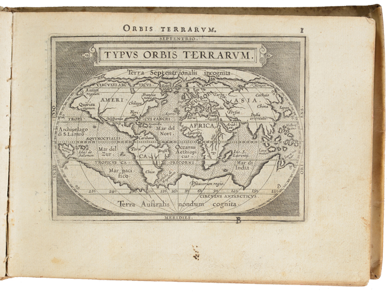
From 1577 to 1595, Philip Galle issued eleven editions of the Epitome, a pocket atlas based on the Theatrum. Most were printed by Plantin. Ortelius allowed his old friends to publish the work, but otherwise he was not involved in its creation, and received none of the profits. Galle’s Epitome was followed by other posthumous Ortelius miniature atlases, such as those by Marchetti, Vrients, and the Arsenius brothers.
An example of Philip Galle’s Epitome (1589)
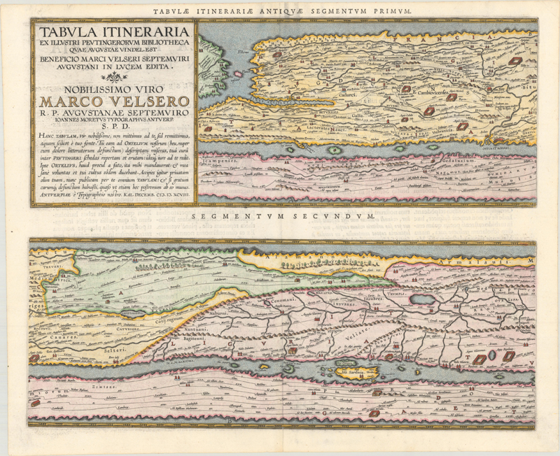
Aside from the Theatrum, its Additamenta, and the Parergon, Ortelius published only minor volumes, such as his geographical thesauruses (1578 and 1587), an Album Amicorum (circa 1594) celebrating his friends and acquaintances, and Aurei Saeculi Imago, an illustrated volume on the ancient Germans published by Galle. His last major cartographic project, unfinished at the time of his death, was his 4-sheet version of the Peutinger map of the Roman empire.
Ortelius’s final cartographic project: the posthumously published Peutinger table (1598)
The resounding success of the Theatrum Orbis Terrarum had made Ortelius a tremendously wealthy man. He used his wealth to grow his personal collection of antiquities, maps, and books. (He was apparently particularly obsessed with his coins.) His cabinet of curiosities swelled to such titanic proportions that he had to purchase a larger house and the house next door to store it. (Perhaps some of the collectors out there can relate.) The “Museum Ortelianum” became an important cultural destination in Antwerp.
Antwerp, however, was sinking into decline. The city crumbled in the aftermath of the Catholic Duke of Parma’s siege of Antwerp in 1585, as Protestants were expelled en masse from the city. Much of the mercantile class and printing industry fled north to Amsterdam, where the great post-Theatrum atlases would be published. The River Scheldt, the vein which once connected Antwerp to international trade, remained blockaded. By the time Ortelius died in 1598, Antwerp’s era of prosperity had decisively concluded, and more than half of his hometown’s pre-siege population had died or moved away.
It is unfortunate that Ortelius died at such a low point for his city, but it is hard to look at the sweep of his life and not see a success story. He emerged from humble origins and died wealthy and widely respected. He was able to live a life full of travel, strong friendships, and invigorating intellectual pursuits. Most importantly for our purposes, he created the modern atlas and inaugurated a new era in the history of cartography with his masterwork, the Theatrum Orbis Terrarum. As Mercator writes in his letter of praise reprinted in later editions of the Theatrum, “You deserve great praise for having selected the best descriptions of each region and collected them into one manual, which can be bought at small cost, kept in a small space and even carried about wherever we please [...] Your work will (I believe) always remain saleable, whatever maps may be re-printed by others.” That assurance is more prescient than Mercator ever could have predicted. More than 450 years after the initial publication of the Theatrum Orbis Terrarum, Ortelius’s maps are still collected, studied, and loved all over the world.
The Maps of the Theatrum
Now we will highlight a handful of the most desirable and important maps from Ortelius' great work.
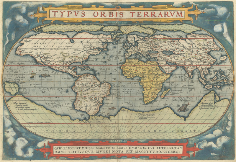
Typus Orbis Terrarum (1570)
First plate
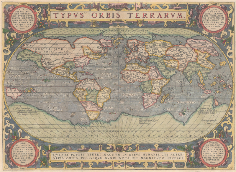
Marcel Van den Broecke writes, “As the first world map occurring in the first regular atlas, this map is of fundamental importance in the history of cartography.” It is one of the few maps in the Theatrum to show the engraver’s signature: Frans Hogenberg, at bottom right. The cartography is largely based on Mercator’s famous world map of 1569, which introduced his revolutionary namesake projection. Ortelius instead opts for an oval projection, situated in an attractive cloud background. The Americas are in a distorted configuration copied from Mercator: North America is much too wide, and South America has a bulbous protrusion along its southwestern coastline. In the Arctic, the Northwest Passage snakes its way south of four large landmasses. Terra Australis Nondum Cognita, a conjectural proto-Antarctica, fills the southernmost section of the map.
Across the lifespan of Ortelius’s atlas, three separate plates of the world map appeared. The original, as described above, was used in the first 16 editions. A visible crack developed in the lower left corner from 1570 onward. The second plate, the rarest of the trio, only appeared in a few editions and is distinguished mainly by the splitting of “Aeternitas” in the Cicero quote at bottom. The changes in the third plate are more significant: the bulging South America coastline is corrected, the Solomon Islands are added near New Guinea, the cloud motif is replaced by strapwork, and engraved medallions fill the corners.
Third plate
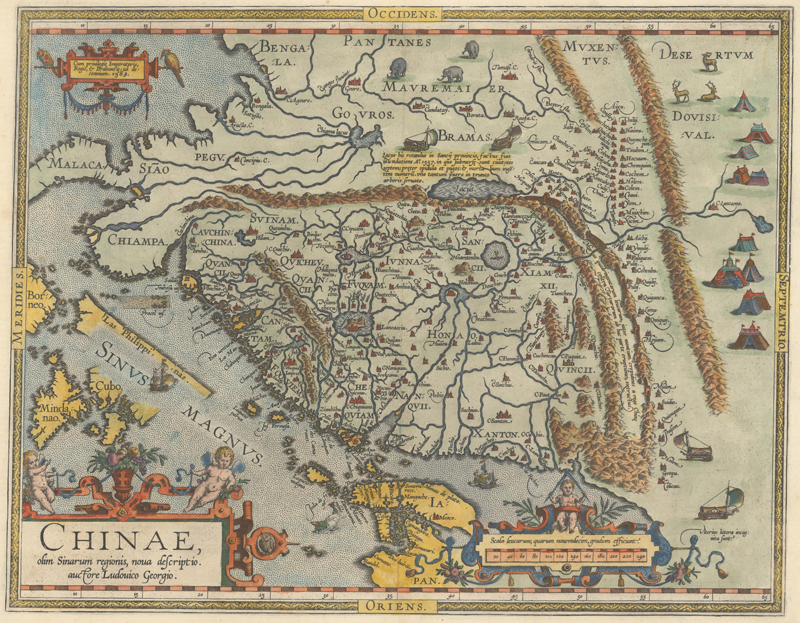
Chinae, olim Sinarum Regionis, Nova Descriptio. Auctore Ludovico Georgio (1584)
Ortelius’s map of China was the first map of the region printed in Europe. For the next 70 years, it was the defining Western view of China. The map is based on the work of Luiz Jorge de Barbuda, a Portuguese Jesuit also known as Ludovicus Georgius, whose manuscript map reached Ortelius by way of Benito Arias Montano. On the map, the north is oriented to the right, an editorial decision that helps it conform with the atlas format. It extends into parts of Indo-China, the Philippines, and Japan. The Great Wall is prominently delineated (although it is more than 12,700 miles too short!), and two mythical lakes are included: Chiama Lacus (Lake Chiamay), with five rivers flowing south, and a larger lake simply labeled Lacus that is purported to be the source of the Yellow River. The evocative illustrations in the interior include tent cities of the Tartars, stags, elephants, and elaborate sail-powered carriages.
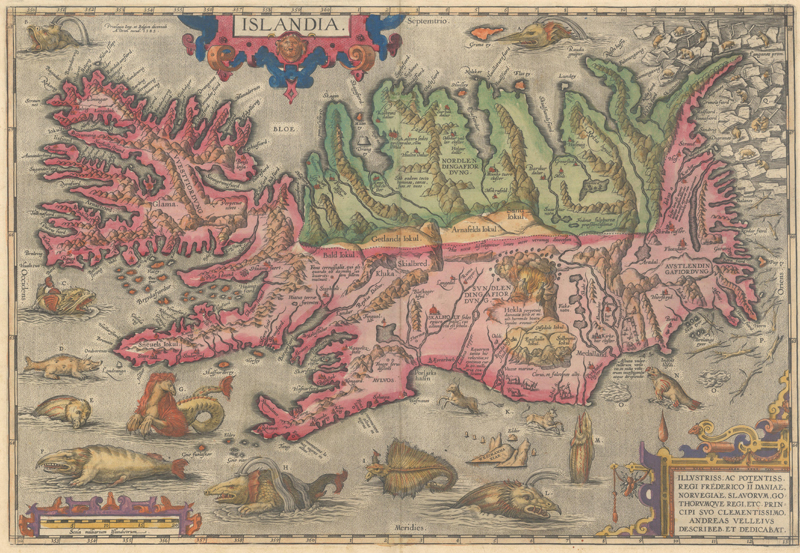
Islandia (1585)
Dated 1585, but first issued in 1587, Ortelius’s map of Iceland is one of the pinnacles of decorative cartography. Its seas are packed with an imaginative assemblage of beasts, with a lettered key on verso providing descriptions of each creature. Alongside its relatively realistic portrayal of whales, walruses, and polar bears, there are more fantastical monsters, among them a sea horse (complete with mane), a sea cow, and an aquatic hyena supposedly derived from the accounts of Swedish writer and cartographer Olaus Magnus. Ortelius attributes the cartography to Danish historian Andres Sorensen Vedel, who drew on a now-lost map by Bishop Gudbrandur Thorlaksson, a native Icelander who likely utilized early records of fjords, church documents, and firsthand knowledge of his homeland as sources.
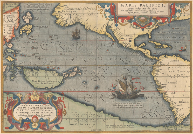
Maris Pacifici, (quod Vulgo Mar del Zur)… (1589)
Ortelius’s map of the Pacific first appeared in the Theatrum in 1590 and is therefore less common than Ortelius’ earlier maps featuring the Americas. Even more importantly, it is the first printed map to specifically focus on the Pacific, based on the cartography of Mercator’s world map of 1569 and roughly 25 Portuguese manuscript maps from Bartolomeo de Lasso. The map was the culmination of 16th-century European knowledge of the ocean, published at a time when Spanish ships were exploring the western coast of the Americas and Manilla galleons were dodging English pirates on the route to Acapulco. Ferdinand Magellan’s pioneering voyage across the Pacific in 1520-21 is commemorated with a large illustration of his ship, the Victoria, in the South Sea (Mar del Zur).
Because it was not widely copied, the map’s depiction of the region remains unique and novel. Ortelius widens the gap between Asia and North America and properly locates the Philippines and Japan, although the mythical Isle of Silver (Isla de Plata) floats to the north of Japan. Within his work, Ortelius wavered on the question of whether or not New Guinea was an island; his 1570 world map shows it as one while his 1587 map of the Americas connects it to the southern continent. Here it is unambiguously delineated as an island. California is illustrated in peninsular form, with the first appearance of the R. Grande at the head of the Gulf of California. Following Mercator’s world map, Tierra del Fuego is part of the vast and mysterious Terra Australis.
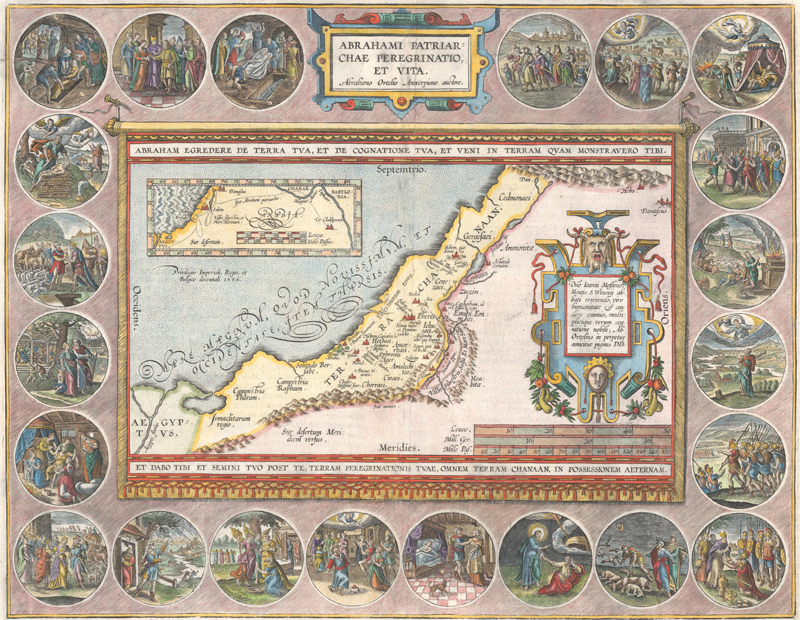
Abrahami Patriarchae Peregrinatio, et Vita (1586)
We end on a bit of an outlier: one of the Parergon maps, designed by Ortelius himself and likely engraved by him as well. Its depiction of the Holy Land is based on Ptolemy, but the content is biblical in nature, detailing the wanderings of Abraham. The map is displayed as though on a banner hung on a wall. Ortelius’s imaginative design includes an elaborately engraved frame containing twenty-two scenes illustrating the life of Abraham, spanning his departure from Ur to his death.
References:
Caboara, Marco, Regnum Chinae: The Printed Western Maps of China to 1735, Brill, Leiden, 2022.
Koeman, Dr. C, The History of Abraham Ortelius and His Theatrum Orbis Terrarum, American Elsevier Publishing Company, Inc., New York, 1964.
Sigurðsson, Haraldur, Image of Iceland – Milestones in Cartography, The Culture House, Reykjavik, 2002.
Suárez, Thomas, Early Mapping of the Pacific – The Epic Story of Seafarers, Adventurers, and Cartographers Who Mapped the Earth’s Greatest Ocean, Periplus Editions, Singapore, 2004.
Van den Broecke, Marcel, Abraham Ortelius 1527-1598: Life - Works - Sources and Friends, Cartographica Neerlandica, Bilthoven, Netherlands, 2015.
Van den Broecke, Marcel, Ortelius Atlas Maps: An Illustrated Guide - Second Revised Edition, Hes & De Graaf Publishers, Houten, Netherlands, 2011.
Van der Krogt, Dr. Peter, Koeman’s Atlantes Neerlandici Volume III, Hes & De Graaf Publishers, ‘t Goy-Houten, Netherlands, 2003.