Subject: United States - Central
Period: 1853-4 (dated)
Publication: U.S. Pacific Railroad Surveys
Color: Black & White
Size:
36.7 x 24.5 inches
93.2 x 62.2 cm
During the 1850s, the U.S. government sponsored an extensive series of expeditions designed to gather information on the vast new territories that had been acquired in western North America. The discovery of gold in California further stimulated westward traffic and heightened the need for a faster and more convenient way to bring the far-flung parts of the country together. In 1853 Congress commissioned the Army's Topographic Bureau to conduct a series of surveys to find a suitable route for a transcontinental railroad. There were six major expeditions; five of them covered the area between the Great Plains and west coast, and the sixth explored the coastal states of California and Oregon. All of these expeditions were accompanied by naturalists and artists to document the landscape, flora and fauna along the route.
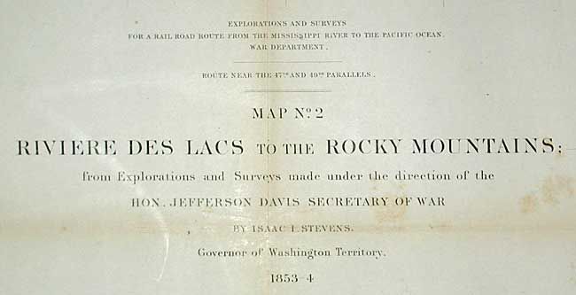
The reports, maps and lithographs were published in the 13 volume report "Explorations and Surveys to ascertain the most practicable and economical route for a Railroad from the Mississippi river to the Pacific Ocean."
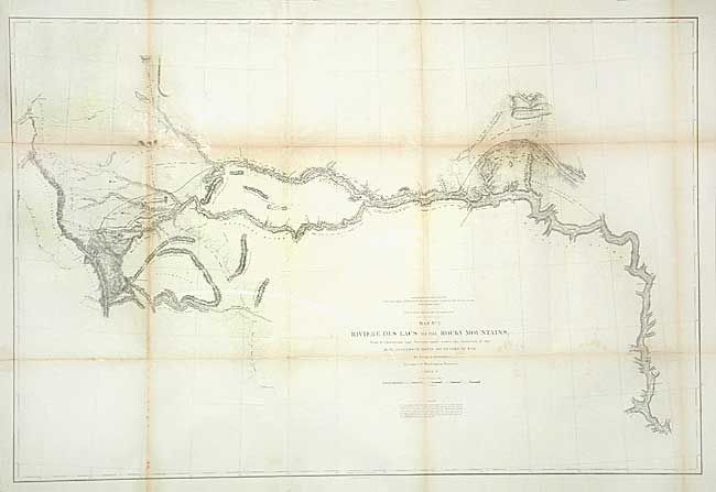
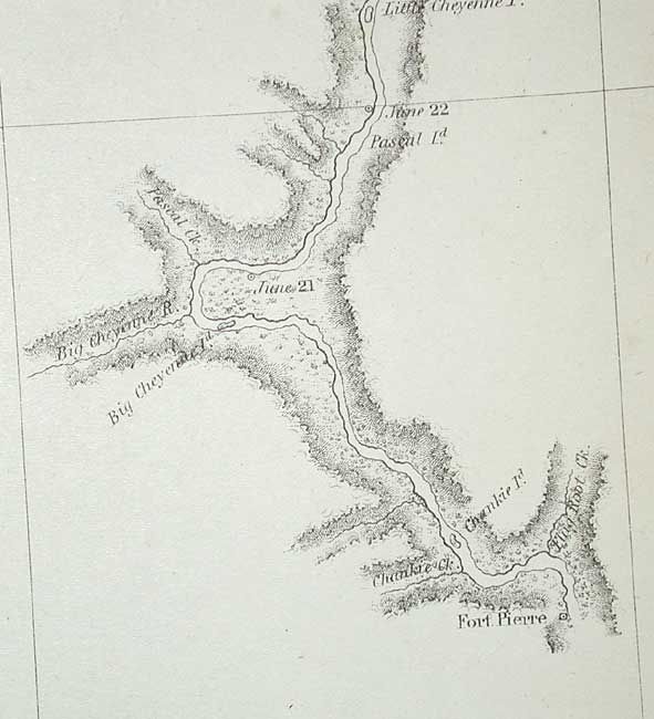
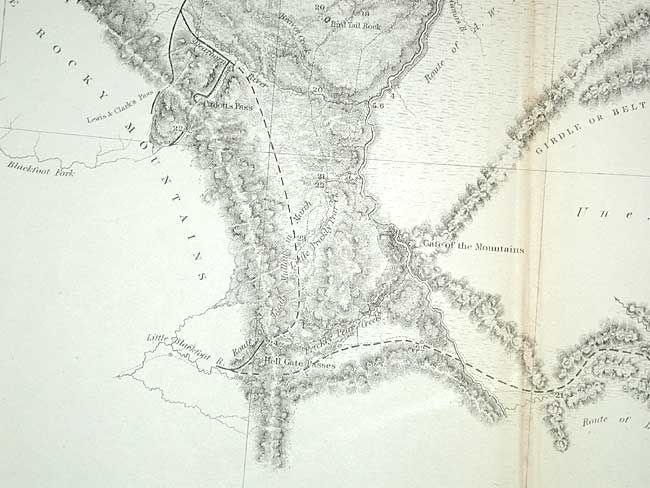
This map details the Stevens surveys beginning on the Missouri River at Fort Pierre and culminating at the Continental Divide of the Rockies. The route travels along the Plateau of the Missouri to Fort Benton (Missoula) and on to the Continental Divide at Lewis and Clark Pass. Locates Hell's Gate Passes to the south. Filled with many place names, forts, unexplored areas, etc. Mountain terrain indicated through fine hachuring.
References: Wheat (TMW) #862.
Condition: B
A few tiny splits at fold corners with old repairs, backed with tissue.