Subject: United States - Central
Period: 1857 (dated)
Publication: Atlas of United States of America…
Color: Hand Color
Size:
16.6 x 13 inches
42.2 x 33 cm
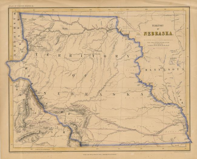
This scarce map is an unusual collaboration between an American (Rogers) and a Scot (A. Keith Johnston). It is derived from the large Map of The United States, British & Central America, by Rogers and Johnston of the same year; perhaps the best example of Scottish highly detailed mapmaking applied to the western territories in the pre civil war period. The map is on a scale of 54.5 miles to one inch, and is very well executed. It shows the Nebraska Territory incorporating the entire northern plains bounded by Minnesota and Iowa on the east, and Washington, Oregon and Utah on the west. The proposed route of the Pacific Railway is over-printed in purple.
References:
Condition: A