Catalog Archive
Auction 106, Lot 108

"Carte des Possessions Angloises & Francoises du Continent de l'Amerique Septentrionale", Palairet, Jean

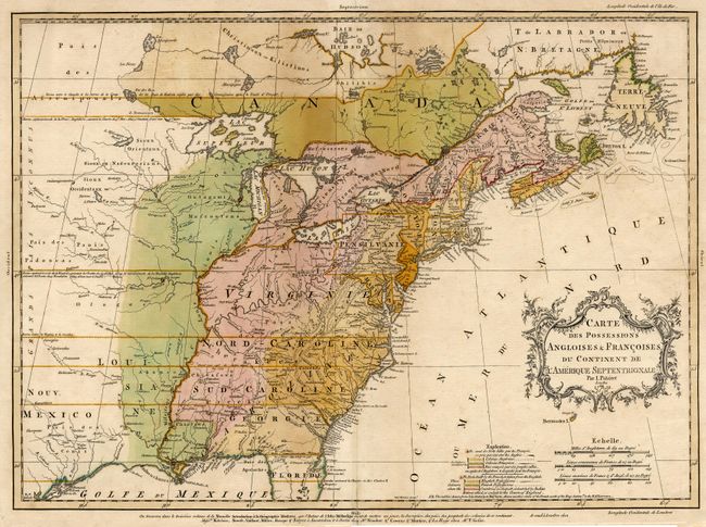
Subject: Colonial United States and Canada

Period: 1756 (dated)

Publication: Atlas Methodique

Color: Hand Color

Size:
22.5 x 16.7 inches
57.2 x 42.4 cm
Download High Resolution Image
(or just click on image to launch the Zoom viewer)

This fascinating map is the second state of one of the best maps of the colonies on the eve of the French and Indian War. Mr. Palairet was the Agent to the States-General in London. In 1755 he published the pamphlet "A Concise Description of the English and French Possessions in North-America." The map was engraved by Thomas Kitchen and intricately colored to show the disputed lands, forts, roads, and the extent of settlement in the region. Embellished with a delicately engraved title cartouche.

References: McCorkle #755-22; Sellers and Van Ee, map #56; Tooley (America), p. 62 #18-c.

Condition: A

Fine original color with slight oxidation.

Estimate: $2,000 - $2,200

Sold for: $2,750

Closed on 3/3/2004

Archived