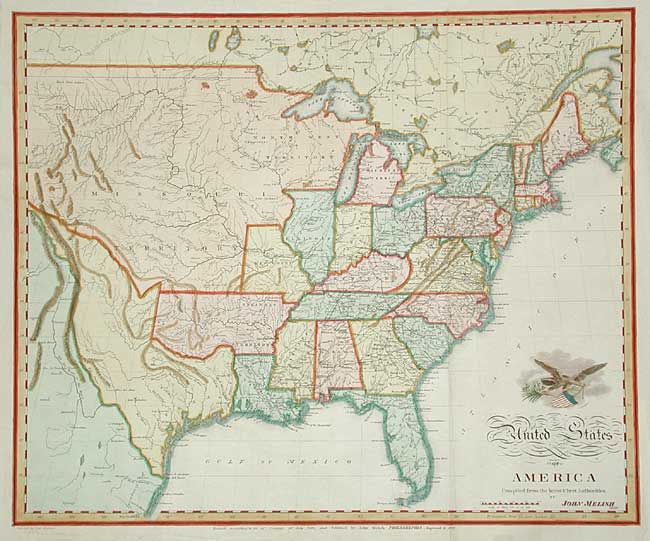
Subject: United States
Period: 1822 (dated)
Publication: The traveller's directory through the United States…
Color: Hand Color
Size:
19.5 x 15.9 inches
49.5 x 40.4 cm
An uncommon map by the important American cartographer John Melish, engraved by Samuel Harrison. The map extends west to the Rocky Mountains and provides a detailed view of the Missouri River based on information from Lewis and Clark's expedition. A notation at the western edge of the map shows where "Clarks Canoes stop 3000 miles from the Mississippi." The large Arkansas Territory takes in most of present-day Oklahoma with the balance of the west being Missouri Territory and North West Territory. Texas is a state in Mexico. Above the script title is a vignette of an eagle blazoned with the stars and stripes. First issued in 1818, the map is dated under the title 1820, with a note that it has been Improved to 1822.
References:
Condition: A
Later color.