Filtered by Category:Canada(Show All Categories)
Showing results for:Auction 118
Catalog Archive
50 lots
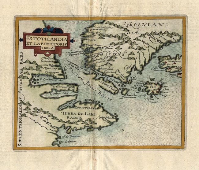
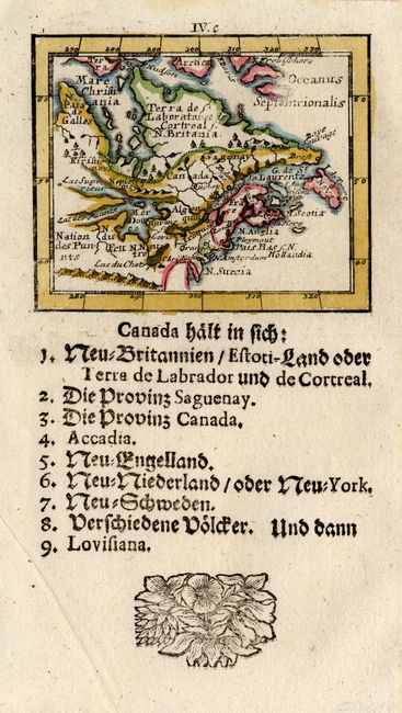
Auction 118, Lot 159
Subject: Canada and Greenland
Metellus, Natalius Sequanus
Estotilandia et Laboratoris Terra, 1600
Size: 9 x 7.1 inches (22.9 x 18 cm)
Estimate: $800 - $1,000
Sold for: $750
Closed on 3/6/2007
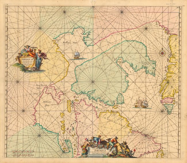
Auction 118, Lot 160
Subject: Canada and Greenland
Wit, Frederick de
Septemtrionaliora Americae a Groenlandia, per Freta Davidis, et Hudson, ad Terram Novam / De Noordelyckste Zee kusten van America van Groenland door de Straet Davis ende Straet Hudson tot Terra Neuf, 1675
Size: 22 x 19 inches (55.9 x 48.3 cm)
Estimate: $900 - $1,400
Sold for: $650
Closed on 3/6/2007
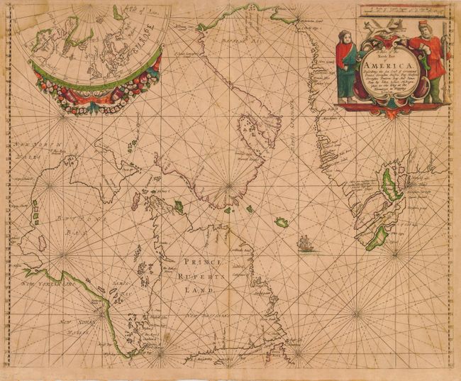
Auction 118, Lot 161
Subject: Canada and Greenland
Seller, John
A Chart of the North Part of America Describing the Sea Coast of Groenland Davies Streights Baffins Bay Hudsons Streights Buttons Bay and James Bay, 1675
Size: 21.3 x 17 inches (54.1 x 43.2 cm)
Estimate: $1,500 - $2,000
Sold for: $2,100
Closed on 3/6/2007
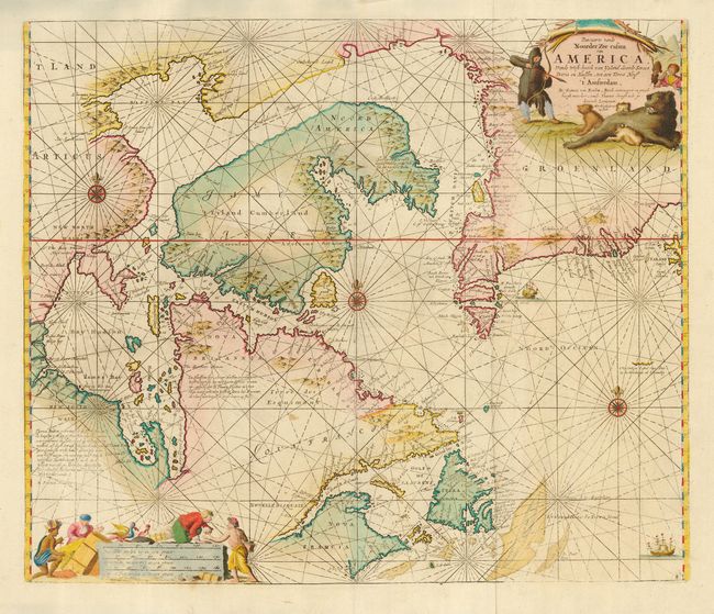
Auction 118, Lot 162
Subject: Canada and Greenland
Keulen, Johannes van
Pascaarte vande Noorder Zee custen van America, vande West-hoeck van Ysland doorde Straet Davis en Hudson, tot aen Terra Neuf, 1728-83
Size: 23.5 x 19.7 inches (59.7 x 50 cm)
Estimate: $600 - $800
Sold for: $450
Closed on 3/6/2007
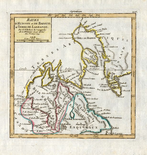
Auction 118, Lot 163
Subject: Canada and Greenland
Robert de Vaugondy
Bayes d'Hudson et de Baffins, et Terre de Labrador, 1749
Size: 6.5 x 6.4 inches (16.5 x 16.3 cm)
Estimate: $100 - $150
Sold for: $75
Closed on 3/6/2007
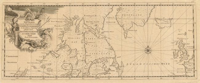
Auction 118, Lot 164
Subject: Canada and North Atlantic
Ellis, Henry
Neue Karte von den Gegenden wo eine Nordwest Durchfahrt in den Iahren 1746-1747…, 1750
Size: 17.5 x 6.8 inches (44.5 x 17.3 cm)
Estimate: $120 - $200
Sold for: $375
Closed on 3/6/2007
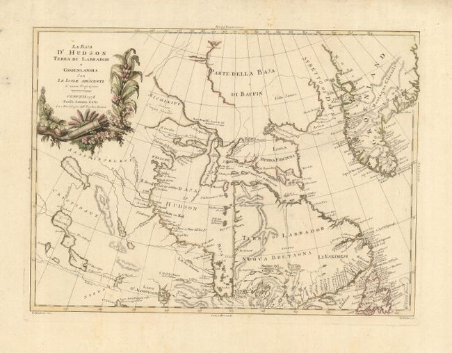
Auction 118, Lot 165
Subject: Canada - Greenland
Zatta, Antonio
La Baja d'Hudson Terra di Labrador e Groenlandia con le Isole Adiacenti, 1778
Size: 15.8 x 11.7 inches (40.1 x 29.7 cm)
Estimate: $250 - $325
Unsold
Closed on 3/6/2007
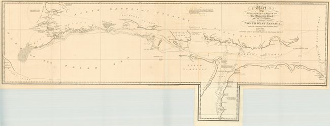
Auction 118, Lot 166
Subject: Canadian Arctic
Parry, William Edward (Adm. Sir)
Chart of the Discoveries & Route of his Majesty's Ships Hecla and Griper in search of a North West Passage, 1821
Size: 37.3 x 13.7 inches (94.7 x 34.8 cm)
Estimate: $250 - $300
Sold for: $325
Closed on 3/6/2007
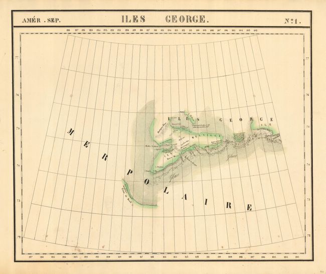
Auction 118, Lot 167
Subject: Canadian Arctic
Vandermaelen, Philippe Marie Guillaume
[Lot of 4 - Arctic Canada], 1825-7
Size: 23 x 19 inches (58.4 x 48.3 cm)
Estimate: $400 - $600
Sold for: $300
Closed on 3/6/2007
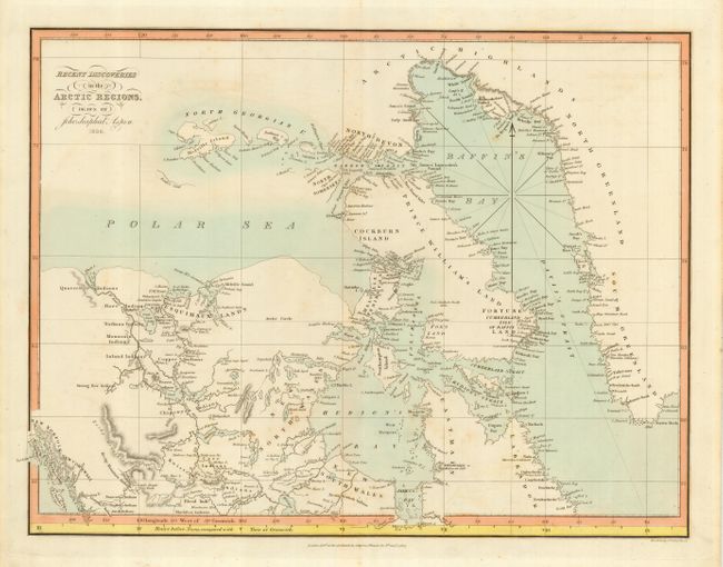
Auction 118, Lot 168
Subject: Canadian Arctic
Aspin, Jehoshaphat
Recent Discoveries in the Arctic Regions, 1827
Size: 17 x 13 inches (43.2 x 33 cm)
Estimate: $200 - $275
Sold for: $150
Closed on 3/6/2007
Auction 118, Lot 169
Subject: Canadian Arctic
Vandermaelen, Philippe Marie Guillaume
[Lot of 4 - Arctic Canada], 1827
Size: 22.8 x 19 inches (57.9 x 48.3 cm)
Estimate: $300 - $500
Sold for: $200
Closed on 3/6/2007
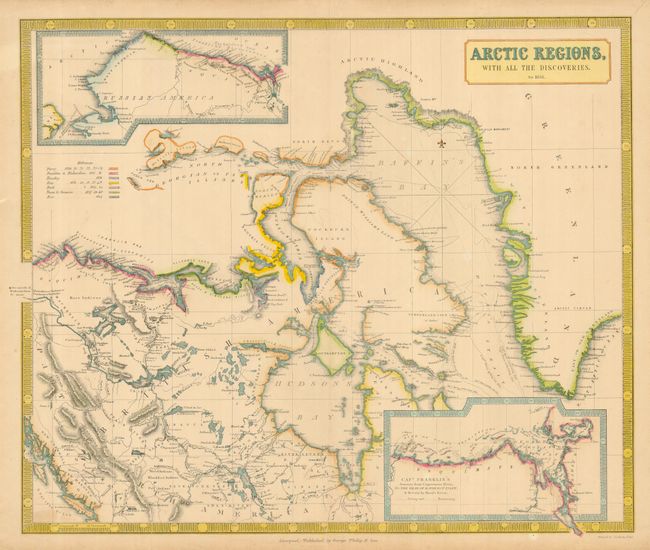
Auction 118, Lot 170
Subject: Canadian Arctic
Philip, George
[Lot of 2] Arctic Regions, with All the Discoveries, to 1851 [together with] Arctic Regions, with All the Discoveries, to 1853, 1851/53
Size: 23.8 x 19.8 inches (60.5 x 50.3 cm)
Estimate: $400 - $600
Unsold
Closed on 3/6/2007
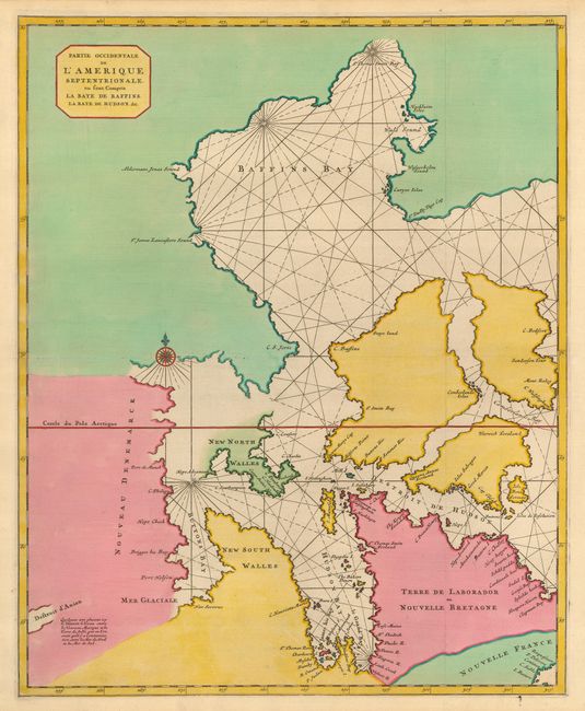
Auction 118, Lot 171
Subject: Canada - Hudson Bay
Mortier, Pierre
Partie Occidentale de l'Amerique Septentrionale, ou sont Compris la Baye de Baffins, la Baye de Hudson, &c., 1695
Size: 18.4 x 22.7 inches (46.7 x 57.7 cm)
Estimate: $700 - $1,000
Unsold
Closed on 3/6/2007
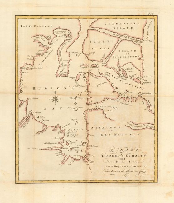
Auction 118, Lot 172
Subject: Canada - Hudson Bay
Swaine Drage, Charles
A Chart of Hudson's Straits and Bay, According to the Discoveries made between the Years 1610 & 1743, 1749
Size: 11.5 x 13.4 inches (29.2 x 34 cm)
Estimate: $150 - $200
Sold for: $110
Closed on 3/6/2007
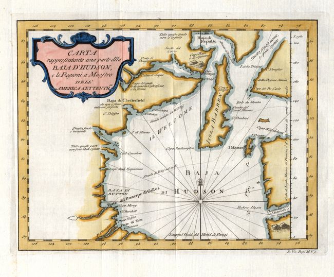
Auction 118, Lot 173
Subject: Canada - Hudson Bay
Rossi, Veremondo
Carta rappresentante una parte dlla Baja d'Hudson, e le Regioni a Maestro dell'America Settentrle., 1763
Size: 10.5 x 8.1 inches (26.7 x 20.6 cm)
Estimate: $140 - $200
Unsold
Closed on 3/6/2007
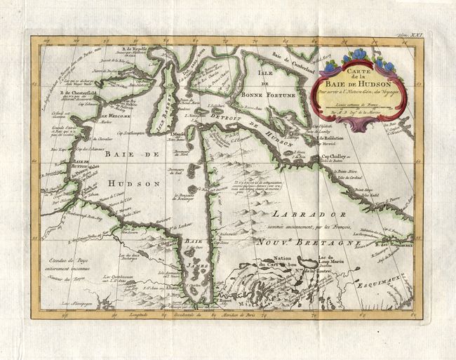
Auction 118, Lot 174
Subject: Canada - Hudson Bay
Bellin, Jacques Nicolas
Carte de la Baie de Hudson, 1777
Size: 11.8 x 8.5 inches (30 x 21.6 cm)
Estimate: $140 - $180
Sold for: $100
Closed on 3/6/2007
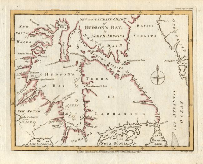
Auction 118, Lot 175
Subject: Canada - Hudson Bay
Lodge, John
New and Accurate Chart of Hudson's Bay, in North America, 1782
Size: 9 x 6.9 inches (22.9 x 17.5 cm)
Estimate: $80 - $150
Unsold
Closed on 3/6/2007
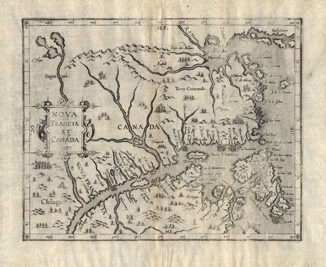
Auction 118, Lot 176
Subject: Eastern Canada
Wytfliet, Cornelis
Nova Francia et Canada, 1597
Size: 11.3 x 9 inches (28.7 x 22.9 cm)
Estimate: $1,200 - $1,800
Sold for: $900
Closed on 3/6/2007
Auction 118, Lot 177
Subject: Eastern Canada
Longman Co.
British America, Comprehending Canada, Labrador, New-Foundland, Nova Scotia &c., 1808
Size: 15.1 x 13.2 inches (38.4 x 33.5 cm)
Estimate: $150 - $200
Sold for: $110
Closed on 3/6/2007
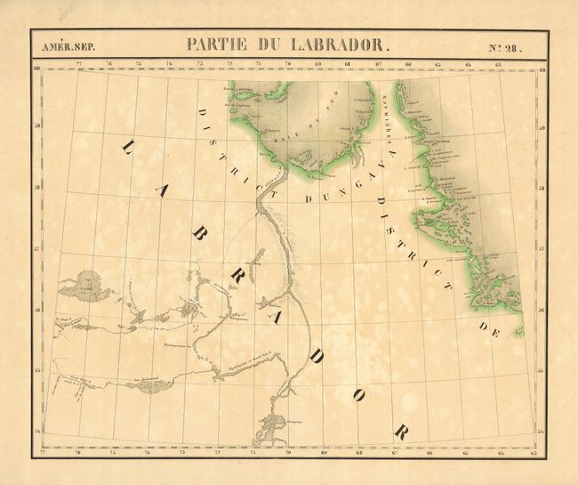
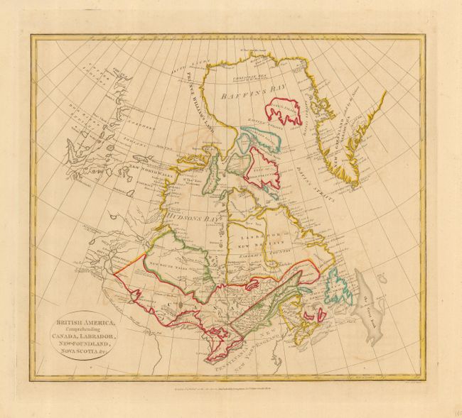
Auction 118, Lot 178
Subject: Eastern Canada
Vandermaelen, Philippe Marie Guillaume
[Lot of 2] Amer. Sep. Partie du Labrador. No. 28. [and] Amer. Sep. Partie du Labrador. No. 29., 1825-7
Size: 22.5 x 18.6 inches (57.2 x 47.2 cm)
Estimate: $200 - $300
Sold for: $150
Closed on 3/6/2007
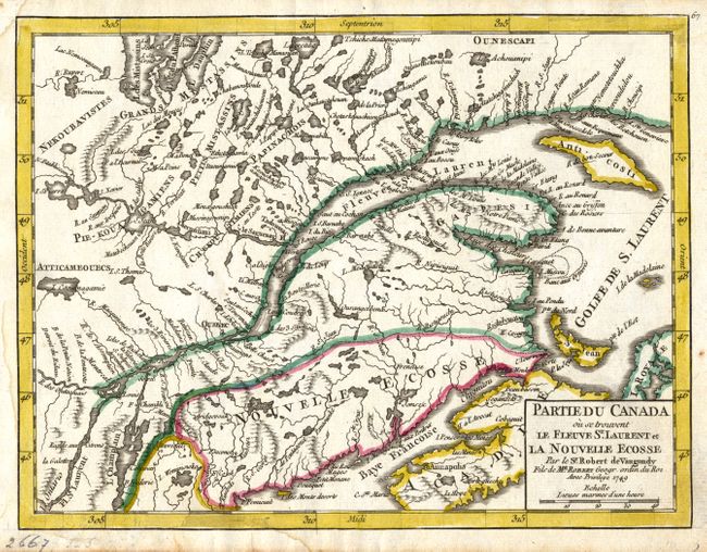
Auction 118, Lot 179
Subject: Canada, Maritime Provinces
Robert de Vaugondy, Didier
Partie du Canada ou se trouvent le Fleuve St. Laurent et la Nouvelle Ecosse, 1749
Size: 8.5 x 6.5 inches (21.6 x 16.5 cm)
Estimate: $120 - $180
Sold for: $90
Closed on 3/6/2007
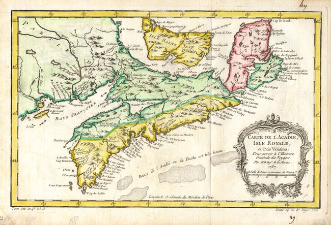
Auction 118, Lot 180
Subject: Canada, Maritime Provinces
Bellin, Jacques Nicolas
Carte de l'Acadie, Isle Royale et Pais Voisins, 1757
Size: 13 x 8.3 inches (33 x 21.1 cm)
Estimate: $150 - $220
Sold for: $130
Closed on 3/6/2007
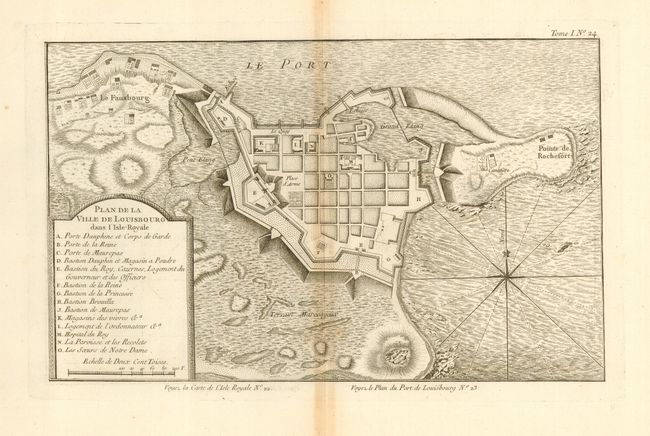
Auction 118, Lot 181
Subject: Canada - Maritime Provinces
Bellin, Jacques Nicolas
[Lot of 3] Plan de la Ville de Louisbourg dans l'Isle Royale [and] L'Isle Royale Situee a l'Entree du Golphe de Saint Laurent [and] Port de Louisbourg dans l'Isle Royale, 1764
Size: See Description
Estimate: $180 - $240
Sold for: $130
Closed on 3/6/2007
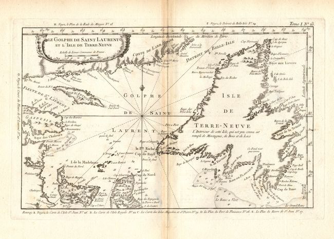
Auction 118, Lot 182
Subject: Canada, Gulf of St. Laurence
Bellin, Jacques Nicolas
Le Golphe de Saint Laurent et l'Isle de Terre-Neuve, 1764
Size: 13.5 x 8.4 inches (34.3 x 21.3 cm)
Estimate: $120 - $160
Sold for: $90
Closed on 3/6/2007
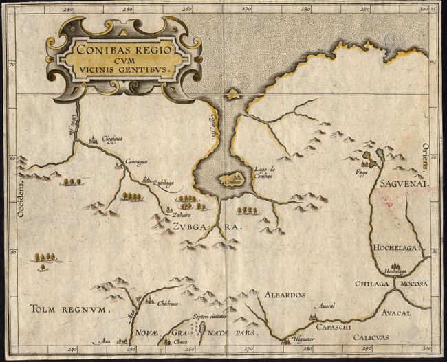
Auction 118, Lot 183
Subject: Central Canada
Wytfliet, Cornelis
Conibas Regio cum Vicinis Gentibus, 1597
Size: 10.5 x 8.5 inches (26.7 x 21.6 cm)
Estimate: $500 - $600
Sold for: $550
Closed on 3/6/2007
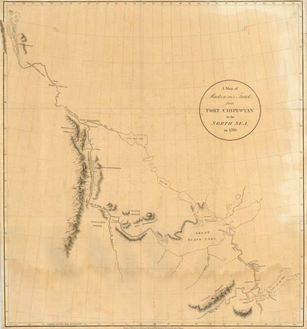
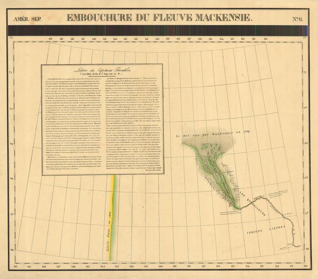
Auction 118, Lot 184
Subject: Central Canada
Mackenzie, Alexander
A Map of Mackenzie's Track from Fort Chipewyan to the North Sea, in 1789, 1801
Size: 22 x 23.8 inches (55.9 x 60.5 cm)
Estimate: $450 - $650
Unsold
Closed on 3/6/2007
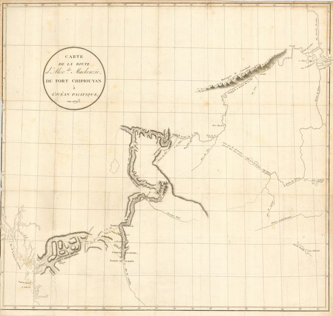
Auction 118, Lot 185
Subject: Central Canada
Mackenzie, Alexander
Carte de la Route d'Alexdre. Mackenzie, du Fort Chipiouyan a l'Ocean Pacifique, en 1793, 1802
Size: 23.5 x 22 inches (59.7 x 55.9 cm)
Estimate: $150 - $250
Sold for: $275
Closed on 3/6/2007
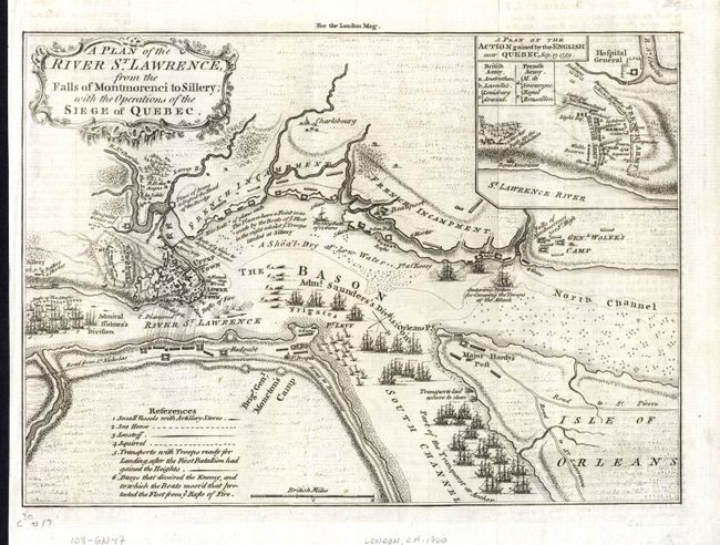
Auction 118, Lot 186
Subject: Canada, Quebec
Anon.
A Plan of the River St. Lawrence from the Falls of Montmorenci to Sillery; with the Operations of the Siege of Quebec, 1759
Size: 10 x 7 inches (25.4 x 17.8 cm)
Estimate: $140 - $180
Sold for: $140
Closed on 3/6/2007
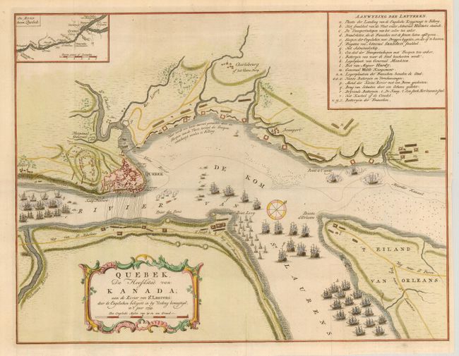
Auction 118, Lot 187
Subject: Canada, Quebec
Tirion, Isaac
Quebek, de Hoofdstad van Kanada; aan de Rivier van St. Laurens…, 1759
Size: 16.7 x 13 inches (42.4 x 33 cm)
Estimate: $275 - $350
Sold for: $325
Closed on 3/6/2007
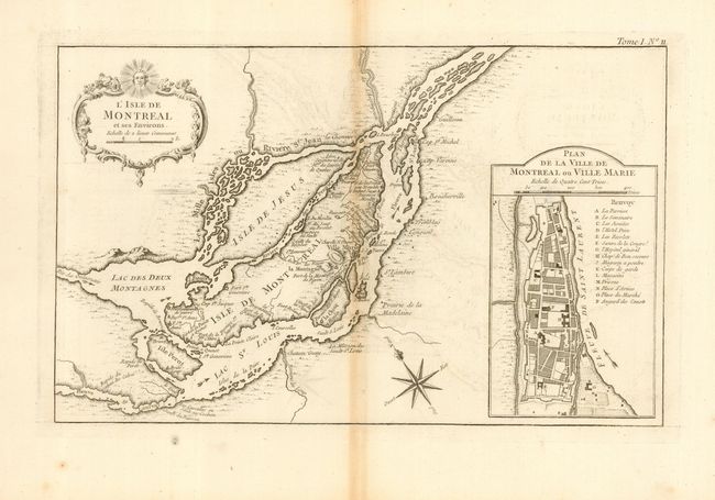
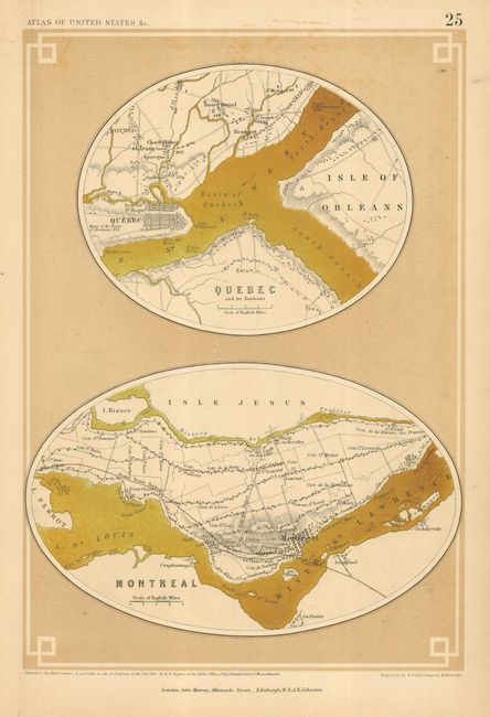
Auction 118, Lot 188
Subject: Canada, Montreal
Bellin, Jacques Nicolas
L'Isle de Montreal et ses Environs, 1764
Size: 13.7 x 8.5 inches (34.8 x 21.6 cm)
Estimate: $180 - $220
Sold for: $350
Closed on 3/6/2007
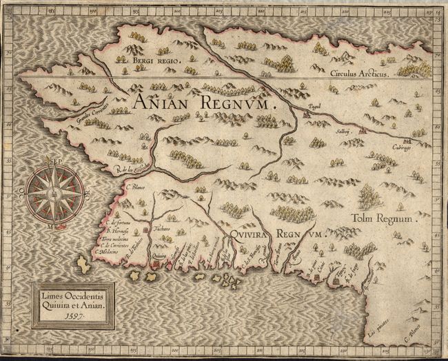
Auction 118, Lot 189
Subject: Western Canada & Alaska
Wytfliet, Cornelis
Limes Occidentis Quivira et Anian, 1597
Size: 11.5 x 9.3 inches (29.2 x 23.6 cm)
Estimate: $800 - $1,000
Sold for: $1,300
Closed on 3/6/2007
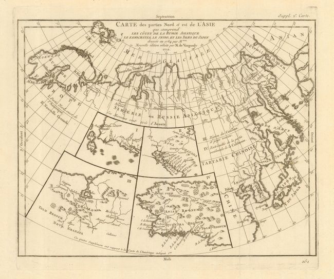
Auction 118, Lot 191
Subject: Canadian Arctic, Pacific Northwest and Northern Asia
Robert de Vaugondy, Didier
[Lot of 2] Carte des parties Nord et est de l'Asia qui comprend les Cotes de la Russie Asiatique le Kamschatka, le Jesso, et les Isles du Japon [together with] Carte qui represente les differentes connoissances...Terres Arctiques…, 1772/3
Size: 13.5 x 11.5 inches (34.3 x 29.2 cm)
Estimate: $300 - $400
Sold for: $220
Closed on 3/6/2007
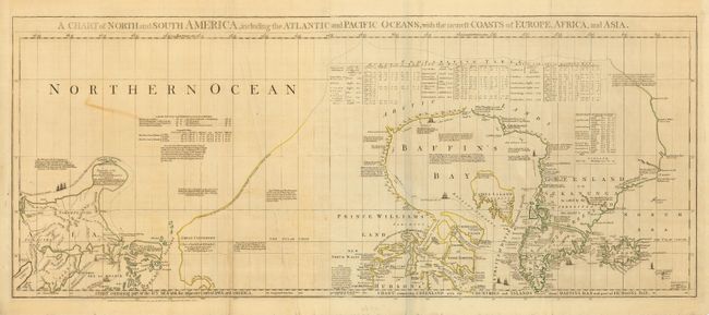
Auction 118, Lot 192
Subject: Canadian Arctic, Hudson Bay and Alaska
Jefferys/Sayer & Bennett
A Chart of North and South America, including the Atlantic and Pacific Oceans…, 1775
Size: 43.5 x 18 inches (110.5 x 45.7 cm)
Estimate: $500 - $1,000
Sold for: $500
Closed on 3/6/2007
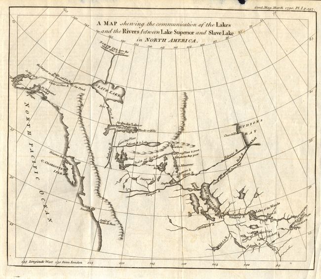
Auction 118, Lot 193
Subject: Western Canada and Alaska
Anon.
A Map Shewing the Communication of the Lakes and the Rivers between Lake Superior and Slave Lake in North America, 1790
Size: 9.3 x 7.8 inches (23.6 x 19.8 cm)
Estimate: $200 - $300
Sold for: $300
Closed on 3/6/2007
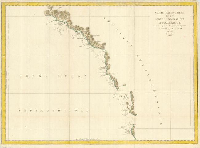
Auction 118, Lot 194
Subject: Western Canada and Alaska
La Perouse, Comte Jean F. Galoup, de
Carte Particuliere de la Cote du Nord-Ouest de l'Amerique reconnue par les Fregates Francaises la Boussole et l'Astrolabe en 1786. 1e. Feuille, 1797
Size: 27 x 19.5 inches (68.6 x 49.5 cm)
Estimate: $200 - $250
Unsold
Closed on 3/6/2007
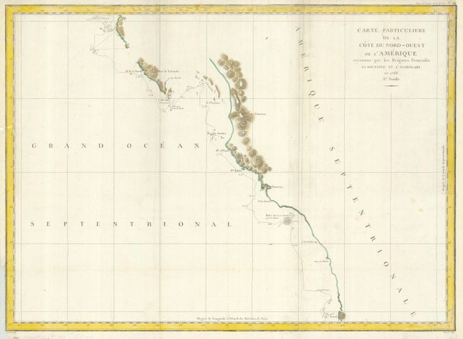
Auction 118, Lot 195
Subject: Western Canada & United States
La Perouse, Comte Jean F. Galoup, de
Carte Particuliere de la Cote du Nord-Ouest de l'Amerique reconnue par les Fregates Francaises la Boussole et l'Astrolabe en 1786. 2e. Feuille, 1797
Size: 27 x 19.5 inches (68.6 x 49.5 cm)
Estimate: $200 - $250
Sold for: $150
Closed on 3/6/2007
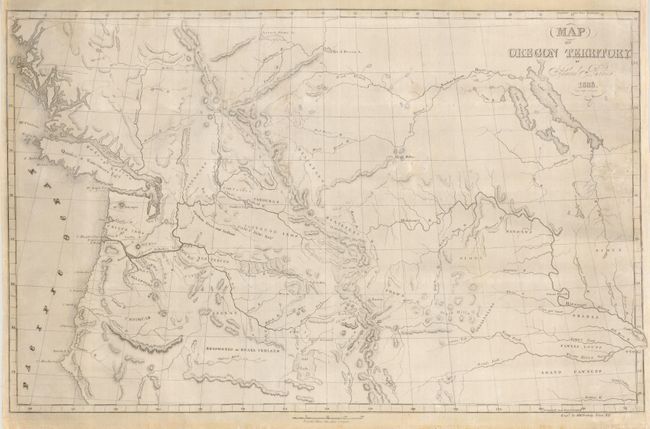
Auction 118, Lot 196
Subject: Western Canada, Pacific Northwest, Oregon Territory
Parker, Samuel (Rev.)
Map of Oregon Territory, 1838
Size: 22 x 14 inches (55.9 x 35.6 cm)
Estimate: $300 - $350
Sold for: $425
Closed on 3/6/2007
Auction 118, Lot 198
Subject: Colonial United States and Canada, Great Lakes
Mueller/Bodenehr
[Canada], 1692
Size: 3 x 2.5 inches (7.6 x 6.4 cm)
Estimate: $350 - $400
Sold for: $300
Closed on 3/6/2007
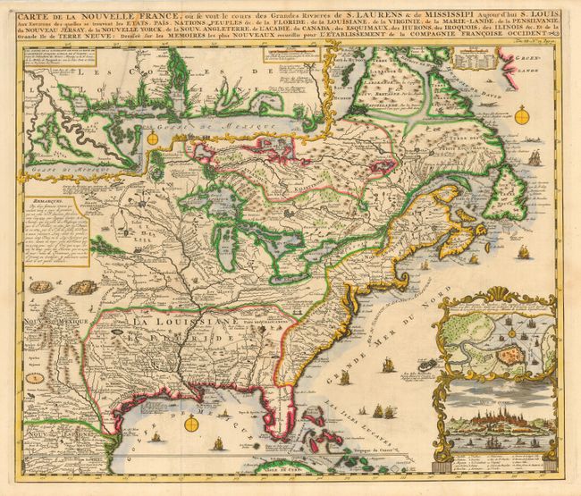
Auction 118, Lot 200
Subject: Colonial United States and Canada
Chatelain, Henry Abraham
Carte de la Nouvelle France, ou se voit le cours des Grandes Rivieres de S. Laurens & de Mississipi Aujour d'hui S. Louis, Aux Environs des-quelles se trouvent les Etats, Pais, Nations, Peuples &c., 1719
Size: 19 x 16.5 inches (48.3 x 41.9 cm)
Estimate: $2,300 - $2,750
Sold for: $3,000
Closed on 3/6/2007
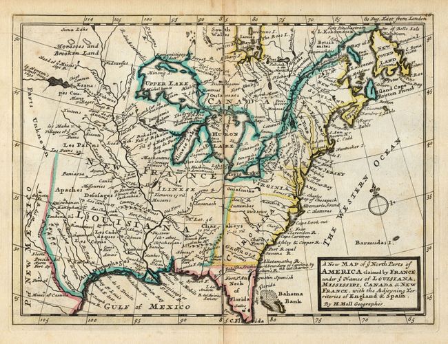
Auction 118, Lot 201
Subject: Colonial United States & Canada
Moll, Herman
A New Map of ye North Parts of America claimed by France under ye Names of Louisiana, Mississipi, Canada & New France, with the Adjoyning Territories of England & Spain, 1735
Size: 10.8 x 7.8 inches (27.4 x 19.8 cm)
Estimate: $550 - $650
Sold for: $475
Closed on 3/6/2007
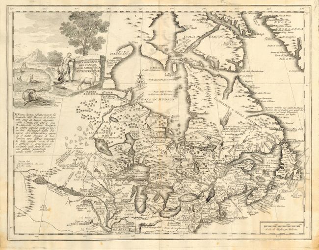
Auction 118, Lot 203
Subject: Colonial United States and Canada
Albrizzi, Girolamo
Carta Geografica del Canada nell'America Settentrionale, 1750
Size: 16.8 x 13 inches (42.7 x 33 cm)
Estimate: $800 - $1,200
Sold for: $600
Closed on 3/6/2007
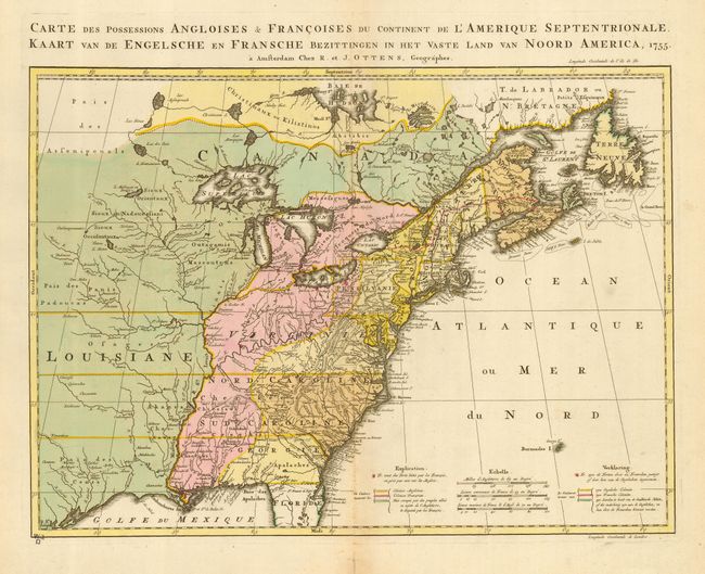
Auction 118, Lot 204
Subject: Colonial United States and Canada
Ottens, Reiner and Joshua
Carte des Possessions Angloises & Francoises du Continent de l'Amerique Septentrionale [also] Kaart van de Engelsche en Fransche Bezittingen in het Vaste Land van Noord America, 1755
Size: 22 x 16 inches (55.9 x 40.6 cm)
Estimate: $1,900 - $2,300
Sold for: $1,400
Closed on 3/6/2007
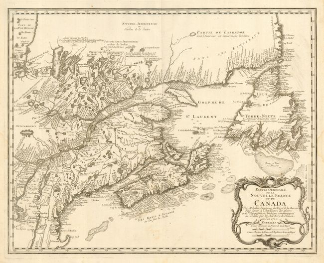
Auction 118, Lot 205
Subject: Colonial United States and Canada
Homann Heirs
Partie Orientale de la Nouvelle France ou du Canada, 1755
Size: 21.3 x 17 inches (54.1 x 43.2 cm)
Estimate: $475 - $550
Sold for: $350
Closed on 3/6/2007
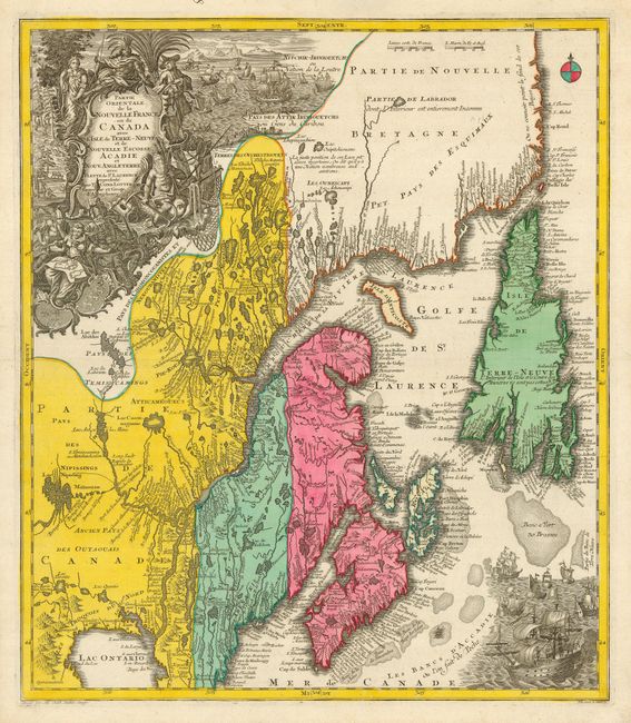
Auction 118, Lot 206
Subject: Colonial United States and Canada
Seutter/Lotter
Partie Orientale de la Nouvelle France ou du Canada avec l'Isle de Terre-Neuve et de Nouvelle Ecosse, Acadie et Nouv. Angleterre…, 1756
Size: 19.5 x 22.5 inches (49.5 x 57.2 cm)
Estimate: $1,400 - $1,800
Sold for: $1,200
Closed on 3/6/2007
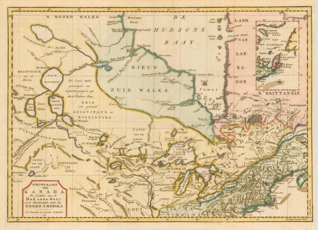
Auction 118, Lot 207
Subject: Colonial United States and Canada
Tirion, Isaac
Nieuwe Kaart van Kanada, de Landen aan de Hudsons-Baay en de Noordwestelyke deelen van Noord-Amerika, 1769
Size: 17 x 12 inches (43.2 x 30.5 cm)
Estimate: $375 - $450
Sold for: $275
Closed on 3/6/2007
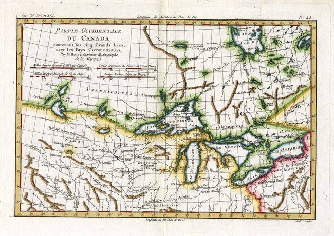
Auction 118, Lot 208
Subject: Colonial United States & Canada, Great Lakes
Bonne, Rigobert
Partie Occidentale du Canada, contenant les cinq Grands Lacs, avec les Pays Circonvoisins, 1775
Size: 12.3 x 8.3 inches (31.2 x 21.1 cm)
Estimate: $350 - $450
Sold for: $600
Closed on 3/6/2007
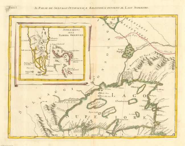
Auction 118, Lot 209
Subject: Colonial United States & Canada, Great Lakes
Zatta, Antonio
Il Paese de Selvaggi Outauacesi e Kilistinesi Intorno al Lago Superiore, 1778
Size: 16.5 x 12 inches (41.9 x 30.5 cm)
Estimate: $375 - $500
Sold for: $275
Closed on 3/6/2007

Auction 118, Lot 210
Subject: Eastern United States and Canada
Anon.
[United States and Canada], 1785
Size: 13.5 x 12.3 inches (34.3 x 31.2 cm)
Estimate: $200 - $250
Sold for: $375
Closed on 3/6/2007
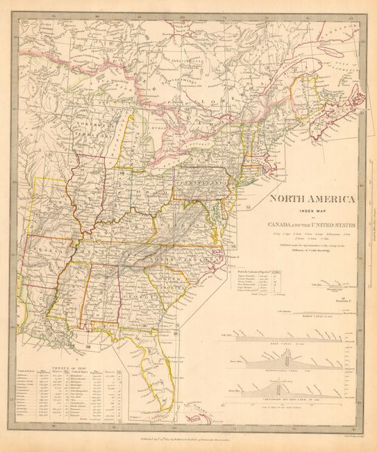
Auction 118, Lot 211
Subject: Eastern Canada & United States
SDUK Society for the Diffusion of Useful Knowledge
North America Index Map to Canada and the United States, 1844
Size: 12.3 x 14.5 inches (31.2 x 36.8 cm)
Estimate: $120 - $140
Sold for: $90
Closed on 3/6/2007
Auction 118, Lot 212
Subject: Canada & United States
Rogers & Johnston
[Lot of 9 Town Plans], 1857
Size: 8.3 x 12 inches (21.1 x 30.5 cm)
Estimate: $300 - $400
Sold for: $200
Closed on 3/6/2007
50 lots