Subject: Central Canada
Period: 1802 (published)
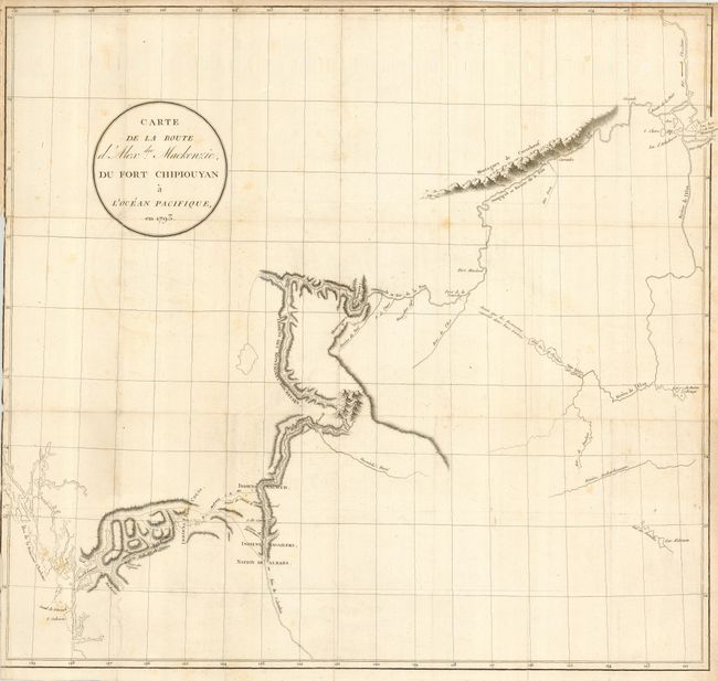
Publication: Voyages d'Alexdre Mackenzie, dans l'Interiour de L'Amerique Septentrionale. . .
Color: Black & White
Size:
23.5 x 22 inches
59.7 x 55.9 cm
Alexander Mackenzie was the first white man to cross the North American continent north of Mexico and thus totally dispel the belief in a Northwest Passage to Hudson Bay. His epic journey was one of incredible hardship and marks an important page in the cartographic history of North America. This map is sparsely engraved with only the regions adjacent to his trek from Fort Chipewyan to Finlay Forks, south along the Parsnip River (headwater of the Peace River), then down the Herrick and McGregor Rivers to the Grande Fourche with the Fraser River (which he mistook for the upper Columbia). He followed the river until the rapids just above Williams Lake and then made his way on foot along established native trails to the Pacific at the mouth of the Bella Coola River. From the French edition, with place-names in French.
References: Wagner-Camp #1:3; Wheat (TMW) #251.
Condition: B
Good impression with folds as issued. Has a narrow margin on the binding side, resulting in some loss to the neatline. Couple of light spots in map.