Catalog Archive
Auction 118, Lot 160

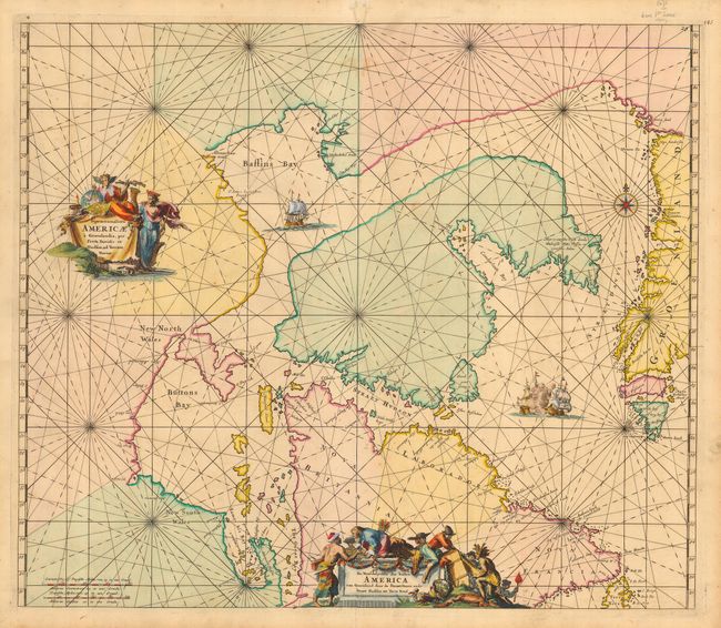
"Septemtrionaliora Americae a Groenlandia, per Freta Davidis, et Hudson, ad Terram Novam / De Noordelyckste Zee kusten van America van Groenland door de Straet Davis ende Straet Hudson tot Terra Neuf", Wit, Frederick de
Subject: Canada and Greenland

Period: 1675 (published)

Publication: Orbis Maritimus ofte Zee Atlas

Color: Hand Color

Size:
22 x 19 inches
55.9 x 48.3 cm
Download High Resolution Image
(or just click on image to launch the Zoom viewer)

This is the first state of De Wit's fine chart of Hudson Bay and Arctic Canada. This beautifully engraved chart was based on Van Loon's important chart of 1666 and includes Hudson Bay and Strait, Baffin Bay and extends to include the western coast of Greenland. The chart shows an erroneous second bay next to James Bay named The Great Bay. A sea battle rages outside of the Hudson Strait and another ship sails in Baffin Bay. The chart is richly embellished with rhumb lines and two elaborate cartouches - the second with a Dutch title.

References: Kershaw #209; Moreland & Bannister, p. 36.

Condition: B

Beautiful, sharp impression with great old color. There is some worming and an old repair at the top of the centerfold, just outside the neatline. Couple of light stains, otherwise fine. Hinge remnants on verso.

Estimate: $900 - $1,400

Sold for: $650

Closed on 3/6/2007

Archived