Subject: Canada, Maritime Provinces
Period: 1757 (dated)
Publication: La Harpe's Histoire Generale des Voyages
Color: Hand Color
Size:
13 x 8.3 inches
33 x 21.1 cm
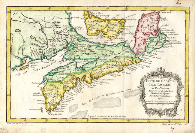
Strongly engraved chart with decorative rococo-style cartouche. Prince Edward Island is shown in good detail, here called Isle Saint Jean. The map covers all of Nova Scotia including Cape Breton. The Micmac tribe is named near Shelburne. Nova Scotia is in part named as Acadie. This map was published shortly after the 1755 expulsion of Acadians from this region. The Acadians were able to come back in 1764, but many settled in Louisiana and did not return. Numerous banks are noted south of Nova Scotia, where 'la Pesche est tres bonne' (the fish are very good). Published 1780-86, second state.
References: Kershaw #783.
Condition: B
Nice impression. Light offsetting, and a couple of stains.