Filtered by Category:United States(Show All Categories)
Showing results for:Auction 118
Catalog Archive
237 lots
Page 1 of 5
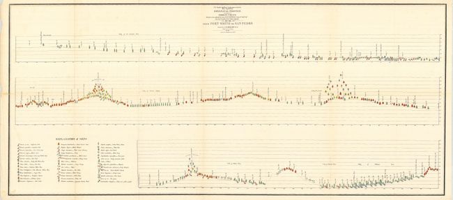
Auction 118, Lot 77
Subject: Western United States, Forests
U.S. War Department
Botanical Profile. Representing the Forest Trees Along the Route Explored by Lieut. A.W. Whipple …from Fort Smith to San Pedro, 1853-54
Size: 47.5 x 20.7 inches (120.7 x 52.6 cm)
Estimate: $350 - $400
Unsold
Closed on 3/6/2007
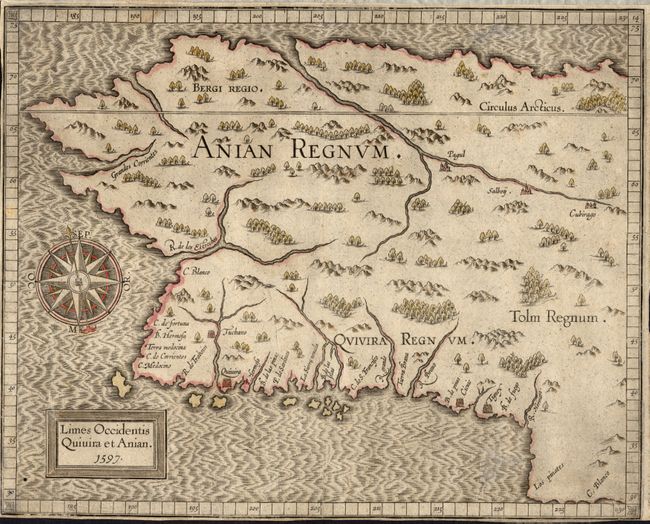
Auction 118, Lot 189
Subject: Western Canada & Alaska
Wytfliet, Cornelis
Limes Occidentis Quivira et Anian, 1597
Size: 11.5 x 9.3 inches (29.2 x 23.6 cm)
Estimate: $800 - $1,000
Sold for: $1,300
Closed on 3/6/2007
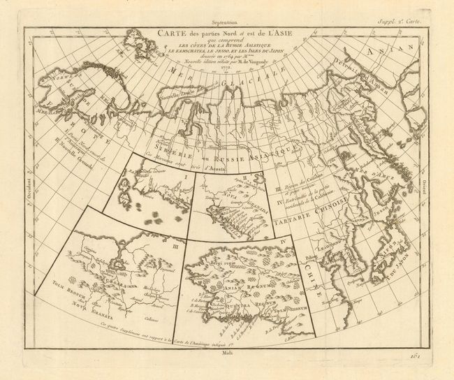
Auction 118, Lot 191
Subject: Canadian Arctic, Pacific Northwest and Northern Asia
Robert de Vaugondy, Didier
[Lot of 2] Carte des parties Nord et est de l'Asia qui comprend les Cotes de la Russie Asiatique le Kamschatka, le Jesso, et les Isles du Japon [together with] Carte qui represente les differentes connoissances...Terres Arctiques…, 1772/3
Size: 13.5 x 11.5 inches (34.3 x 29.2 cm)
Estimate: $300 - $400
Sold for: $220
Closed on 3/6/2007
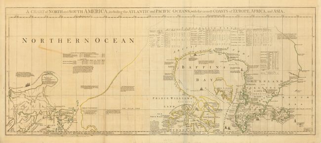
Auction 118, Lot 192
Subject: Canadian Arctic, Hudson Bay and Alaska
Jefferys/Sayer & Bennett
A Chart of North and South America, including the Atlantic and Pacific Oceans…, 1775
Size: 43.5 x 18 inches (110.5 x 45.7 cm)
Estimate: $500 - $1,000
Sold for: $500
Closed on 3/6/2007
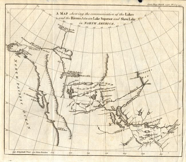
Auction 118, Lot 193
Subject: Western Canada and Alaska
Anon.
A Map Shewing the Communication of the Lakes and the Rivers between Lake Superior and Slave Lake in North America, 1790
Size: 9.3 x 7.8 inches (23.6 x 19.8 cm)
Estimate: $200 - $300
Sold for: $300
Closed on 3/6/2007
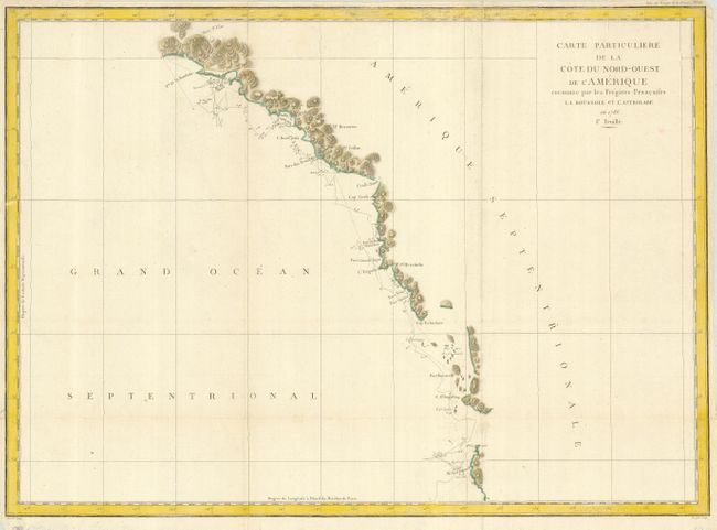
Auction 118, Lot 194
Subject: Western Canada and Alaska
La Perouse, Comte Jean F. Galoup, de
Carte Particuliere de la Cote du Nord-Ouest de l'Amerique reconnue par les Fregates Francaises la Boussole et l'Astrolabe en 1786. 1e. Feuille, 1797
Size: 27 x 19.5 inches (68.6 x 49.5 cm)
Estimate: $200 - $250
Unsold
Closed on 3/6/2007
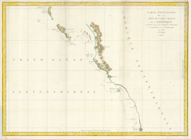
Auction 118, Lot 195
Subject: Western Canada & United States
La Perouse, Comte Jean F. Galoup, de
Carte Particuliere de la Cote du Nord-Ouest de l'Amerique reconnue par les Fregates Francaises la Boussole et l'Astrolabe en 1786. 2e. Feuille, 1797
Size: 27 x 19.5 inches (68.6 x 49.5 cm)
Estimate: $200 - $250
Sold for: $150
Closed on 3/6/2007
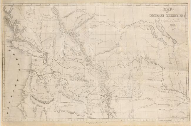
Auction 118, Lot 196
Subject: Western Canada, Pacific Northwest, Oregon Territory
Parker, Samuel (Rev.)
Map of Oregon Territory, 1838
Size: 22 x 14 inches (55.9 x 35.6 cm)
Estimate: $300 - $350
Sold for: $425
Closed on 3/6/2007
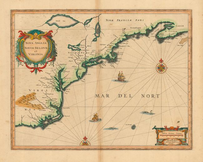
Auction 118, Lot 197
Subject: Colonial New England and Mid-Atlantic
Jansson, Jan
Nova Anglia Novum Belgium et Virginia, 1639
Size: 19.8 x 15.2 inches (50.3 x 38.6 cm)
Estimate: $2,200 - $2,500
Unsold
Closed on 3/6/2007
Auction 118, Lot 198
Subject: Colonial United States and Canada, Great Lakes
Mueller/Bodenehr
[Canada], 1692
Size: 3 x 2.5 inches (7.6 x 6.4 cm)
Estimate: $350 - $400
Sold for: $300
Closed on 3/6/2007
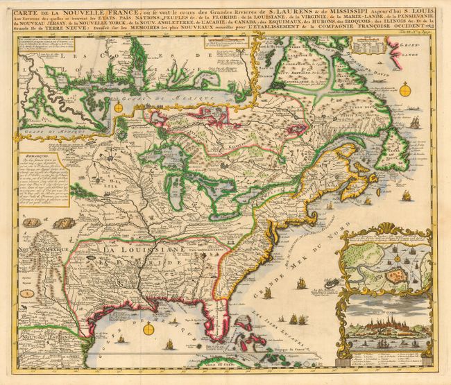
Auction 118, Lot 200
Subject: Colonial United States and Canada
Chatelain, Henry Abraham
Carte de la Nouvelle France, ou se voit le cours des Grandes Rivieres de S. Laurens & de Mississipi Aujour d'hui S. Louis, Aux Environs des-quelles se trouvent les Etats, Pais, Nations, Peuples &c., 1719
Size: 19 x 16.5 inches (48.3 x 41.9 cm)
Estimate: $2,300 - $2,750
Sold for: $3,000
Closed on 3/6/2007
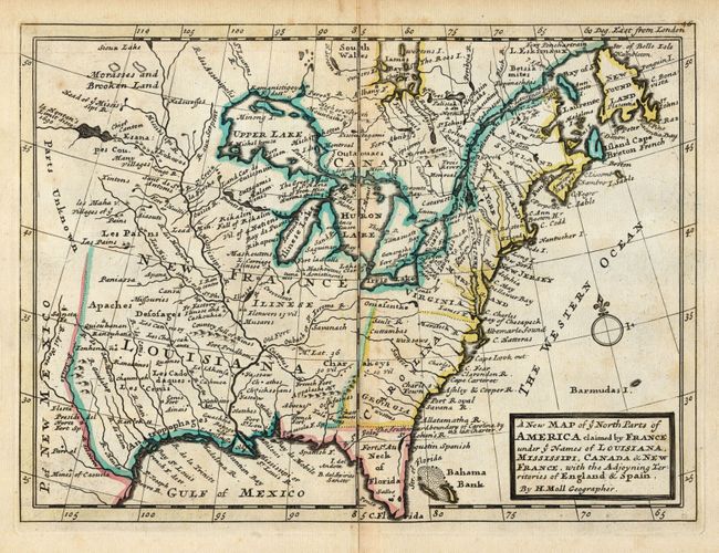
Auction 118, Lot 201
Subject: Colonial United States & Canada
Moll, Herman
A New Map of ye North Parts of America claimed by France under ye Names of Louisiana, Mississipi, Canada & New France, with the Adjoyning Territories of England & Spain, 1735
Size: 10.8 x 7.8 inches (27.4 x 19.8 cm)
Estimate: $550 - $650
Sold for: $475
Closed on 3/6/2007
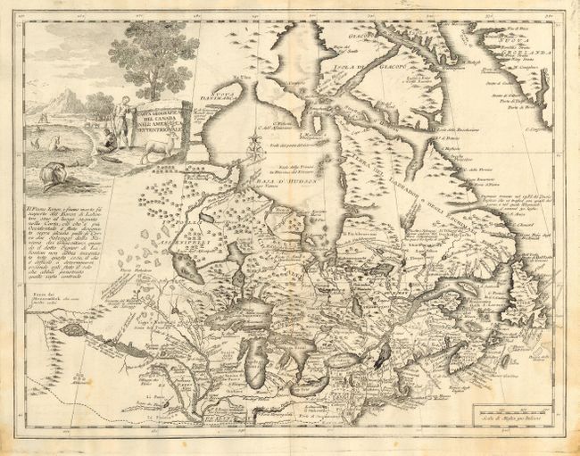
Auction 118, Lot 203
Subject: Colonial United States and Canada
Albrizzi, Girolamo
Carta Geografica del Canada nell'America Settentrionale, 1750
Size: 16.8 x 13 inches (42.7 x 33 cm)
Estimate: $800 - $1,200
Sold for: $600
Closed on 3/6/2007
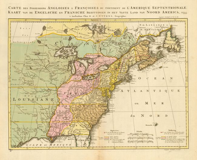
Auction 118, Lot 204
Subject: Colonial United States and Canada
Ottens, Reiner and Joshua
Carte des Possessions Angloises & Francoises du Continent de l'Amerique Septentrionale [also] Kaart van de Engelsche en Fransche Bezittingen in het Vaste Land van Noord America, 1755
Size: 22 x 16 inches (55.9 x 40.6 cm)
Estimate: $1,900 - $2,300
Sold for: $1,400
Closed on 3/6/2007
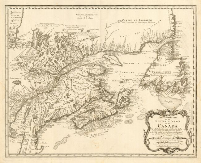
Auction 118, Lot 205
Subject: Colonial United States and Canada
Homann Heirs
Partie Orientale de la Nouvelle France ou du Canada, 1755
Size: 21.3 x 17 inches (54.1 x 43.2 cm)
Estimate: $475 - $550
Sold for: $350
Closed on 3/6/2007
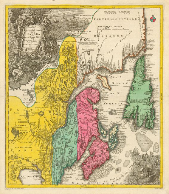
Auction 118, Lot 206
Subject: Colonial United States and Canada
Seutter/Lotter
Partie Orientale de la Nouvelle France ou du Canada avec l'Isle de Terre-Neuve et de Nouvelle Ecosse, Acadie et Nouv. Angleterre…, 1756
Size: 19.5 x 22.5 inches (49.5 x 57.2 cm)
Estimate: $1,400 - $1,800
Sold for: $1,200
Closed on 3/6/2007
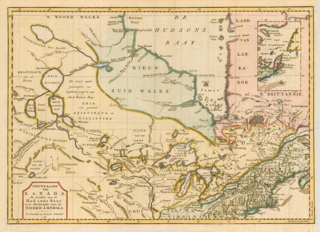
Auction 118, Lot 207
Subject: Colonial United States and Canada
Tirion, Isaac
Nieuwe Kaart van Kanada, de Landen aan de Hudsons-Baay en de Noordwestelyke deelen van Noord-Amerika, 1769
Size: 17 x 12 inches (43.2 x 30.5 cm)
Estimate: $375 - $450
Sold for: $275
Closed on 3/6/2007
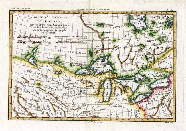
Auction 118, Lot 208
Subject: Colonial United States & Canada, Great Lakes
Bonne, Rigobert
Partie Occidentale du Canada, contenant les cinq Grands Lacs, avec les Pays Circonvoisins, 1775
Size: 12.3 x 8.3 inches (31.2 x 21.1 cm)
Estimate: $350 - $450
Sold for: $600
Closed on 3/6/2007
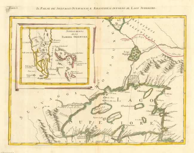
Auction 118, Lot 209
Subject: Colonial United States & Canada, Great Lakes
Zatta, Antonio
Il Paese de Selvaggi Outauacesi e Kilistinesi Intorno al Lago Superiore, 1778
Size: 16.5 x 12 inches (41.9 x 30.5 cm)
Estimate: $375 - $500
Sold for: $275
Closed on 3/6/2007

Auction 118, Lot 210
Subject: Eastern United States and Canada
Anon.
[United States and Canada], 1785
Size: 13.5 x 12.3 inches (34.3 x 31.2 cm)
Estimate: $200 - $250
Sold for: $375
Closed on 3/6/2007
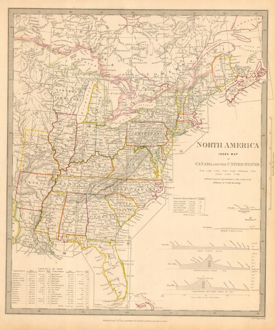
Auction 118, Lot 211
Subject: Eastern Canada & United States
SDUK Society for the Diffusion of Useful Knowledge
North America Index Map to Canada and the United States, 1844
Size: 12.3 x 14.5 inches (31.2 x 36.8 cm)
Estimate: $120 - $140
Sold for: $90
Closed on 3/6/2007
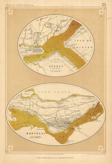
Auction 118, Lot 212
Subject: Canada & United States
Rogers & Johnston
[Lot of 9 Town Plans], 1857
Size: 8.3 x 12 inches (21.1 x 30.5 cm)
Estimate: $300 - $400
Sold for: $200
Closed on 3/6/2007
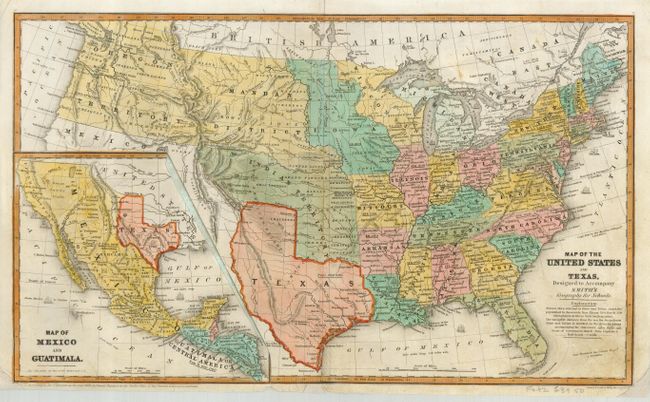
Auction 118, Lot 213
Subject: United States
Burgess, Daniel
Map of the United States and Texas, Designed to Accompany Smith's Geography for Schools, 1839
Size: 17.4 x 10.3 inches (44.2 x 26.2 cm)
Estimate: $200 - $250
Sold for: $600
Closed on 3/6/2007
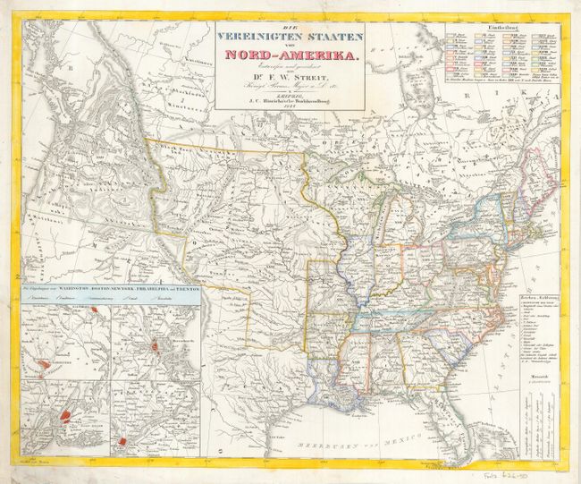
Auction 118, Lot 214
Subject: United States
Streit, Friedrich Wilhelm
Die Vereinigten Staaten von Nord-Amerika, 1844
Size: 18.5 x 15.1 inches (47 x 38.4 cm)
Estimate: $250 - $350
Sold for: $150
Closed on 3/6/2007
Auction 118, Lot 215
Subject: United States
Cornell, Sarah Sophia
United States, 1855
Size: 20.5 x 12.3 inches (52.1 x 31.2 cm)
Estimate: $150 - $200
Sold for: $140
Closed on 3/6/2007
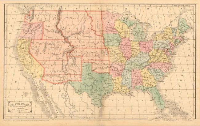
Auction 118, Lot 216
Subject: United States
Thomas, Cowperthwait & Co.
A New Map of the United States of America by J.H. Young, 1856
Size: 26.3 x 15.5 inches (66.8 x 39.4 cm)
Estimate: $300 - $400
Sold for: $400
Closed on 3/6/2007
Auction 118, Lot 217
Subject: United States
Black, Adam & Charles
General Map of the United States, 1858
Size: 21.5 x 16.2 inches (54.6 x 41.1 cm)
Estimate: $180 - $250
Sold for: $140
Closed on 3/6/2007
Auction 118, Lot 218
Subject: United States
[Lot of 2] Colton's United States of America [and] Map of the United States and Territories. Together with Canada &c., 1860-72
Size: See Description
Estimate: $150 - $200
Sold for: $110
Closed on 3/6/2007
Auction 118, Lot 219
Subject: United States
Johnson & Ward
New Military Map of the United States Showing the Forts, Military Posts, &c with Enlarged Plans of Southern Harbors, 1861
Size: 22.5 x 15.8 inches (57.2 x 40.1 cm)
Estimate: $180 - $230
Sold for: $140
Closed on 3/6/2007
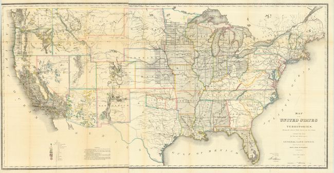
Auction 118, Lot 220
Subject: United States
General Land Office
Map of the United States and Territories Shewing the extent of Public Surveys and other details constructed from the Plats and official sources of the General Land Office…, 1866
Size: 55 x 28 inches (139.7 x 71.1 cm)
Estimate: $400 - $500
Sold for: $300
Closed on 3/6/2007
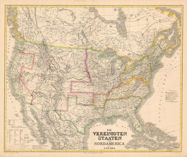
Auction 118, Lot 221
Subject: United States
Kiepert, Heinrich C.
Die Vereinigten Staaten von Nord America nebst Canada, 1870
Size: 25.3 x 20.7 inches (64.3 x 52.6 cm)
Estimate: $150 - $200
Sold for: $110
Closed on 3/6/2007
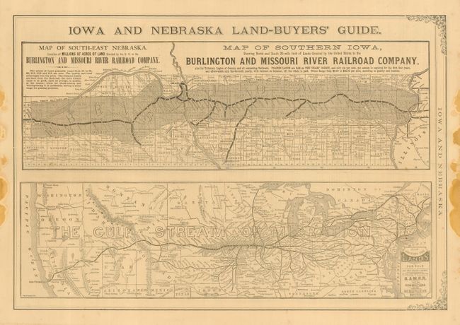
Auction 118, Lot 222
Subject: United States
Railroad Companies, (Various)
[Railroad Promotional Newspaper] Iowa and Nebraska Burlington and Missouri River R.R. Company Lands, 1875
Size: 19.8 x 13.4 inches (50.3 x 34 cm)
Estimate: $350 - $450
Sold for: $250
Closed on 3/6/2007
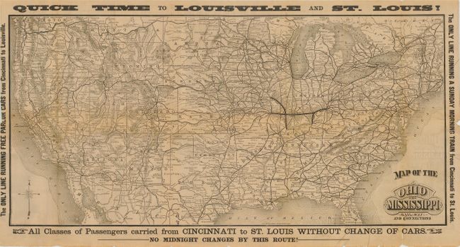
Auction 118, Lot 223
Subject: United States
Railroad Companies, (Various)
Map of the Ohio and Mississippi Railway and Connections, 1880
Size: 26.5 x 13 inches (67.3 x 33 cm)
Estimate: $120 - $140
Sold for: $160
Closed on 3/6/2007
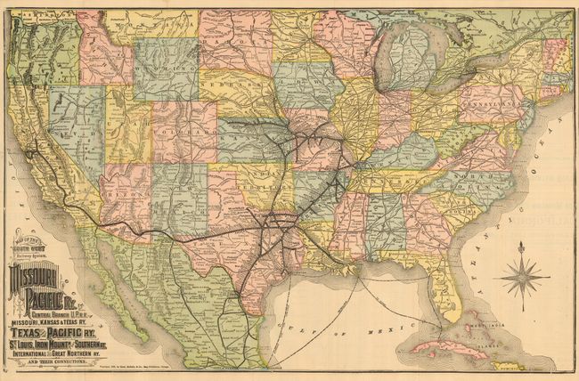
Auction 118, Lot 224
Subject: United States
Rand McNally & Co.
Iron Mountain Route to Arkansas, Texas and California, 1883
Size: 24.4 x 15.5 inches (62 x 39.4 cm)
Estimate: $200 - $250
Sold for: $425
Closed on 3/6/2007
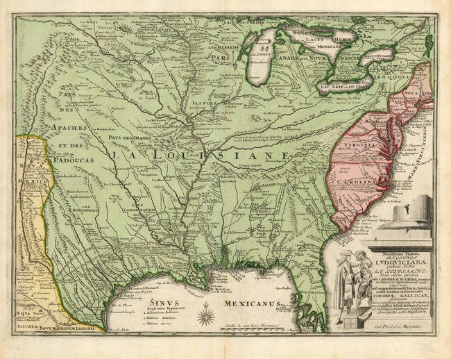
Auction 118, Lot 225
Subject: Colonial United States
Weigel, Christopher
Novissima Tabula Regionis Ludovicianae Gallice dicta la Louisiane…, 1734
Size: 16.3 x 12.5 inches (41.4 x 31.8 cm)
Estimate: $1,400 - $1,800
Sold for: $1,600
Closed on 3/6/2007
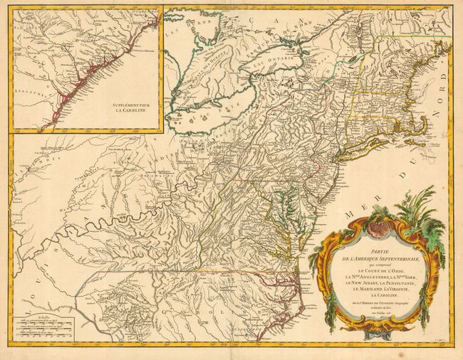
Auction 118, Lot 226
Subject: Colonial United States
Robert de Vaugondy, Gilles
Partie de l'Amerique Septentrionale qui comprend le Cours de l'Ohio, la Nlle. Angleterre, la Nlle. York, le New Jersey, la Pensylvanie, le Maryland, la Virginie, la Caroline, 1755
Size: 24.5 x 18.8 inches (62.2 x 47.8 cm)
Estimate: $1,000 - $1,200
Sold for: $750
Closed on 3/6/2007
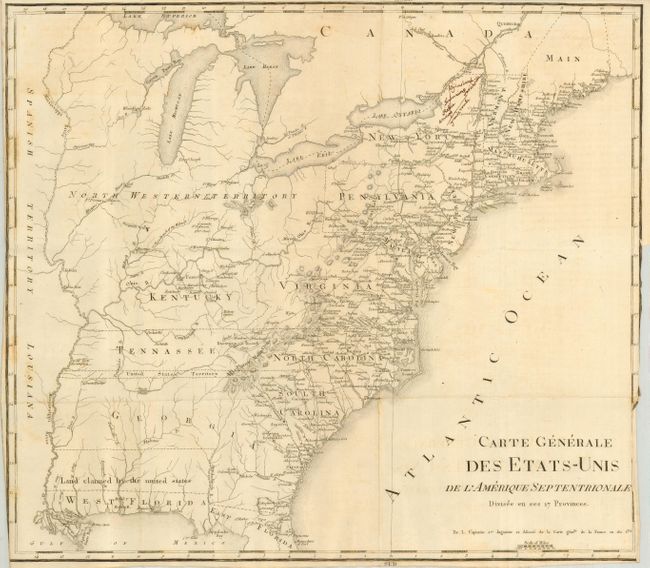
Auction 118, Lot 227
Subject: United States - Eastern
Rochefoucald Liancourt, Francois Alexander
Carte Generale des Etats-Unis de l'Amerique Septentrionale Divisee en ses 17 Provinces, 1800
Size: 18.5 x 15.5 inches (47 x 39.4 cm)
Estimate: $400 - $500
Sold for: $300
Closed on 3/6/2007
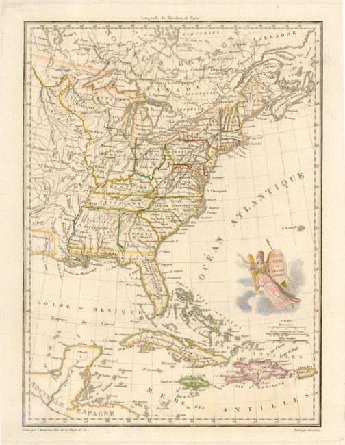
Auction 118, Lot 228
Subject: United States - Eastern
Chamouin, Jean Baptiste Marie
Etats Unis et Grandes Antilles, 1810
Size: 8.8 x 12 inches (22.4 x 30.5 cm)
Estimate: $230 - $275
Sold for: $170
Closed on 3/6/2007
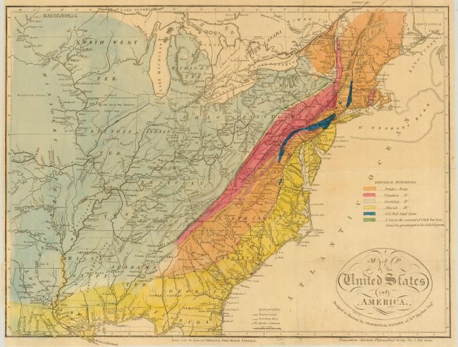
Auction 118, Lot 229
Subject: United States - Eastern
Melish, John
Map of the United States of America Designed to Illustrate the Geological Memoir of Wm. Mclure Esqr., 1818
Size: 17 x 13 inches (43.2 x 33 cm)
Estimate: $350 - $450
Sold for: $425
Closed on 3/6/2007
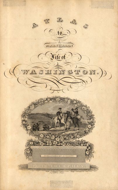
Auction 118, Lot 230
Subject: Eastern United States
Marshall, John
[Lot of 11 - Revolutionary War maps], 1832
Size: 7 x 9.5 inches (17.8 x 24.1 cm)
Estimate: $375 - $450
Sold for: $275
Closed on 3/6/2007
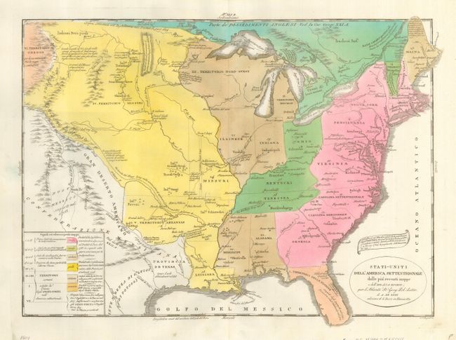
Auction 118, Lot 231
Subject: United States - Eastern and Central
Tasso, G.
Stati-Uniti dell'America Settentrionale dalle piu recenti mappe…, 1832
Size: 18 x 13 inches (45.7 x 33 cm)
Estimate: $300 - $400
Sold for: $250
Closed on 3/6/2007
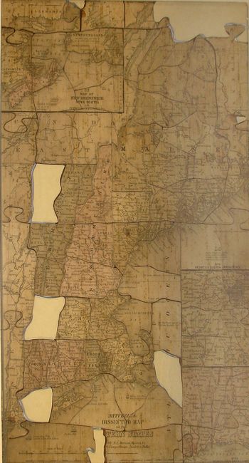
Auction 118, Lot 232
Subject: Eastern United States - Puzzle
Cowperthwait, Desilver & Butler
Mitchell's Dissected Puzzle Map of the Eastern United States., 1854
Size: 10.5 x 16.5 inches (26.7 x 41.9 cm)
Estimate: $300 - $400
Sold for: $150
Closed on 3/6/2007
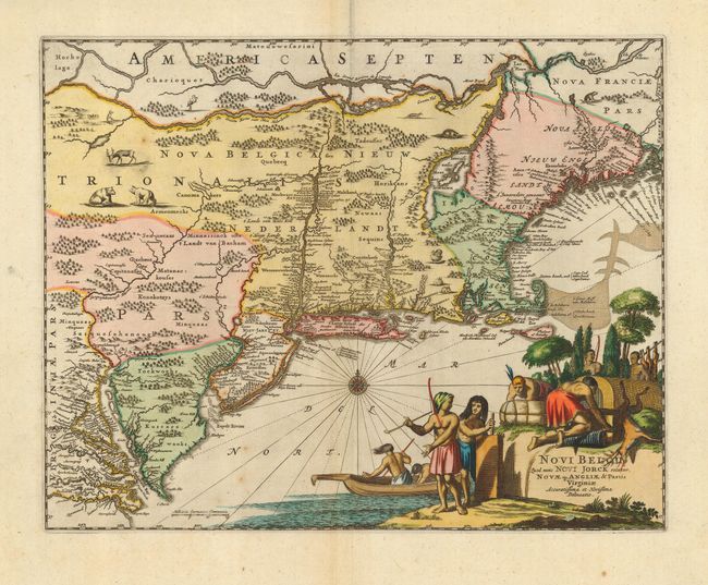
Auction 118, Lot 233
Subject: Colonial Northeast
Montanus/Ogilby
Novi Belgii, quod nunc Novi Jorck Vocatur, Novae qz. Angliae & Partis Virginiae Accuratissima et Novissima Delineatio, 1671
Size: 14.3 x 11.5 inches (36.3 x 29.2 cm)
Estimate: $1,800 - $2,000
Sold for: $1,300
Closed on 3/6/2007
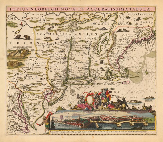
Auction 118, Lot 234
Subject: Colonial Northeast
Allard, Hugo
Totius Neobelgii Nova et Accuratissima Tabula, 1680
Size: 21.3 x 18.3 inches (54.1 x 46.5 cm)
Estimate: $11,000 - $15,000
Sold for: $11,000
Closed on 3/6/2007
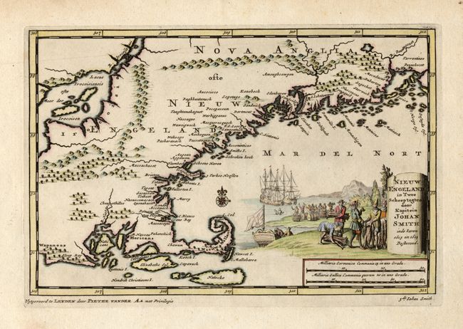
Auction 118, Lot 235
Subject: Colonial New England
Aa, Pieter van der
Nieuw Engeland in Twee Scheepstogten door Kapitein Johan Smith in de Jaren 1614 en 1615, 1707
Size: 9 x 6 inches (22.9 x 15.2 cm)
Estimate: $800 - $900
Sold for: $650
Closed on 3/6/2007
Auction 118, Lot 236
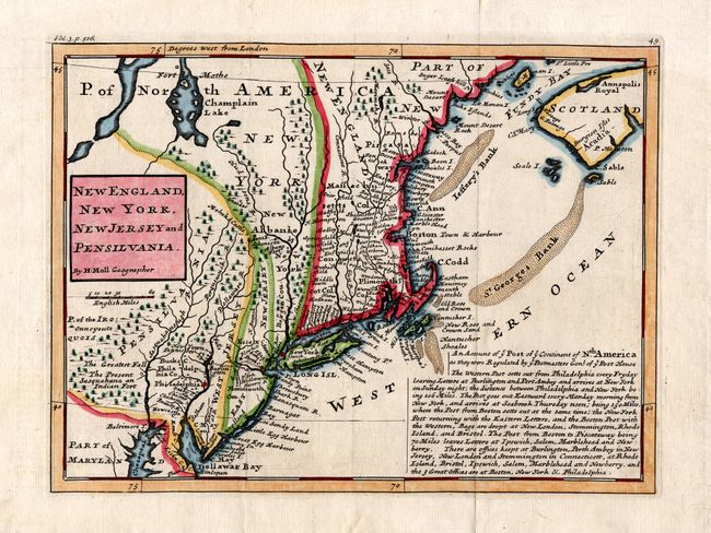
Subject: Colonial Northeast
Moll, Herman
New England, New York, New Jersey, and Pensilvania &c., 1739
Size: 10.8 x 8 inches (27.4 x 20.3 cm)
Estimate: $600 - $800
Sold for: $425
Closed on 3/6/2007

Auction 118, Lot 237
Subject: Colonial New England and Mid-Atlantic
Bellin, Jacques Nicolas
Carte de la Nouvelle Angleterre, Nouvelle Yorck, Pensilvanie…, 1757
Size: 11.7 x 8 inches (29.7 x 20.3 cm)
Estimate: $200 - $300
Sold for: $210
Closed on 3/6/2007
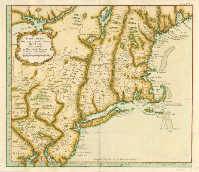
Auction 118, Lot 238
Subject: Colonial New England and Mid-Atlantic
Bellin, Jacques Nicolas
Carte de la Nouvelle Angleterre New York Pensilvanie et Nouveau Jersay…, 1764
Size: 14.5 x 12.6 inches (36.8 x 32 cm)
Estimate: $800 - $1,000
Sold for: $600
Closed on 3/6/2007
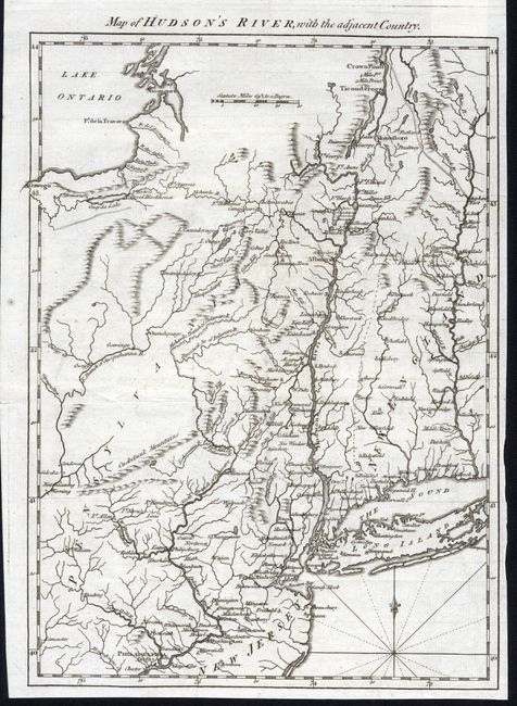
Auction 118, Lot 239
Subject: Northeastern United States
Anon.
Map of Hudson's River with the Adjacent Country, 1778
Size: 8.5 x 11.8 inches (21.6 x 30 cm)
Estimate: $300 - $350
Sold for: $150
Closed on 3/6/2007
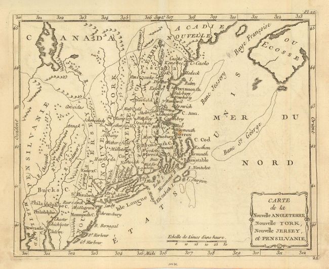
Auction 118, Lot 240
Subject: Colonial Northeast
Laporte, Joseph de
Carte de la Nouvelle Angleterre, Nouvelle York, Nouvelle Jersey, et Pensilvanie, 1783
Size: 8.7 x 7 inches (22.1 x 17.8 cm)
Estimate: $275 - $325
Sold for: $200
Closed on 3/6/2007
237 lots
Page 1 of 5