Subject: Canada, Quebec
Period: 1759 (published)
Publication: London Magazine,
Color: Black & White
Size:
10 x 7 inches
25.4 x 17.8 cm
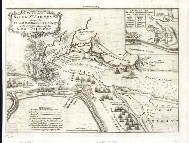
This is a very detailed engraved map of the siege of Quebec during the French and Indian War of 1759. The map shows the positions of the two opposing forces with numerous war ships in the river surrounding the city. Admiral Holme's Division is upstream with Admiral Saunder's Division to the east and also up the South Channel. Locates the HMS Centurion in the North Channel just below General Wolfe's land based camp near the Falls of Montmoreenci. At upper right is a "Plan of the Action gained by the English near Quebec, Sep. 13, 1759." Fancy rococo-style title cartouche. Published in the November, 1759 issue of the London Magazine.
References: Jolly LOND-178.
Condition: A
Crisp, early impression printed on hand laid paper with original margins. Short marginal split at top, closed on verso, and hinge tape on verso.