Subject: Canada - Maritime Provinces
Period: 1764 (circa)
Publication: Le Petite Atlas Maritime
Color: Black & White
Three fine copper engraved charts focusing on Cape Breton Island - here called l'Isle Royale. War broke out between France and England in 1744 and a large number of maps were produced to describe the areas involved. Louisbourg was the center of the lucrative cod fishery and a mercantile shipping point between Europe and the New World. The French lost Louisbourg to a determined British army, but the treaty of Aix-la-Chappelle returned Louisbourg to the French in 1749. By 1758 Louisbourg was once again attacked by the British and in 1760 the fortification walls were dismantled.
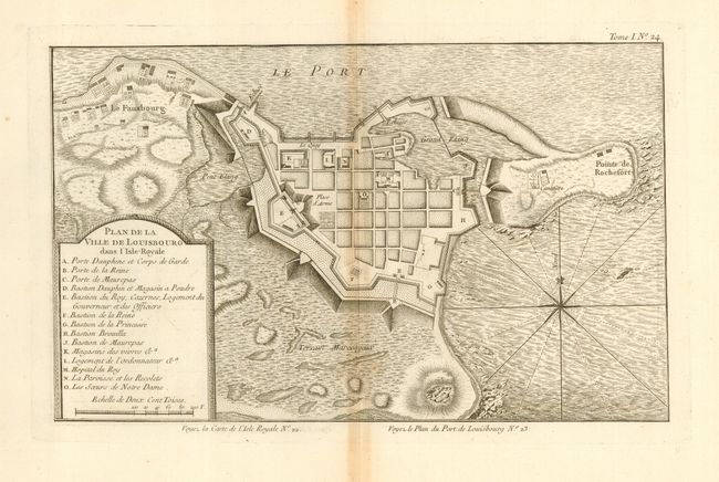
1) This map details the fortified town of Louisbourg. Within the title cartouche is a legend that locates 14 important buildings within the fortress including the magazine, hospital, and much more. A handsome chart with fully engraved seas and compass rose with fleur-de-lys. 13.3" x 8.2".
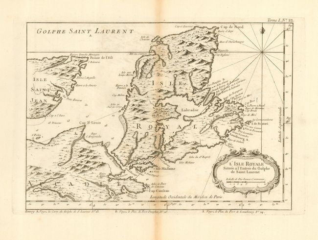
2) The entire island is shown with detail particularly along the eastern coast. Topography and watershed are depicted. Rococo-style cartouche incorporates the distance scale. 11.6" x 8.3".
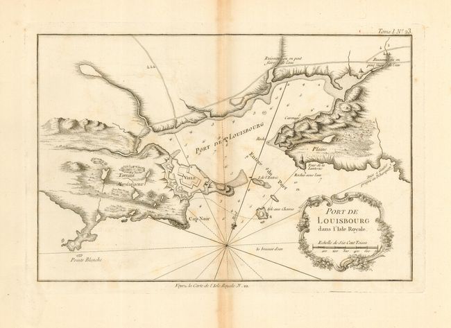
3) The harbor of Louisbourg in the southeast portion of the island is portrayed in great detail, locating Cap Noir, Plaine, the lighthouse, and the fortified town. Rhumb lines with fleur-de-lys and a rococo-style title cartouche decorate the map. 12.2" x 8".
References: 1) Kershaw #928; 2) Kershaw #877; 3) Kershaw #927.
Condition: B
All are fine, dark impressions on thick hand laid paper with very wide margins. Each toned along centerfold.