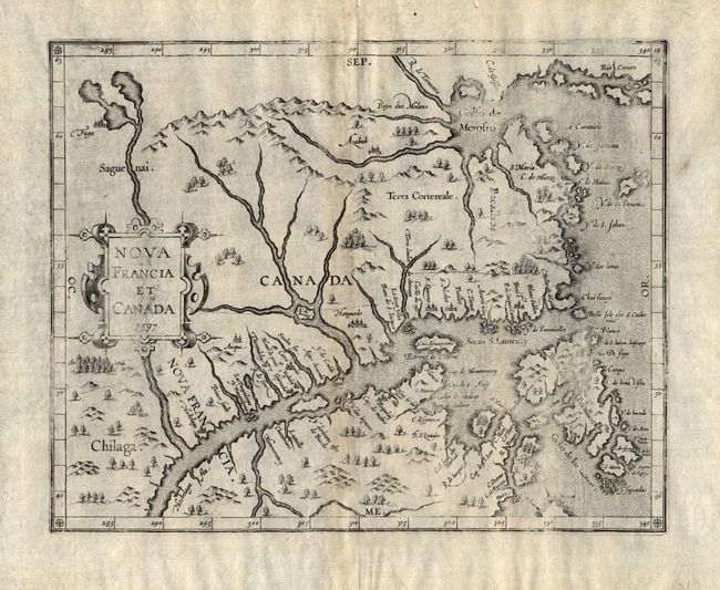
Subject: Eastern Canada
Period: 1597 (dated)
Publication: Descriptionis Ptolemaicae augmentum
Color: Black & White
Size:
11.3 x 9 inches
28.7 x 22.9 cm
This map is cartographically important for a number of reasons - it is the first state of the plate, issued in the first atlas of the New World, the first map to use Canada in its title, and the first to concentrate on the St. Lawrence River and gulf. The general outline of the map is derived from Gerard Mercator and summarizes sixteenth-century knowledge of the region. The region north of the St. Lawrence and east of the Saguenai River is labeled Canada, and Nova Francia is centered on the town of Hochelaga (present-day Montreal).
References: Burden #102; Kershaw #35.
Condition: B
Generally clean example with generous margins. There are a couple very short marginal tears and a centerfold separation at the top, well away from the map. Hinge remnants on verso. The impression is uneven, else very good.