Subject: Canada, Montreal
Period: 1764 (circa)
Publication: Le Petite Atlas Maritime
Color: Black & White
Size:
13.7 x 8.5 inches
34.8 x 21.6 cm
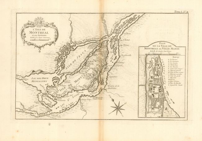
A well engraved copper plate chart that shows the islands of Montreal and Jesus in great detail. Montreal (here Ville Marie) is depicted as a walled and fortified city. The map locates the forts Roland, Gde. Ance, Pte. Claire, Ste. Anne, Ste. Genevieve, and more. Also includes the surrounding islands of Ste. Therese, S. Andre, Perot, Bizard, etc. A large inset at right contains a "Plan de la Ville de Montreal ou Ville Marie" with a legend locating and naming fifteen important buildings. The chart features a rococo-style cartouche that incorporates a distance scale. Compass rose and fleur-de-lis further decorate the chart.
References: Kershaw #1108.
Condition: B
Good impression printed on a full sheet of hand laid paper with large watermark and wide margins. Toned along centerfold, some light offsetting, and a few marginal spots.