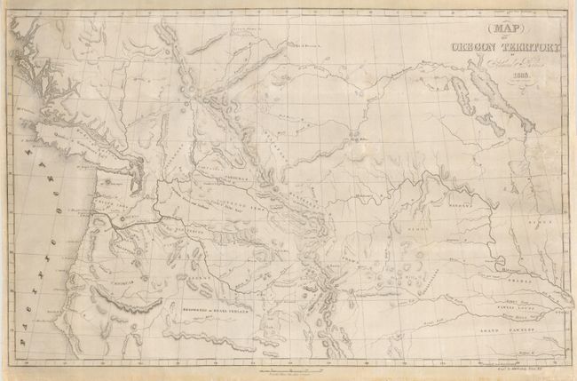
Subject: Western Canada, Pacific Northwest, Oregon Territory
Period: 1838 (dated)
Publication: Journal of Our Exploring Tour beyond the Rocky Mountains
Color: Black & White
Size:
22 x 14 inches
55.9 x 35.6 cm
Samuel Parker was a missionary who accompanied a fur-trading party on an expedition from Council Bluffs Iowa to the Oregon Territory. At the time, the region was claimed by both the British and the United States and was little known except to the fur-traders. Parker's map, based on both personal observation and reports of the fur-traders of the Hudson Bay Company, is a landmark in the mapping of the region. The map provides an excellent view of the river systems and tribal territory. It shows several forts, including an early depiction of Fort Hall. The map extends to include much of present-day Canada.
References: Wheat [TMW] #438; Wagner-Camp #70.
Condition: B
Issued folding, now backed with Japanese tissue and remargined at right with some neatline in facsimile and a repaired binding tear.