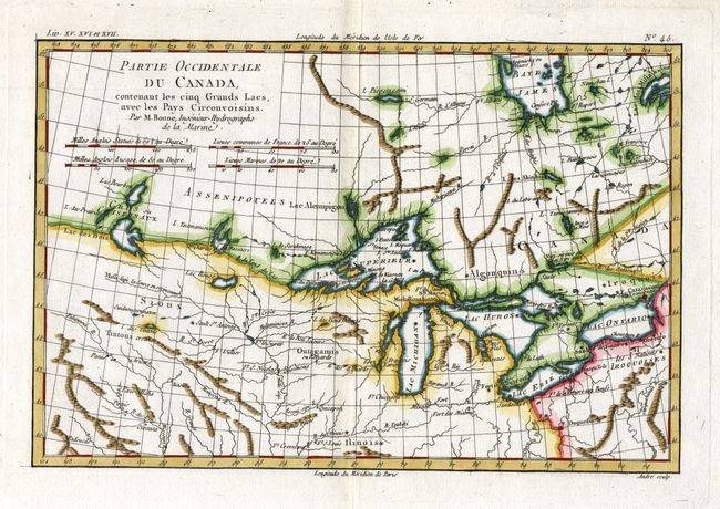
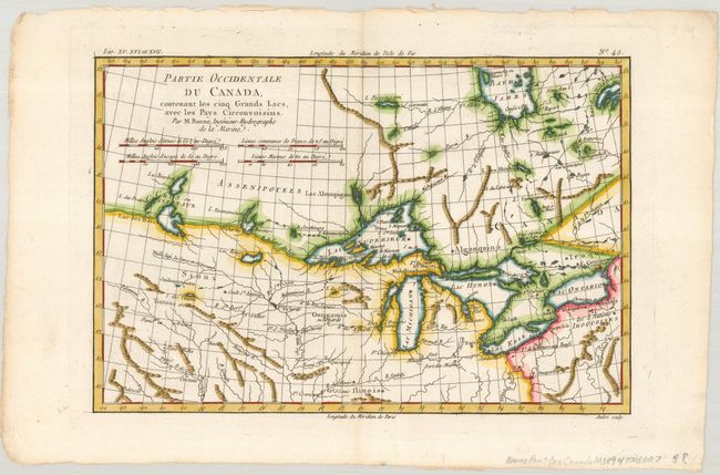
Subject: Colonial United States & Canada, Great Lakes
Period: 1775 (published)
Publication: Atlas de toutes les parties connues du Globe Terrestre…
Color: Hand Color
Size:
12.3 x 8.3 inches
31.2 x 21.1 cm
A nice example of one of the most interesting maps of the Great Lakes that depicts frontier forts, missions, and fur trade routes. It covers the region from James Bay to just below Ft. Duquesne and from Lake Ontario through the Great Plains. It contains numerous Indian tribe names and forts including Detroit, St. Louis, Toronto and Chicagou. Lake Superior contains Isle Royale, as well as the phantom islands of St. Anne, Maurepas and Ponchartrain, which were reported by the Jesuit explorer Charlevoix. The Keweenaw Peninsula is noted as Pt. de Kiaonan. The source of the Mississippi is noted as inconnu or unknown. First state, engraved by Andre.
References: Kershaw #973; Sellers and Van Ee #173.
Condition: A
Lovely color and nice impression. A couple of chips in top, blank margin, well away from the map.