Filtered by Category:Books, Atlases, Travel Guides, Geography & Reference Books(Show All Categories)
Showing results for:Auction 178
Catalog Archive
40 lots
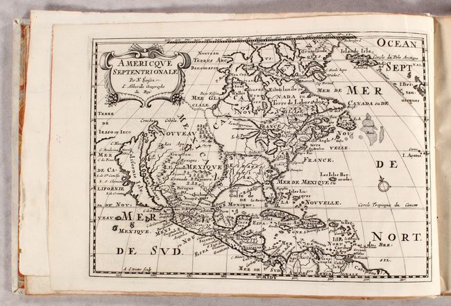
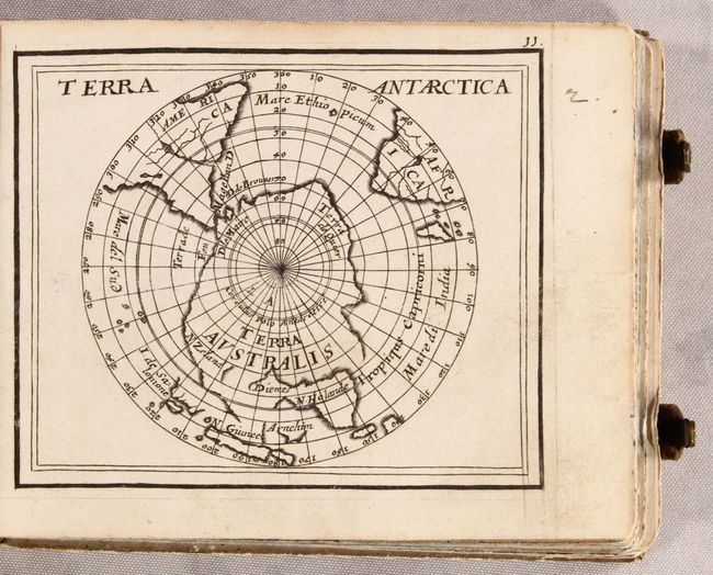
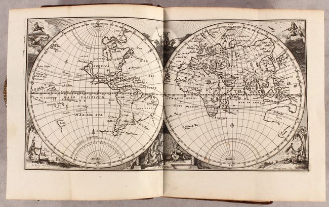
Auction 178, Lot 48
Subject: Western Hemisphere - America
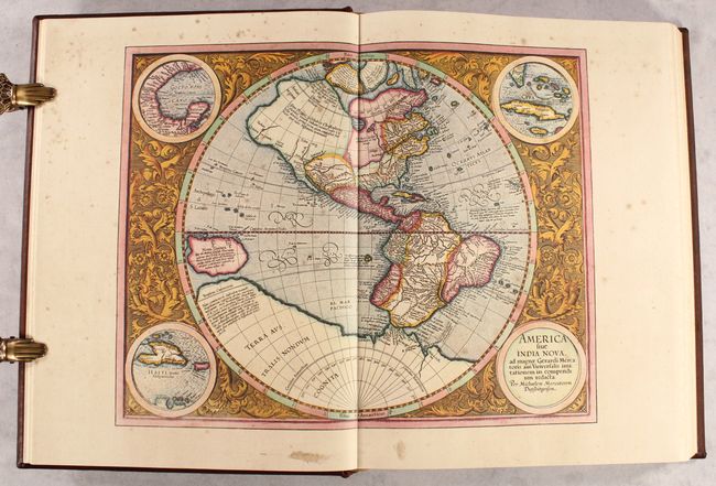
Sanson, Nicolas
L'Amerique en Plusieurs Cartes Nouvelles et Exactes; et en Divers Traittez de Geographie & d'Histoire..., 1699
Size: 13.7 x 9.1 inches (34.8 x 23.1 cm)
Estimate: $5,500 - $6,500
Sanson's Highly Desirable Atlas of the Americas with 15 Maps
Sold for: $4,250
Closed on 6/10/2020
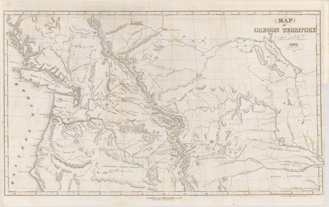
Auction 178, Lot 94
Subject: Western United States & Canada
Parker, Samuel (Rev.)
Map of Oregon Territory [with] Journal of an Exploring Tour Beyond the Rocky Mountains..., 1844
Size: 23.3 x 13.4 inches (59.2 x 34 cm)
Estimate: $500 - $650
Sold for: $475
Closed on 6/10/2020
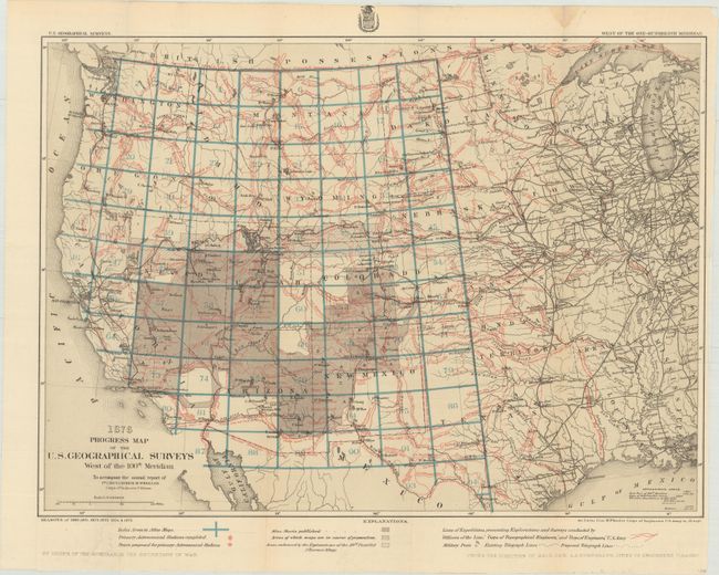
Auction 178, Lot 133
Subject: Western United States
Wheeler, George (Lt)
[Lot of 3 - Annual Reports of the Corps of Engineers - Geographical Surveys West of the 100th Meridian], 1876-78
Size: 6.4 x 9.4 inches (16.3 x 23.9 cm)
Estimate: $450 - $550
Unsold
Closed on 6/10/2020
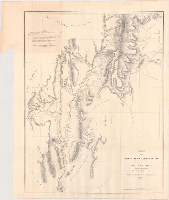
Auction 178, Lot 135
Subject: Southwestern United States
Emory, William Hemsley
[Maps with Report] Map of the Territory of New Mexico... [and] Sketch of Part of the March & Wagon Road of Lt. Colonel Cooke... [accompanying] Notes of a Military Reconnoissance, from Fort Leavenworth, in Missouri, to San Diego, in California…, 1848
Size: 5.8 x 9 inches (14.7 x 22.9 cm)
Estimate: $400 - $475
Unsold
Closed on 6/10/2020
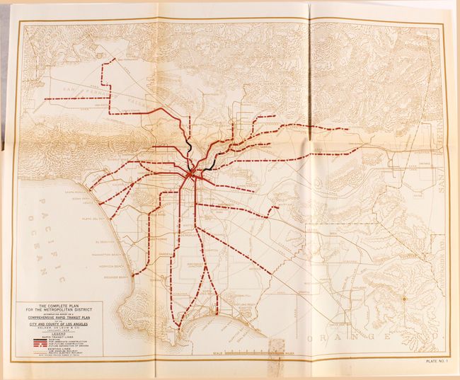
Auction 178, Lot 147
Subject: Los Angeles, California
Report and Recommendations on a Comprehensive Rapid Transit Plan for the City and County of Los Angeles, 1925
Size: 8.8 x 11.3 inches (22.4 x 28.7 cm)
Estimate: $200 - $250
Sold for: $275
Closed on 6/10/2020
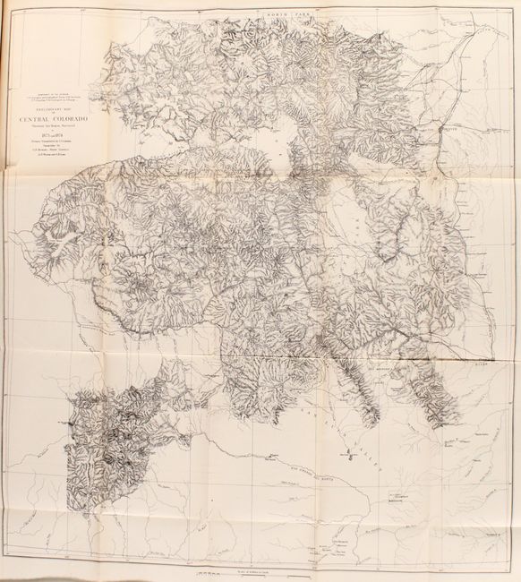
Auction 178, Lot 151
Subject: Colorado
Hayden, Ferdinand Vandeveer
Annual Report of the United States Geological and Geographical Survey of the Territories, Embracing Colorado and Parts of Adjacent Territories..., 1876
Size: 6 x 9.3 inches (15.2 x 23.6 cm)
Estimate: $400 - $475
Sold for: $375
Closed on 6/10/2020
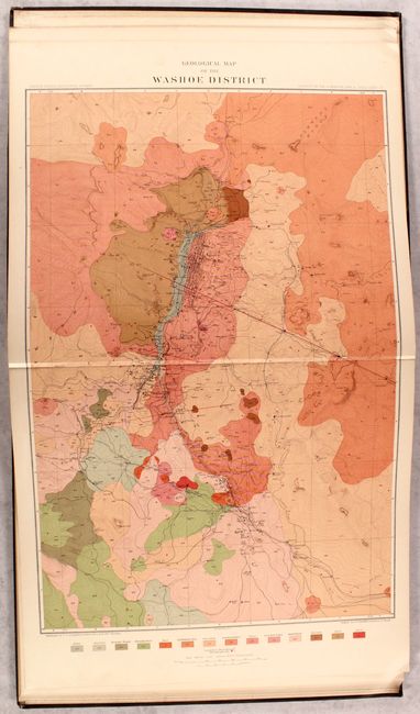
Auction 178, Lot 181
Subject: Nevada, Atlas
U.S. Geological Survey (USGS)
Atlas to Accompany the Monograph on the Geology of the Comstock Lode and the Washoe District, 1882
Size: 18 x 20.2 inches (45.7 x 51.3 cm)
Estimate: $350 - $425
Sold for: $250
Closed on 6/10/2020
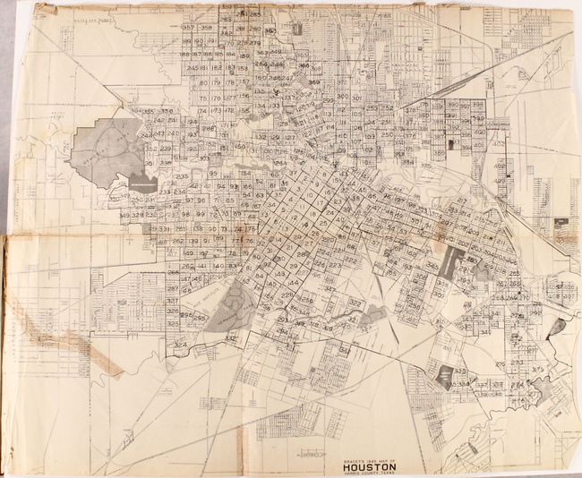
Auction 178, Lot 194
Subject: Houston, Texas
Bracey’s Block Maps of the City of Houston. For 1946 Showing Who Owns Houston in Detail..., 1946
Size: 12 x 10.1 inches (30.5 x 25.7 cm)
Estimate: $180 - $220
Sold for: $230
Closed on 6/10/2020
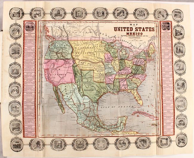
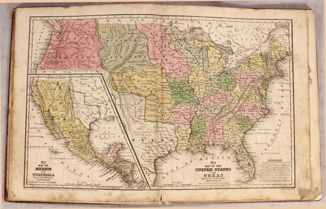
Auction 178, Lot 207
Subject: United States & Mexico
Haven, John
Map of the United States and Mexico Including Oregon, Texas and the Californias [bound in] The American's Own Book; or the Constitutions of the Several States in the Union..., 1849
Size: 22.2 x 17.7 inches (56.4 x 45 cm)
Estimate: $800 - $950
Sold for: $600
Closed on 6/10/2020
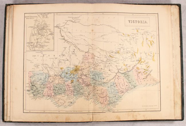
Auction 178, Lot 545
Subject: Australia, Atlas
Black, Adam & Charles
Atlas of Australia with All the Gold Regions. A Series of Maps from the Latest and Best Authorities, 1851
Size: 9.9 x 13.1 inches (25.1 x 33.3 cm)
Estimate: $500 - $650
Sold for: $500
Closed on 6/10/2020
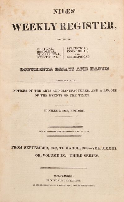
Auction 178, Lot 585
Subject: Document - Jim Bowie
[Eyewitness Account of the Jim Bowie Knife Fight] [in] Niles' Weekly Register, 1827
Size: 6.3 x 9.8 inches (16 x 24.9 cm)
Estimate: $250 - $325
Sold for: $150
Closed on 6/10/2020

Auction 178, Lot 589
Subject: Document - Boxer Rebellion
U.S. Government
[Boxer Rebellion] Annual Reports of the War Department for the Fiscal Year Ending June 30, 1900. Report of the Lieutenant-General Commanding the Army ... Part 7, 1900
Size: 5.9 x 9.3 inches (15 x 23.6 cm)
Estimate: $250 - $325
Sold for: $150
Closed on 6/10/2020
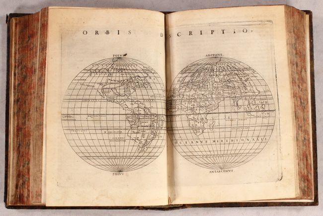
Auction 178, Lot 590
Subject: Atlases
Ptolemy/Ruscelli
La Geografia di Claudio Tolomeo Alessandrino..., 1574
Size: 6.5 x 9.2 inches (16.5 x 23.4 cm)
Estimate: $8,000 - $10,000
Ruscelli's Complete, Third Edition Atlas
Sold for: $6,000
Closed on 6/10/2020
Auction 178, Lot 591
Subject: Atlases
Duval/Beer
[Geographia Universalis...], 1678
Size: 6.1 x 4.9 inches (15.5 x 12.4 cm)
Estimate: $5,500 - $6,500
Miniature Atlas with 82 Maps Based on Duval
Unsold
Closed on 6/10/2020
Auction 178, Lot 592
Subject: Atlases
Peeters, Jacques
L'Atlas en Abrege, ou Nouvelle Description du Monde, 1692
Size: 4.6 x 7.5 inches (11.7 x 19.1 cm)
Estimate: $3,500 - $4,250
Rare, Complete Atlas with 43 Maps
Sold for: $3,250
Closed on 6/10/2020
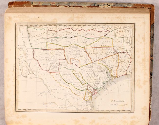
Auction 178, Lot 593
Subject: Atlases, Texas
Bradford, Thomas Gamaliel
A Comprehensive Atlas Geographical, Historical & Commercial, 1835
Size: 10.8 x 13.1 inches (27.4 x 33.3 cm)
Estimate: $2,500 - $3,250
First Printed Atlas to Contain a Separate Map of Texas
Sold for: $2,400
Closed on 6/10/2020
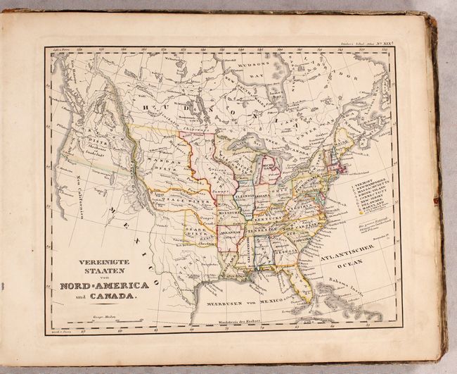
Auction 178, Lot 594
Subject: Atlases
Mitchell, Samuel Augustus
Mitchell's School Atlas, 1839
Size: 9.8 x 12.1 inches (24.9 x 30.7 cm)
Estimate: $300 - $375
Rare, Early Mitchell School Atlas
Sold for: $200
Closed on 6/10/2020
Auction 178, Lot 595
Subject: Atlases
Perthes, Justus
[2 Atlases Bound in 1 Volume] Schul-Atlas uber alle Theile der Erde nach dem Neusten Zustande, und uber das Weltgebaude [and] Orbis Terrarum Antiquus. Schul-Atlas der Alten Welt, 1842-45
Size: 12 x 9.5 inches (30.5 x 24.1 cm)
Estimate: $550 - $650
Two School Atlases with 42 Maps
Sold for: $400
Closed on 6/10/2020
Auction 178, Lot 596
Subject: Atlases
Cram, George F. & Company
New Indexed Commercial Atlas of the Western and Southern States. A Complete Guide for Business Men..., 1882
Size: 12.5 x 17.8 inches (31.8 x 45.2 cm)
Estimate: $800 - $950
Sold for: $650
Closed on 6/10/2020
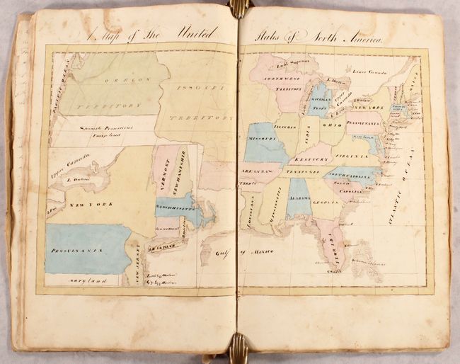
Auction 178, Lot 597
Subject: Geography Books
Geography, 1834
Size: 10.3 x 16 inches (26.2 x 40.6 cm)
Estimate: $1,500 - $2,500
Manuscript Geography Book with 9 Maps and Colorful Commentary
Sold for: $1,000
Closed on 6/10/2020
Auction 178, Lot 598
Subject: Geography Books
Royal Geographical Society
The Journal of the Royal Geographical Society. Volume the Thirty-Fourth, 1864
Size: 5.7 x 8.9 inches (14.5 x 22.6 cm)
Estimate: $400 - $475
Sold for: $425
Closed on 6/10/2020
Auction 178, Lot 599
Subject: Exploration & Surveys
General Land Office
Report of the Commissioner of the General Land Office for the Year 1865, 1865
Size: 5.8 x 9.2 inches (14.7 x 23.4 cm)
Estimate: $300 - $400
Presentation Example from GLO Commissioner Edmunds
Sold for: $240
Closed on 6/10/2020
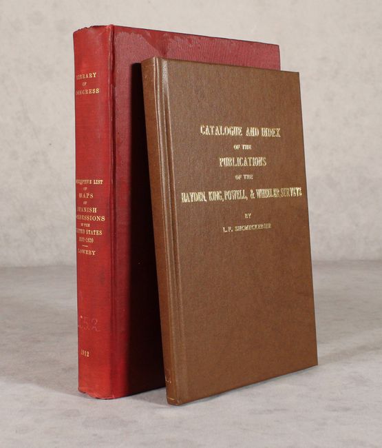
Auction 178, Lot 600
Subject: References
[Lot of 2] The Lowery Collection - A Descriptive List of Maps of the Spanish Possessions Within the Present Limits of the United States... [and] Catalogue and Index of the Publications of the Hayden, King, Powell, and Wheeler Surveys..., 1904-12
Size: See Description
Estimate: $100 - $130
NO RESERVE
Sold for: $31
Closed on 6/10/2020

Auction 178, Lot 601
Subject: References
Humphreys, A.L.
Old Decorative Maps and Charts, 1926
Size: 10 x 12.4 inches (25.4 x 31.5 cm)
Estimate: $250 - $325
Sold for: $180
Closed on 6/10/2020
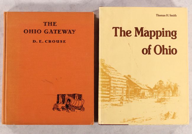
Auction 178, Lot 602
Subject: References, Ohio
[Lot of 2] The Ohio Gateway [and] The Mapping of Ohio - The Delineation of the State of Ohio Through the Use of Manuscript Maps, Printed Maps, and Plats..., 1938-77
Size: See Description
Estimate: $120 - $150
NO RESERVE
Sold for: $11
Closed on 6/10/2020
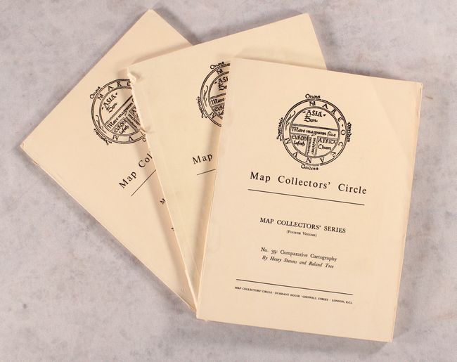
Auction 178, Lot 603
Subject: References, North America
Tooley, R. V.
[Lot of 3] Map Collectors' Circle - No. 20: North American City Plans [and] No. 39: Comparative Cartography [and] No. 96: Printed Maps of America Part IV, 1965-74
Size: 7.2 x 9.7 inches (18.3 x 24.6 cm)
Estimate: $30 - $40
NO RESERVE
Sold for: $35
Closed on 6/10/2020
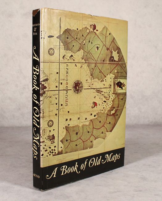
Auction 178, Lot 604
Subject: References, United States
A Book of Old Maps Delineating American History from the Earliest Days Down to the Close of the Revolutionary War, 1969
Size: 10.1 x 14.5 inches (25.7 x 36.8 cm)
Estimate: $110 - $140
Sold for: $160
Closed on 6/10/2020
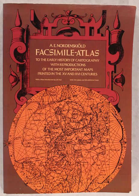
Auction 178, Lot 605
Subject: References, Facsimile Atlas
Nordenskiold, Nils Adolf E.
Facsimile-Atlas to the Early History of Cartography with Reproductions of the Most Important Maps Printed in the XV and XVI Centuries, 1973
Size: 11 x 16 inches (27.9 x 40.6 cm)
Estimate: $110 - $140
Sold for: $120
Closed on 6/10/2020
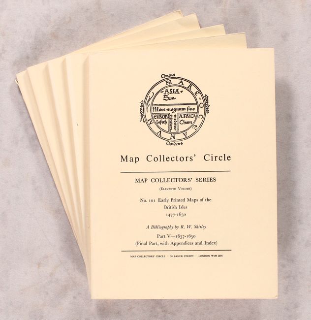
Auction 178, Lot 606
Subject: References
Shirley, Rodney W.
[Lot of 5] Map Collectors' Circle - Nos. 90, 94, 95, 97, and 101: Early Printed Maps of the British Isles 1477-1650 Parts-I-V, 1973-74
Size: 7.3 x 9.8 inches (18.5 x 24.9 cm)
Estimate: $100 - $130
NO RESERVE
Unsold
Closed on 6/10/2020
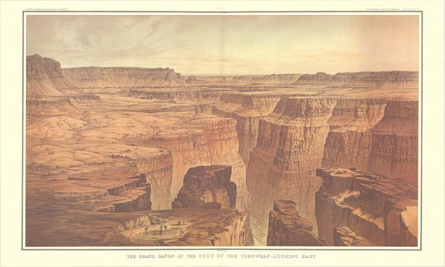
Auction 178, Lot 607
Subject: References, Facsimile Atlas
Dutton, Clarence Edward
[Facsimile] Atlas to Accompany the Monograph on the Tertiary History of the Grand Canon District, 1977
Size: 16.9 x 20.3 inches (42.9 x 51.6 cm)
Estimate: $275 - $350
Sold for: $140
Closed on 6/10/2020
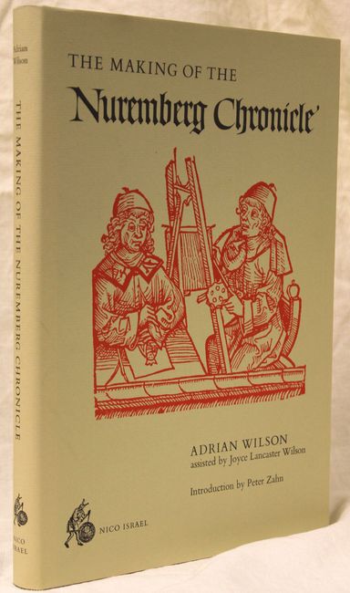
Auction 178, Lot 608
Subject: References, Incunabula
Wilson, Adrian
The Making of the Nuremberg Chronicle, 1978
Size: 9.9 x 13.9 inches (25.1 x 35.3 cm)
Estimate: $140 - $170
Sold for: $110
Closed on 6/10/2020
Auction 178, Lot 609
Subject: References, Facsimile Atlas
Mercator, Gerard
[Facsimile] Atlas sive Cosmographicae Meditationes de Fabrica Mundi et Fabricati Figura, 1979
Size: 13.2 x 17.8 inches (33.5 x 45.2 cm)
Estimate: $275 - $350
Sold for: $375
Closed on 6/10/2020
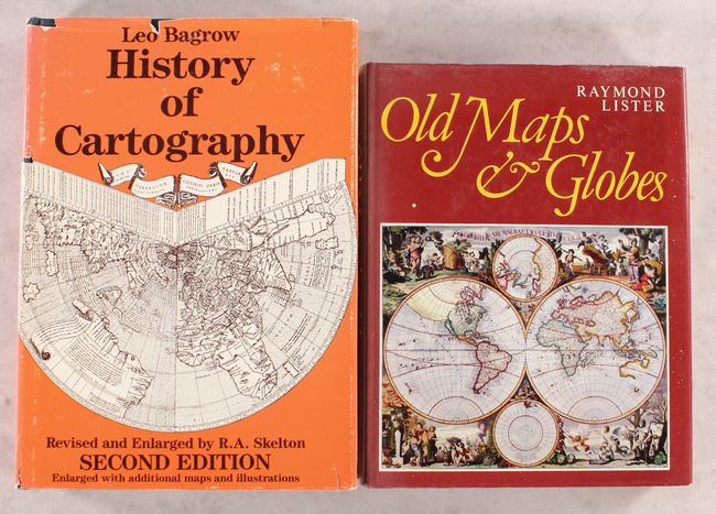
Auction 178, Lot 610
Subject: References, General Cartographic History
[Lot of 2] History of Cartography [and] Old Maps and Globes with a List of Cartographers, Engravers, Publishers and Printers..., 1979-85
Size: See Description
Estimate: $70 - $90
NO RESERVE
Sold for: $130
Closed on 6/10/2020
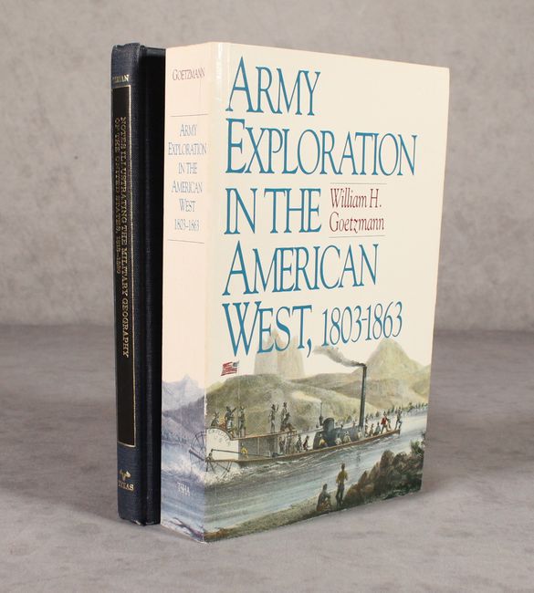
Auction 178, Lot 611
Subject: References, U.S. Military
[Lot of 2] Notes Illustrating the Military Geography of the United States 1813-1880 [and] Army Exploration in the American West, 1803-1863, 1979-91
Size: See Description
Estimate: $40 - $60
NO RESERVE
Sold for: $32
Closed on 6/10/2020
Auction 178, Lot 612
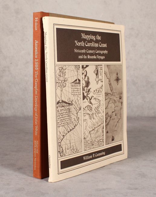
Subject: References, Colonial Virginia & North Carolina
[Lot of 2] America 1585 - The Complete Drawings of John White [and] Mapping the North Carolina Coast -Sixteenth-Century Cartography and the Roanoke Voyages, 1984-88
Size: See Description
Estimate: $50 - $70
NO RESERVE
Sold for: $210
Closed on 6/10/2020
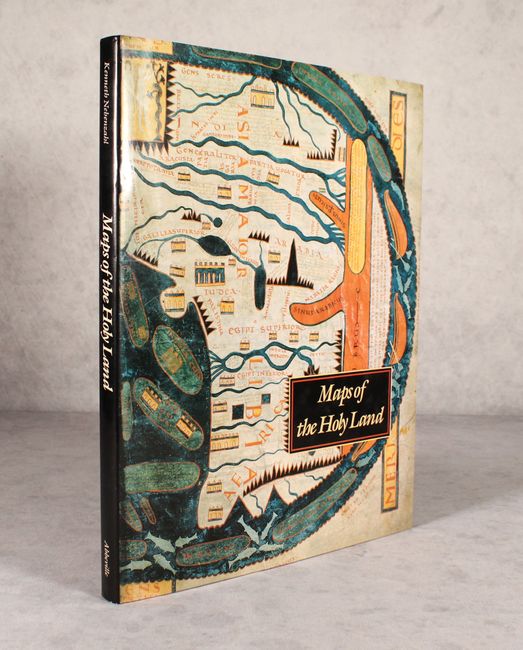
Auction 178, Lot 613
Subject: References, Holy Land
Nebenzahl, Kenneth
Maps of the Holy Land - Images of Terra Sancta Through Two Millennia, 1986
Size: 12.1 x 15.3 inches (30.7 x 38.9 cm)
Estimate: $70 - $90
NO RESERVE
Sold for: $55
Closed on 6/10/2020
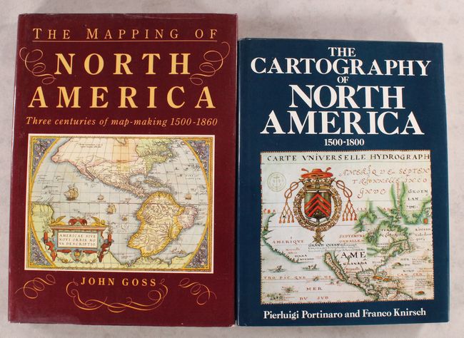
Auction 178, Lot 614
Subject: References, North America
[Lot of 2] The Mapping of North America - Three Centuries of Map-Making 1500-1860 [and] The Cartography of North America 1500-1800, 1987-90
Size: See Description
Estimate: $100 - $130
Sold for: $130
Closed on 6/10/2020
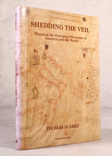
Auction 178, Lot 615
Subject: References
Suarez, Thomas
Shedding the Veil - Mapping the European Discovery of America and the World, 1992
Size: 8.8 x 11.8 inches (22.4 x 30 cm)
Estimate: $70 - $90
NO RESERVE
Sold for: $90
Closed on 6/10/2020
Auction 178, Lot 616
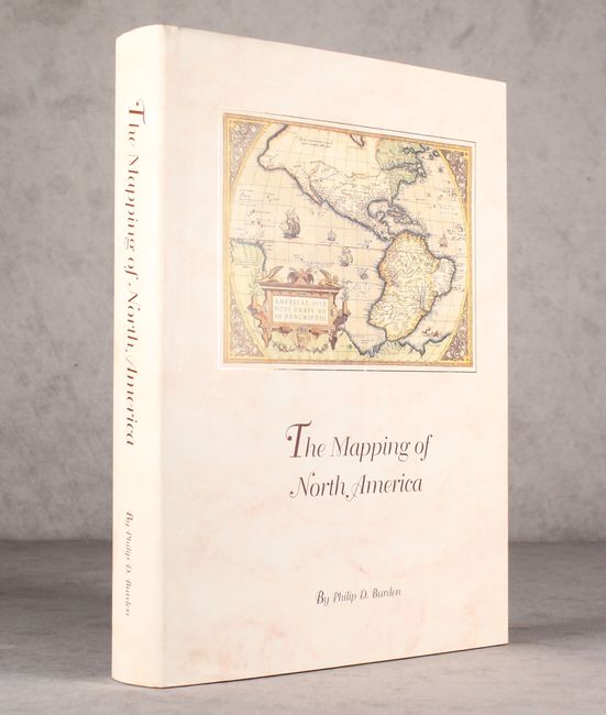
Subject: References, North America
Burden, Philip D.
The Mapping of North America - A List of Printed Maps 1511-1670, 1996
Size: 10.5 x 14.3 inches (26.7 x 36.3 cm)
Estimate: $200 - $230
Sold for: $150
Closed on 6/10/2020
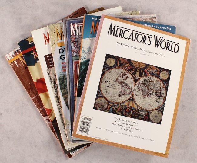
Auction 178, Lot 617
Subject: References, Magazines
[Lot of 7] Mercator's World - The Magazine of Maps, Atlases, Globes and Charts, 1996-2002
Size: 8.4 x 10.9 inches (21.3 x 27.7 cm)
Estimate: $50 - $70
NO RESERVE
Sold for: $36
Closed on 6/10/2020
40 lots