Filtered by Category:Canada(Show All Categories)
Showing results for:Auction 178
Catalog Archive
26 lots
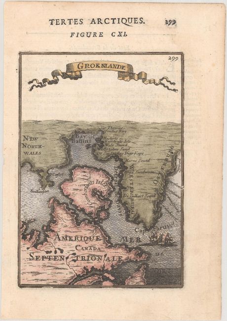
Auction 178, Lot 70
Subject: Northeastern Canada & Greenland
Mallet, Alain Manesson
Groenlande, 1683
Size: 4.1 x 5.9 inches (10.4 x 15 cm)
Estimate: $120 - $150
Sold for: $90
Closed on 6/10/2020
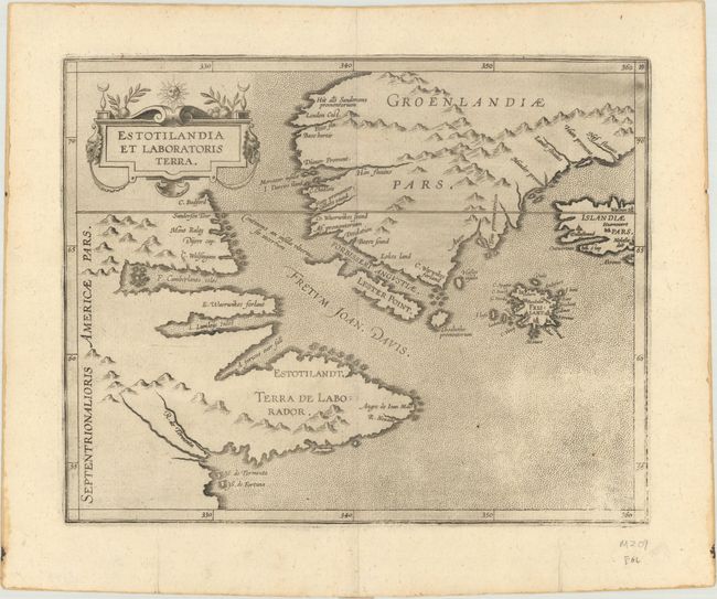
Auction 178, Lot 71
Subject: Eastern Canada & Greenland
Wytfliet, Cornelis
Estotilandia et Laboratoris Terra, 1597
Size: 11.3 x 9.1 inches (28.7 x 23.1 cm)
Estimate: $950 - $1,100
Unsold
Closed on 6/10/2020
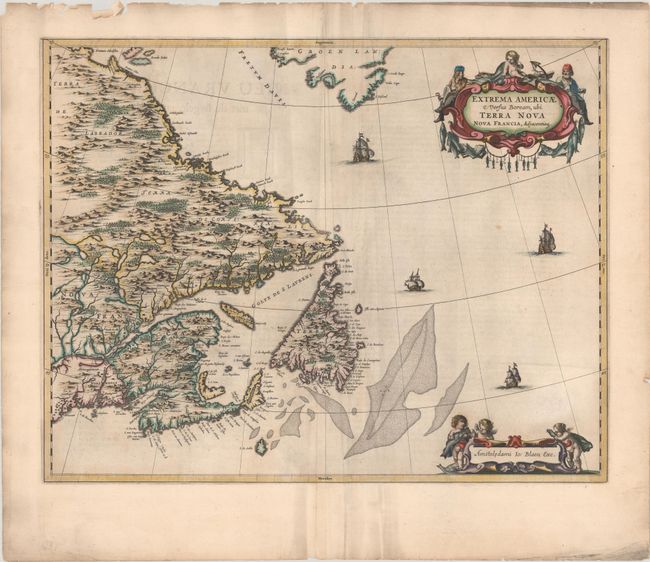
Auction 178, Lot 72
Subject: Eastern Canada
Blaeu, Johannes
Extrema Americae Versus Boream, ubi Terra Nova Nova Francia, Adjacentiaqs, 1664
Size: 22.3 x 17.5 inches (56.6 x 44.5 cm)
Estimate: $1,900 - $2,200
Blaeu's Only Map of Canada, Showing the Canadian Maritimes
Sold for: $1,400
Closed on 6/10/2020
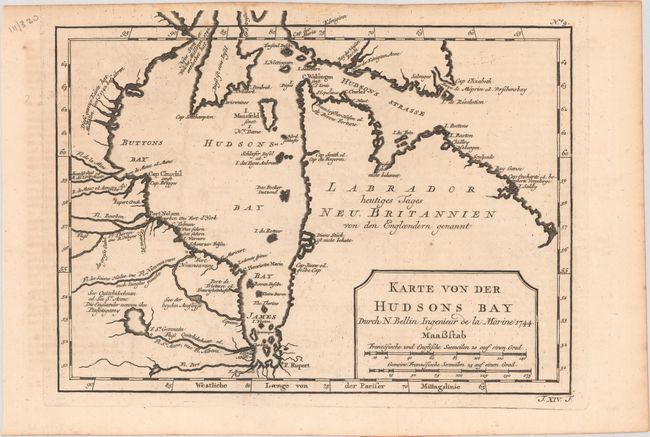
Auction 178, Lot 73
Subject: Eastern Canada, Hudson Bay
Bellin, Jacques Nicolas
[Lot of 2] Karte von der Hudsons Bay [and] Carte de la Baye de Hudson pour Servir a l'Histoire Generale des Voyages, 1744-57
Size: See Description
Estimate: $160 - $190
Sold for: $120
Closed on 6/10/2020
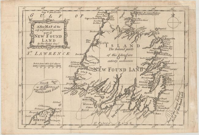
Auction 178, Lot 74
Subject: Eastern Canada
[Lot of 2] A New Map of the Only Useful and Frequented Part of New Found Land [and] Carte du Cours du Fleuve de St. Laurent Depuis son Embouchure Jusqu'au Dessus de Quebec..., 1757-62
Size: See Description
Estimate: $240 - $300
Sold for: $160
Closed on 6/10/2020
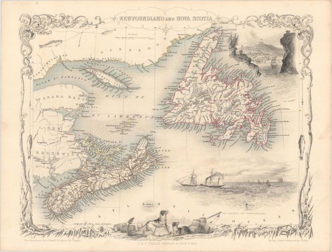
Auction 178, Lot 75
Subject: Eastern Canada
Tallis, John
Newfoundland and Nova Scotia, 1850
Size: 12.9 x 9.9 inches (32.8 x 25.1 cm)
Estimate: $110 - $140
Sold for: $80
Closed on 6/10/2020
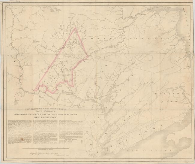
Auction 178, Lot 76
Subject: New Brunswick, Canada
Cross, Joseph
New Brunswick and Nova Scotia Land Company. A Map of the Company's Tract of Land in the Province of New Brunswick, 1834
Size: 26.8 x 22.3 inches (68.1 x 56.6 cm)
Estimate: $140 - $170
Sold for: $150
Closed on 6/10/2020
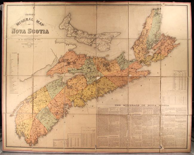
Auction 178, Lot 77
Subject: Nova Scotia
Church, Ambrose F.
Church's Mineral Map of Nova Scotia, 1889
Size: 58.1 x 46.8 inches (147.6 x 118.9 cm)
Estimate: $550 - $700
Sold for: $400
Closed on 6/10/2020
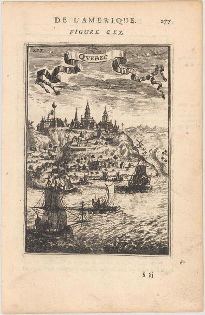
Auction 178, Lot 78
Subject: Quebec, Canada
[Lot of 2] Quebec [and] Quebec, 1683-1722
Size: See Description
Estimate: $140 - $170
Sold for: $100
Closed on 6/10/2020
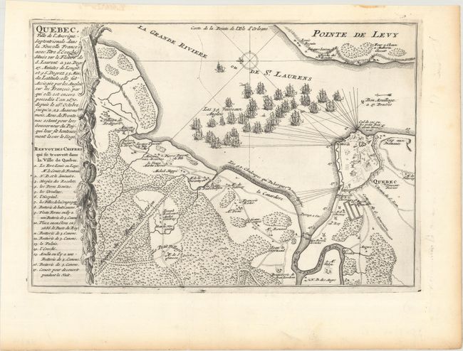
Auction 178, Lot 79
Subject: Quebec, Canada
Fer, Nicolas de
Quebec, Ville de l'Amerique Septentrionale, dans la Nouvelle France..., 1696
Size: 11.8 x 8.1 inches (30 x 20.6 cm)
Estimate: $275 - $350
Sold for: $200
Closed on 6/10/2020
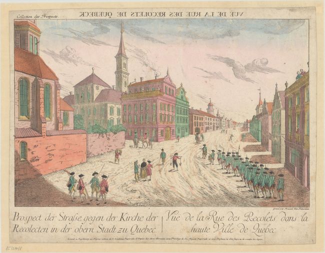
Auction 178, Lot 80
Subject: Quebec, Canada
Haberman, F. X.
Vue de la Rue des Recolets de Quebeck, 1780
Size: 15.6 x 9.9 inches (39.6 x 25.1 cm)
Estimate: $200 - $230
Sold for: $150
Closed on 6/10/2020
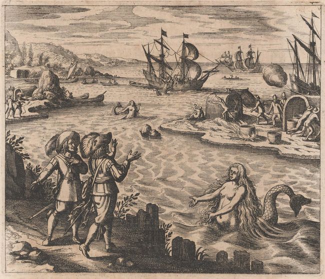
Auction 178, Lot 81
Subject: St. John's Harbor, Canada
Bry, Theodore de
[A Strange Creature at St. John's Harbour], 1627
Size: 6.9 x 5.8 inches (17.5 x 14.7 cm)
Estimate: $240 - $300
Sold for: $180
Closed on 6/10/2020
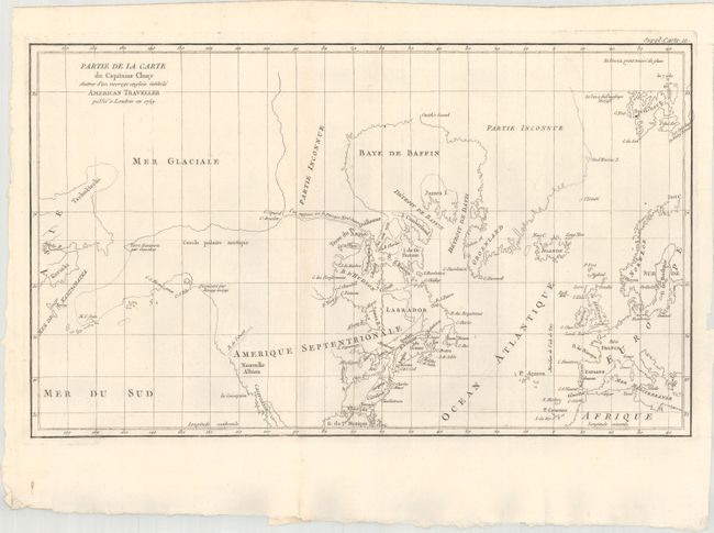
Auction 178, Lot 82
Subject: Colonial United States & Canada, Arctic
Robert de Vaugondy, Didier
Partie de la Carte du Capitaine Cluny Auteur d'un Ouvrage Anglois Intitule American Traveller Publie a Londres en 1769, 1773
Size: 19.4 x 11.5 inches (49.3 x 29.2 cm)
Estimate: $120 - $150
Sold for: $90
Closed on 6/10/2020
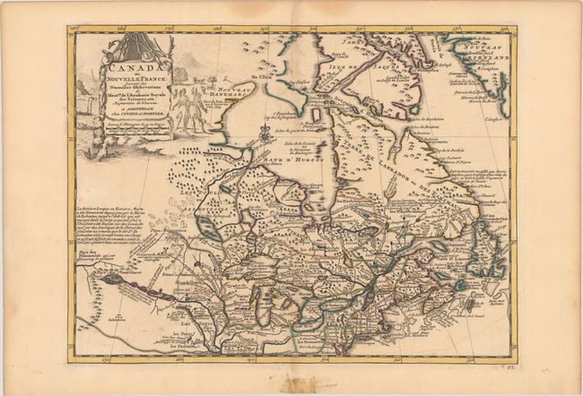
Auction 178, Lot 83
Subject: Colonial Northeastern United States & Canada
Covens & Mortier
Canada ou Nouvelle France, Suivant les Nouvelles Observations de Messrs. de l'Academie Royale des Sciences, Etc..., 1735
Size: 11.7 x 8.8 inches (29.7 x 22.4 cm)
Estimate: $400 - $475
Sold for: $300
Closed on 6/10/2020
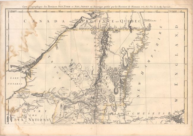
Auction 178, Lot 84
Subject: Colonial Northeastern United States & Canada
Homann Heirs
Carte Geographique des Provinces Neu-York et Neu-Jersey en Amerique, 1778
Size: 22.3 x 14.1 inches (56.6 x 35.8 cm)
Estimate: $300 - $375
Unsold
Closed on 6/10/2020
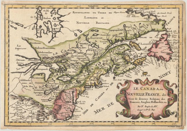
Auction 178, Lot 85
Subject: Colonial Eastern United States & Canada, Great Lakes
Sanson, Nicolas
Le Canada, ou Nouvelle France, &c. Tiree de Diverses Relations des Francois, Anglois, Hollandois, &c, 1683
Size: 12.1 x 8.2 inches (30.7 x 20.8 cm)
Estimate: $550 - $650
Small Version of a Keystone Map for Great Lakes Collections
Sold for: $500
Closed on 6/10/2020
Auction 178, Lot 86
Subject: Colonial Eastern United States & Canada
Bonne/Lattre
[On 2 Sheets] Partie de l'Amerique Septentrionale, qui Comprend le Canada, la Louisiane, le Labrador, le Groenland, la Nouvelle Angleterre, la Floride &c..., 1776
Size: 17.1 x 11.8 inches (43.4 x 30 cm)
Estimate: $200 - $230
Sold for: $150
Closed on 6/10/2020
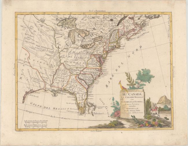
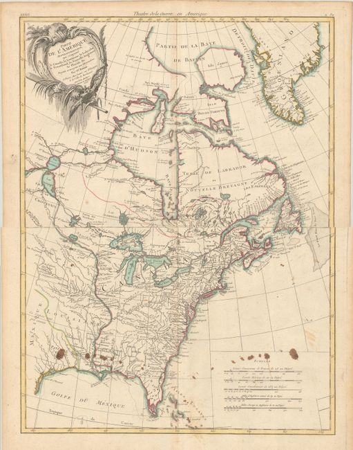
Auction 178, Lot 87
Subject: Colonial Eastern United States & Canada
Zatta, Antonio
Il Canada, le Colonie Inglesi con la Luigiana, e Florida, 1778
Size: 15.9 x 11.9 inches (40.4 x 30.2 cm)
Estimate: $475 - $600
Sold for: $350
Closed on 6/10/2020
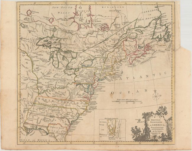
Auction 178, Lot 88
Subject: Colonial Eastern United States & Canada
Kitchin, Thomas
British Dominions in America, Drawn from the Latest and Best Authorities [with related text], 1782
Size: 14.8 x 13.3 inches (37.6 x 33.8 cm)
Estimate: $475 - $600
Sold for: $350
Closed on 6/10/2020
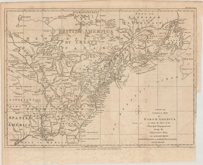
Auction 178, Lot 89
Subject: Eastern United States & Canada
Lodge, John
A New and Correct Map of North America in Which the Places of the Principal Engagements During the Present War, Are Accurately Inserted..., 1783
Size: 14.8 x 10.9 inches (37.6 x 27.7 cm)
Estimate: $3,000 - $4,000
Rare Map Presenting the "Rebel Colonies now the United States of America"
Sold for: $3,750
Closed on 6/10/2020
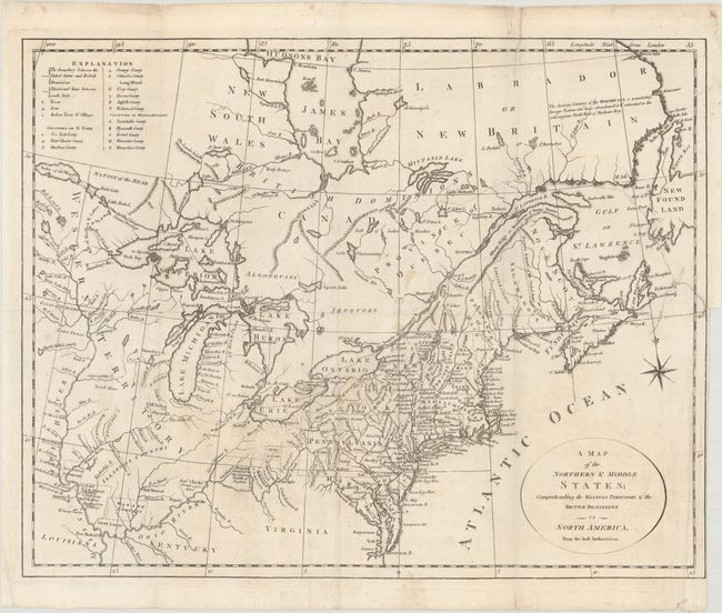
Auction 178, Lot 90
Subject: Eastern United States & Canada
[Lot of 2] A Map of the Northern & Middle States; Comprehending the Western Territory & the British Dominions in North America... [and] United States of America, 1792-97
Size: See Description
Estimate: $500 - $650
Sold for: $350
Closed on 6/10/2020
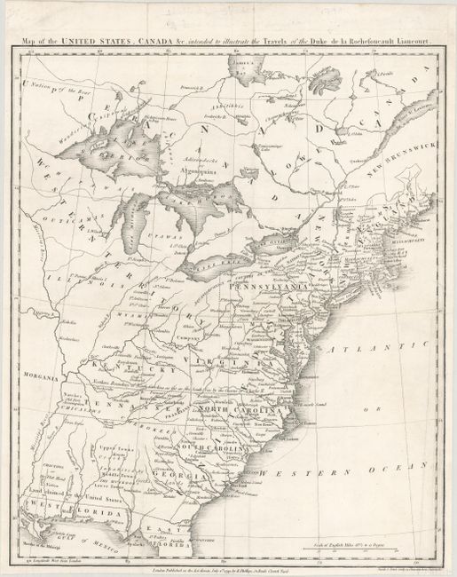
Auction 178, Lot 91
Subject: Eastern United States & Canada, Franklin
Rochefoucald Liancourt, Francois Alexander
Map of the United States, Canada &c. Intended to Illustrate the Travels of the Duke de la Rochefoucault Liancourt, 1799
Size: 13.3 x 15.9 inches (33.8 x 40.4 cm)
Estimate: $1,400 - $1,700
Features the Short-Lived Franklinia and Morgania
Sold for: $1,200
Closed on 6/10/2020
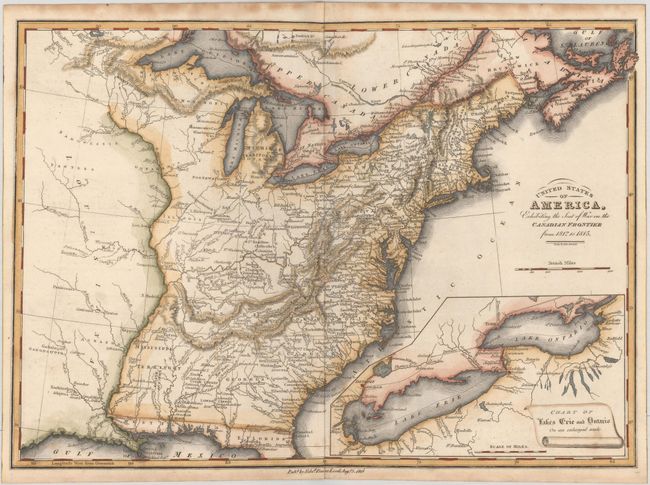
Auction 178, Lot 92
Subject: Eastern United States & Canada
Baines, Edward
United States of America, Exhibiting the Seat of War on the Canadian Frontier from 1812 to 1815, 1816
Size: 13.5 x 9.7 inches (34.3 x 24.6 cm)
Estimate: $300 - $375
Sold for: $220
Closed on 6/10/2020
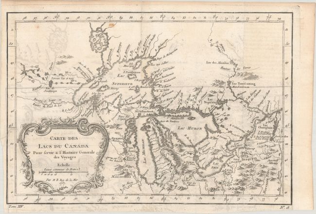
Auction 178, Lot 93
Subject: Colonial Central United States & Canada, Great Lakes
Bellin, Jacques Nicolas
Carte des Lacs du Canada pour Servir a l'Histoire Generale des Voyages, 1757
Size: 11.4 x 7.8 inches (29 x 19.8 cm)
Estimate: $300 - $375
Sold for: $220
Closed on 6/10/2020
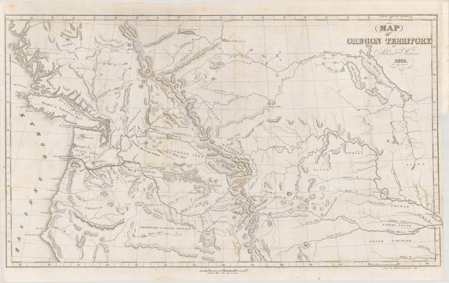
Auction 178, Lot 94
Subject: Western United States & Canada
Parker, Samuel (Rev.)
Map of Oregon Territory [with] Journal of an Exploring Tour Beyond the Rocky Mountains..., 1844
Size: 23.3 x 13.4 inches (59.2 x 34 cm)
Estimate: $500 - $650
Sold for: $475
Closed on 6/10/2020
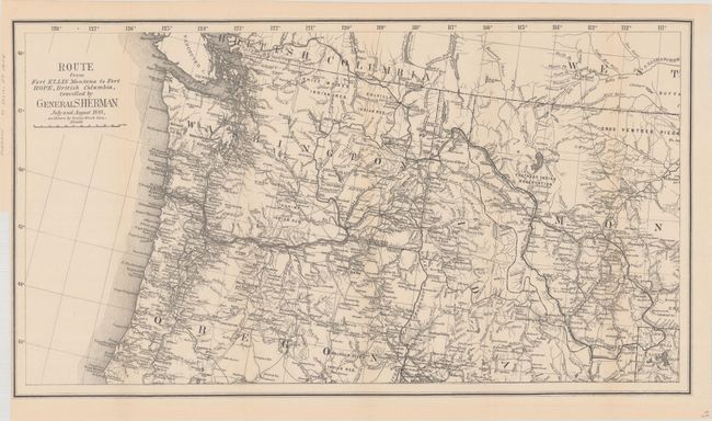
Auction 178, Lot 95
Subject: Northwestern United States & British Columbia
U.S. Government
Route from Fort Ellis Montana to Fort Hope, British Columbia, Travelled by General Sherman July and August 1883, as Shown by Heavy Black Line, 1883
Size: 27.4 x 15.2 inches (69.6 x 38.6 cm)
Estimate: $275 - $350
Sold for: $200
Closed on 6/10/2020
26 lots