Filtered by Category:United States(Show All Categories)
Showing results for:Auction 178
Catalog Archive
129 lots
Page 1 of 3
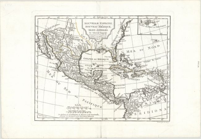
Auction 178, Lot 68
Subject: Southern North America
Robert de Vaugondy/Delamarche
Nouvelle Espagne, Nouveau Mexique, Isles Antilles, 1794
Size: 12.2 x 9.5 inches (31 x 24.1 cm)
Estimate: $140 - $170
Sold for: $100
Closed on 6/10/2020
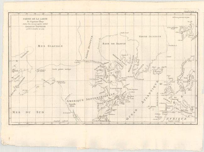
Auction 178, Lot 82
Subject: Colonial United States & Canada, Arctic
Robert de Vaugondy, Didier
Partie de la Carte du Capitaine Cluny Auteur d'un Ouvrage Anglois Intitule American Traveller Publie a Londres en 1769, 1773
Size: 19.4 x 11.5 inches (49.3 x 29.2 cm)
Estimate: $120 - $150
Sold for: $90
Closed on 6/10/2020
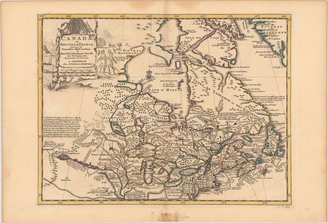
Auction 178, Lot 83
Subject: Colonial Northeastern United States & Canada
Covens & Mortier
Canada ou Nouvelle France, Suivant les Nouvelles Observations de Messrs. de l'Academie Royale des Sciences, Etc..., 1735
Size: 11.7 x 8.8 inches (29.7 x 22.4 cm)
Estimate: $400 - $475
Sold for: $300
Closed on 6/10/2020
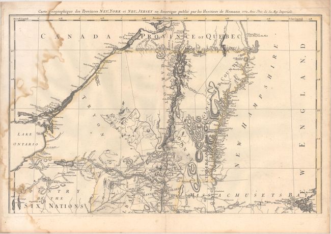
Auction 178, Lot 84
Subject: Colonial Northeastern United States & Canada
Homann Heirs
Carte Geographique des Provinces Neu-York et Neu-Jersey en Amerique, 1778
Size: 22.3 x 14.1 inches (56.6 x 35.8 cm)
Estimate: $300 - $375
Unsold
Closed on 6/10/2020
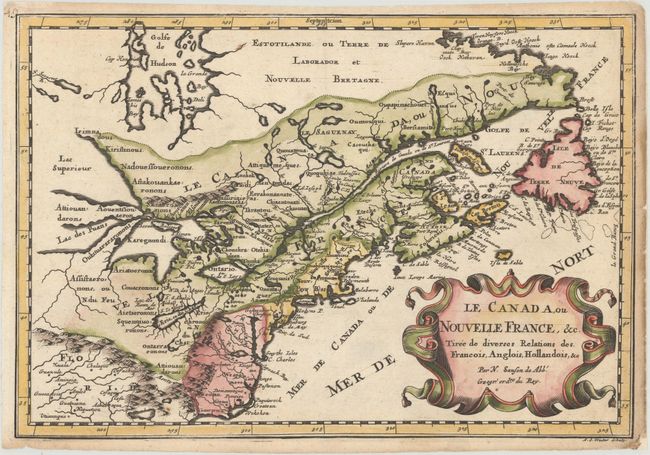
Auction 178, Lot 85
Subject: Colonial Eastern United States & Canada, Great Lakes
Sanson, Nicolas
Le Canada, ou Nouvelle France, &c. Tiree de Diverses Relations des Francois, Anglois, Hollandois, &c, 1683
Size: 12.1 x 8.2 inches (30.7 x 20.8 cm)
Estimate: $550 - $650
Small Version of a Keystone Map for Great Lakes Collections
Sold for: $500
Closed on 6/10/2020
Auction 178, Lot 86
Subject: Colonial Eastern United States & Canada
Bonne/Lattre
[On 2 Sheets] Partie de l'Amerique Septentrionale, qui Comprend le Canada, la Louisiane, le Labrador, le Groenland, la Nouvelle Angleterre, la Floride &c..., 1776
Size: 17.1 x 11.8 inches (43.4 x 30 cm)
Estimate: $200 - $230
Sold for: $150
Closed on 6/10/2020
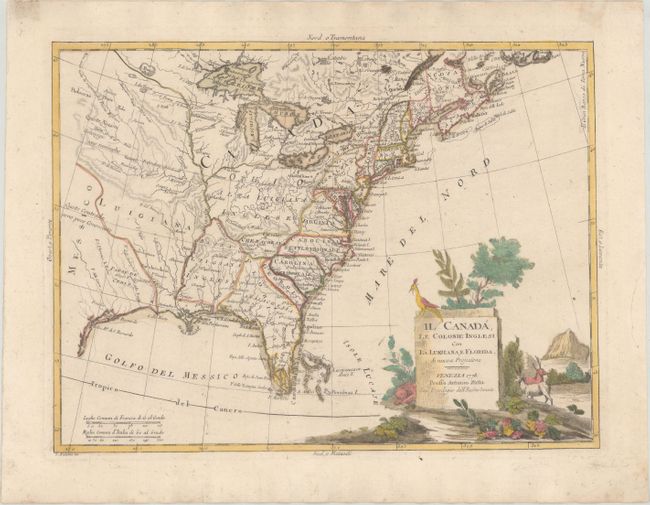
Auction 178, Lot 87
Subject: Colonial Eastern United States & Canada
Zatta, Antonio
Il Canada, le Colonie Inglesi con la Luigiana, e Florida, 1778
Size: 15.9 x 11.9 inches (40.4 x 30.2 cm)
Estimate: $475 - $600
Sold for: $350
Closed on 6/10/2020
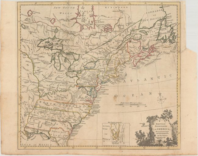
Auction 178, Lot 88
Subject: Colonial Eastern United States & Canada
Kitchin, Thomas
British Dominions in America, Drawn from the Latest and Best Authorities [with related text], 1782
Size: 14.8 x 13.3 inches (37.6 x 33.8 cm)
Estimate: $475 - $600
Sold for: $350
Closed on 6/10/2020
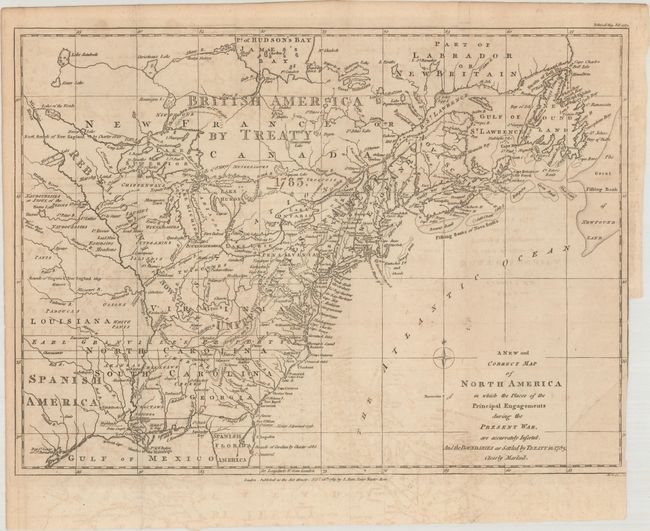
Auction 178, Lot 89
Subject: Eastern United States & Canada
Lodge, John
A New and Correct Map of North America in Which the Places of the Principal Engagements During the Present War, Are Accurately Inserted..., 1783
Size: 14.8 x 10.9 inches (37.6 x 27.7 cm)
Estimate: $3,000 - $4,000
Rare Map Presenting the "Rebel Colonies now the United States of America"
Sold for: $3,750
Closed on 6/10/2020
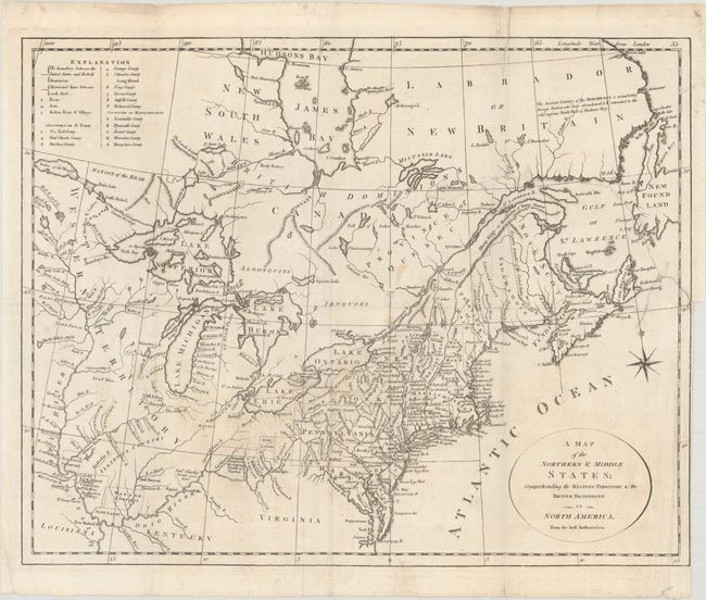
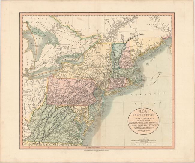
Auction 178, Lot 90
Subject: Eastern United States & Canada
[Lot of 2] A Map of the Northern & Middle States; Comprehending the Western Territory & the British Dominions in North America... [and] United States of America, 1792-97
Size: See Description
Estimate: $500 - $650
Sold for: $350
Closed on 6/10/2020
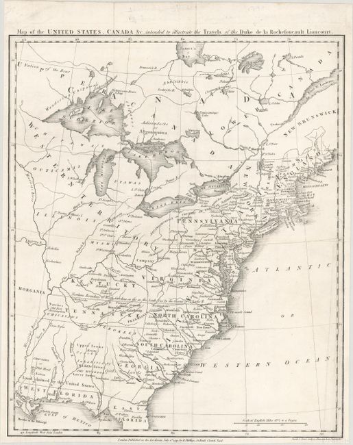
Auction 178, Lot 91
Subject: Eastern United States & Canada, Franklin
Rochefoucald Liancourt, Francois Alexander
Map of the United States, Canada &c. Intended to Illustrate the Travels of the Duke de la Rochefoucault Liancourt, 1799
Size: 13.3 x 15.9 inches (33.8 x 40.4 cm)
Estimate: $1,400 - $1,700
Features the Short-Lived Franklinia and Morgania
Sold for: $1,200
Closed on 6/10/2020
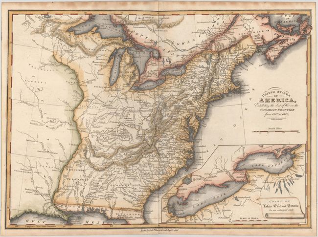
Auction 178, Lot 92
Subject: Eastern United States & Canada
Baines, Edward
United States of America, Exhibiting the Seat of War on the Canadian Frontier from 1812 to 1815, 1816
Size: 13.5 x 9.7 inches (34.3 x 24.6 cm)
Estimate: $300 - $375
Sold for: $220
Closed on 6/10/2020
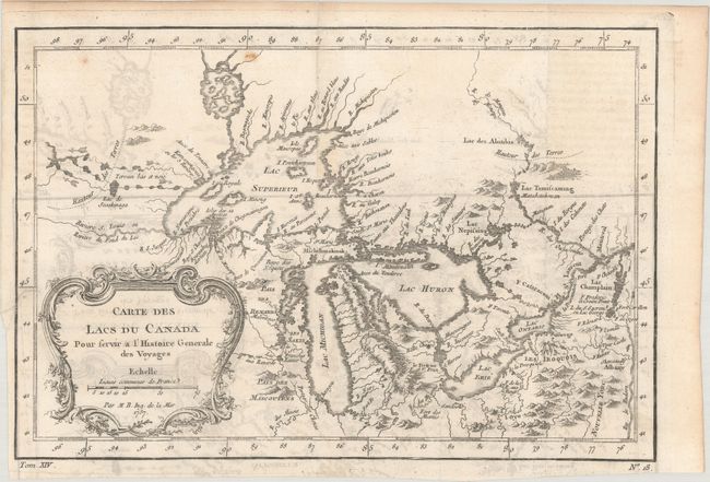
Auction 178, Lot 93
Subject: Colonial Central United States & Canada, Great Lakes
Bellin, Jacques Nicolas
Carte des Lacs du Canada pour Servir a l'Histoire Generale des Voyages, 1757
Size: 11.4 x 7.8 inches (29 x 19.8 cm)
Estimate: $300 - $375
Sold for: $220
Closed on 6/10/2020
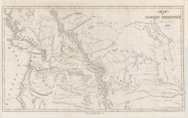
Auction 178, Lot 94
Subject: Western United States & Canada
Parker, Samuel (Rev.)
Map of Oregon Territory [with] Journal of an Exploring Tour Beyond the Rocky Mountains..., 1844
Size: 23.3 x 13.4 inches (59.2 x 34 cm)
Estimate: $500 - $650
Sold for: $475
Closed on 6/10/2020
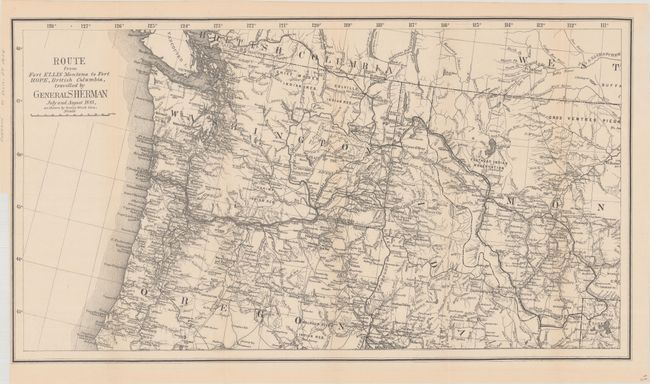
Auction 178, Lot 95
Subject: Northwestern United States & British Columbia
U.S. Government
Route from Fort Ellis Montana to Fort Hope, British Columbia, Travelled by General Sherman July and August 1883, as Shown by Heavy Black Line, 1883
Size: 27.4 x 15.2 inches (69.6 x 38.6 cm)
Estimate: $275 - $350
Sold for: $200
Closed on 6/10/2020
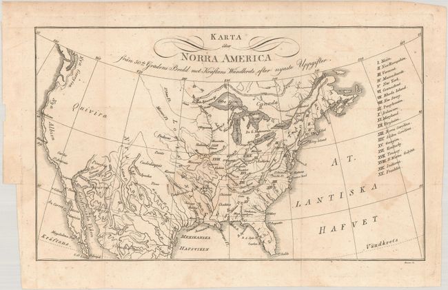
Auction 178, Lot 96
Subject: United States, Franklin
Zimmerman, Eberhard A.W.
Karta Ofver Norra America..., 1817
Size: 10.3 x 6.2 inches (26.2 x 15.7 cm)
Estimate: $275 - $350
Rare Swedish Map Showing the State of Franklin
Sold for: $200
Closed on 6/10/2020
Auction 178, Lot 97
Subject: United States, Texas
Smiley, Thomas T.
United States, 1842
Size: 17 x 10.6 inches (43.2 x 26.9 cm)
Estimate: $350 - $425
Sold for: $200
Closed on 6/10/2020
Auction 178, Lot 98
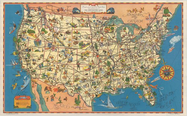
Subject: United States
[Lot of 2] A Good-Natured Map of the United States... [and] Defense Map of America, 1940
Size: See Description
Estimate: $140 - $170
Sold for: $450
Closed on 6/10/2020
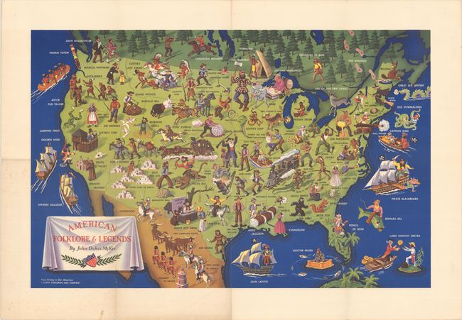
Auction 178, Lot 99
Subject: United States
American Folklore & Legends, 1950
Size: 31 x 20.1 inches (78.7 x 51.1 cm)
Estimate: $240 - $300
Sold for: $300
Closed on 6/10/2020
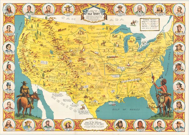
Auction 178, Lot 100
Subject: United States
Danny Arnold's Pictorial Map of the Old West Showing Pioneer Trails and Battles, Indian's Territories, Stagecoach Lines, Military Forts, Historical Data of the Frontier Period Around 1840, 1950
Size: 33.8 x 23.8 inches (85.9 x 60.5 cm)
Estimate: $240 - $300
Sold for: $180
Closed on 6/10/2020
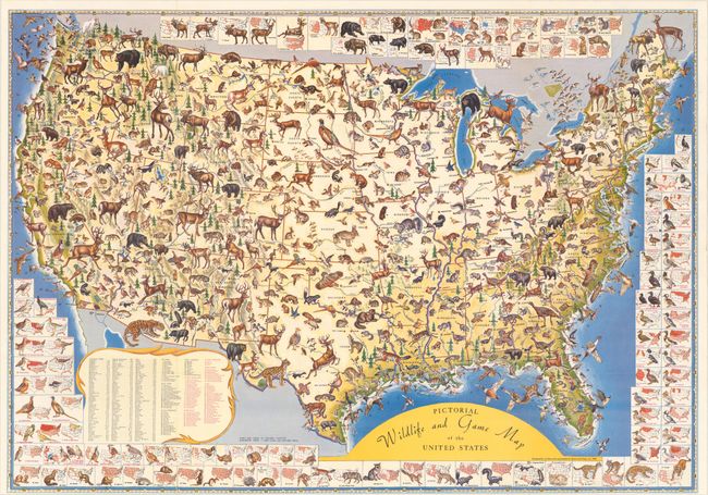
Auction 178, Lot 101
Subject: United States
Pictorial Wildlife and Game Map of the United States, 1956
Size: 26.8 x 18.8 inches (68.1 x 47.8 cm)
Estimate: $160 - $190
Sold for: $250
Closed on 6/10/2020
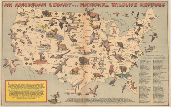
Auction 178, Lot 102
Subject: United States
An American Legacy...National Wildlife Refuges, 1957
Size: 18.7 x 11.6 inches (47.5 x 29.5 cm)
Estimate: $60 - $80
NO RESERVE - Official Boy Scout Map
Sold for: $160
Closed on 6/10/2020
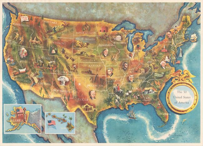
Auction 178, Lot 104
Subject: United States, Presidential Election
[Lot of 2] The 50 United States of America [and] 1960 Presidential Election Map and Tally Sheet, 1960
Size: See Description
Estimate: $250 - $325
Sold for: $150
Closed on 6/10/2020
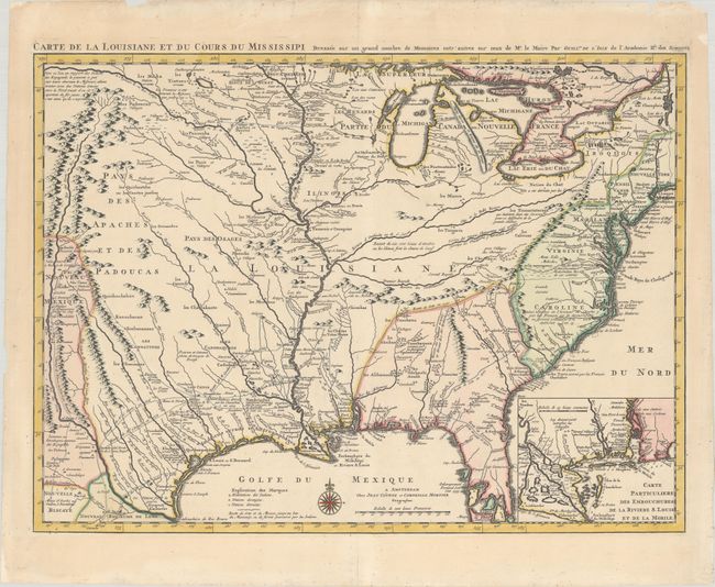
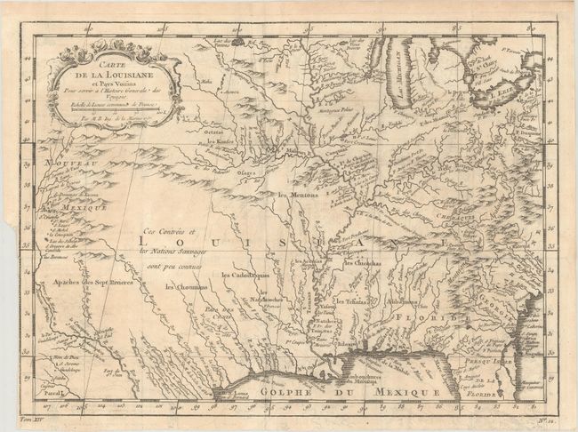
Auction 178, Lot 105
Subject: Colonial Eastern United States, Louisiana Territory
Delisle/Covens & Mortier
Carte de la Louisiane et du Cours du Mississipi Dressee sur un Grand Nombre de Memoires Entr'autres sur ceux de Mr. le Maire, 1730
Size: 23.4 x 17.3 inches (59.4 x 43.9 cm)
Estimate: $1,600 - $1,900
Delisle's Influential Map of the Louisiana Territory
Sold for: $1,400
Closed on 6/10/2020
Auction 178, Lot 106
Subject: Colonial Eastern United States
Bellin, Jacques Nicolas
[Lot of 2] Carte de la Louisiane et Pays Voisins pour Servir a l'Histoire Generale des Voyages [and] Carte de la Caroline et Georgie…, 1757
Size: See Description
Estimate: $300 - $375
Sold for: $160
Closed on 6/10/2020
Auction 178, Lot 107
Subject: Eastern United States, Franklin
Brion de la Tour, Louis
Carte des Etats-Unis d'Amerique et du Cours du Mississipi, 1783
Size: 10.6 x 8.7 inches (26.9 x 22.1 cm)
Estimate: $900 - $1,100
One of the Earliest Maps to Feature the State of Franklin
Sold for: $1,100
Closed on 6/10/2020
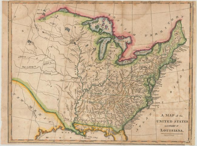
Auction 178, Lot 108
Subject: Eastern United States
Brookes, Richard
A Map of the United States and Part of Louisiana, 1812
Size: 10.6 x 8.3 inches (26.9 x 21.1 cm)
Estimate: $200 - $230
Sold for: $150
Closed on 6/10/2020
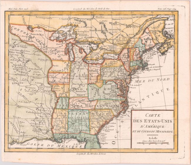
Auction 178, Lot 109
Subject: Eastern United States
[Lot of 2] Map of the United States of America [and] United States of America Compiled from the Latest & Best Authorities, 1814-21
Size: See Description
Estimate: $700 - $850
Sold for: $450
Closed on 6/10/2020
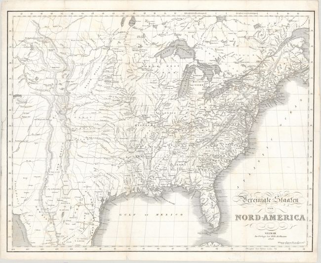
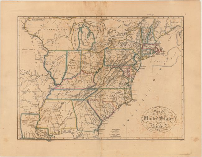
Auction 178, Lot 110
Subject: Eastern United States
Hoffman, W.
Vereinigte Staaten von Nord-America , 1828
Size: 20.5 x 16.2 inches (52.1 x 41.1 cm)
Estimate: $375 - $450
Sold for: $275
Closed on 6/10/2020
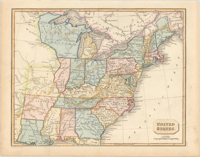
Auction 178, Lot 111
Subject: Eastern United States
Russell, John C.
United States, 1828
Size: 10.1 x 8 inches (25.7 x 20.3 cm)
Estimate: $250 - $325
Sold for: $130
Closed on 6/10/2020
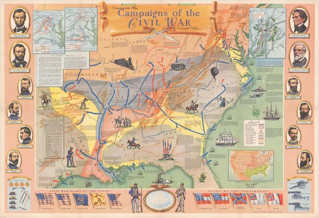
Auction 178, Lot 112
Subject: Eastern United States, Civil War
Hammond, C. S.
Campaigns of the Civil War, 1961
Size: 36.9 x 24.9 inches (93.7 x 63.2 cm)
Estimate: $100 - $130
NO RESERVE
Sold for: $33
Closed on 6/10/2020
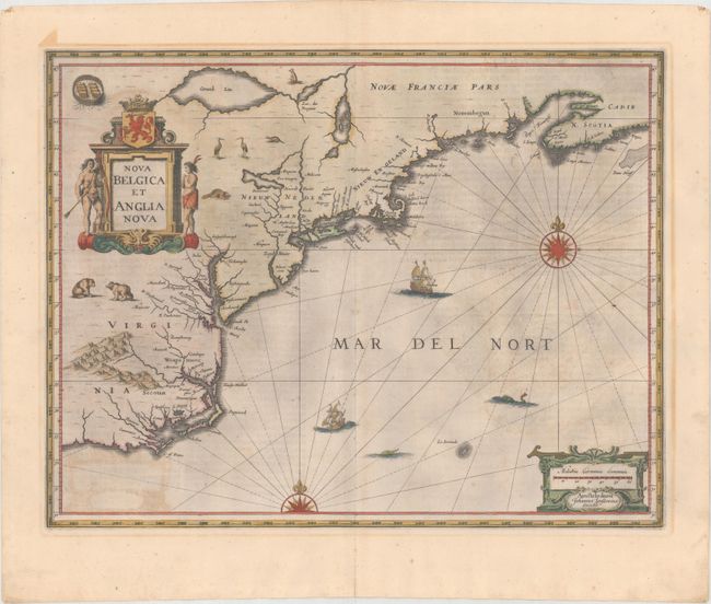
Auction 178, Lot 113
Subject: Colonial New England & Mid-Atlantic United States
Jansson, Jan
Nova Belgica et Anglia Nova, 1644
Size: 19.7 x 15.2 inches (50 x 38.6 cm)
Estimate: $1,600 - $1,900
Jansson's Influential Map of the East Coast - in Contemporary Color
Sold for: $800
Closed on 6/10/2020
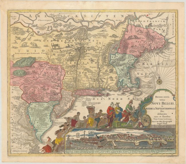
Auction 178, Lot 114
Subject: Colonial New England & Mid-Atlantic United States
Seutter/Lotter
Recens Edita Totius Novi Belgii, in America Septentrionali Siti, Delineatio Cura et Sumtibus, 1760
Size: 22.9 x 19.6 inches (58.2 x 49.8 cm)
Estimate: $2,750 - $3,500
Decorative Edition from Jansson-Visscher Series with View of Manhattan
Sold for: $2,000
Closed on 6/10/2020
Auction 178, Lot 115
Subject: New England & Mid-Atlantic United States
Cary, John
A New Map of Part of the United States of North America, Containing Those of New York, Vermont, New Hampshire, Massachusets, Connecticut, Rhode Island. Pennsylvania, New Jersey, Delaware, Maryland and Virginia..., 1812
Size: 20.4 x 18 inches (51.8 x 45.7 cm)
Estimate: $400 - $500
Sold for: $300
Closed on 6/10/2020
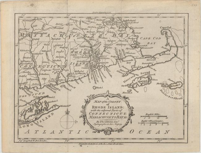
Auction 178, Lot 116
Subject: Colonial New England United States
Kitchin, Thomas
A Map of the Colony of Rhode Island: with the Adjacent Parts of Connecticut, Massachusets Bay. &c., 1778
Size: 9.5 x 7.1 inches (24.1 x 18 cm)
Estimate: $250 - $325
Sold for: $210
Closed on 6/10/2020
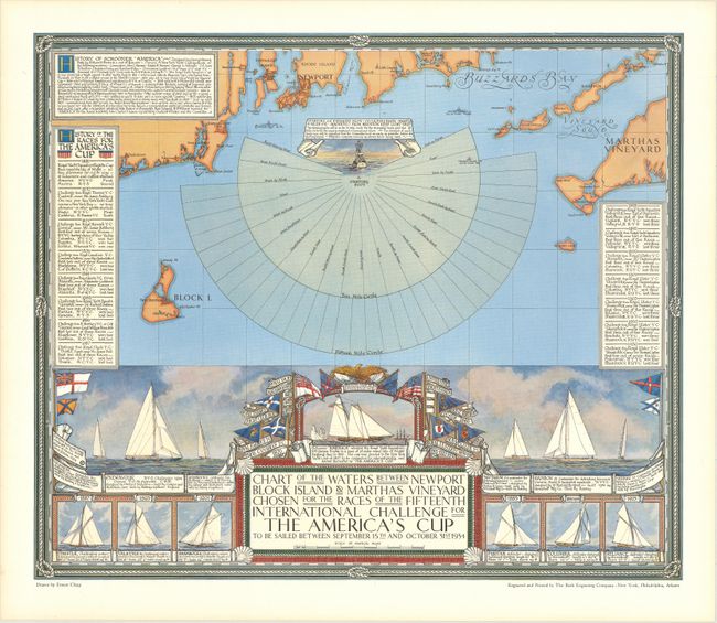
Auction 178, Lot 117
Subject: New England United States
Chart of the Waters Between Newport Block Island & Marthas Vineyard Chosen for the Races of the Fifteenth International Challenge for the America's Cup..., 1934
Size: 20 x 17 inches (50.8 x 43.2 cm)
Estimate: $550 - $700
Map Promoting the 1934 America's Cup Race
Sold for: $400
Closed on 6/10/2020
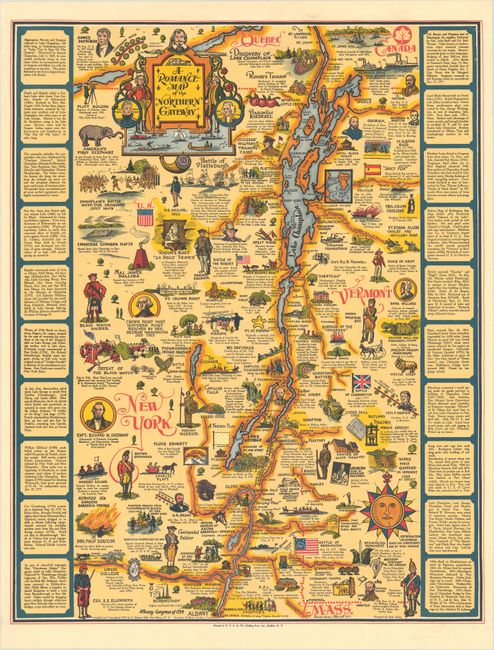
Auction 178, Lot 118
Subject: New York & Vermont
A Romance Map of the Northern Gateway , 1951
Size: 17.8 x 22.6 inches (45.2 x 57.4 cm)
Estimate: $180 - $210
Sold for: $160
Closed on 6/10/2020
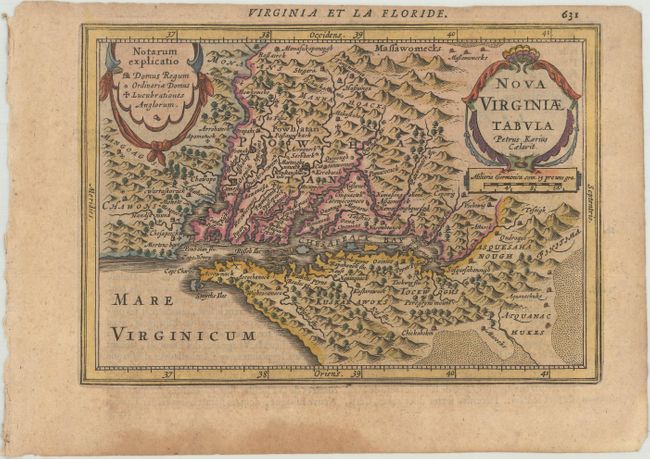
Auction 178, Lot 119
Subject: Colonial Mid-Atlantic United States
Jansson, Jan
Nova Virginiae Tabula, 1630
Size: 7.5 x 5.2 inches (19.1 x 13.2 cm)
Estimate: $600 - $750
Second Derivative of John Smith's Map of Virginia
Sold for: $400
Closed on 6/10/2020
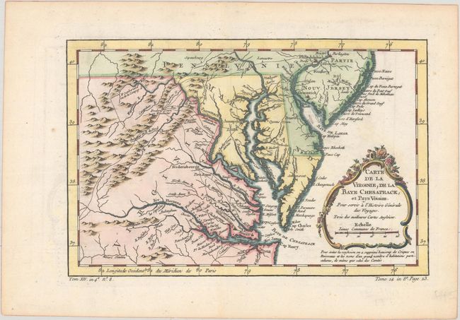
Auction 178, Lot 120
Subject: Colonial Mid-Atlantic United States
Bellin, Jacques Nicolas
Carte de la Virginie, de la Baye Chesapeack, et Pays Voisins. Pour Servir a l'Histoire Generale des Voyages, 1758
Size: 11.4 x 7.5 inches (29 x 19.1 cm)
Estimate: $275 - $350
Sold for: $200
Closed on 6/10/2020
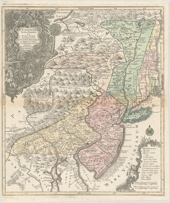
Auction 178, Lot 121
Subject: Colonial Mid-Atlantic United States
Lotter, Tobias Conrad
Pensylvania Nova Jersey et Nova York cum Regionibus ad Fluvium Delaware in America Sitis, Nova Delineatione ob Oculos Posita, 1760
Size: 19.4 x 22.6 inches (49.3 x 57.4 cm)
Estimate: $1,200 - $1,500
Sold for: $900
Closed on 6/10/2020
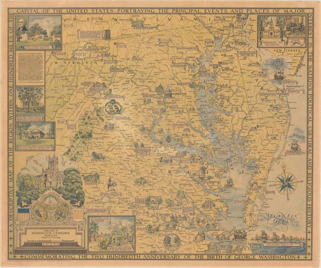
Auction 178, Lot 122
Subject: Mid-Atlantic United States
A Descriptive Map of the Region Within One Hundred Miles of the Capital of the United States..., 1932
Size: 33.3 x 27.6 inches (84.6 x 70.1 cm)
Estimate: $800 - $1,000
Ernest Clegg's Map Commemorating George Washington
Sold for: $500
Closed on 6/10/2020
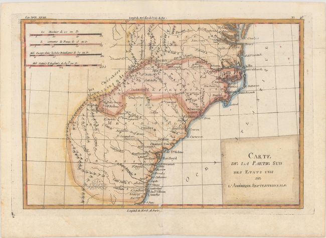
Auction 178, Lot 123
Subject: Colonial Southeast United States
Bonne, Rigobert
Carte de la Partie Sud des Etats Unis de l'Amerique Septentrionale, 1782
Size: 12.2 x 8.2 inches (31 x 20.8 cm)
Estimate: $110 - $140
Sold for: $170
Closed on 6/10/2020
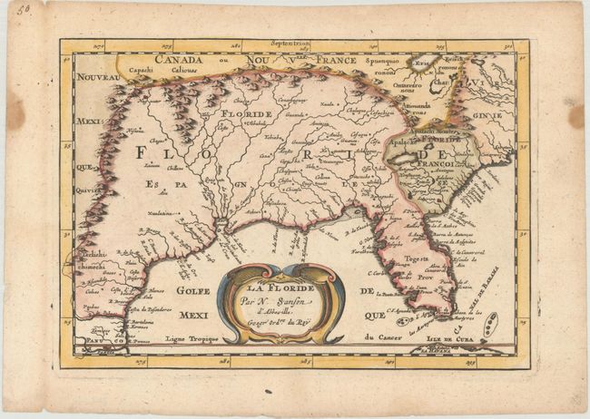
Auction 178, Lot 124
Subject: Colonial Southern United States
Sanson, Nicolas
La Floride, 1683
Size: 9.9 x 7 inches (25.1 x 17.8 cm)
Estimate: $475 - $600
Sold for: $350
Closed on 6/10/2020
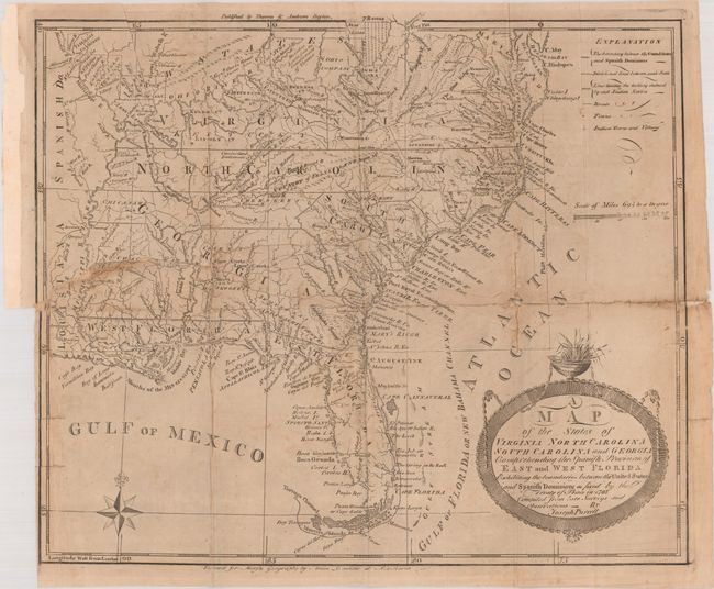
Auction 178, Lot 125
Subject: Southern United States, Franklin
Purcell, Joseph
A Map of the States of Virginia North Carolina South Carolina and Georgia Comprehending the Spanish Provinces of East and West Florida..., 1793
Size: 14.8 x 12.6 inches (37.6 x 32 cm)
Estimate: $700 - $900
Second State of Purcell's Map Locating the Proposed State of Frankland
Sold for: $550
Closed on 6/10/2020
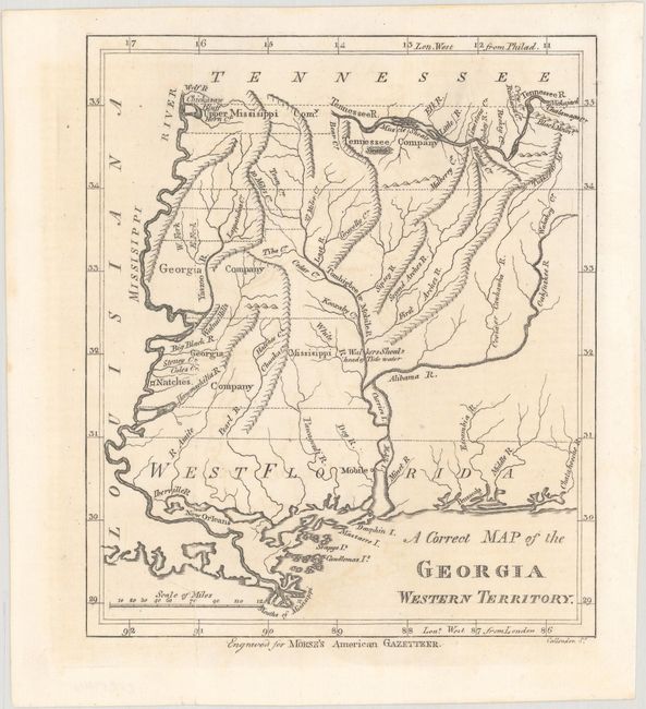
Auction 178, Lot 126
Subject: Mississippi & Alabama
Morse, Jedidiah (Rev.)
A Correct Map of the Georgia Western Territory, 1797
Size: 6 x 7.1 inches (15.2 x 18 cm)
Estimate: $240 - $300
Sold for: $140
Closed on 6/10/2020
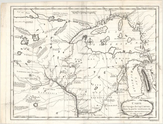
Auction 178, Lot 127
Subject: Central United States
Carver, Jonathan (Capt.)
Carte des Voyages du Cape. Carver, dans la Partie Interieure de l'Amerique Septentrionale, en 1766, et 1767, 1784
Size: 13.5 x 10.4 inches (34.3 x 26.4 cm)
Estimate: $700 - $850
Sold for: $600
Closed on 6/10/2020
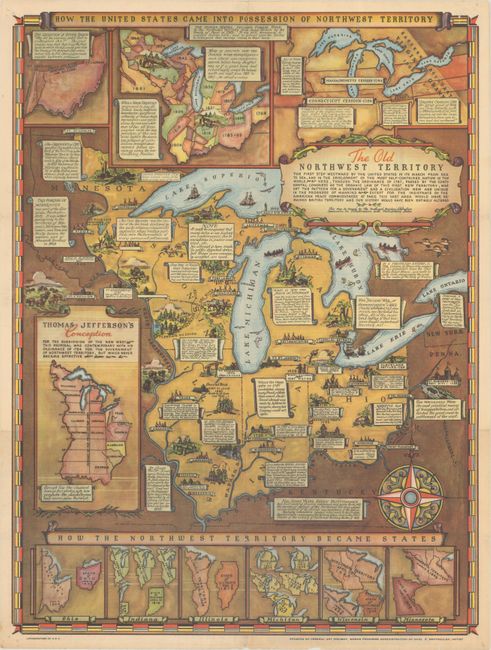
Auction 178, Lot 128
Subject: Central United States
The Old Northwest Territory - The First Step Westward by the United States in Its March from Sea to Sea..., 1937
Size: 16.6 x 21.9 inches (42.2 x 55.6 cm)
Estimate: $120 - $150
Sold for: $190
Closed on 6/10/2020
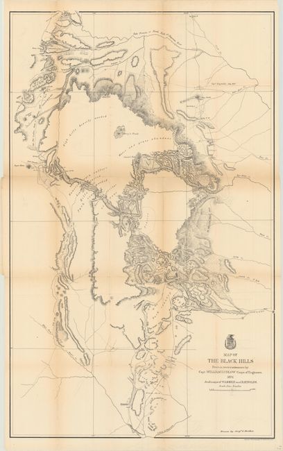
Auction 178, Lot 129
Subject: Dakota Territory
Ludlow, William (Capt.)
Map of the Black Hills from a Reconnaissance by Capt. William Ludlow Corps of Engineers, 1874
Size: 23.7 x 38.2 inches (60.2 x 97 cm)
Estimate: $140 - $170
Sold for: $100
Closed on 6/10/2020
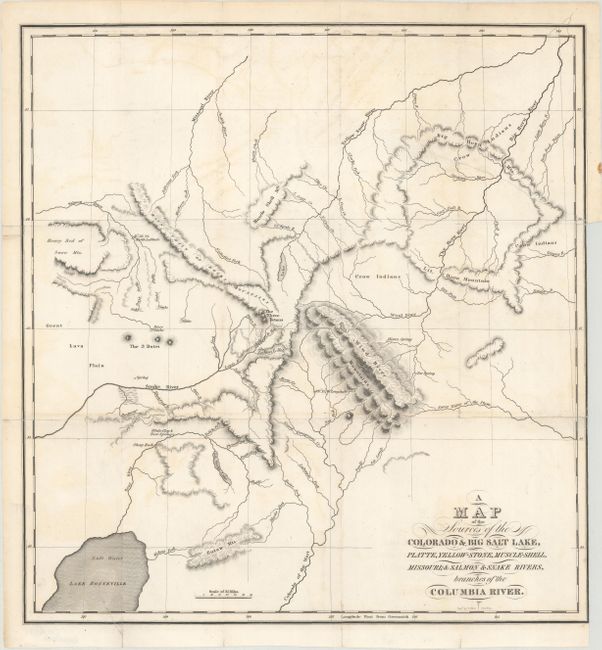
Auction 178, Lot 130
Subject: Western United States
Bonneville, Benjamin L. E. de
A Map of the Sources of the Colorado & Big Salt Lake, Platte, Yellow-Stone, Muscle-Shell, Missouri; & Salmon & Snake Rivers, Branches of the Columbia River, 1837
Size: 15.4 x 16.7 inches (39.1 x 42.4 cm)
Estimate: $450 - $550
Sold for: $300
Closed on 6/10/2020
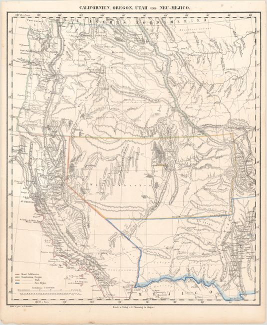
Auction 178, Lot 131
Subject: Western United States
Flemming, Carl
Californien, Oregon, Utah und Neu-Mejico, 1850
Size: 13.6 x 15.7 inches (34.5 x 39.9 cm)
Estimate: $180 - $210
Sold for: $130
Closed on 6/10/2020
129 lots
Page 1 of 3