Subject: Houston, Texas
Period: 1946 (published)
Publication:
Color: Hand Color
Size:
12 x 10.1 inches
30.5 x 25.7 cm
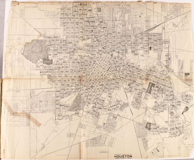
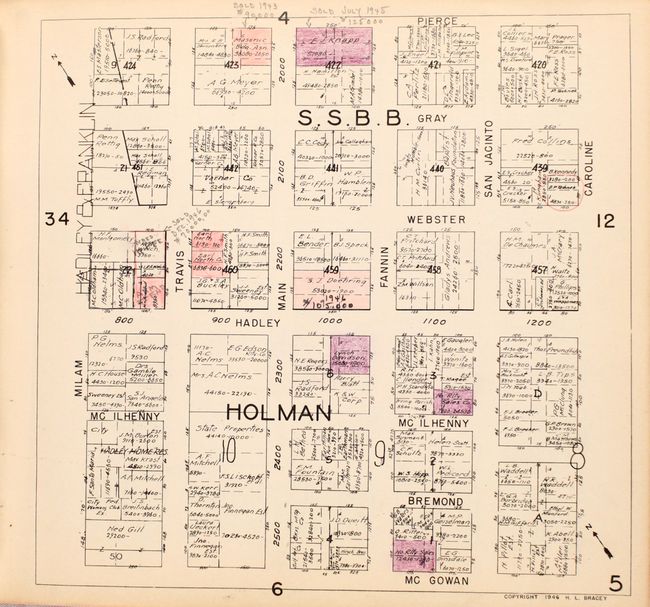
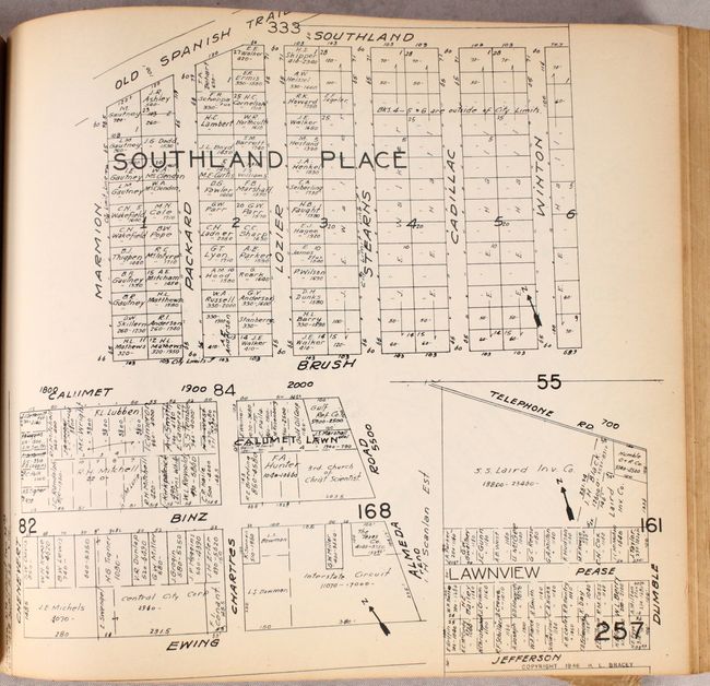
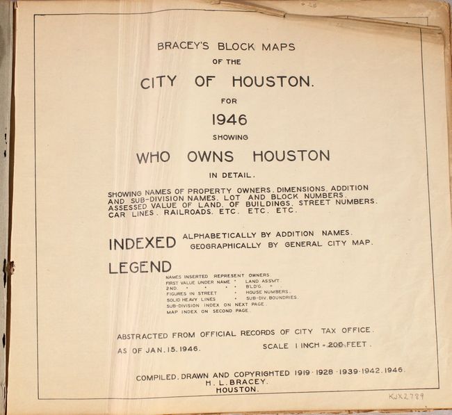
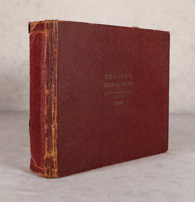
This highly detailed volume by H.L. Bracey contains a total of 423 maps "showing names of property owners, dimensions, addition and sub-division names, lot and block numbers, assessed value of lands..." and more. Features a large folding map of Houston (23.7 x 19.5") that serves as the index map for the following 422 detail maps, each measuring approximately 9.5 x 9.0". The index map curiously omits block #100, 199 and 344 and is therefore skipped in the detail map pagination. Many maps have manuscript annotations and some coloring, apparently updating the maps with new information, including sales prices, making it a truly up-to-date record of real estate holdings. Also includes a small manuscript map laid in at page 321. Oblong quarto, hardbound in maroon cloth with gilt title on the front cover. No past sales records and only two institutional examples found on OCLC.
References:
Condition: B
The maps are generally good to mostly very good with numerous manuscript notations from use. The folding index map is fair (C+) with small chips along the top sheet edge along with a 5.5" binding tear at left and several small fold separations that have all been closed on verso with cello tape. The last two detailed maps (#424 and #425) have a small hole at lower right measuring approximately 1.0 x 0.75". Title page is creased. The hinges are starting and covers are worn.