Subject: Western United States
Period: 1876-78 (published)
Publication:
Color: Printed Color
Size:
6.4 x 9.4 inches
16.3 x 23.9 cm
This lot consists of Wheeler's annual reports on Surveys West of the 100th Meridian for the 1876-78 seasons. The 1876 report emphasizes completed work in California and Colorado (346 pages, 3 folding maps), the 1877 report continues the work in these two states as well as a new Utah section (124 pages, no progress map), and the 1878 report includes survey work in 14 of the 15 western states/territories (246 pages, no progress map). Each report covers a broad range of topics including astronomical observations, routes of communication, natural resources, and numerous individual reports. Included with the 1876 report are the following three maps:
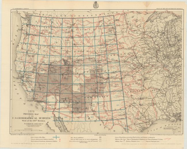
Progress Map of the U.S. Geographical Surveys West of the 100th Meridian..., printed color (22.2 x 16.1"). Covers the seasons of 1869 and 1871-75 and shows the various routes of western expeditions and the important surveys of King (40th parallel) and Wheeler. Among the many details are the locations of military posts, astronomical stations, telegraphic lines, and the routes of cattle droves and trains. The progress maps are among the most interesting, informative and useful maps of the West. Condition: Clean and bright (A).
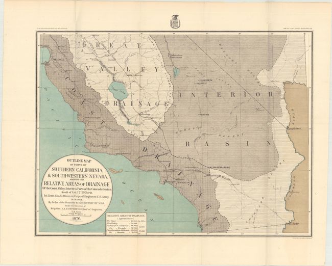
Outline Map of Parts of Southern California & South-Western Nevada, Showing the Relative Areas of Drainage..., printed color (19.1 x 14.3"). This map covers the region from San Diego north to Santa Cruz and east to the Sierra Nevadas. The map uses color and texture to identify three drainage regions: Coast Drainage, Great Valley Drainage, and the Interior Basin. The "Visalia Div. S.P.R.R." runs down the Great Valley Drainage meeting the Southern Pacific Railroad, and the "Old Salt Lake Road" runs northwest out of San Bernardino to a tiny Las Vegas. Condition: Clean and bright with two small splits at the fold junctions. (A)
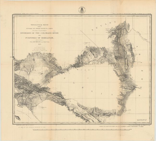
Topographical Sketch Showing the Outward and Inward Route of a Party, While Examining the Practicability of a Diversion of the Colorado River for Purposes of Irrigation..., black & white (19.1 x 14.8"). This highly detailed lithograph covers the region from Los Angeles to Needles and north to the Las Vegas area, documenting the expedition's route. As the title suggests, the expedition's task was in understanding the viability of rerouting water from the Colorado River to southeastern California. In addition to highlighting the expedition's route, the map shows highly detailed topography and the early road system. Condition: There is an old tape stain along the lower right fold and one tiny hole with minor loss of image. (B+)
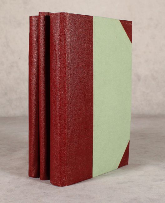
All volumes rebound in faux half-leather over paper boards.
References:
Condition:
See description above for map condition and grades. Text is very good with a hint of toning and a narrow dampstain confined to the top sheet edges. New binding has minor wear.