Subject: United States & Mexico
Period: 1849 (published)
Publication:
Color: Hand Color
Size:
22.2 x 17.7 inches
56.4 x 45 cm
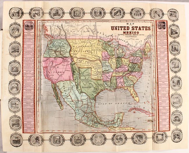
This scarce ornamental map depicts the United States and Mexico during the Mexican-American War. It shows a small New Mexico Territory situated between the new state of Texas and the disputed area of New California. There is a red line following the Platte, Snake and Columbia Rivers labeled the "Route of Oregon Immigrants" as well as a "Route to the United States" stretching from San Francisco to the Sweetwater River. The map is surrounded by an ornamental border including 30 state seals with two columns of statistical information flanking the map. The last dated state is 1846 (Iowa). A similar broadside map measuring 15.3 x 10.5" is noted in Wheat (#514), containing a large text panel below the image discussing the Seat of War.
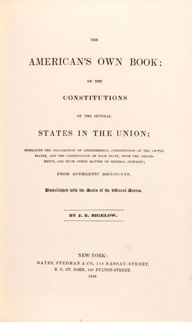
The map is still attached to the inside rear cover of The American's Own Book by J.R. Bigelow. This volume contains the constitutions of the thirty states at the time of publishing, the U.S. Constitution, and the Declaration of Independence. Includes frontispiece illustrations of George Washington and the signing of the Declaration of Independence. 536 pages with additional advertisements. Octavo, hardbound in brown cloth with gilt illustrations on the front cover and spine.
References: Wheat (TMW) #513; cf. Wheat (Gold) #26.
Condition: B+
The folding map has a few faint spots and minor toning mostly in the margins. The text is clean, bright, and pristine. Covers are slightly bowed with light wear and bumped edges. An overall attractive example.