Filtered by Category:Books, Atlases, Travel Guides, Geography & Reference Books(Show All Categories)
Showing results for:Auction 171
Catalog Archive
52 lots
Page 1 of 2
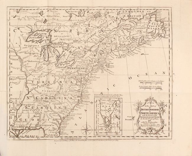
Auction 171, Lot 127
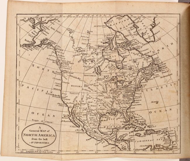
Subject: Colonial Eastern United States & Canada, History Book
Kitchin, Thomas
[Maps in Book] A New Map of the British Dominions in North America; with the Limits of the Governments Annexed Thereto by the Late Treaty of Peace... [bound in] The Annual Register, or a View of the History, Politics, and Literature…, 1782
Size: 11.8 x 9.5 inches (30 x 24.1 cm)
Estimate: $700 - $850
Sold for: $500
Closed on 2/6/2019
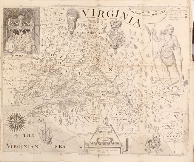
Auction 171, Lot 174
Subject: Mid-Atlantic United States
Smith, John (Capt.)
[2 Volumes] The True Travels, Adventures and Observations of Captaine Iohn Smith, in Europe, Asia, Africke, and America..., 1819
Size: 5.3 x 8.7 inches (13.5 x 22.1 cm)
Estimate: $1,000 - $1,300
Sold for: $675
Closed on 2/6/2019
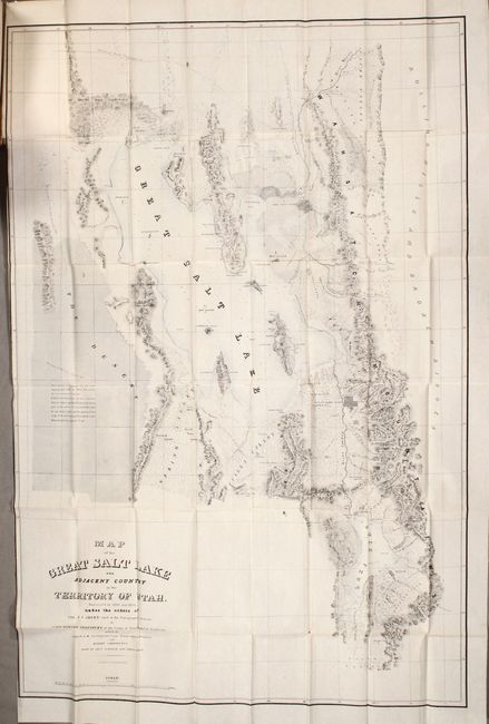
Auction 171, Lot 199
Subject: Western United States, Utah
Stansbury, M. Howard (Capt.)
[2 Maps in Report] Map of the Great Salt Lake and Adjacent Country in the Territory of Utah [and] Map of a Reconnaissance between Fort Leavenworth...and the Great Salt Lake [in Report] Exploration and Survey of the Valley of the Great Salt Lake of Utah, 1852
Size: 5.9 x 9.1 inches (15 x 23.1 cm)
Estimate: $600 - $750
Sold for: $300
Closed on 2/6/2019
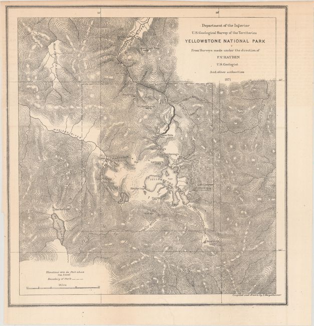
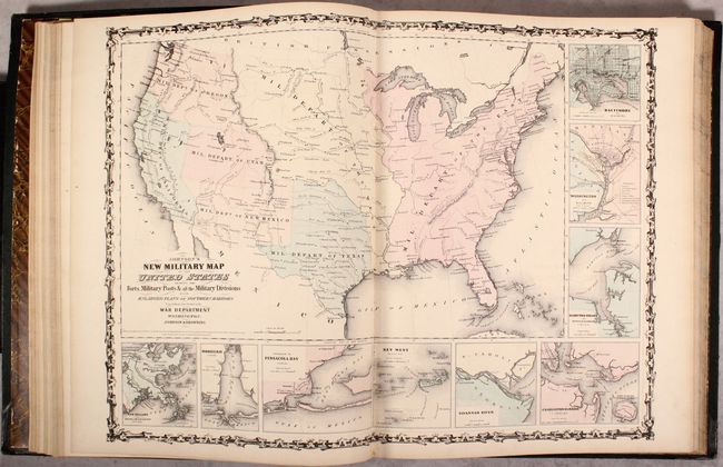
Auction 171, Lot 207
Subject: Montana, Wyoming & Yellowstone
Hayden, Ferdinand Vandeveer
Preliminary Report of the United States Geological Survey of Montana and Portions of Adjacent Territories; Being a Fifth Annual Report of Progress, 1872
Size: 5.8 x 9.1 inches (14.7 x 23.1 cm)
Estimate: $230 - $275
Important Report that Helped Establish Yellowstone National Park
Sold for: $250
Closed on 2/6/2019
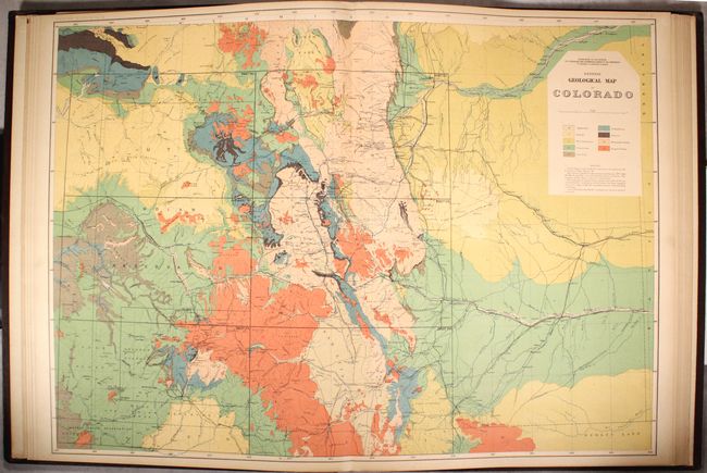
Auction 171, Lot 230
Subject: Colorado
Hayden, Ferdinand Vandeveer
Geological and Geographical Atlas of Colorado and Portions of Adjacent Territory, 1881
Size: 20.3 x 26.9 inches (51.6 x 68.3 cm)
Estimate: $1,200 - $1,500
Sold for: $1,900
Closed on 2/6/2019
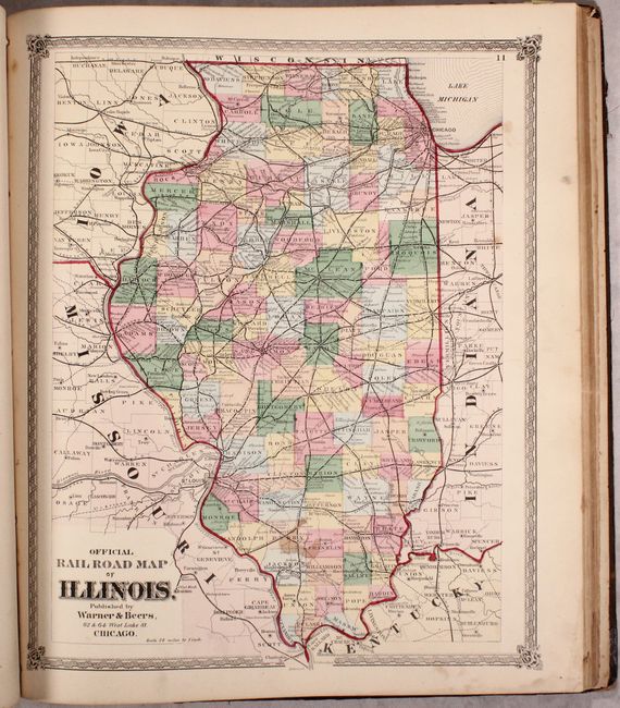
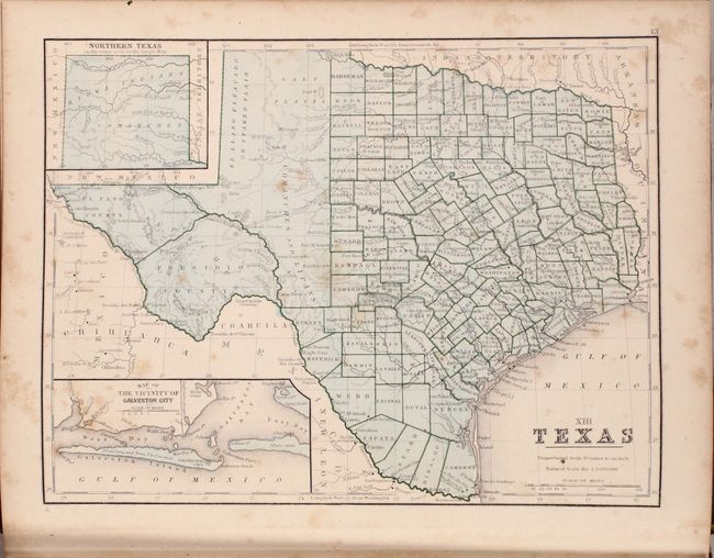
Auction 171, Lot 257
Subject: Illinois, United States, Atlases
Warner & Beers
Atlas of Whiteside Co. and the State of Illinois to Which Is Added an Atlas of the United States Maps of the Hemispheres &c. &c. &c., 1872
Size: 15.8 x 18.4 inches (40.1 x 46.7 cm)
Estimate: $600 - $800
Sold for: $400
Closed on 2/6/2019
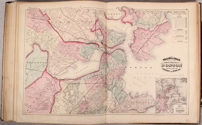
Auction 171, Lot 261
Subject: Massachusetts, Atlases
Walling & Gray
Official Topographical Atlas of Massachusetts, from Astronomical, Trigonometrical, and Various Local Surveys, 1871
Size: 13.7 x 17.4 inches (34.8 x 44.2 cm)
Estimate: $500 - $650
Sold for: $260
Closed on 2/6/2019
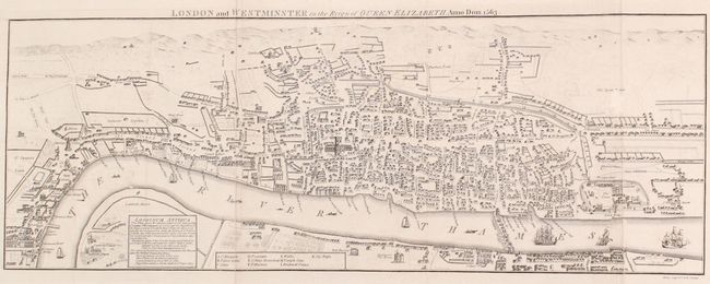
Auction 171, Lot 450
Subject: London, England
Some Account of London; Third Edition, 1793
Size: 7.9 x 10 inches (20.1 x 25.4 cm)
Estimate: $180 - $220
Sold for: $210
Closed on 2/6/2019
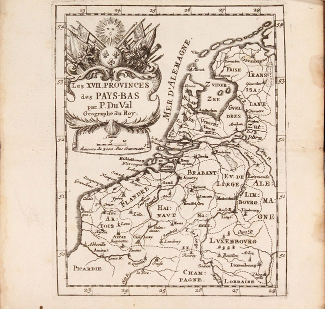
Auction 171, Lot 492
Subject: Low Countries
Duval, Pierre
[Two Atlases in One Book] Cartes et Tables de Geographie, des Provinces Eschues a la Reine Tres-Chretiene [and] Les XII. Provinces. Ou sont les Conquestes du Roy en Holande, et en Flandres, 1672
Size: 3.6 x 6 inches (9.1 x 15.2 cm)
Estimate: $1,600 - $1,900
Two Miniature Atlases of Louis XIV's Attempts to Conquer the Spanish Netherlands
Sold for: $1,000
Closed on 2/6/2019
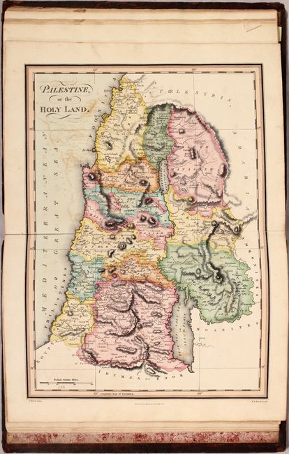
Auction 171, Lot 753
Subject: Atlases
The Scripture Atlas, or a Series of Maps, to Illustrate the Old and New Testament, 1812
Size: 9.6 x 12.3 inches (24.4 x 31.2 cm)
Estimate: $375 - $450
Sold for: $275
Closed on 2/6/2019
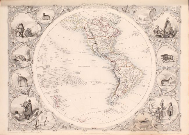
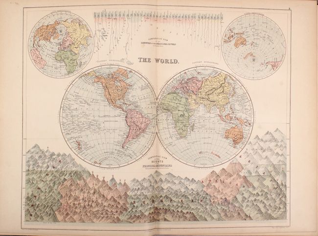
Auction 171, Lot 754
Subject: Atlases
Tallis, John
The Illustrated Atlas, and Modern History of the World…, 1851
Size: 11.2 x 15.1 inches (28.4 x 38.4 cm)
Estimate: $4,000 - $5,000
Tallis' Decorative Atlas
Sold for: $3,500
Closed on 2/6/2019
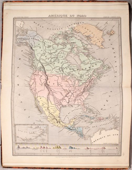
Auction 171, Lot 755
Subject: Atlases
Andriveau-Goujon, J.
Atlas Elementaire Simplifie de Geographie Moderne, 1853
Size: 11.5 x 17.9 inches (29.2 x 45.5 cm)
Estimate: $450 - $550
Sold for: $300
Closed on 2/6/2019
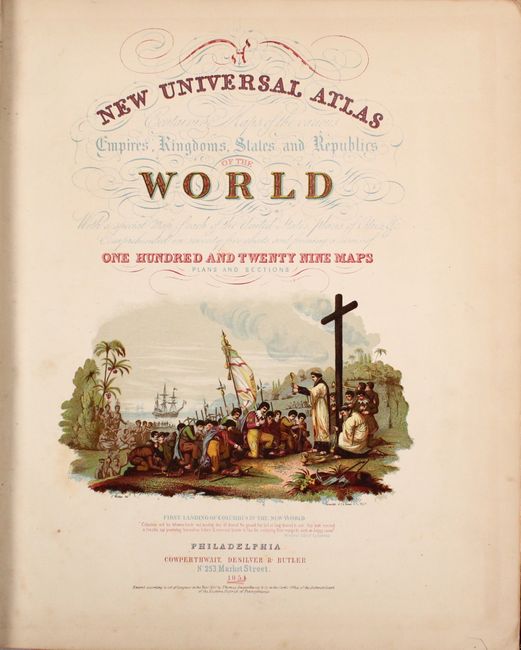
Auction 171, Lot 756
Subject: Atlases
Cowperthwait, Desilver & Butler
A New Universal Atlas Containing Maps of the Various Empires, Kingdoms, States and Republics of the World..., 1854
Size: 14.1 x 17.4 inches (35.8 x 44.2 cm)
Estimate: $3,000 - $3,750
Cowperthwait's Desirable Atlas Emphasizing the American Continent
Sold for: $2,200
Closed on 2/6/2019
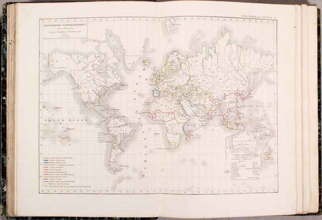
Auction 171, Lot 757
Subject: Atlases
Dussieux, Louis Entienne
Atlas General de Geographie Physique, Politique et Historique, 1856
Size: 10 x 13.8 inches (25.4 x 35.1 cm)
Estimate: $450 - $550
Sold for: $300
Closed on 2/6/2019
Auction 171, Lot 758
Subject: Atlases
Johnson & Browning
Johnson's New Illustrated (Steel Plate) Family Atlas, with Descriptions, Geographical, Statistical, and Historical, 1861
Size: 15 x 18.7 inches (38.1 x 47.5 cm)
Estimate: $1,000 - $1,300
Sold for: $750
Closed on 2/6/2019
Auction 171, Lot 759
Subject: Atlases
Mitchell, Samuel Augustus
Mitchell's New Reference Atlas for the Use of Colleges, Libraries, Families, and Counting Houses, in a Series of Fifty-Six Copperplate Maps..., 1865
Size: 10.4 x 12.6 inches (26.4 x 32 cm)
Estimate: $500 - $650
Sold for: $260
Closed on 2/6/2019
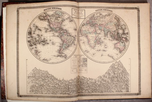
Auction 171, Lot 760
Subject: Atlases
Black, Adam & Charles
Black's General Atlas of the World - American Edition..., 1870
Size: 13.6 x 18.3 inches (34.5 x 46.5 cm)
Estimate: $400 - $500
Sold for: $190
Closed on 2/6/2019
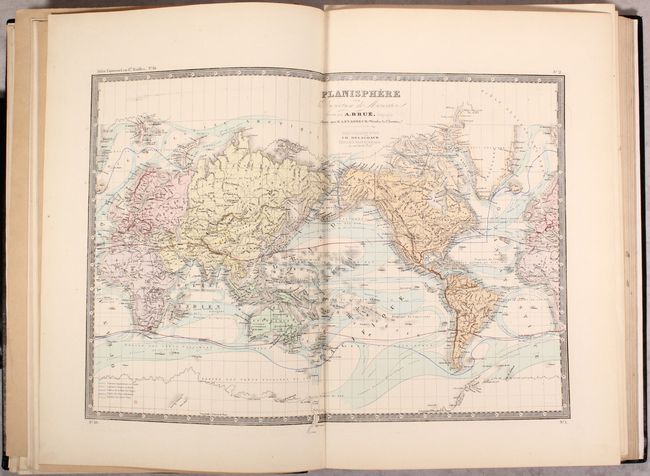
Auction 171, Lot 761
Subject: Atlases
Brue, Adrien Hubert
Atlas Universel de Geographie Physique, Politique, Ancienne et Moderne Contenant les Cartes Generales et Particulieres de Toutes les Parties du Monde..., 1876
Size: 13.2 x 19.1 inches (33.5 x 48.5 cm)
Estimate: $550 - $700
Sold for: $400
Closed on 2/6/2019
Auction 171, Lot 762
Subject: Atlases
Taintor Brothers
The American Household and Commercial Atlas of the World, 1876
Size: 17 x 22.1 inches (43.2 x 56.1 cm)
Estimate: $2,500 - $3,250
Rare, Large-Format Atlas with an Emphasis on the United States
Sold for: $1,700
Closed on 2/6/2019
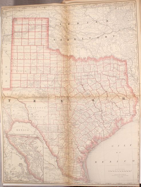
Auction 171, Lot 763
Subject: Atlases
Rand McNally & Co.
Rand, McNally & Co.'s Business Atlas Containing Large Scale Maps of Each State and Territory of the United States, the Provinces of Canada, West India Islands, Etc., Etc..., 1877
Size: 10.9 x 14.3 inches (27.7 x 36.3 cm)
Estimate: $600 - $800
Rare Second Edition of Rand McNally's First Atlas
Sold for: $350
Closed on 2/6/2019
Auction 171, Lot 764
Subject: Atlases
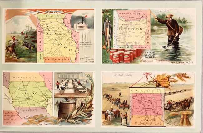
Arbuckle Bros. Coffee Co.
Arbuckles' Illustrated Atlas of the United States of America, 1889
Size: 11.1 x 7 inches (28.2 x 17.8 cm)
Estimate: $450 - $550
Sold for: $230
Closed on 2/6/2019
Auction 171, Lot 765
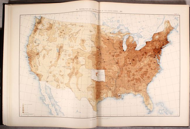
Subject: Atlases
U.S. Department of Interior
Statistical Atlas of the United States, Based Upon Results of the Eleventh Census, 1898
Size: 16.6 x 21.2 inches (42.2 x 53.8 cm)
Estimate: $400 - $500
Sold for: $300
Closed on 2/6/2019
Auction 171, Lot 766
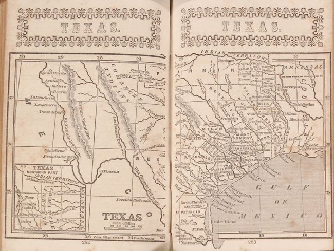
Subject: Geography Books
Guthrie, William
A New Geographical, Historical, and Commercial Grammar; and Present State of the Several Kingdoms of the World..., 1794
Size: 5.1 x 8.6 inches (13 x 21.8 cm)
Estimate: $300 - $375
Sold for: $200
Closed on 2/6/2019
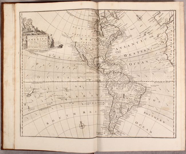
Auction 171, Lot 767
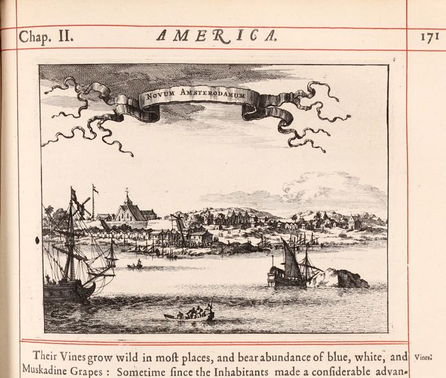
Subject: Exploration & Surveys, America
Montanus/Ogilby
[2 Volumes - America: Being the Latest and Most Accurate Description of the New World], 1671
Size: 11.4 x 16.4 inches (29 x 41.7 cm)
Estimate: $1,400 - $1,800
Sold for: $1,200
Closed on 2/6/2019
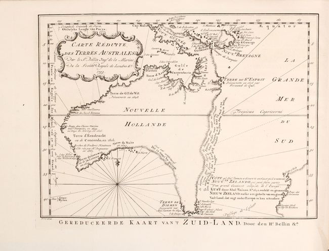
Auction 171, Lot 768
Subject: Exploration & Surveys, Australia
Prevost, Anton Francois
Histoire Generale des Voyages, ou Nouvelle Collection de Toutes les Relations de Voyages par Mer et par Terre ... Tome Seizieme, 1758
Size: 8.3 x 10.4 inches (21.1 x 26.4 cm)
Estimate: $1,200 - $1,500
Prevost Volume Including A Rare Pre-Cook Map Focusing on Australia
Sold for: $850
Closed on 2/6/2019
Auction 171, Lot 769
Subject: Exploration & Surveys
Harris, John
[2 Volumes] Navigantium Atque Itinerantium Bibliotheca. Or, a Complete Collection of Voyages and Travels..., 1764
Size: 10.7 x 16.6 inches (27.2 x 42.2 cm)
Estimate: $7,500 - $9,000
Harris' Important Collection of Voyages with 61 Maps and Plates
Sold for: $5,250
Closed on 2/6/2019
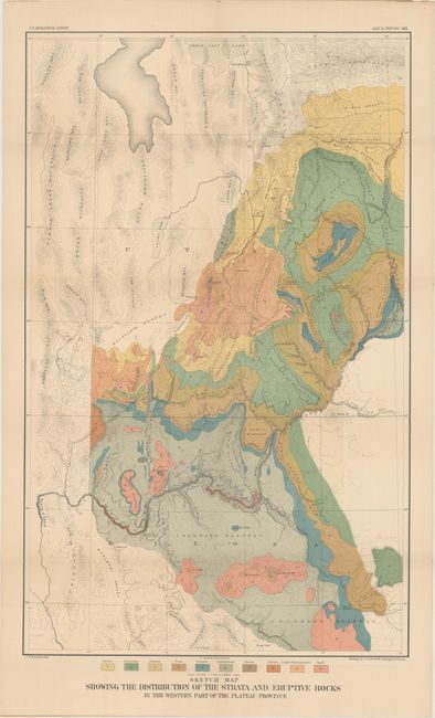
Auction 171, Lot 770
Subject: Exploration & Surveys, Grand Canyon
Powell, John Wesley
Second Annual Report of the United States Geological Survey to the Secretary of the Interior 1880-'81, 1882
Size: 8 x 11.7 inches (20.3 x 29.7 cm)
Estimate: $375 - $450
Sold for: $150
Closed on 2/6/2019
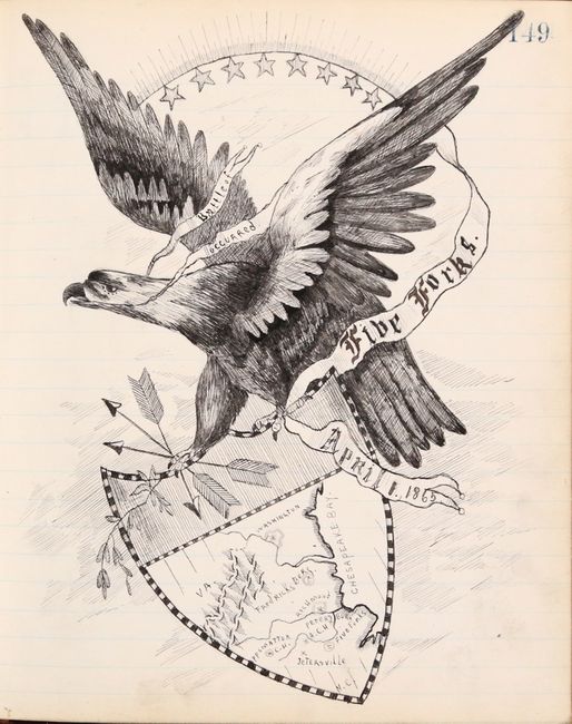
Auction 171, Lot 771
Subject: Manuscript Atlas, Civil War
[Manuscript U.S. and Civil War Atlas], 1888
Size: 7.2 x 8.6 inches (18.3 x 21.8 cm)
Estimate: $500 - $700
A Fascinating, Embellished Manuscript Atlas
Sold for: $4,250
Closed on 2/6/2019
Auction 171, Lot 772
Subject: Miscellaneous Books
Beadle, D. W.
The American Lawyer, and Business-Man's Form-Book; Containing Forms and Instructions..., 1856
Size: 4.6 x 7.4 inches (11.7 x 18.8 cm)
Estimate: $100 - $130
Sold for: $75
Closed on 2/6/2019
Auction 171, Lot 773
Subject: Miscellaneous Books
The Manual of Statistics Stock Exchange Hand-Book..., 1899
Size: 5.5 x 7.7 inches (14 x 19.6 cm)
Estimate: $140 - $170
Sold for: $75
Closed on 2/6/2019
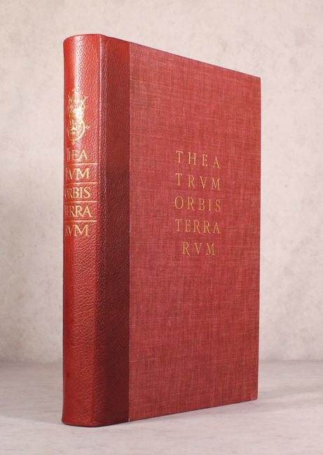
Auction 171, Lot 774
Subject: References, Facsimile Atlas
Ortelius, Abraham
[Facsimile] Theatrum Orbis Terrarum, 1964
Size: 11.9 x 16.6 inches (30.2 x 42.2 cm)
Estimate: $375 - $450
Sold for: $275
Closed on 2/6/2019

Auction 171, Lot 775
Subject: References, Facsimile Atlas
Thornton & Seller
[Facsimile] The English Pilot - The Fourth Book, 1967
Size: 12.3 x 20 inches (31.2 x 50.8 cm)
Estimate: $240 - $300
Sold for: $120
Closed on 2/6/2019
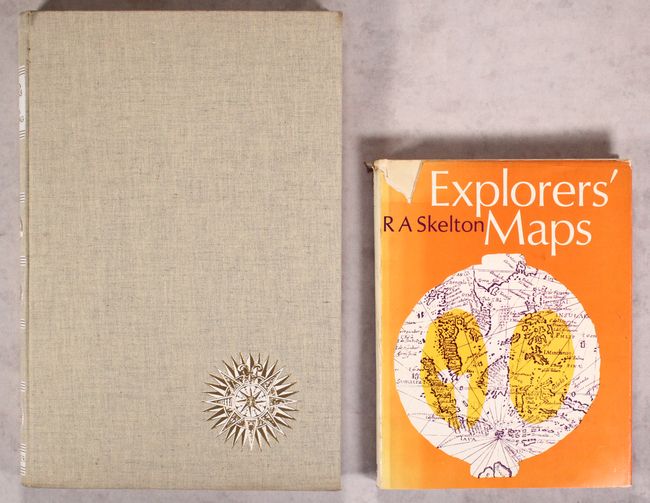
Auction 171, Lot 776
Subject: References
[Lot of 2] Landmarks of Mapmaking - An Illustrated Survey of Maps and Mapmakers [and] Explorers' Maps - Chapters in the Cartographic Record of Geographical Discovery, 1968-70
Size: See Description
Estimate: $90 - $120
NO RESERVE
Sold for: $36
Closed on 2/6/2019
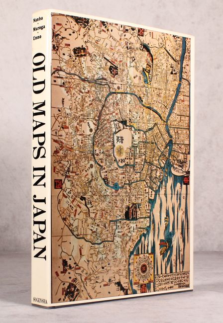
Auction 171, Lot 777
Subject: References, Japan
Old Maps in Japan, 1973
Size: 10.5 x 14.5 inches (26.7 x 36.8 cm)
Estimate: $475 - $600
Sold for: $200
Closed on 2/6/2019
Auction 171, Lot 778
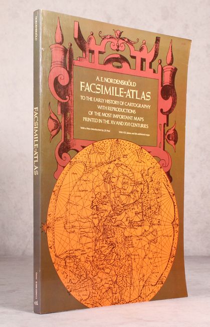
Subject: References, Facsimile Atlas
Nordenskiold, Nils Adolf E.
Facsimile-Atlas to the Early History of Cartography with Reproductions of the Most Important Maps Printed in the XV and XVI Centuries, 1973
Size: 10.9 x 15.8 inches (27.7 x 40.1 cm)
Estimate: $80 - $100
NO RESERVE
Sold for: $120
Closed on 2/6/2019
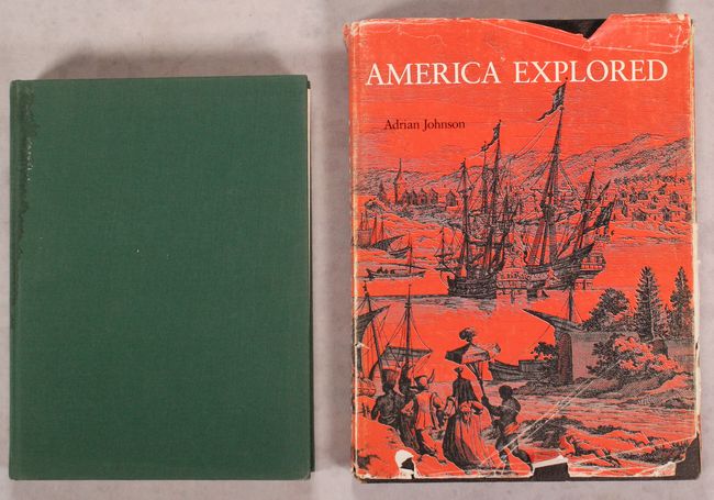
Auction 171, Lot 779
Subject: References, North America
[Lot of 2] The Exploration of North America 1630-1776 [and] America Explored - A Cartographical History of the Exploration of North America, 1974
Size: See Description
Estimate: $55 - $75
NO RESERVE
Sold for: $70
Closed on 2/6/2019
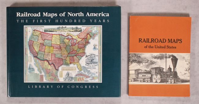
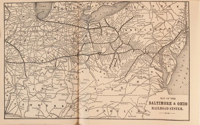
Auction 171, Lot 780
Subject: References, Railroads
Modelski, Andrew M.
[Lot of 2] Railroad Maps of North America - The First Hundred Years [and] Railroad Maps of the United States - A Selective Annotated Bibliography of Original 19th-Century Maps in the Geography and Map Division of the Library of Congress, 1975-84
Size: See Description
Estimate: $100 - $130
Sold for: $75
Closed on 2/6/2019
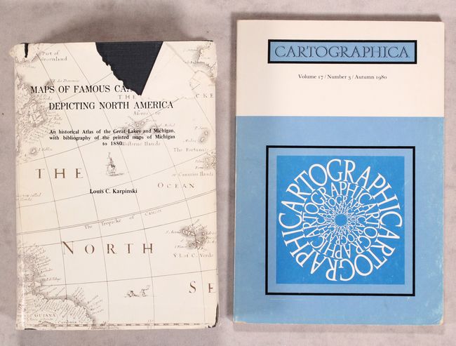
Auction 171, Lot 781
Subject: References, Great Lakes, Canada
[Lot of 2] Maps of Famous Cartographers Depicting North America - An Historical Atlas of the Great Lakes and Michigan... [and] Cartographica - Volume 17/Number 3/Autumn 1980, 1977-80
Size: See Description
Estimate: $160 - $200
Sold for: $70
Closed on 2/6/2019
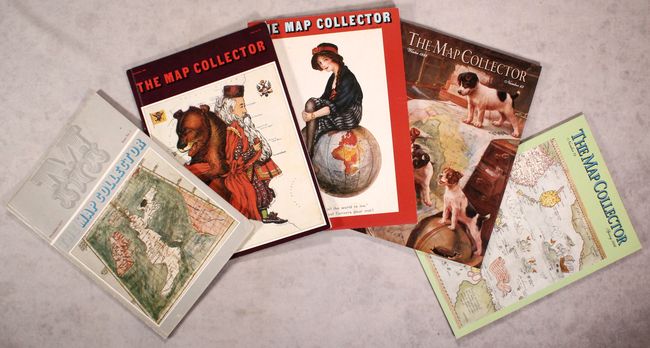
Auction 171, Lot 782
Subject: References
[Lot of 74] The Map Collector, 1977-96
Size: 8.3 x 11.8 inches (21.1 x 30 cm)
Estimate: $350 - $450
Sold for: $250
Closed on 2/6/2019
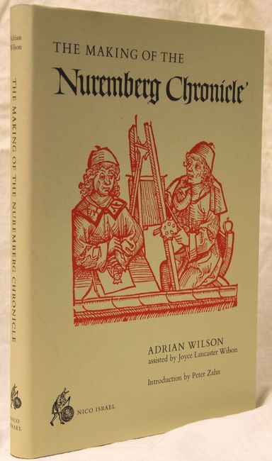
Auction 171, Lot 783
Subject: References
Wilson, Adrian
The Making of the Nuremberg Chronicle, 1978
Size: 9.8 x 14 inches (24.9 x 35.6 cm)
Estimate: $140 - $170
Sold for: $100
Closed on 2/6/2019
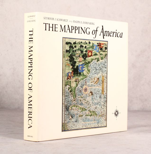
Auction 171, Lot 784
Subject: References, North America
Schwartz & Ehrenberg
The Mapping of America, 1980
Size: 11.9 x 10.9 inches (30.2 x 27.7 cm)
Estimate: $70 - $90
Sold for: $50
Closed on 2/6/2019
Auction 171, Lot 785
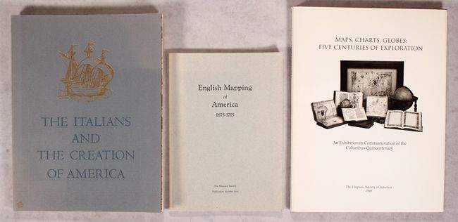
Subject: References
[Lot of 3] The Italians and the Creation of America... [and] English Mapping of America 1675-1715... [and] Maps, Charts, Globes: Five Centuries of Exploration..., 1980-92
Size: See Description
Estimate: $80 - $110
NO RESERVE
Sold for: $41
Closed on 2/6/2019
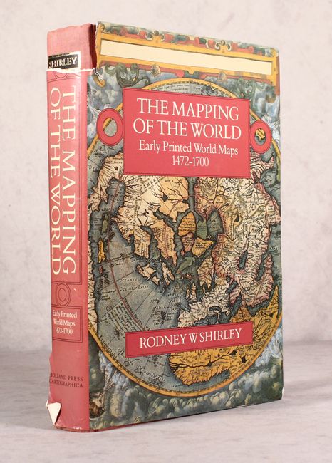
Auction 171, Lot 786
Subject: References, World
Shirley, Rodney W.
The Mapping of the World - Early Printed World Maps 1472-1700, 1983
Size: 10 x 13.8 inches (25.4 x 35.1 cm)
Estimate: $475 - $600
Sold for: $240
Closed on 2/6/2019
Auction 171, Lot 787
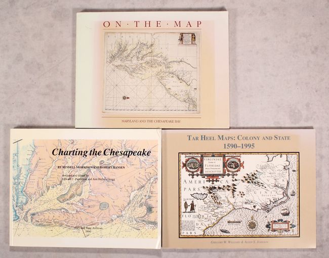
Subject: References, Mid-Atlantic United States
[Lot of 3] Washington College Presents - On the Map - An Exhibit and Catalogue of Maps Relating to Maryland and the Chesapeake Bay... [and] Charting the Chesapeake [and] Tar Heel Maps: Colony and States 1590-1995..., 1983-96
Size: See Description
Estimate: $90 - $120
NO RESERVE
Sold for: $46
Closed on 2/6/2019
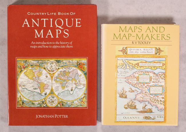
Auction 171, Lot 788
Subject: References
[Lot of 2] Country Life Book of Antique Maps - An Introduction to the History of Maps and How to Appreciate Them [and] Maps and Map-Makers, 1988-90
Size: See Description
Estimate: $40 - $60
NO RESERVE
Sold for: $70
Closed on 2/6/2019
Auction 171, Lot 789
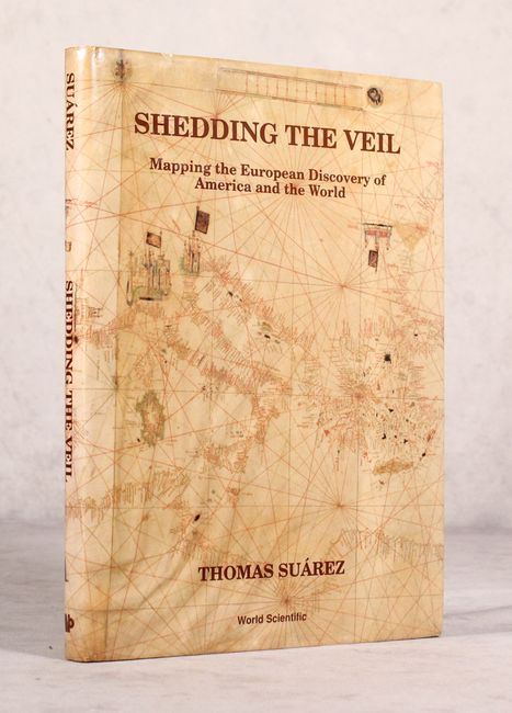
Subject: References
Suarez, Thomas
Shedding the Veil - Mapping the European Discovery of America and the World, 1992
Size: 8.7 x 11.8 inches (22.1 x 30 cm)
Estimate: $90 - $120
NO RESERVE
Sold for: $110
Closed on 2/6/2019
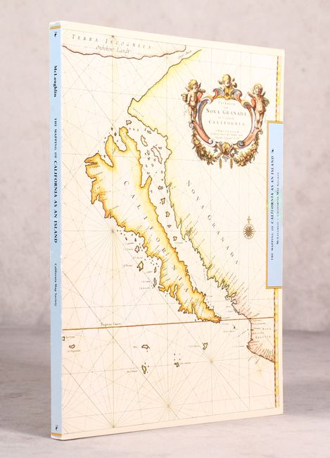
Auction 171, Lot 790
Subject: References
McLaughlin, Glen
The Mapping of California as an Island - An Illustrated Checklist, 1995
Size: 8.5 x 11 inches (21.6 x 27.9 cm)
Estimate: $90 - $120
NO RESERVE
Sold for: $60
Closed on 2/6/2019
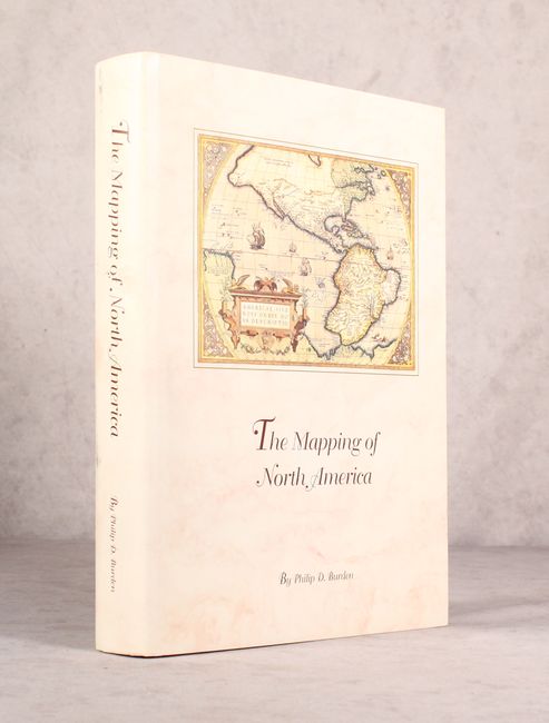
Auction 171, Lot 791
Subject: References, North America
Burden, Philip D.
The Mapping of North America - A List of Printed Maps 1511-1670, 1996
Size: 10.5 x 14.3 inches (26.7 x 36.3 cm)
Estimate: $200 - $230
Sold for: $150
Closed on 2/6/2019

Auction 171, Lot 792
Subject: References
Biblio - The Magazine for Collectors of Books, Manuscripts, and Ephemera Volume 1 Number 1, 1996
Size: 8.4 x 10.9 inches (21.3 x 27.7 cm)
Estimate: $15 - $30
NO RESERVE
Sold for: $7
Closed on 2/6/2019
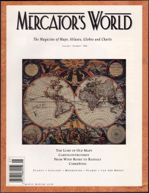
Auction 171, Lot 793
Subject: References
Mercator's World - The Magazine of Maps, Atlases, Globes and Charts Volume I Number I, 1996
Size: 8.4 x 10.9 inches (21.3 x 27.7 cm)
Estimate: $20 - $40
NO RESERVE
Sold for: $23
Closed on 2/6/2019
52 lots
Page 1 of 2