Subject: References, Great Lakes, Canada
Period: 1977-80 (published)
Publication:
Color: Black & White
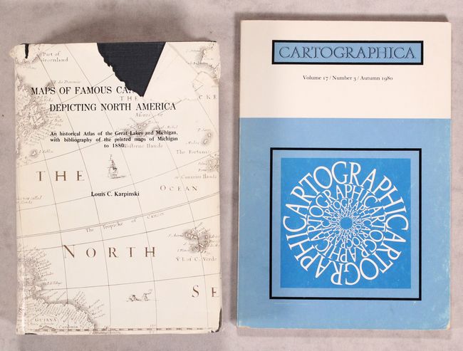
A. Maps of Famous Cartographers Depicting North America - An Historical Atlas of the Great Lakes and Michigan..., by Louis C. Karpinski, published 1977 (6.3 x 9.1"). Important bibliography of the printed maps of Michigan 1804-1880. This 539 page work provides a comprehensive historical perspective of the mapping of the Great Lakes and Michigan. Second edition, unchanged reprint of the 1931 edition. Includes a series of over a hundred reproductions of maps. Hard bound in blue cloth, with gilt titles on front cover and spine and a pictorial dust jacket. Condition: Contents are very good. Covers have minor shelf wear, and the dust jacket has several tears and some light stains. (A)
B. Cartographica - Volume 17/Number 3/Autumn 1980, by BV Gutsell, published 1980 (6.8 x 9.9"). Published by the University of Toronto Press, this journal includes articles on Canadian cartography. This particular issue includes two essays on the Great Lakes, G. Malcolm Lewis's "Changing National Perspectives and the Mapping of the Great Lakes Between 1755 and 1795" and Conrad E. Heidenreich's "Mapping the Great Lakes: The Period of Exploration, 1603-1700." Also included is L.M. Sebert's "The Land Surveys of Ontario 1750-1980" and commentary and coverage on cartography, recent cartographic literature, and books and atlases. An illuminating find for collectors of Great Lakes material. Condition: Contents are slightly toned, and covers have minor soiling and wear. (B+)
References:
Condition:
See description above.