Filtered by Category:United States(Show All Categories)
Showing results for:Auction 171
Catalog Archive
194 lots
Page 1 of 4
Auction 171, Lot 47
Subject: World
[Lot of 3] TWA Trans World Airlines International Air Routes [and] TWA Air Routes in the United States [and] TWA International Air Routes U.S.A. - Europe - Africa - Asia, 1952-60
Size: See Description
Estimate: $120 - $150
Sold for: $110
Closed on 2/6/2019
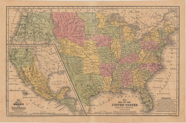
Auction 171, Lot 104
Subject: North America, Texas
Mitchell, Samuel Augustus
[Lot of 3] No. 5 Map of the United States Engraved to Illustrate Mitchell's School and Family Geography [and] No. 4 Map of North America... [and] No. 15 Map of Oregon and Upper California..., 1839-46
Size: See Description
Estimate: $250 - $325
Sold for: $150
Closed on 2/6/2019
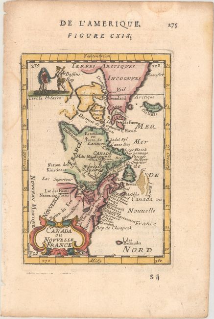
Auction 171, Lot 122
Subject: Colonial Eastern United States & Canada
Mallet, Alain Manesson
Canada ou Nouvelle France, 1683
Size: 4 x 5.6 inches (10.2 x 14.2 cm)
Estimate: $200 - $230
Sold for: $150
Closed on 2/6/2019
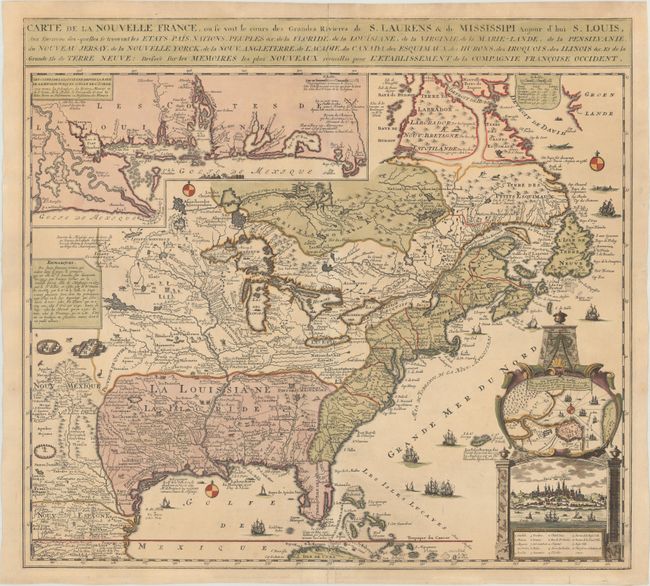
Auction 171, Lot 123
Subject: Colonial Eastern United States & Canada
Fer, Nicolas de
Carte de la Nouvelle France, ou se voit le Cours des Grandes Rivieres de S. Laurens & de Mississipi Aujour d'hui S. Louis, aux Environs des-quelles se Trouvent les Etats, Pais, Nations, Peuples &c..., 1719
Size: 21.4 x 19.5 inches (54.4 x 49.5 cm)
Estimate: $2,300 - $2,750
Striking Map of French Colonial Possessions
Sold for: $1,700
Closed on 2/6/2019
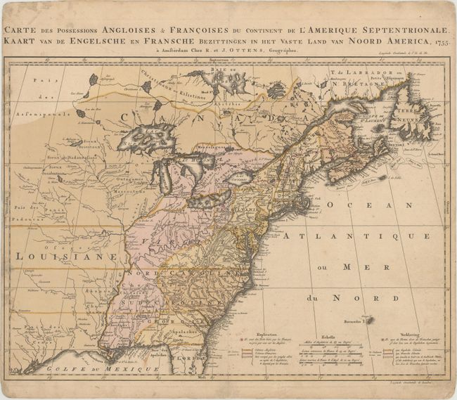
Auction 171, Lot 124
Subject: Colonial Eastern United States & Canada
Ottens, Reiner and Joshua
Carte des Possessions Angloises & Francoises du Continent de l'Amerique Septentrionale / Kaart van de Engelsche en Fransche Bezittingen in het Vaste Land van Noord America, 1755
Size: 22.4 x 16.3 inches (56.9 x 41.4 cm)
Estimate: $2,000 - $2,300
Dutch Version of an Important Map Showing Territorial Claims at the Outset of the French and Indian War
Unsold
Closed on 2/6/2019
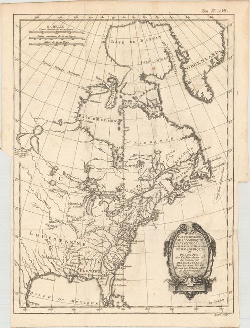
Auction 171, Lot 125
Subject: Colonial Eastern United States & Canada
Bonne, Rigobert
Partie du Nord de l'Amerique Septentrionale. Pour Servir a l'Histoire Philosophique et Politique…, 1774
Size: 9.3 x 12.6 inches (23.6 x 32 cm)
Estimate: $180 - $220
Sold for: $100
Closed on 2/6/2019
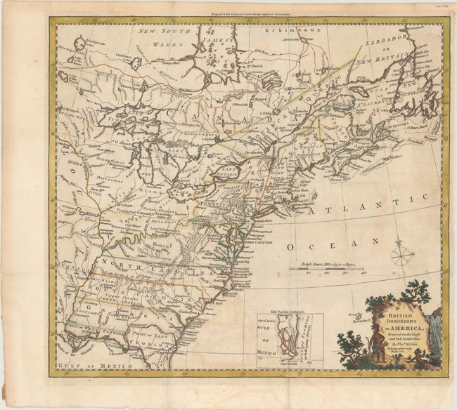
Auction 171, Lot 126
Subject: Colonial Eastern United States & Canada
Kitchin, Thomas
British Dominions in America, Drawn from the Latest and Best Authorities, 1780
Size: 14.8 x 13.4 inches (37.6 x 34 cm)
Estimate: $550 - $700
Sold for: $400
Closed on 2/6/2019
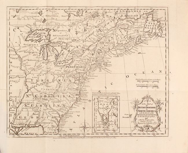
Auction 171, Lot 127
Subject: Colonial Eastern United States & Canada, History Book
Kitchin, Thomas
[Maps in Book] A New Map of the British Dominions in North America; with the Limits of the Governments Annexed Thereto by the Late Treaty of Peace... [bound in] The Annual Register, or a View of the History, Politics, and Literature…, 1782
Size: 11.8 x 9.5 inches (30 x 24.1 cm)
Estimate: $700 - $850
Sold for: $500
Closed on 2/6/2019
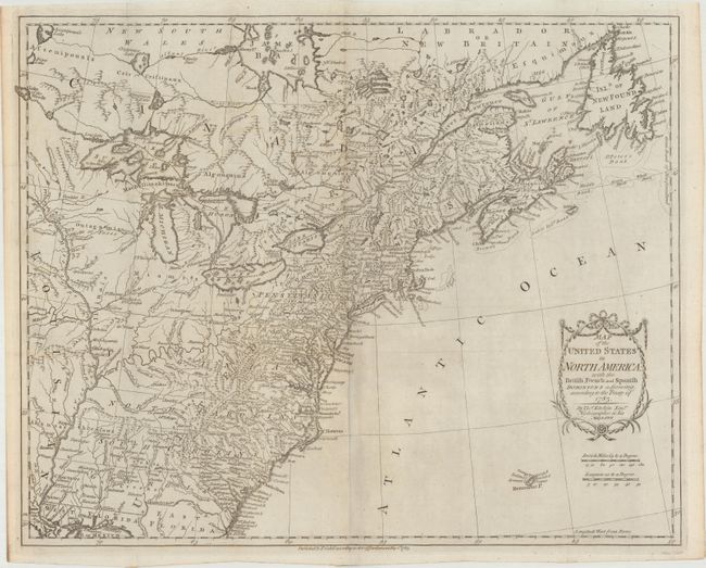
Auction 171, Lot 128
Subject: Eastern United States & Canada
Kitchin, Thomas
Map of the United States in North America: with the British, French and Spanish Dominions Adjoining, According to the Treaty of 1783, 1783
Size: 20.2 x 16.1 inches (51.3 x 40.9 cm)
Estimate: $1,200 - $1,500
Sold for: $850
Closed on 2/6/2019
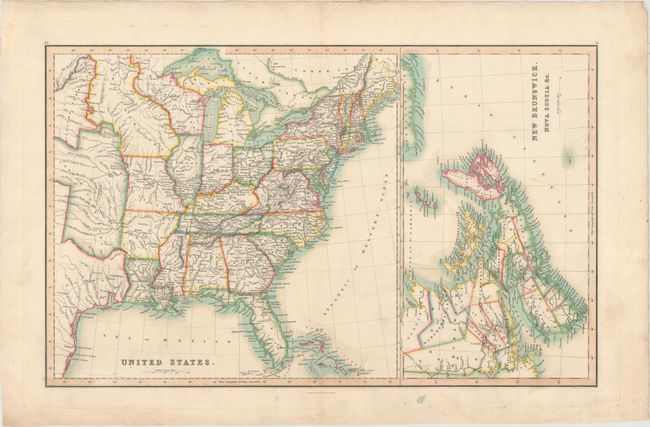
Auction 171, Lot 129
Subject: Eastern United States & Canada
Smith & Son
United States [on sheet with] New Brunswick, Nova Scotia &c., 1846
Size: 22.7 x 14.1 inches (57.7 x 35.8 cm)
Estimate: $160 - $190
Sold for: $95
Closed on 2/6/2019
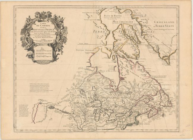
Auction 171, Lot 130
Subject: Colonial Northeastern United States & Canada, Great Lakes
Delisle, Guillaume
Carte du Canada ou de la Nouvelle France et des Decouvertes qui y ont ete Faites Dressee sur Plusieurs Observations..., 1703
Size: 25.6 x 19.6 inches (65 x 49.8 cm)
Estimate: $2,200 - $2,500
Delisle's Seminal Map of Canada and the Great Lakes
Sold for: $1,200
Closed on 2/6/2019
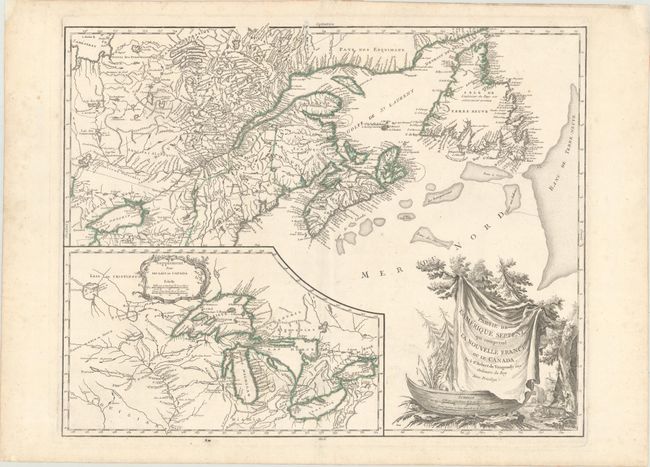
Auction 171, Lot 131
Subject: Colonial Northeastern United States & Canada, Great Lakes
Robert de Vaugondy, Didier
Partie de l'Amerique Septent? qui Comprend la Nouvelle France ou le Canada, 1784
Size: 23.8 x 18.8 inches (60.5 x 47.8 cm)
Estimate: $550 - $700
Sold for: $400
Closed on 2/6/2019
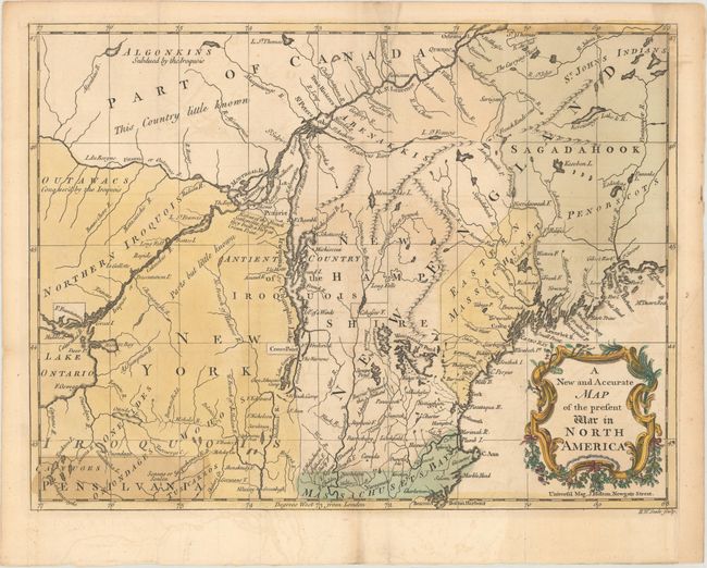
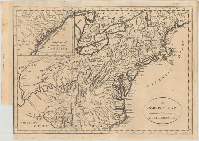
Auction 171, Lot 132
Subject: Colonial Northeastern United States & Canada
Hinton, John
A New and Accurate Map of the Present War in North America, 1757
Size: 14.4 x 10.8 inches (36.6 x 27.4 cm)
Estimate: $475 - $600
Sold for: $450
Closed on 2/6/2019
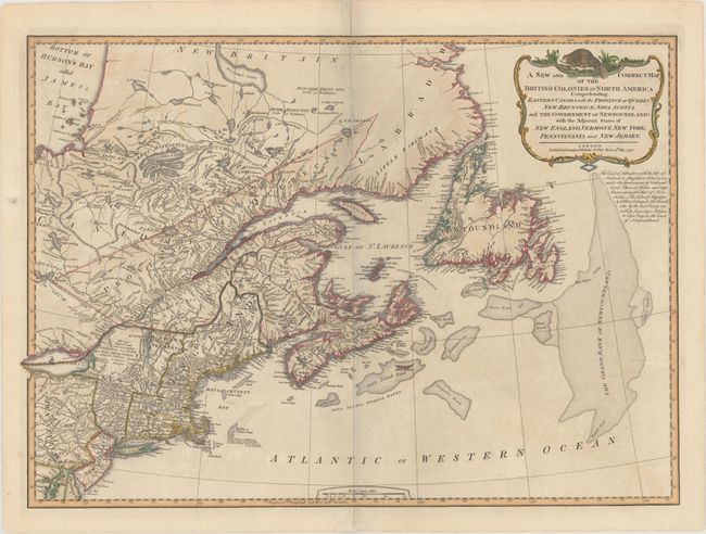
Auction 171, Lot 133
Subject: Northeastern United States & Canada
Laurie & Whittle
A New and Correct Map of the British Colonies in North America Comprehending Eastern Canada with the Province of Quebec, New Brunswick, Nova Scotia, and the Government of Newfoundland: with the Adjacent States of New England..., 1794
Size: 26.3 x 18.9 inches (66.8 x 48 cm)
Estimate: $550 - $650
Sold for: $425
Closed on 2/6/2019
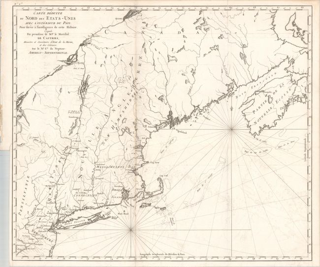
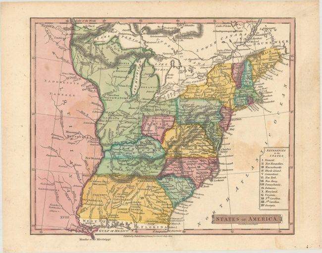
Auction 171, Lot 134
Subject: Northeastern United States & Canada
Carte Reduite du Nord des Etats-Unis avec l'Interieur du Pays. Pour Servir a Intelligence de Cette Histoire..., 1830
Size: 22.9 x 19.6 inches (58.2 x 49.8 cm)
Estimate: $375 - $450
Unsold
Closed on 2/6/2019
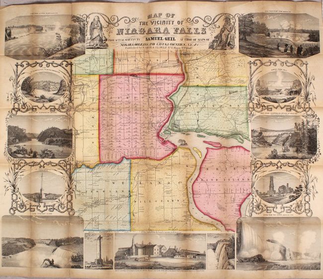
Auction 171, Lot 135
Subject: Niagara Falls, New York, Canada
Geil, Samuel
Map of the Vicinity of Niagara Falls from Actual Surveys..., 1853
Size: 28.3 x 22.7 inches (71.9 x 57.7 cm)
Estimate: $350 - $425
Sold for: $1,400
Closed on 2/6/2019
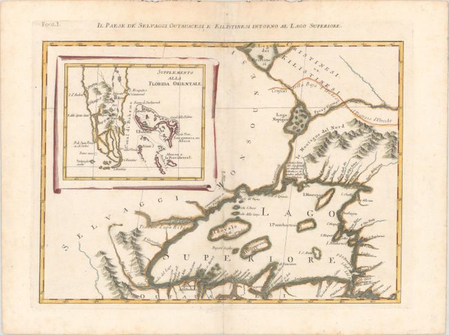
Auction 171, Lot 136
Subject: Great Lakes, Florida
Zatta, Antonio
Il Paese de Selvaggi Outauacesi, e Kilistinesi Intorno al Lago Superiore, 1785
Size: 16.6 x 12.1 inches (42.2 x 30.7 cm)
Estimate: $250 - $325
Sold for: $110
Closed on 2/6/2019
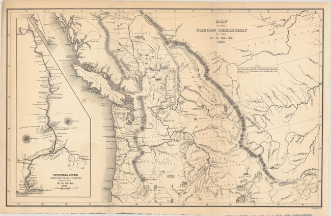
Auction 171, Lot 137
Subject: Northwestern United States & Canada
Wilkes, Charles
Map of the Oregon Territory by the U.S. Ex. Ex., 1841
Size: 13.1 x 8.2 inches (33.3 x 20.8 cm)
Estimate: $200 - $230
Sold for: $150
Closed on 2/6/2019
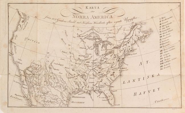
Auction 171, Lot 138
Subject: United States, Franklin
Zimmerman, Eberhard A.W.
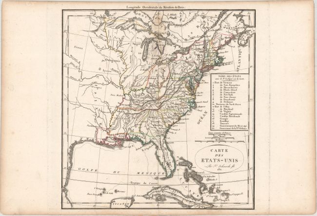
Karta ofver Norra America... [bound in] Jorden och Dess Invanare...Fjerde Delen, 1817
Size: 10.4 x 6.3 inches (26.4 x 16 cm)
Estimate: $250 - $325
Rare Swedish Map Showing the State of Franklin
Sold for: $190
Closed on 2/6/2019
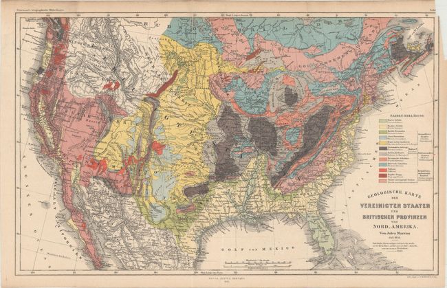
Auction 171, Lot 139
Subject: United States
Marcou, Jules
Geologische Karte der Vereinicten Staaten und Britischen Provinzen von Nord_Amerika, 1855
Size: 15.4 x 9.6 inches (39.1 x 24.4 cm)
Estimate: $200 - $230
Sold for: $150
Closed on 2/6/2019
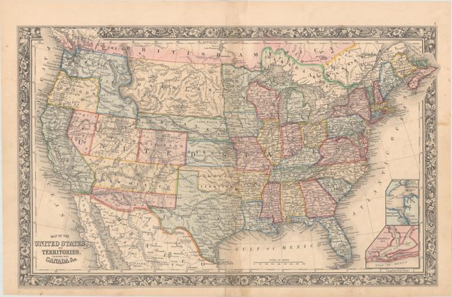
Auction 171, Lot 140
Subject: United States
Mitchell, Samuel Augustus
Map of the United States, and Territories. Together with Canada &c., 1860
Size: 21.4 x 13.2 inches (54.4 x 33.5 cm)
Estimate: $275 - $350
Sold for: $210
Closed on 2/6/2019
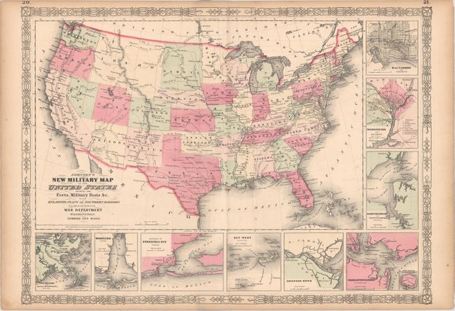
Auction 171, Lot 141
Subject: United States, Civil War
Johnson and Ward
Johnson's New Military Map of the United States Showing the Forts, Military Posts &c. with Enlarged Plans of Southern Harbors..., 1861
Size: 23.9 x 17.4 inches (60.7 x 44.2 cm)
Estimate: $200 - $230
Sold for: $100
Closed on 2/6/2019
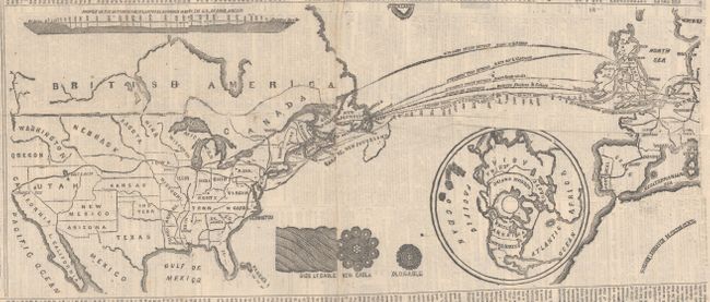
Auction 171, Lot 142
Subject: United States, North Atlantic
New York Tribune
[Untitled - Map of Proposed Atlantic Cable], 1865
Size: 17.3 x 7.2 inches (43.9 x 18.3 cm)
Estimate: $140 - $170
NO RESERVE
Sold for: $65
Closed on 2/6/2019

Auction 171, Lot 143
Subject: United States
[Lot of 2] 1876 Progress Map of the U.S. Geographical Surveys West of the 100th Meridian... [and] United States Showing Routes of Principal Explorers and Early Roads and Highways, 1876-1908
Size: See Description
Estimate: $220 - $250
Sold for: $275
Closed on 2/6/2019
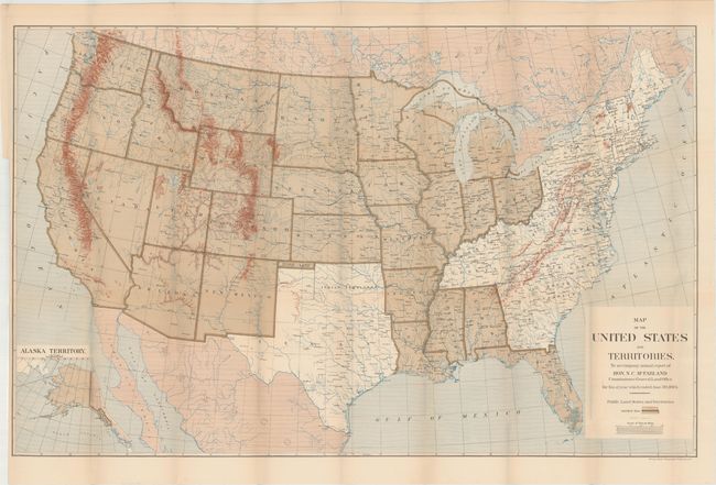
Auction 171, Lot 144
Subject: United States
General Land Office
Map of the United States and Territories..., 1884
Size: 38.3 x 24.1 inches (97.3 x 61.2 cm)
Estimate: $160 - $200
NO RESERVE
Sold for: $45
Closed on 2/6/2019
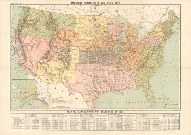
Auction 171, Lot 145
Subject: United States
Hausermann, R.
Missions Catholiques aux Etats-Unis, 1900
Size: 37.3 x 27.5 inches (94.7 x 69.9 cm)
Estimate: $325 - $400
Unsold
Closed on 2/6/2019
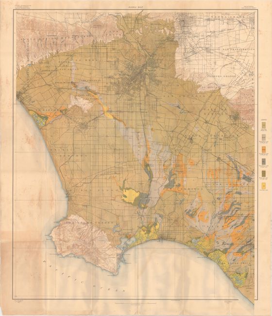
Auction 171, Lot 146
Subject: United States
U.S.D.A.
[Lot of 56 - U.S.D.A. Soil Maps], 1903
Size: 6 x 9.5 inches (15.2 x 24.1 cm)
Estimate: $200 - $250
Features Maps of Los Angeles & San Jose
Sold for: $100
Closed on 2/6/2019
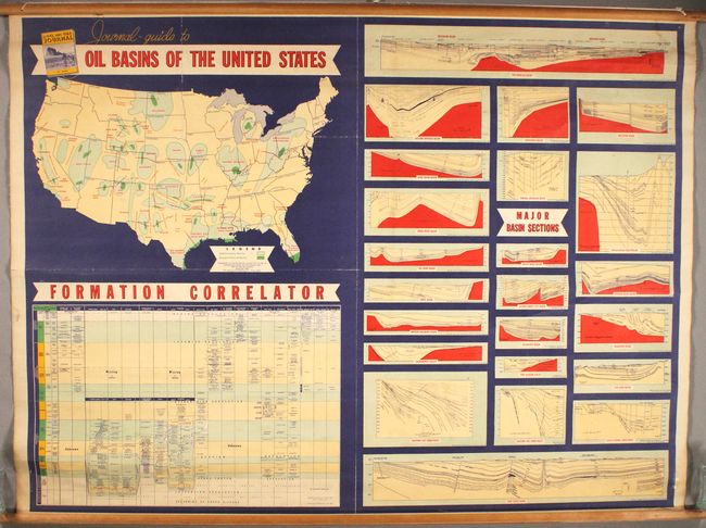
Auction 171, Lot 147
Subject: United States, Oil
Journal-Guide to Oil Basins of the United States, 1952
Size: 45.9 x 34.6 inches (116.6 x 87.9 cm)
Estimate: $220 - $250
Sold for: $240
Closed on 2/6/2019
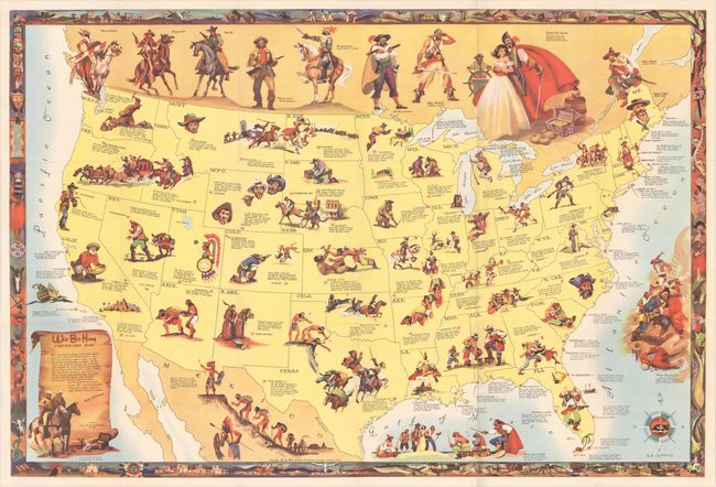
Auction 171, Lot 148
Subject: United States
Rand McNally & Co.
[Lot of 2] Wild Bill Hickok Treasure Map [and] Wild Bill Hickok Guide to Lost Treasures, 1952
Size: See Description
Estimate: $140 - $180
Sold for: $300
Closed on 2/6/2019
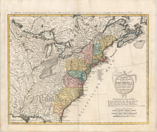
Auction 171, Lot 149
Subject: Eastern United States
Gussefeld/Homann Heirs
Charte uber die XIII Vereinigte Staaten von Nord-America..., 1784
Size: 22.6 x 17.6 inches (57.4 x 44.7 cm)
Estimate: $750 - $900
Sold for: $450
Closed on 2/6/2019
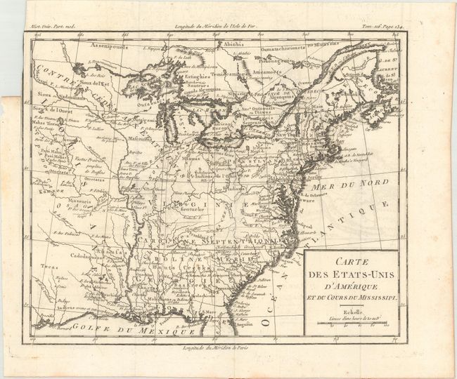
Auction 171, Lot 150
Subject: Eastern United States, Franklin
Brion de la Tour, Louis
Carte des Etats-Unis d'Amerique et du Cours du Mississipi, 1788
Size: 10.6 x 8.7 inches (26.9 x 22.1 cm)
Estimate: $900 - $1,100
One of the Earliest Maps to Feature the State of Franklin
Unsold
Closed on 2/6/2019
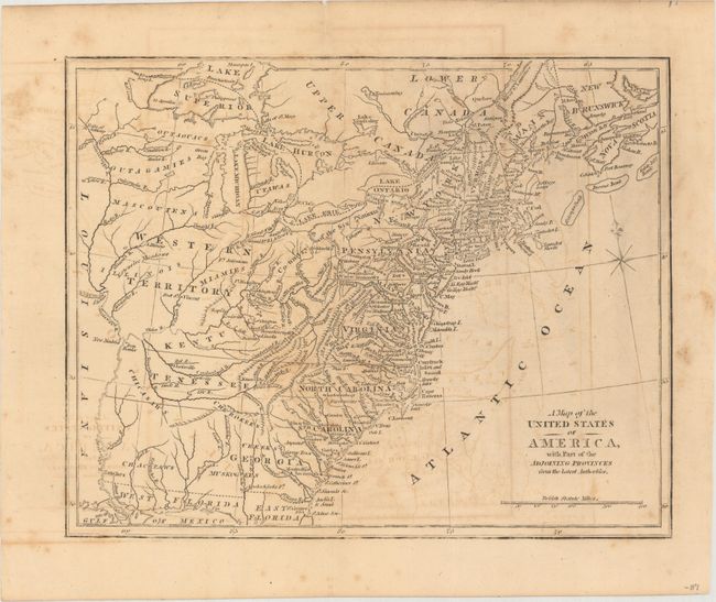
Auction 171, Lot 151
Subject: Eastern United States
Stockdale, John
Part of the United States of North America, 1798
Size: 18.5 x 16.2 inches (47 x 41.1 cm)
Estimate: $200 - $230
Sold for: $170
Closed on 2/6/2019
Auction 171, Lot 152
Subject: Eastern United States
Anon.
A Map of the United States of America, with Part of the Adjoining Provinces, from the latest Authorities, 1810
Size: 10.6 x 8.4 inches (26.9 x 21.3 cm)
Estimate: $160 - $200
Sold for: $85
Closed on 2/6/2019
Auction 171, Lot 153
Subject: Eastern United States
Delamarche, Felix
Carte des Etats-Unis, 1811
Size: 10.9 x 11.4 inches (27.7 x 29 cm)
Estimate: $300 - $375
Unsold
Closed on 2/6/2019
Auction 171, Lot 154
Subject: Eastern United States
A Correct Map of North America, 1812
Size: 11.4 x 8.1 inches (29 x 20.6 cm)
Estimate: $220 - $250
NO RESERVE
Unsold
Closed on 2/6/2019
Auction 171, Lot 155
Subject: Eastern United States
Russell, John C.
States of America, 1814
Size: 8.8 x 7.4 inches (22.4 x 18.8 cm)
Estimate: $200 - $230
Sold for: $100
Closed on 2/6/2019
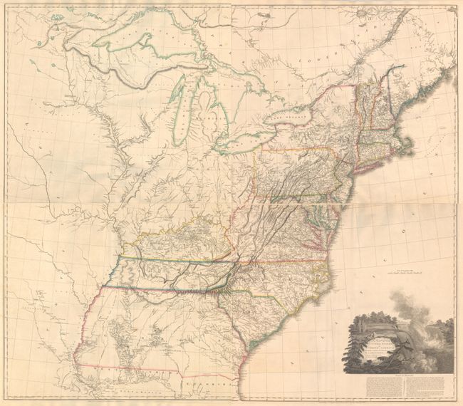
Auction 171, Lot 156
Subject: Eastern United States
Arrowsmith, Aaron, Sr.
[On 4 Sheets] A Map of the United States of North America Drawn from a Number of Critical Researches, 1815
Size: 27.8 x 24.3 inches (70.6 x 61.7 cm)
Estimate: $9,000 - $11,000
Large Format Map Used by Lewis & Clark
Unsold
Closed on 2/6/2019
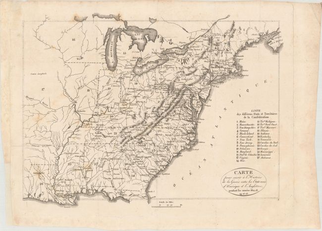
Auction 171, Lot 157
Subject: Eastern United States
Carte pour Servir a l'Historie de la Guerre Entre les Etats-Unis d'Amerique et l'Angleterre, Pendant les Annees 1812, 13, 14 et 15 [with] Histoire de la Guerre Entre les Etats-Unis d'Amerique et l'Angleterre, 1820
Size: 13.1 x 9.8 inches (33.3 x 24.9 cm)
Estimate: $200 - $230
Unsold
Closed on 2/6/2019
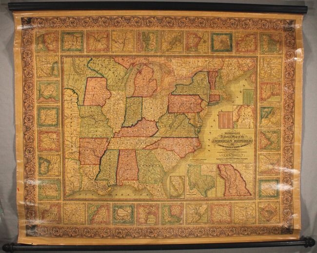
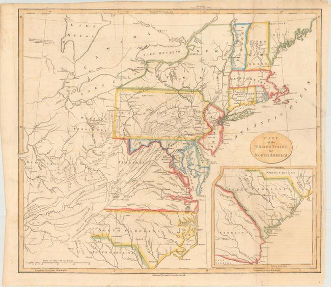
Auction 171, Lot 158
Subject: Eastern United States
Mitchell, Samuel Augustus
Mitchell's National Map of the American Republic or United States of North America, Together with Maps of the Vicinities of Thirty-Two of the Principal Cities and Towns in the Union, 1846
Size: 47 x 38 inches (119.4 x 96.5 cm)
Estimate: $1,100 - $1,400
Unsold
Closed on 2/6/2019
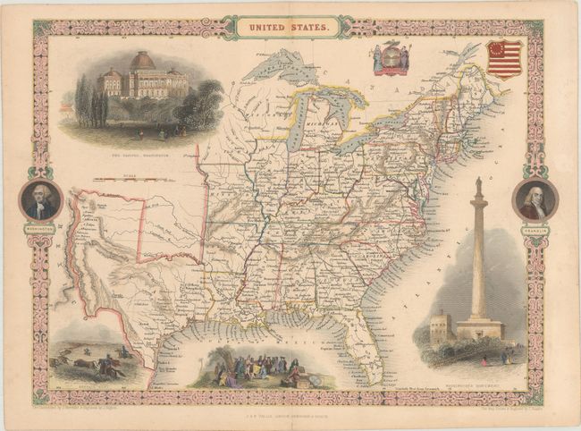
Auction 171, Lot 159
Subject: Eastern United States
Tallis, John
United States, 1850
Size: 13.4 x 9.7 inches (34 x 24.6 cm)
Estimate: $250 - $325
Sold for: $160
Closed on 2/6/2019
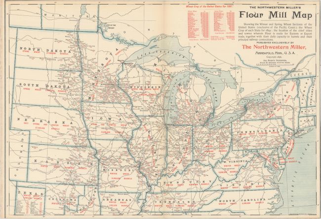
Auction 171, Lot 160
Subject: Eastern United States
Matthews-Northrup Co
The Northwestern Miller's Flour Mill Map Showing the Winter and Spring Wheat Sections of the United States (Exclusive of the Pacific Coast)..., 1896
Size: 19.9 x 13.8 inches (50.5 x 35.1 cm)
Estimate: $50 - $70
NO RESERVE
Sold for: $13
Closed on 2/6/2019
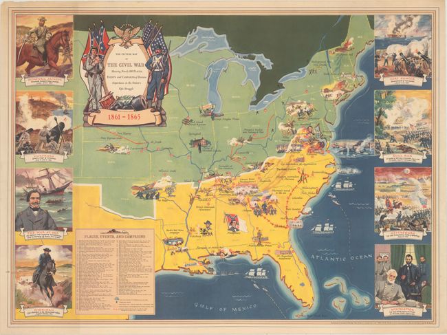
Auction 171, Lot 161
Subject: Eastern United States, Civil War
The Picture Map of the Civil War Showing Nearly 100 Places, Events and Campaigns of Decisive Importance in the Nation's Epic Struggle, 1956
Size: 29.6 x 22 inches (75.2 x 55.9 cm)
Estimate: $120 - $150
Sold for: $425
Closed on 2/6/2019
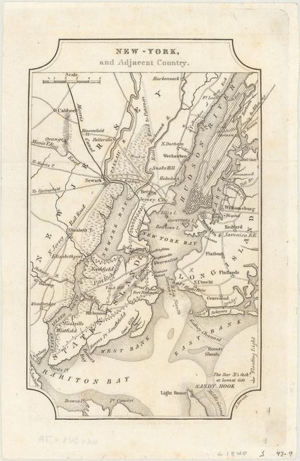
Auction 171, Lot 162
Subject: Eastern United States Cities
Melish, John
[Lot of 7] New-York, and Adjacent Country [and] District of Columbia [and] Boston... [and] Baltimore, Annapolis... [and] Charleston... [and] View of the Country Round the Falls of Niagara [and] Ballston & Saratoga Springs, City of Albany..., 1822
Size: 4 x 6.4 inches (10.2 x 16.3 cm)
Estimate: $350 - $425
NO RESERVE
Unsold
Closed on 2/6/2019
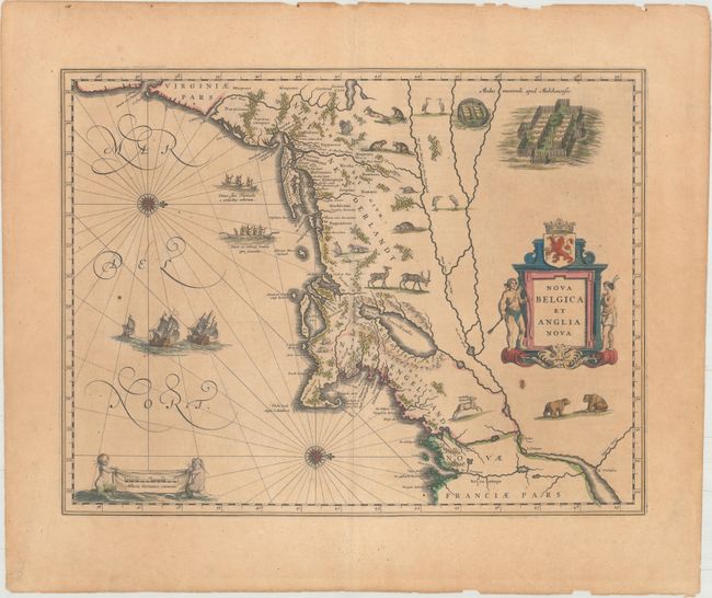
Auction 171, Lot 163
Subject: Colonial New England & Mid-Atlantic United States
Blaeu, Willem
Nova Belgica et Anglia Nova, 1643
Size: 19.8 x 15.1 inches (50.3 x 38.4 cm)
Estimate: $2,200 - $2,500
Important Map of Colonial New England and the Mid-Atlantic
Unsold
Closed on 2/6/2019
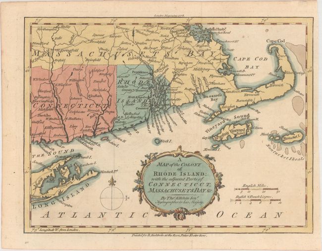
Auction 171, Lot 164
Subject: Colonial New England United States
Kitchin, Thomas
A Map of the Colony of Rhode Island: with the Adjacent Part of Connecticut, Massachusetts Bay. &c., 1778
Size: 9.4 x 7.1 inches (23.9 x 18 cm)
Estimate: $350 - $425
Sold for: $190
Closed on 2/6/2019
Auction 171, Lot 165
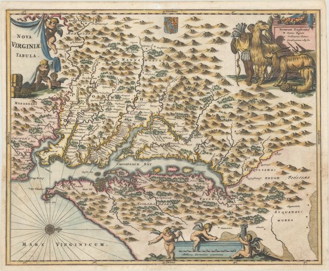
Subject: Colonial Mid-Atlantic United States
Montanus, Arnoldus
Nova Virginiae Tabula, 1671
Size: 14.2 x 11.5 inches (36.1 x 29.2 cm)
Estimate: $800 - $950
Sold for: $600
Closed on 2/6/2019
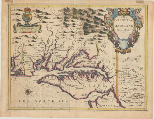
Auction 171, Lot 166
Subject: Colonial Mid-Atlantic United States
Speed/Lamb
A Map of Virginia and Maryland, 1676
Size: 19.4 x 14.9 inches (49.3 x 37.8 cm)
Estimate: $4,750 - $6,000
The First Printed Map to Draw Upon the Legendary Herrman Map of the Chesapeake Bay - Previously Owned by Coolie Verner
Unsold
Closed on 2/6/2019
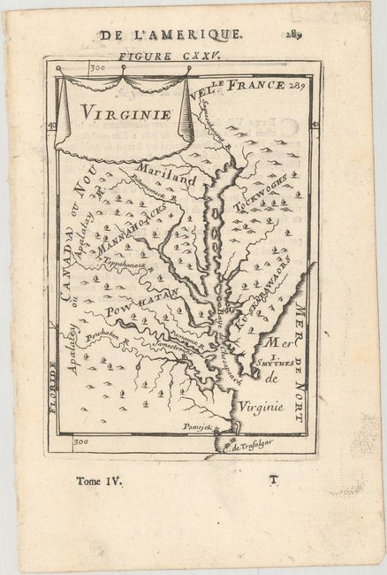
Auction 171, Lot 167
Subject: Colonial Mid-Atlantic United States
Mallet, Alain Manesson
Virginie, 1683
Size: 4 x 5.9 inches (10.2 x 15 cm)
Estimate: $250 - $325
Sold for: $180
Closed on 2/6/2019
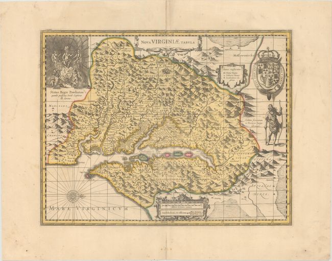
Auction 171, Lot 168
Subject: Colonial Mid-Atlantic United States
Hondius/Schenk & Valck
Nova Virginiae Tabula, 1700
Size: 19.2 x 14.8 inches (48.8 x 37.6 cm)
Estimate: $1,400 - $1,800
One of the Most Important 17th Century Maps of the Chesapeake Bay
Unsold
Closed on 2/6/2019
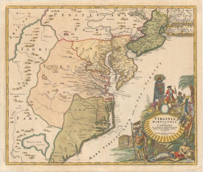
Auction 171, Lot 169
Subject: Colonial Mid-Atlantic United States
Homann, Johann Baptist
Virginia Marylandia et Carolina in America Septentrionali Britannorum Industria Excultae, 1730
Size: 22.8 x 19.2 inches (57.9 x 48.8 cm)
Estimate: $1,900 - $2,200
Map Created to Promote German Immigration to the New World
Unsold
Closed on 2/6/2019
194 lots
Page 1 of 4