Subject: Atlases
Period: 1851 (published)
Publication:
Color: Hand Color
Size:
11.2 x 15.1 inches
28.4 x 38.4 cm
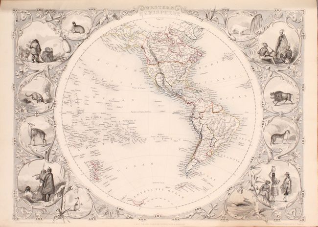
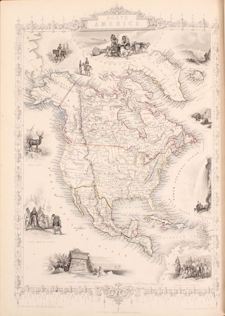
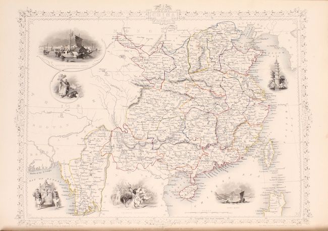
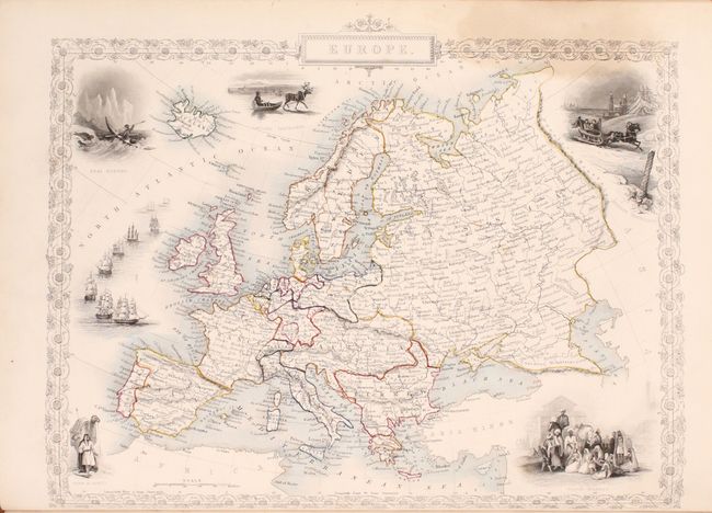
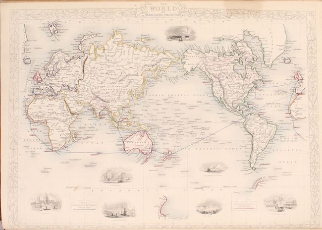
The maps from The Illustrated Atlas were first published in serial form to a target audience that led insular lives due to the expense and hardship of travel. All that changed as the progress of the nineteenth century brought swift and dramatic changes in public awareness of far away places. Tallis' maps no doubt played an important role in this dramatic awakening. These maps not only provided up-to-date geographical knowledge, but also used vignette views within the map's design to show the native people and their occupations, cities and points of interest. The maps hark back to a cartographic tradition from the Dutch mapmakers of the seventeenth century with finely engraved decorative borders. The maps were drawn and engraved by John Rapkin with views drawn and engraved by a number of prominent artists. The maps were issued as a complete volume from 1851 until about 1865. Some of the maps were also published in other history books published by Tallis including British Colonies and, without the vignettes, in geographical dictionaries and encyclopedias until about 1880.
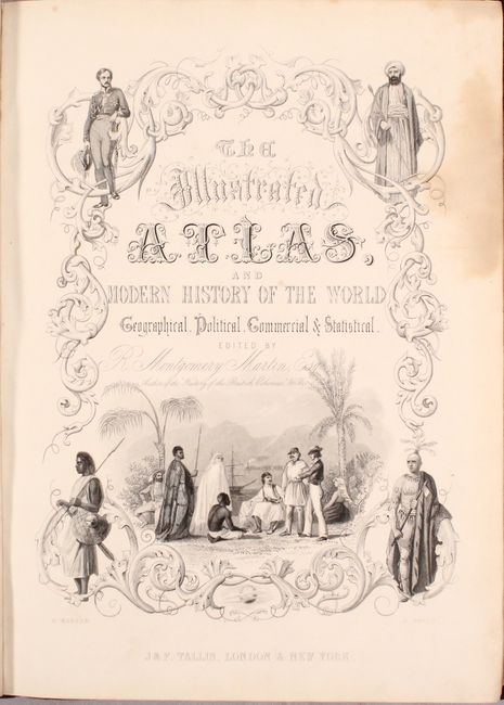
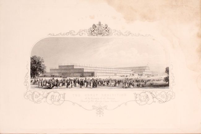
This scarce and very desirable folio atlas is one of the last "decorative type" atlases to be published. Edited by R. Montgomery Martin and published by John Tallis & Co., it is sometimes called the "Tallis Atlas." This complete atlas contains a frontispiece of the Great Exhibition, 81 maps, 2 charts and related text pages interspersed throughout. The maps not only provided up-to-date geographical knowledge, but also used vignette views within the map's design to show the native people and their occupations, cities, and points of interest. The maps hark back to a cartographic tradition from the Dutch mapmakers of the seventeenth century with finely engraved decorative borders. Of particular interest are:
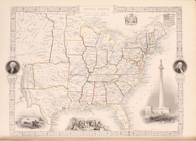
United States. This edition of the map includes a large Western Territory that lies above a shortened Texas and stretches between New Mexico and the western boundaries of Missouri and Arkansas. New Mexico or Santa Fe lies east of the Rio Grande, with Mexico to the west. A huge Missouri Territory occupies much of the Great Plains region, as it extends from an oddly shaped Nebraska and off the map to the west. Nebraska stretches from the Canadian border to the Western Territory as a thin strip of land lying against Minnesota and Iowa to the east. This beautifully engraved map is surrounded by a decorative border with portraits of Washington and Franklin. Vignettes of a buffalo hunt, Penn's treaty with the Indians, Washington's Monument in Baltimore, and two U.S. seals further adorn the map.
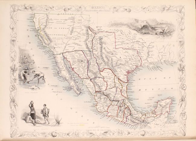
Mexico, California and Texas. This is the second, and most desirable, state of this fine steel-engraved map that was issued during a time of great transition in the region. After gold was discovered in California, the plate was re-engraved to include a vignette of gold panning and to locate the gold regions of California which are delineated through hand coloring. Texas is shown with its original state borders that include much of present-day New Mexico and extend into Colorado. Two other vignettes show Mexican peasantry and the ancient Mayan ruins at Uxmal. The very decorative border incorporates native plants of the region.
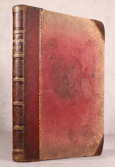
Seven maps of Australia and New Zealand including Western Australia, New South Wales, Part of South Australia, and Van Diemen's Island to name a few. Hardbound in brown quarter leather with tips over red cloth boards with gilt title on spine. A.E.G.
References:
Condition: B+
The maps are in original outline color and the vignettes and borders are uncolored, as issued. The vast majority of the maps are very good or better and only a few good with some light toning and occasional staining or foxing. The stains are primarily in the first portion of the atlas and impact maps of the Western Hemisphere, Europe, France, and Prussia. There are larger stains occupying a top corner of the frontispiece and engraved title page. Text pages are fine. Covers are worn and stained, and the edges are bumped.