Filtered by Category:United States(Show All Categories)
Showing results for:Auction 98
Catalog Archive
135 lots
Page 1 of 3
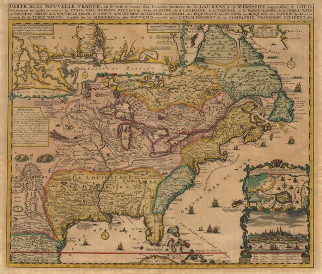
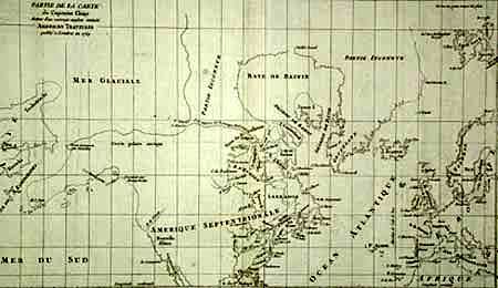
Auction 98, Lot 86
Subject: Colonial North America
Chatelain, Henry Abraham
Carte de la Nouvelle France, ou se voit le cours des Grandes Rivieres de S. Laurens & de Mississipi Aujour d'hui S. Louis, Aux Environs des-quelles se trouvent les Etats, Pais, Nations, Peuples &c., 1732
Size: 19.1 x 16.5 inches (48.5 x 41.9 cm)
Estimate: $2,200 - $2,400
Sold for: $2,300
Closed on 3/6/2002
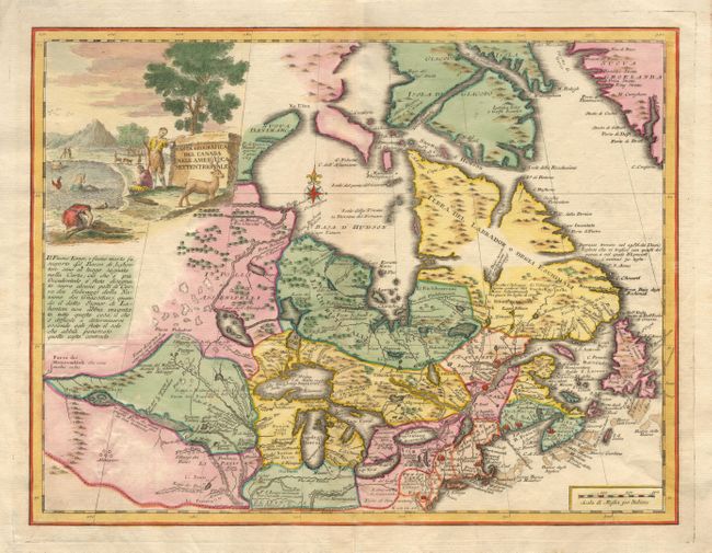
Auction 98, Lot 88
Subject: Colonial United States and Canada
Albrizzi, Girolamo
Carta Geografica del Canada nell' America Settentrionale, 1742
Size: 17 x 12.8 inches (43.2 x 32.5 cm)
Estimate: $750 - $850
Sold for: $550
Closed on 3/6/2002
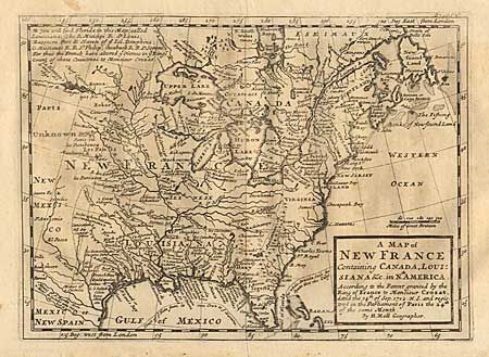
Auction 98, Lot 89
Subject: Colonial United States and Canada
Moll, Herman
A Map of New France Containing Canada, Louisiana &c. in Nth. America. According to the Patent Granted by the King of France to Monsieur Crozat, Dated the 14th of Sep. 1712 N.S. and Registered in the Parliament of Paris the 24th of Same Month, 1745
Size: 10 x 7.3 inches (25.4 x 18.5 cm)
Estimate: $400 - $450
Sold for: $375
Closed on 3/6/2002

Auction 98, Lot 90
Subject: Colonial United States and Canada - Great Lakes
Delisle/Buache
Carte du Canada ou de la Nouvelle France et des Decouvertes qui y ont ete faites Dressee sur plusieurs Observations, 1745
Size: 25.5 x 19.5 inches (64.8 x 49.5 cm)
Estimate: $2,000 - $2,500
Unsold
Closed on 3/6/2002
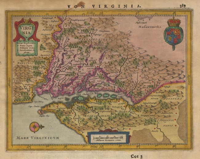
Auction 98, Lot 91
Subject: Colonial Mid Atlantic
Jansson, Jan
Virginia, 1648
Size: 7.5 x 5.7 inches (19.1 x 14.5 cm)
Estimate: $500 - $550
Sold for: $425
Closed on 3/6/2002
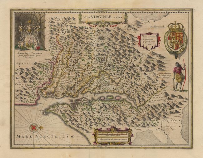
Auction 98, Lot 92
Subject: Colonial Southeast
Hondius, Henricus
Nova Virginiae Tabula, 1665
Size: 19.5 x 15 inches (49.5 x 38.1 cm)
Estimate: $2,400 - $2,500
Sold for: $2,200
Closed on 3/6/2002
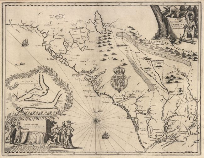
Auction 98, Lot 93
Subject: Colonial Carolina
Moxon/Ogilby
A New Discription of Carolina By Order of the Lords Proprietors, 1672
Size: 21.2 x 16.2 inches (53.8 x 41.1 cm)
Estimate: $5,000 - $6,000
Sold for: $15,500
Closed on 3/6/2002
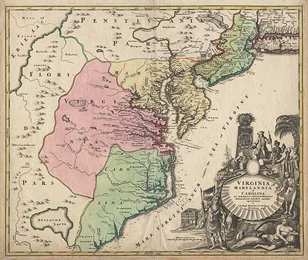
Auction 98, Lot 94
Subject: Colonial United States
Homann, Johann Baptist
Virginia Marylandia et Carolina in America Septentrionali Britannorum industria excultae, 1720
Size: 22.5 x 19 inches (57.2 x 48.3 cm)
Estimate: $1,900 - $2,000
Sold for: $1,500
Closed on 3/6/2002

Auction 98, Lot 95
Subject: Colonial United States
Moll, Herman
New England, New York, New Jersey, and Pensilvania &c., 1745
Size: 10 x 7.1 inches (25.4 x 18 cm)
Estimate: $350 - $400
Sold for: $450
Closed on 3/6/2002
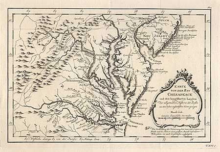
Auction 98, Lot 96
Subject: Colonial United States
Bellin, Jacques Nicolas
Karte von der Bay Chesapeack und den benachbarten Laden, 1747
Size: 11.1 x 7.3 inches (28.2 x 18.5 cm)
Estimate: $300 - $350
Sold for: $350
Closed on 3/6/2002
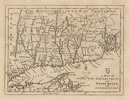
Auction 98, Lot 97
Subject: Colonial New England
Anon.
A Map of Connecticut and Rhode Island, with Long Island Sound, &c., 1776
Size: 8.8 x 6.8 inches (22.4 x 17.3 cm)
Estimate: $240 - $275
Sold for: $325
Closed on 3/6/2002

Auction 98, Lot 98
Subject: Colonial Pennsylvania and New Jersey
Dury, Andrew
A Chart of Delaware Bay and River, Containing a full and exact description of the Shores, Creeks, Harbours, Soundings, Shoals, Sands and Bearings of the most considerable Land Marks, from the Capes to Philadelphia, 1776
Size: 27.8 x 18 inches (70.6 x 45.7 cm)
Estimate: $3,750 - $4,000
Unsold
Closed on 3/6/2002
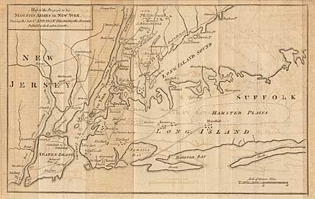
Auction 98, Lot 99
Subject: Colonial New York
Anon.
Map of the Progress of his Majesty's Armies in New York, 1776
Size: 12 x 7.8 inches (30.5 x 19.8 cm)
Estimate: $180 - $220
Sold for: $325
Closed on 3/6/2002
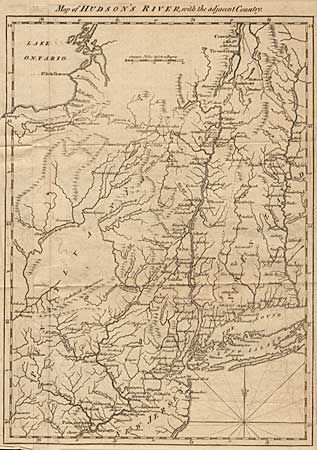
Auction 98, Lot 100
Subject: Colonial New York and New England
Anon.
Map of Hudson's River, with the adjacent Country, 1778
Size: 11.5 x 8.3 inches (29.2 x 21.1 cm)
Estimate: $230 - $275
Sold for: $210
Closed on 3/6/2002
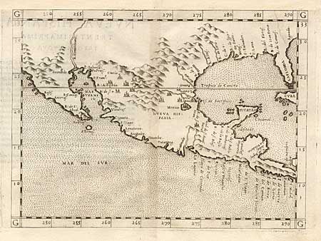
Auction 98, Lot 101
Subject: Colonial Mexico and Southwest
Ruscelli, Girolamo
Nueva Hispania Tabula Nova, 1561
Size: 9.7 x 7.2 inches (24.6 x 18.3 cm)
Estimate: $850 - $950
Sold for: $800
Closed on 3/6/2002
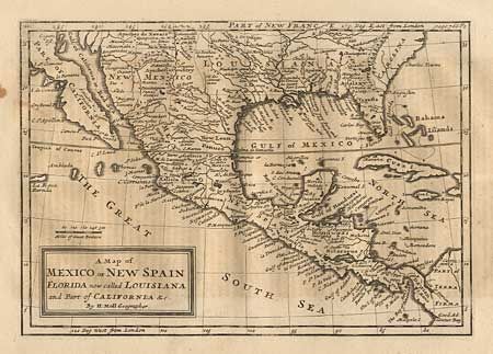
Auction 98, Lot 102
Subject: Colonial Mexico and Southwest
Moll, Herman
A Map of Mexico or New Spain Florida now called Louisiana and Part of California &c., 1745
Size: 10 x 7 inches (25.4 x 17.8 cm)
Estimate: $350 - $400
Sold for: $375
Closed on 3/6/2002
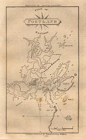
Auction 98, Lot 112
Subject: Canada & United States
Blunt, Edmund
[Lot of 3 plans] Plan of Portland Harbour [and] Isle of Sable [and] [Untitled - Newport, RI], 1833
Size: See Description
Estimate: $80 - $120
Sold for: $90
Closed on 3/6/2002
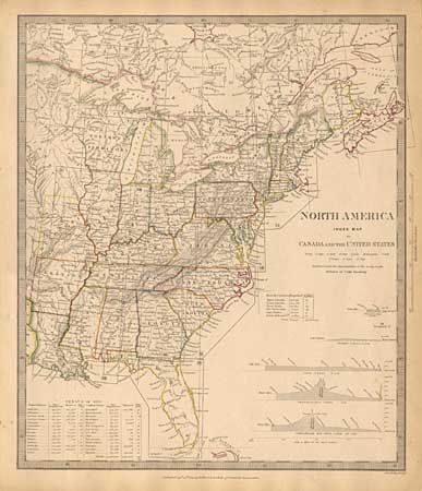
Auction 98, Lot 113
Subject: Eastern United States and Canada
SDUK Society for the Diffusion of Useful Knowledge
North America Index Map to Canada and the United States, 1834
Size: 12.4 x 14.5 inches (31.5 x 36.8 cm)
Estimate: $80 - $100
Sold for: $110
Closed on 3/6/2002
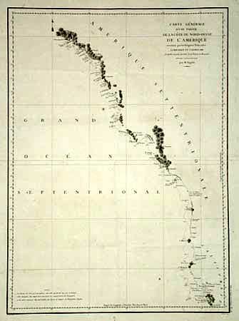
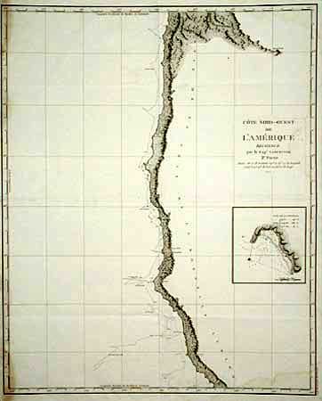
Auction 98, Lot 114
Subject: West Coast
La Perouse, Comte Jean F. Galoup, de
Carte Generale d'une Partie de la Cote du Nord-Ouest de l'Amerique reconnue par les Fregates Francaises la Boussole et l'Astrolabe, 1797
Size: 19.3 x 26.6 inches (49 x 67.6 cm)
Estimate: $300 - $350
Sold for: $220
Closed on 3/6/2002
Auction 98, Lot 115
Subject: Western Canada and United States
Anon.
Abtheilung V. Britisch Nord-America. II Blatt, 1848
Size: 15 x 18.5 inches (38.1 x 47 cm)
Estimate: $150 - $200
Sold for: $140
Closed on 3/6/2002
Auction 98, Lot 116
Subject: Canada and Alaska
Robert de Vaugondy, Didier
Partie de la Carte du Capitaine Cluny Auteur d'un ouvrage anglois intitule American Traveller, 1772
Size: 19.4 x 11.5 inches (49.3 x 29.2 cm)
Estimate: $200 - $250
Sold for: $180
Closed on 3/6/2002
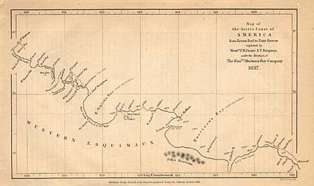
Auction 98, Lot 117
Subject: Canada and Alaska
Royal Geographical Society
Map of the Arctic Coast of America from return Reef to Point Barrow explored by Mess.rs P.W. Dease & T. Simpson under the direction of the Hon.ble Hudson's Bay Company, 1838
Size: 7.8 x 4.5 inches (19.8 x 11.4 cm)
Estimate: $50 - $60
Sold for: $35
Closed on 3/6/2002
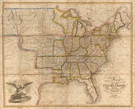
Auction 98, Lot 118
Subject: United States
Merchant, G.W.
Map of the United States Drawn from the most approved Surveys, 1826
Size: 20 x 16.2 inches (50.8 x 41.1 cm)
Estimate: $600 - $800
Sold for: $900
Closed on 3/6/2002
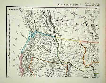
Auction 98, Lot 119
Subject: United States
Flemming, Carl
Vereinigte Staaten von Nord Amerika, 1850-55
Size: 27 x 21.5 inches (68.6 x 54.6 cm)
Estimate: $400 - $450
Sold for: $300
Closed on 3/6/2002
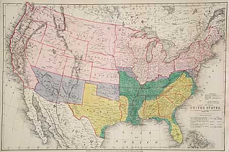
Auction 98, Lot 120
Subject: United States
Bacon, G. W. & Company
Map of the United States, Showing the Territory in Possession of the Federal Union, January 1864, 1864
Size: 26.2 x 17.2 inches (66.5 x 43.7 cm)
Estimate: $60 - $80
Sold for: $140
Closed on 3/6/2002
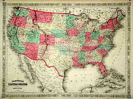
Auction 98, Lot 121
Subject: United States
Johnson and Ward
Johnson's United States, 1864
Size: 23.2 x 17 inches (58.9 x 43.2 cm)
Estimate: $60 - $80
Sold for: $160
Closed on 3/6/2002
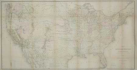
Auction 98, Lot 122
Subject: United States
General Land Office
Map of the United States and Territories Showing the extent of Public Surveys and other details constructed from the Plats and official sources of the General Land Office…, 1867
Size: 54.5 x 28.2 inches (138.4 x 71.6 cm)
Estimate: $300 - $400
Sold for: $375
Closed on 3/6/2002
Auction 98, Lot 123
Subject: United States
Gray
[Lot of 4 thematic maps], 1873
Size: See Description
Estimate: $80 - $100
Sold for: $220
Closed on 3/6/2002
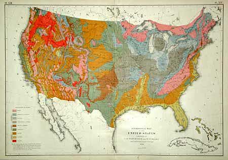
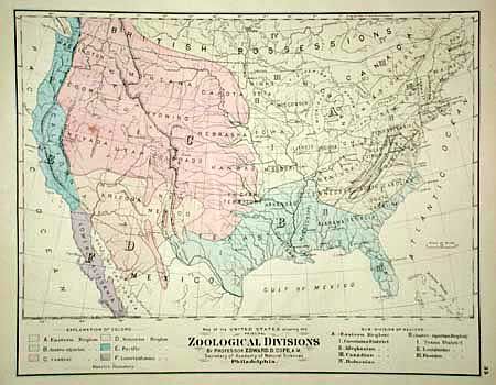
Auction 98, Lot 124
Subject: United States
Hitchcock, Charles Henry
Geological Map of the United States compiled by C.H. Hitchcock and W.P. Blake…, 1874
Size: 28 x 19.7 inches (71.1 x 50 cm)
Estimate: $200 - $250
Sold for: $750
Closed on 3/6/2002
Auction 98, Lot 125
Subject: United States
Perthes, Justus
[Set of 6 Maps] Die Vereinigten Staten von Nord-Amerika in 6 Blattern, 1877
Size: 16 x 12.8 inches (40.6 x 32.5 cm)
Estimate: $250 - $300
Sold for: $230
Closed on 3/6/2002
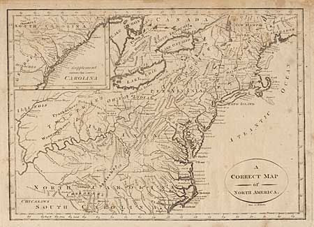
Auction 98, Lot 126
Subject: United States - Eastern
Wooten, Joseph
A Correct Map of North America, 1808
Size: 11.5 x 8.3 inches (29.2 x 21.1 cm)
Estimate: $200 - $250
Sold for: $170
Closed on 3/6/2002
Auction 98, Lot 127
Subject: United States - Southern
Blunt, Edmund
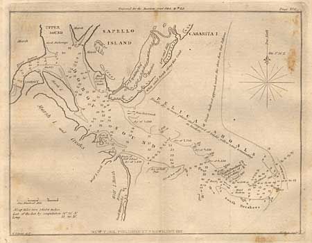
[Lot of 3 charts] Savannah River [and] [Untitled - Doboy Sound] [and] Pensacola Harbour, 1833
Size: See Description
Estimate: $80 - $100
Sold for: $90
Closed on 3/6/2002
Auction 98, Lot 128
Subject: United States - Southern
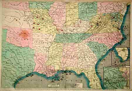
Colton, George Woolworth
Pictorial History of the War of 1861, 1861
Size: 29.5 x 20.5 inches (74.9 x 52.1 cm)
Estimate: $200 - $250
Sold for: $100
Closed on 3/6/2002

Auction 98, Lot 129
Subject: Southcentral United States
U.S. War Department
Map of United States Military Rail Roads, Showing the Rail Roads Operated during the War from 1862-1866, as Military Lines under the Direction of Bvt. Brig. Gen. B.C. McCallum, Director and General Manager, 1866
Size: 38.2 x 25 inches (97 x 63.5 cm)
Estimate: $300 - $350
Unsold
Closed on 3/6/2002
Auction 98, Lot 130
Subject: Central United States
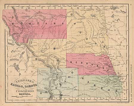
McNally, Francis
Nebraska, Kansas, Dakota Colorado and Montana, 1865
Size: 10.5 x 8.5 inches (26.7 x 21.6 cm)
Estimate: $50 - $60
Sold for: $65
Closed on 3/6/2002
Auction 98, Lot 131
Subject: Central United States
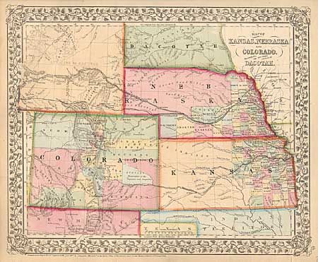
Mitchell, Samuel Augustus
Map of Kansas, Nebraska and Colorado, Showing also the Southern Portion of Dacotah, 1867
Size: 14 x 11.5 inches (35.6 x 29.2 cm)
Estimate: $100 - $120
Sold for: $140
Closed on 3/6/2002
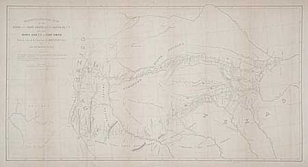
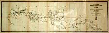
Auction 98, Lot 132
Subject: United States - Southwestern
Marcy, Capt. R.B.
Topographical Map of the Road from Fort Smith, Arks. to Santa Fe, N.M. and from Dona Ana N.M. to Fort Smith, 1852
Size: 28 x 14.7 inches (71.1 x 37.3 cm)
Estimate: $300 - $350
Sold for: $150
Closed on 3/6/2002
Auction 98, Lot 133
Subject: Western and Midwest
U.S. War Department
[Great Plains: Fort Leavenworth to Santa Fe], 1860
Size: 17.5 x 10 inches (44.5 x 25.4 cm)
Estimate: $150 - $250
Sold for: $275
Closed on 3/6/2002
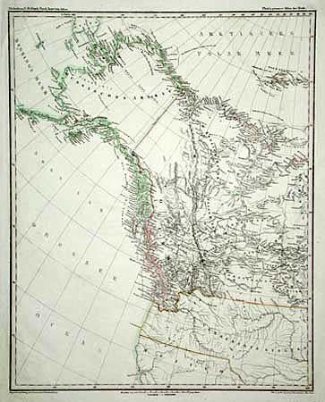
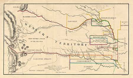
Auction 98, Lot 134
Subject: Western United States
Abert/Hood
Map of the United States Territory of Oregon West of the Rocky Mountains Exhibiting the vaious Trading Depots or Forts occupied by the British Hudson Bay Company connected with the Western and Northwestern Fur Trade, 1838
Size: 20.5 x 17.3 inches (52.1 x 43.9 cm)
Estimate: $350 - $400
Sold for: $850
Closed on 3/6/2002
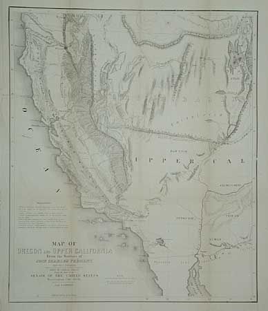
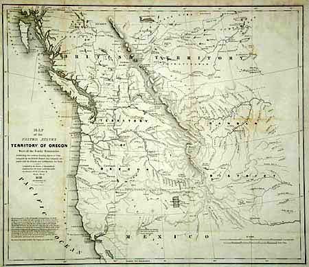
Auction 98, Lot 135
Subject: Western United States
Fremont/Preuss
Map of Oregon and Upper California from the Surveys of John Charles Fremont and other Authorities, 1848
Size: 16.5 x 19.5 inches (41.9 x 49.5 cm)
Estimate: $350 - $400
Sold for: $275
Closed on 3/6/2002
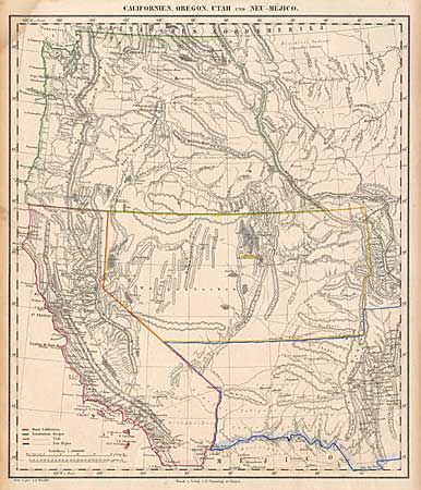
Auction 98, Lot 136
Subject: Western United States
Flemming, Carl
Californien, Oregon, Utah und Neu-Mejico, 1850-55
Size: 12.5 x 15.5 inches (31.8 x 39.4 cm)
Estimate: $275 - $325
Sold for: $170
Closed on 3/6/2002
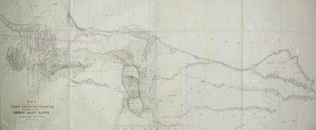
Auction 98, Lot 137
Subject: Western United States
Stansbury, M. Howard (Capt.)
Map of a Reconnaissance between Fort Leavenworth on the Missouri River, and the Great Salt Lake in the Territory of Utah, made in 1849 and 1850…, 1852
Size: 66 x 28 inches (167.6 x 71.1 cm)
Estimate: $400 - $500
Sold for: $300
Closed on 3/6/2002
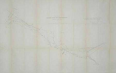
Auction 98, Lot 138
Subject: Western United States
U.S. Railroad Surveys
[Set of 3 railroad maps], 1853
Size: See Description
Estimate: $300 - $400
Sold for: $375
Closed on 3/6/2002
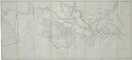
Auction 98, Lot 139
Subject: Northwestern United States
U.S. Railroad Surveys
Milk R. to the Crossing of the Columbia R…, 1855
Size: 61 x 24 inches (154.9 x 61 cm)
Estimate: $150 - $200
Sold for: $160
Closed on 3/6/2002
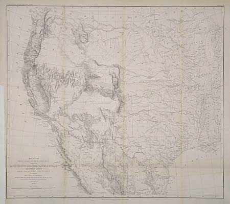
Auction 98, Lot 140
Subject: Western United States and Mexico
Emory, William Hemsley
Map of the United States and Their Territories Between the Mississippi and the Pacific Ocean and Part of Mexico Compiled from Surveys…, 1857-8
Size: 22.8 x 20.3 inches (57.9 x 51.6 cm)
Estimate: $300 - $350
Sold for: $325
Closed on 3/6/2002
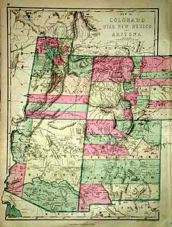
Auction 98, Lot 141
Subject: Western United States
Williams, J. David
Map of Colorado, Utah, New Mexico, and Arizona, 1870
Size: 12.3 x 17 inches (31.2 x 43.2 cm)
Estimate: $100 - $140
Sold for: $100
Closed on 3/6/2002
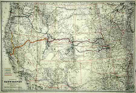
Auction 98, Lot 142
Subject: Western United States
Colton, G.W. & C.B.
Map Showing the Pacific Railways and Their Branches Prepared for the United States Pacific Railway Commission, 1887
Size: 33 x 22.5 inches (83.8 x 57.2 cm)
Estimate: $250 - $300
Sold for: $325
Closed on 3/6/2002
Auction 98, Lot 143
Subject: Southwestern United States
U.S. Army
Outline Map showing a New Route from Texas to Fort Yuma, California, for Cattle Droves and Trains En route to California, 1867
Size: 49 x 14.5 inches (124.5 x 36.8 cm)
Estimate: $150 - $200
Sold for: $325
Closed on 3/6/2002
Auction 98, Lot 144
Subject: West Coast - California and Oregon
Vancouver, George (Capt)
Cote Nord-Ouest de l'Amerique Reconnue par le Cap.e Vancouver. 2e. Partie, 1799
Size: 24 x 29.7 inches (61 x 75.4 cm)
Estimate: $550 - $600
Sold for: $400
Closed on 3/6/2002
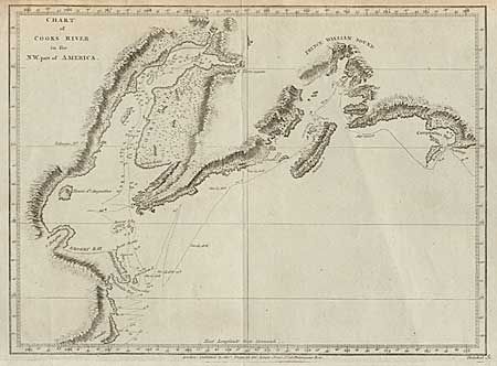
Auction 98, Lot 145
Subject: Alaska
Cook/Hogg
Chart of Cooks River in the N.W. part of America, 1779
Size: 11.7 x 8.5 inches (29.7 x 21.6 cm)
Estimate: $75 - $100
Sold for: $110
Closed on 3/6/2002
135 lots
Page 1 of 3