Subject: Colonial Carolina
Period: 1672 (circa)
Publication:
Color: Black & White
Size:
21.2 x 16.2 inches
53.8 x 41.1 cm
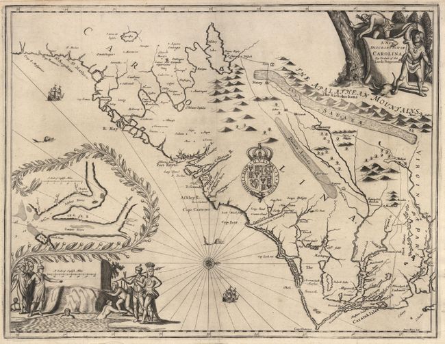
This landmark map is known as the First Lords Proprietors Map. Drawn and engraved by James Moxon and published both in Ogilby's America and in a promotional tract by Samuel Wilson (the proprietor's secretary) titled Account of the Province of Carolina. This map is based on a number of early accounts including Lederer, Hilton, Sandford, Ashley-Cooper and Culpeper. Much of the nomenclature is heavily interspersed with names of the Lords Proprietors. It was chiefly through this popular map that Lederer's misconceptions became quickly disseminated and so widely copied. It is the basis of Franicis Lamb's map published in the final edition of Speed's Prospect…. The finely engraved map is oriented with north to the right and is splendidly embellished with a title cartouche featuring two Native Americans, the distance scale surrounded by a group of natives, a decorative inset of Charles Town and vicinity, the arms of Charles II, a compass rose, ships and sea monsters.
References: Cumming (SE) #70.
Condition: A
Superb impression with faint toning along fold and a small expert repair at fold intersection.