Catalog Archive
Auction 98, Lot 122

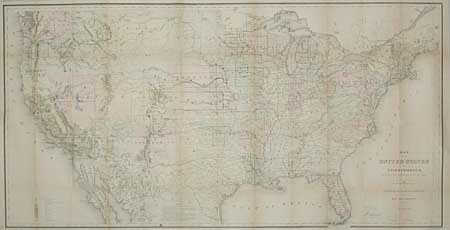
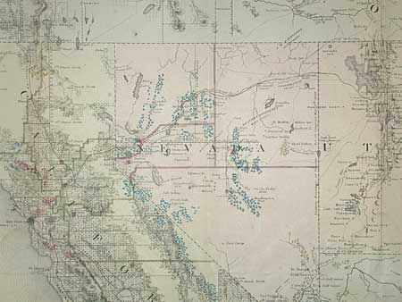
"Map of the United States and Territories Showing the extent of Public Surveys and other details constructed from the Plats and official sources of the General Land Office…", General Land Office

Subject: United States

Period: 1867 (dated)

Publication:

Color: Hand Color

Size:
54.5 x 28.2 inches
138.4 x 71.6 cm
Download High Resolution Image
(or just click on image to launch the Zoom viewer)

This map, in full original hand color, is one of the more remarkable maps produced by General Land Office. It shows the extent of the Public Surveys in 1868 and many items of great interest. Most significant are the gold, silver, copper, and other mineral deposits that are color-coded to mark their location. The sites of army forts and posts provide an excellent view of the undeveloped territories and the western frontier. Details include land grants, townships, subdivisions, railroads, mining districts & etc. Present-day Wyoming is shown as part of the Dakota Territory. Constructed from Plats and Official Sources of the General Land Office under the direction of Hon. J.S. Wilson, Commissioner, by Joseph Gorlinski.

References: Wheat [TMW] 1168.

Condition: B

Backed with Japanese tissue. Toned along folds.

Estimate: $300 - $400

Sold for: $375

Closed on 3/6/2002

Archived