Catalog Archive
Auction 98, Lot 120

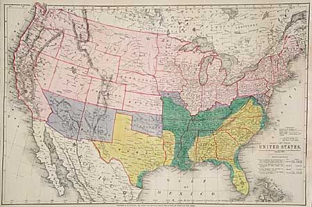
"Map of the United States, Showing the Territory in Possession of the Federal Union, January 1864", Bacon, G. W. & Company

Subject: United States

Period: 1864 (dated)

Publication:

Color: Printed Color

Size:
26.2 x 17.2 inches
66.5 x 43.7 cm
Download High Resolution Image
(or just click on image to launch the Zoom viewer)

An unusual Civil War map with several interesting features. An 'explanation' gives information on territorial claims, both by the Confederate States and the Federal Union, including areas reclaimed from the Rebellion. Also gives the square miles and populations, all color-coded to the map. Several Western Territorial boundaries are incorrect. Good detail of railroads.

References:

Condition: A

Strong, bright color. Remargined right side to compensate for binder's close trim, else very good.

Estimate: $60 - $80

Sold for: $140

Closed on 3/6/2002

Archived