Subject: United States
Period: 1850-55 (circa)
Publication: Handatlas
Color: Hand Color
Size:
27 x 21.5 inches
68.6 x 54.6 cm
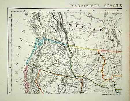
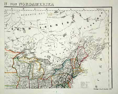
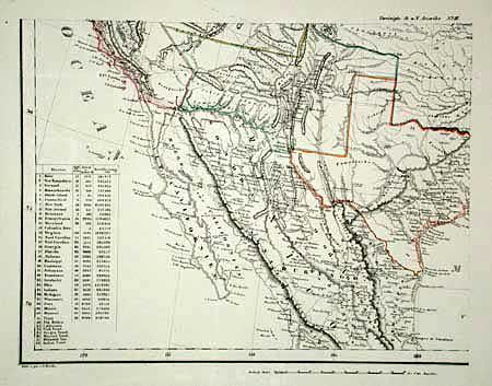
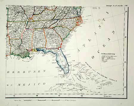
Four sheets make up this map of the United States and provide an excellent view, particularly of the American West. The panhandle of Texas is shown extending extending to its furthest northern point in present-day Colorado. Indian Territory occupies most of the central plains incorporating present-day Oklahoma, Kansas, Colorado and southern Wyoming. Minnesota Territory extends west to the Missouri and Nebraska Territory runs to Canada and the Rockies. A key shows the states & territories, with populations, number of counties & size. The combined size of all four plates would be 27 x 21.5" if joined.
References:
Condition: A
Minor foxing in margins.