Filtered by Category:United States(Show All Categories)
Showing results for:Auction 180
Catalog Archive
218 lots
Page 1 of 5
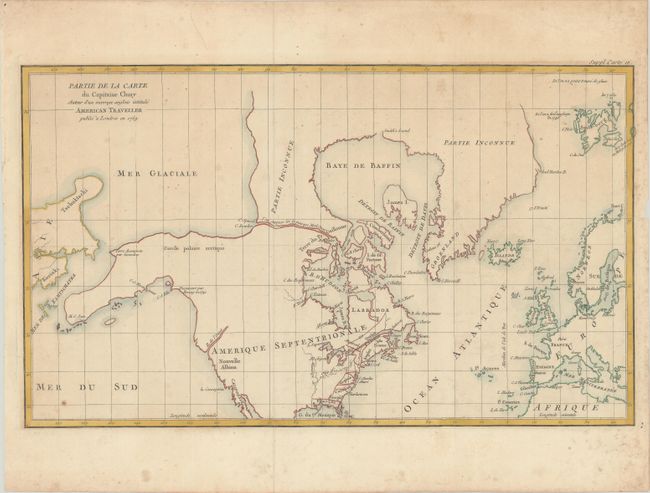
Auction 180, Lot 103
Subject: Colonial United States & Canada, Arctic
Robert de Vaugondy, Didier
Partie de la Carte du Capitaine Cluny Auteur d'un Ouvrage Anglois Intitule American Traveller Publie a Londres en 1769, 1773
Size: 19.4 x 11.5 inches (49.3 x 29.2 cm)
Estimate: $140 - $170
Sold for: $100
Closed on 11/18/2020
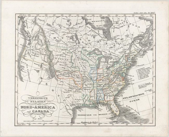
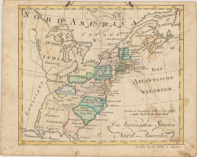
Auction 180, Lot 104
Subject: United States & Canada
Stieler, Adolph
Vereinigte Staaten von Nord-America und Canada, 1840
Size: 9.4 x 7.5 inches (23.9 x 19.1 cm)
Estimate: $150 - $180
Sold for: $110
Closed on 11/18/2020
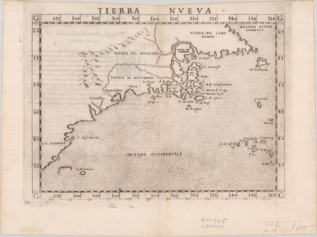
Auction 180, Lot 105
Subject: Eastern United States & Canada
Ruscelli, Girolamo
Tierra Nueva, 1562
Size: 9.6 x 7.1 inches (24.4 x 18 cm)
Estimate: $1,200 - $1,500
First State of Ruscelli's Map of the East Coast
Sold for: $850
Closed on 11/18/2020
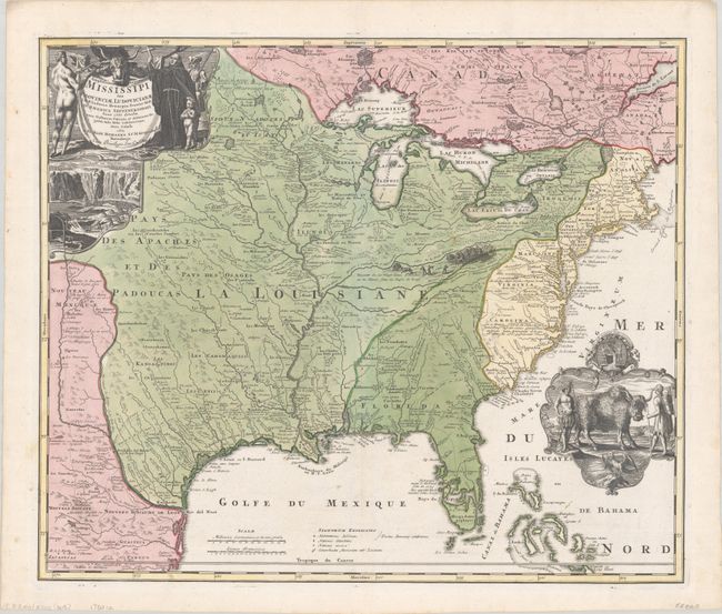
Auction 180, Lot 106
Subject: Colonial Eastern United States & Canada
Homann, Johann Baptist
Amplissimae Regionis Mississipi seu Provinciae Ludovicianae a R.P. Ludovico Hennepin Francisc Miss in America Septentrionali Anno 1687..., 1720
Size: 22.6 x 19.1 inches (57.4 x 48.5 cm)
Estimate: $2,200 - $2,500
Striking Map of Colonial America with Buffalo Vignette
Sold for: $2,750
Closed on 11/18/2020
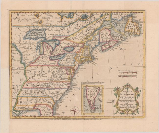
Auction 180, Lot 107
Subject: Colonial Eastern United States & Canada
Kitchin, Thomas
A New Map of the British Dominions in North America; with the Limits of the Governments Annexed Thereto by the Late Treaty of Peace, and Settled by Proclamation, October 7th, 1763, 1763
Size: 11.9 x 9.6 inches (30.2 x 24.4 cm)
Estimate: $475 - $600
Sold for: $500
Closed on 11/18/2020
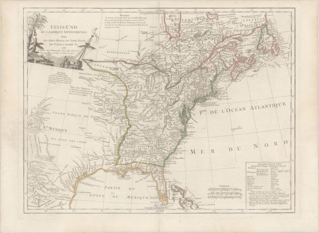
Auction 180, Lot 108
Subject: Eastern United States & Canada
Delamarche, Charles Francois
Etats-Unis de l'Amerique Septentrionale avec les Isles Royale, de Terre Neuve, de St. Jean, l'Acadie &c., 1785
Size: 24.6 x 18.6 inches (62.5 x 47.2 cm)
Estimate: $950 - $1,200
First Reference to Michigan as a Land Division of the United States
Sold for: $700
Closed on 11/18/2020
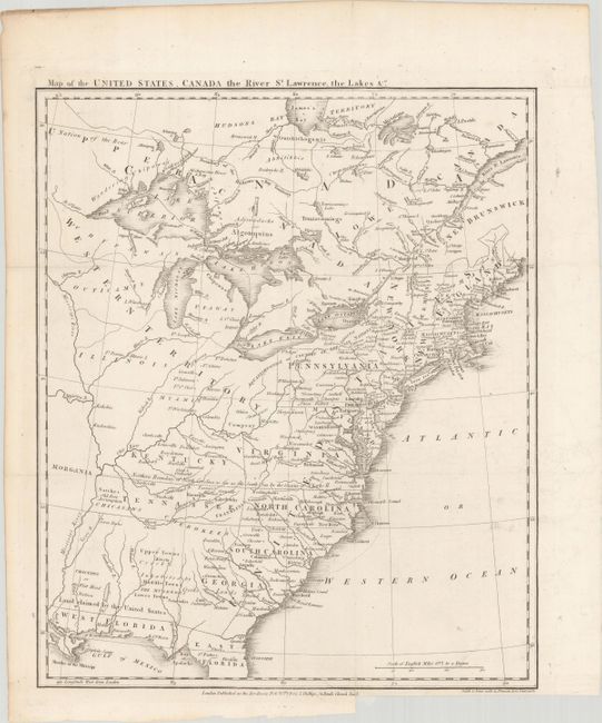
Auction 180, Lot 109
Subject: Eastern United States & Canada, Franklin
Phillips, Richard (Sir)
Map of the United States, Canada the River St. Lawrence, the Lakes &c., 1801
Size: 13.4 x 16 inches (34 x 40.6 cm)
Estimate: $1,400 - $1,700
Features the Short-Lived Franklinia and Morgania
Sold for: $1,000
Closed on 11/18/2020
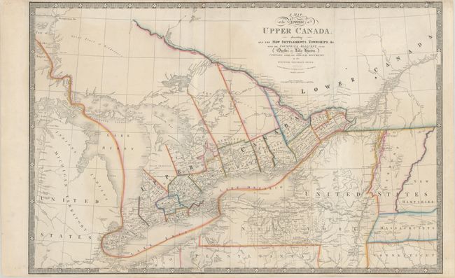
Auction 180, Lot 110
Subject: Eastern United States & Canada
Wyld, James
A Map of the Province of Upper Canada, Describing All the New Settlements, Townships, &c. with the Countries Adjacent, from Quebec to Lake Huron..., 1850
Size: 34.3 x 22.5 inches (87.1 x 57.2 cm)
Estimate: $325 - $400
Sold for: $325
Closed on 11/18/2020
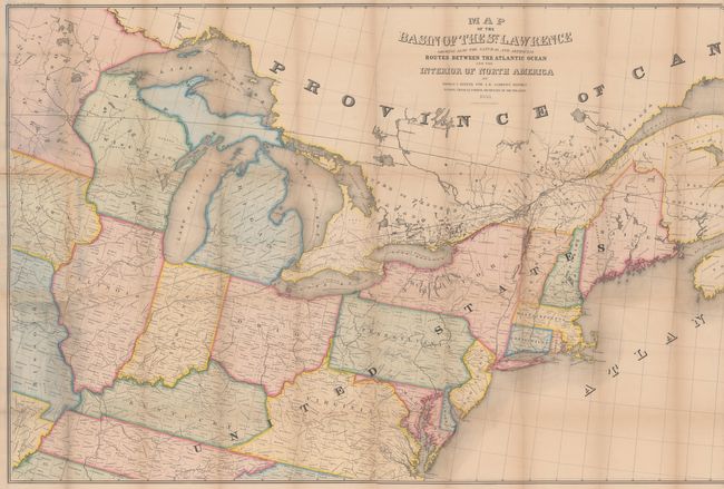
Auction 180, Lot 111
Subject: Eastern United States & Canada
Andrews, Israel D.
Map of the Basin of the St. Lawrence Showing Also the Natural and Artificial Routes Between the Atlantic Ocean and Interior of North America, 1853
Size: 76.8 x 34.4 inches (195.1 x 87.4 cm)
Estimate: $240 - $300
Sold for: $150
Closed on 11/18/2020
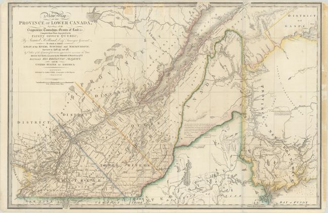
Auction 180, Lot 112
Subject: Maine & Eastern Canada
Wyld, James
A New Map of the Province of Lower Canada, Describing All the Seigneuries, Townships, Grants of Land, &c. Compiled from Plans Deposited in the Patent Office Quebec; by Samuel Holland, Esq. Surveyor General…, 1838
Size: 34.2 x 22.7 inches (86.9 x 57.7 cm)
Estimate: $475 - $600
Unsold
Closed on 11/18/2020
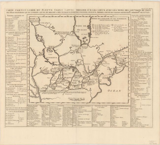
Auction 180, Lot 113
Subject: Colonial Northeastern United States & Canada, Great Lakes
Chatelain, Henry Abraham
Carte Particuliere du Fleuve Saint Louis Dressee sur les Lieux avec les Noms des Sauvages du Pais..., 1720
Size: 17.8 x 14.4 inches (45.2 x 36.6 cm)
Estimate: $600 - $750
Sold for: $550
Closed on 11/18/2020
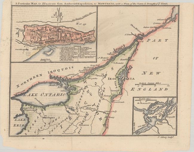
Auction 180, Lot 114
Subject: Colonial Northeastern United States & Canada, Montreal
Gibson, John
A Particular Map, to Illustrate Gen. Amherst's Expedition, to Montreal; with a Plan of the Town & Draught of ye Island, 1760
Size: 8.9 x 7 inches (22.6 x 17.8 cm)
Estimate: $140 - $170
Sold for: $130
Closed on 11/18/2020
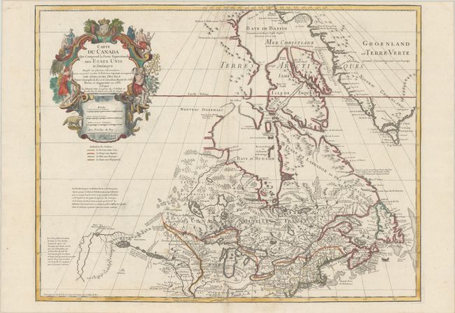
Auction 180, Lot 115
Subject: Colonial Northeastern United States & Canada, Great Lakes
Delisle/Dezauche
Carte du Canada qui Comprend la Partie Septentrionale des Etats Unis d'Amerique Dressee sur Plusieurs Observations et sur un Grand Nombre de Relations Imprimees ou Manuscrites..., 1783
Size: 25.6 x 19.8 inches (65 x 50.3 cm)
Estimate: $700 - $850
Sold for: $400
Closed on 11/18/2020
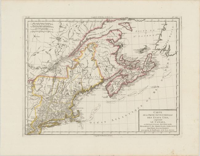
Auction 180, Lot 116
Subject: Northeastern United States & Canada
Tardieu
Carte de la Partie Septentrionale des Etats-Unis, Comprenant le Canada, la Nouvelle Ecosse, New Hampshire, Massachuset's Bay, Rhode-Island, Connecticut, New-Yorck, Etat de Vermont..., 1798
Size: 16.8 x 12.8 inches (42.7 x 32.5 cm)
Estimate: $160 - $190
Sold for: $120
Closed on 11/18/2020
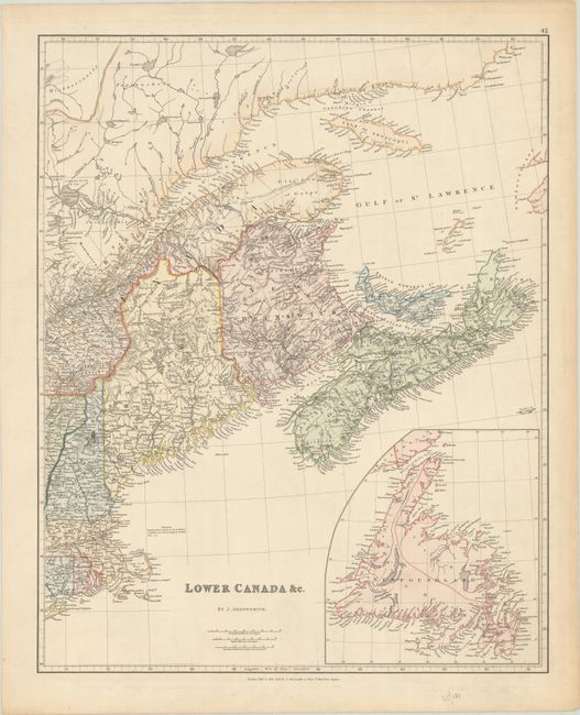
Auction 180, Lot 117
Subject: Northeastern United States & Canada
Arrowsmith, John
Lower Canada &c., 1834
Size: 19 x 23.6 inches (48.3 x 59.9 cm)
Estimate: $200 - $230
Sold for: $100
Closed on 11/18/2020
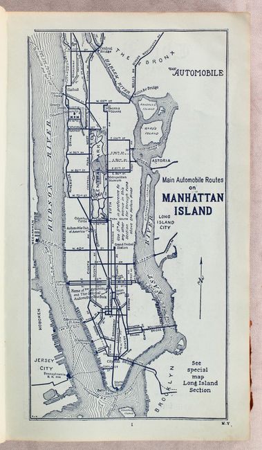
Auction 180, Lot 118
Subject: Northeastern United States & Canada
American Automobile Assoc.
[Lot of 2] The Automobile Official AAA 1906 Blue Book... [and] The Automobile Official AAA 1907 Blue Book..., 1906-07
Size: 5.5 x 9.5 inches (14 x 24.1 cm)
Estimate: $200 - $250
Earliest AAA Automobile Blue Books
Sold for: $200
Closed on 11/18/2020
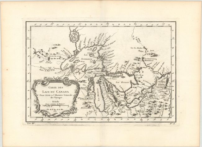
Auction 180, Lot 119
Subject: Colonial Central United States & Canada, Great Lakes
Bellin, Jacques Nicolas
Carte des Lacs du Canada pour Servir a l'Histoire Generale des Voyages, 1757
Size: 11.4 x 7.6 inches (29 x 19.3 cm)
Estimate: $350 - $425
Sold for: $250
Closed on 11/18/2020
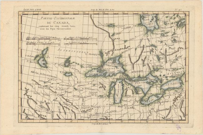
Auction 180, Lot 120
Subject: Colonial Great Lakes
Bonne, Rigobert
Partie Occidentale du Canada, Contenant les Cinq Grands Lacs, avec les Pays Circonvoisins, 1790
Size: 12.5 x 8.3 inches (31.8 x 21.1 cm)
Estimate: $200 - $230
Sold for: $190
Closed on 11/18/2020
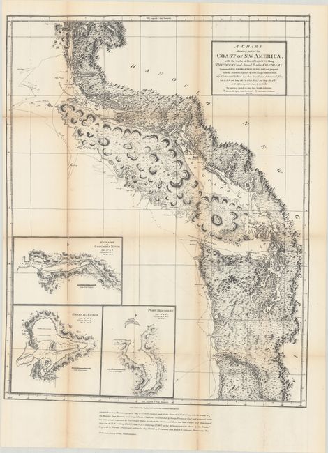
Auction 180, Lot 121
Subject: Northwestern United States & Canada
Vancouver, George (Capt)
A Chart Shewing Part of the Coast of N.W. America, with the Tracks of His Majesty’s Sloop Discovery and Armed Tender Chatham..., 1872
Size: 21.8 x 27.9 inches (55.4 x 70.9 cm)
Estimate: $160 - $190
Sold for: $130
Closed on 11/18/2020
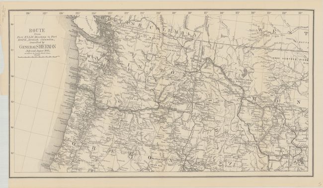
Auction 180, Lot 122
Subject: Northwestern United States & British Columbia
U.S. Government
Route from Fort Ellis Montana to Fort Hope, British Columbia, Travelled by General Sherman July and August 1883, as Shown by Heavy Black Line, 1883
Size: 27.4 x 15.2 inches (69.6 x 38.6 cm)
Estimate: $300 - $375
Sold for: $150
Closed on 11/18/2020
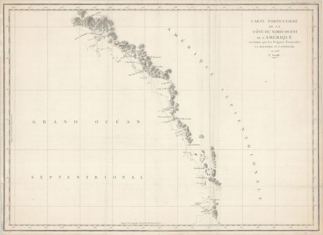
Auction 180, Lot 123
Subject: Western Canada & Alaska
La Perouse, Comte Jean F. Galoup, de
Carte Particuliere de la Cote du Nord-Ouest de l'Amerique Reconnue par les Fregates Francaises la Boussole et l'Astrolabe en 1786. 1e. Feuille, 1797
Size: 27.3 x 19.6 inches (69.3 x 49.8 cm)
Estimate: $180 - $210
Unsold
Closed on 11/18/2020
Auction 180, Lot 124
Subject: United States
[Lot of 2] Die Vereinigten Staaten von Nord-Amerika [and] Die Vereinigten Staaten von Nord America, 1795-1829
Size: See Description
Estimate: $275 - $350
Sold for: $200
Closed on 11/18/2020

Auction 180, Lot 125
Subject: United States
Map of the United States [in] A Moral and Political Sketch of the United States of North America, 1833
Size: 14.3 x 11.7 inches (36.3 x 29.7 cm)
Estimate: $400 - $475
Sold for: $300
Closed on 11/18/2020
Auction 180, Lot 126
Subject: United States, Texas
Flemming, Carl
Vereinigte Staaten von Nord-America, 1844
Size: 16.1 x 12.6 inches (40.9 x 32 cm)
Estimate: $200 - $230
Sold for: $150
Closed on 11/18/2020
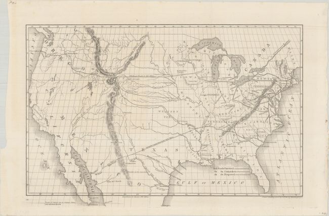
Auction 180, Lot 127
Subject: United States, Railroads
Throop, O. H.
[Untitled - Map of Proposed Routes of Western Railroads], 1846
Size: 15.5 x 10.3 inches (39.4 x 26.2 cm)
Estimate: $160 - $190
Sold for: $120
Closed on 11/18/2020
Auction 180, Lot 128
Subject: United States
Colton, Joseph Hutchins
The United States of America, 1855
Size: 26.3 x 15.5 inches (66.8 x 39.4 cm)
Estimate: $400 - $500
Sold for: $300
Closed on 11/18/2020
Auction 180, Lot 129
Subject: United States
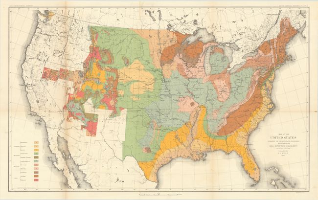
[Lot of 2] Map of the United States Exhibiting the Present Status of Knowledge Relating to the Areal Distribution of Geologic Groups... [and] Map of the United States and Territories to Accompany Annual Report of Honorable Wm. A. J. Sparks..., 1884-85
Size: See Description
Estimate: $200 - $230
Includes the First Published Geological Map of the United States by the U.S.G.S.
Sold for: $130
Closed on 11/18/2020
Auction 180, Lot 130
Subject: United States
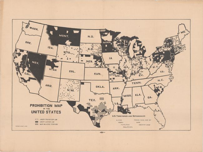
Prohibition Map of the United States, 1915
Size: 21.3 x 13.2 inches (54.1 x 33.5 cm)
Estimate: $300 - $400
Rare Map Issued 5 Years Before the Prohibition Amendment Passed
Sold for: $325
Closed on 11/18/2020
Auction 180, Lot 131
Subject: United States
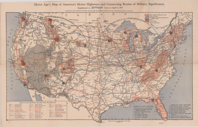
Motor Age's Map of America's Motor Highways and Connecting Routes of Military Significance..., 1917
Size: 26.5 x 16.3 inches (67.3 x 41.4 cm)
Estimate: $160 - $190
Sold for: $120
Closed on 11/18/2020
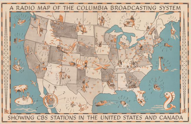
Auction 180, Lot 132
Subject: United States, Radio
[Lot of 2] Radio Map of the Columbia Broadcasting Stations in the United States and Canada [and] Radio Tours Radio Stations Map of the United States Canada and Mexico Showing at a Glance Location, Call Letters and Frequency of All Stations, 1933-35
Size: See Description
Estimate: $160 - $190
Sold for: $120
Closed on 11/18/2020
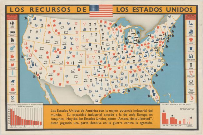
Auction 180, Lot 133
Subject: United States, World War II
Anon.
Los Recursos de los Estados Unidos, 1940
Size: 28.4 x 18.6 inches (72.1 x 47.2 cm)
Estimate: $600 - $800
Sold for: $375
Closed on 11/18/2020
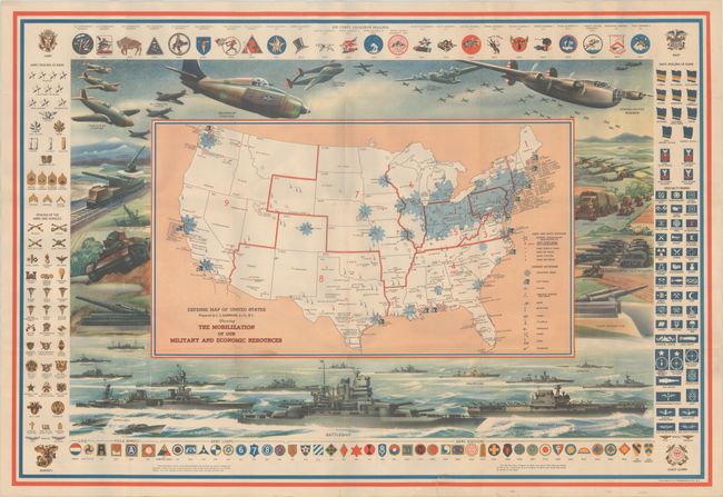
Auction 180, Lot 134
Subject: United States, World War II
Hammond, C. S.
Defense Map of United States Prepared by C.S. Hammond & Co. N.Y. Showing the Mobilization of Our Military and Economic Resources, 1941
Size: 31 x 21.1 inches (78.7 x 53.6 cm)
Estimate: $350 - $425
Sold for: $350
Closed on 11/18/2020
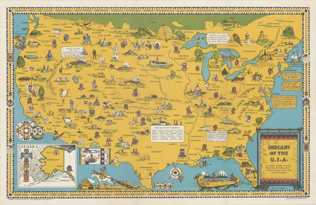
Auction 180, Lot 135
Subject: United States, Indians
Indians of the U.S.A., 1944
Size: 33.1 x 20.9 inches (84.1 x 53.1 cm)
Estimate: $275 - $350
Sold for: $1,600
Closed on 11/18/2020
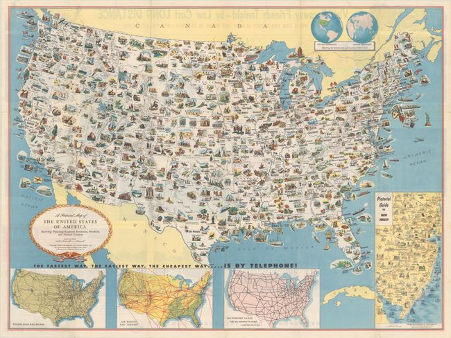
Auction 180, Lot 136
Subject: United States
[Lot of 2] A Pictorial Map of the United States of America Showing Principal Regional Resources, Products, and Natural Features [and] The United States - The Land and the People, 1953-58
Size: See Description
Estimate: $200 - $250
Sold for: $275
Closed on 11/18/2020
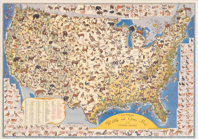
Auction 180, Lot 137
Subject: United States
Pictorial Wildlife and Game Map of the United States, 1956
Size: 26.8 x 18.8 inches (68.1 x 47.8 cm)
Estimate: $160 - $190
Sold for: $550
Closed on 11/18/2020
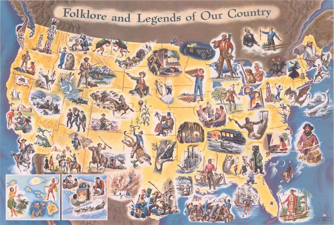
Auction 180, Lot 138
Subject: United States
Folklore and Legends of Our Country, 1960
Size: 35.5 x 24 inches (90.2 x 61 cm)
Estimate: $160 - $190
Sold for: $180
Closed on 11/18/2020
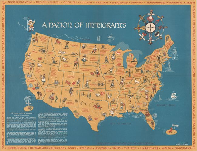
Auction 180, Lot 139
Subject: United States
A Nation of Immigrants, 1963
Size: 20.4 x 15.4 inches (51.8 x 39.1 cm)
Estimate: $600 - $800
Companion Map to John F. Kennedy's Work on Immigration
Sold for: $395
Closed on 11/18/2020
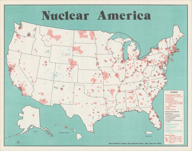
Auction 180, Lot 140
Subject: United States
Nuclear America, 1979
Size: 21.1 x 16.3 inches (53.6 x 41.4 cm)
Estimate: $150 - $180
Sold for: $190
Closed on 11/18/2020
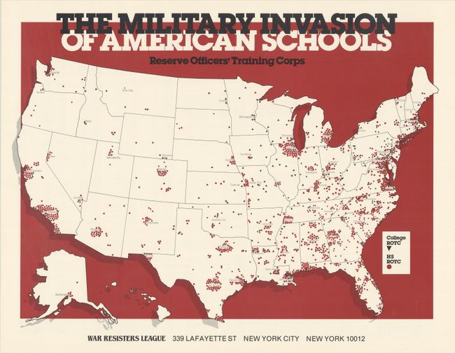
Auction 180, Lot 141
Subject: United States
The Military Invasion of American Schools - Reserve Officers' Training Corps, 1985
Size: 20.8 x 15.3 inches (52.8 x 38.9 cm)
Estimate: $150 - $180
NO RESERVE
Sold for: $80
Closed on 11/18/2020
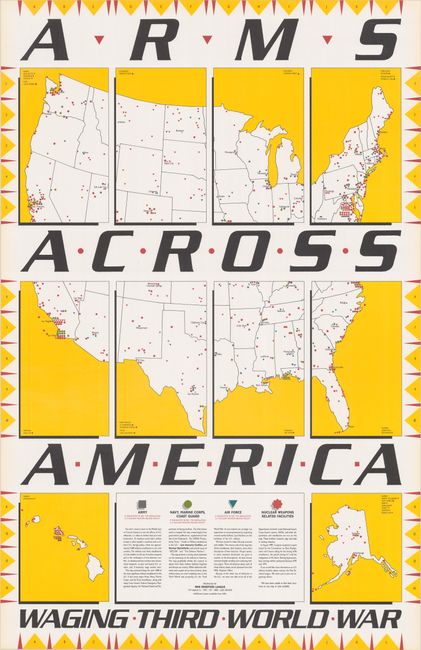
Auction 180, Lot 142
Subject: United States
Arms Across America Waging Third World War, 1989
Size: 22 x 34 inches (55.9 x 86.4 cm)
Estimate: $180 - $210
NO RESERVE
Sold for: $210
Closed on 11/18/2020
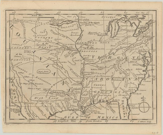
Auction 180, Lot 143
Subject: Colonial Eastern United States
Gibson, John
[Untitled - North America, Louisiana, Virginia & Carolina], 1763
Size: 9.5 x 7.1 inches (24.1 x 18 cm)
Estimate: $200 - $230
Sold for: $130
Closed on 11/18/2020
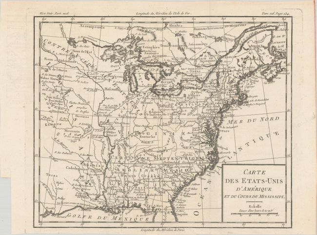
Auction 180, Lot 144
Subject: Eastern United States, Franklin
Brion de la Tour, Louis
Carte des Etats-Unis d'Amerique et du Cours du Mississipi, 1788
Size: 10.6 x 8.7 inches (26.9 x 22.1 cm)
Estimate: $900 - $1,100
One of the Earliest Maps to Feature the State of Franklin
Sold for: $650
Closed on 11/18/2020
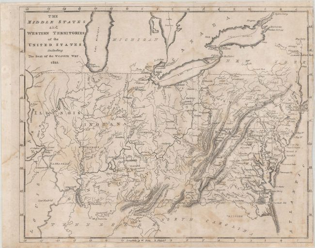
Auction 180, Lot 145
Subject: Eastern United States
Carey, Mathew
[Lot of 3] The Middle States and Western Territories of the United States Including the Seat of the Western War [and] The Eastern States with Part of Canada [and] The Southern States and Missisippi Territory, 1812
Size: 9.7 x 7.8 inches (24.6 x 19.8 cm)
Estimate: $250 - $325
Sold for: $500
Closed on 11/18/2020
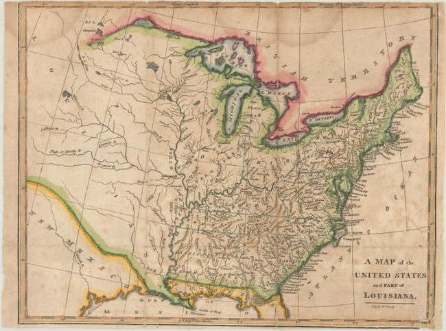
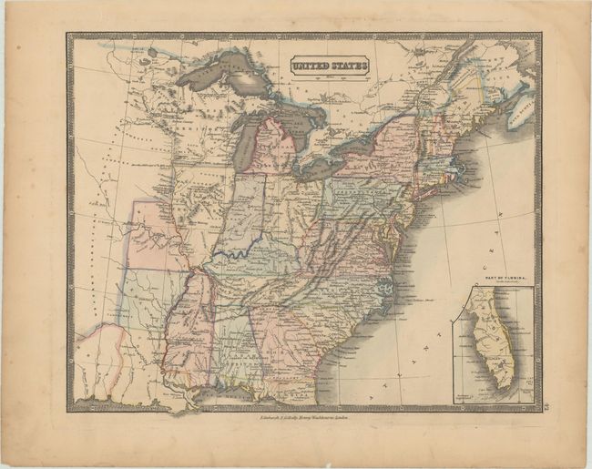
Auction 180, Lot 146
Subject: Eastern United States
Brookes, Richard
A Map of the United States and Part of Louisiana, 1812
Size: 10.6 x 8.3 inches (26.9 x 21.1 cm)
Estimate: $200 - $230
Sold for: $150
Closed on 11/18/2020
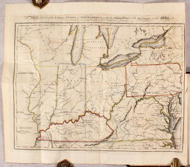
Auction 180, Lot 147
Subject: Eastern United States
Map of Part of the United States of North America, with the Territory of the Illinois on the Ohio...[bound in] Notes on a Journey in America, from the Coast of Virginia to the Territory of Illinois, 1818
Size: 16 x 12 inches (40.6 x 30.5 cm)
Estimate: $550 - $700
Sold for: $400
Closed on 11/18/2020
Auction 180, Lot 148
Subject: Eastern United States
Melish, John
United States of America, 1827
Size: 21.1 x 16.8 inches (53.6 x 42.7 cm)
Estimate: $750 - $900
Sold for: $1,300
Closed on 11/18/2020
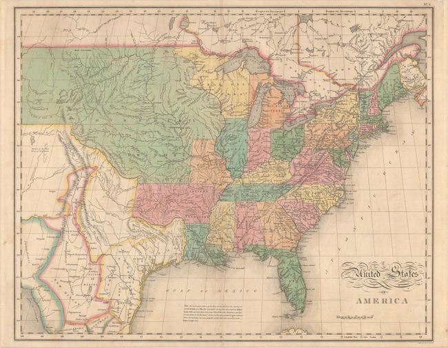
Auction 180, Lot 149
Subject: Eastern United States
Gellatly, J.
United States, 1830
Size: 13.3 x 10.8 inches (33.8 x 27.4 cm)
Estimate: $200 - $240
Sold for: $150
Closed on 11/18/2020
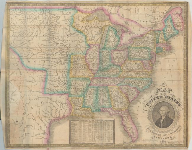
Auction 180, Lot 150
Subject: Eastern United States
Phelps, Humphrey
Map of the United States, 1836
Size: 19.8 x 16 inches (50.3 x 40.6 cm)
Estimate: $400 - $500
Sold for: $450
Closed on 11/18/2020
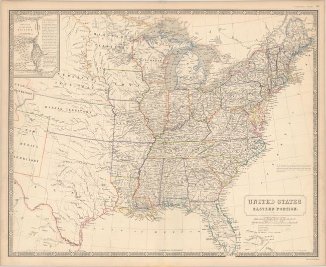
Auction 180, Lot 151
Subject: Eastern United States
Johnston, W. & A.K.
United States Eastern Portion, 1857
Size: 24.3 x 19.4 inches (61.7 x 49.3 cm)
Estimate: $300 - $400
Features An Unusual Texas Configuration
Sold for: $325
Closed on 11/18/2020
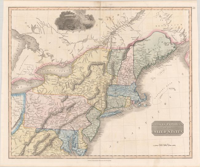
Auction 180, Lot 152
Subject: New England & Mid-Atlantic United States
Thomson, John
Northern Provinces of the United States, 1823
Size: 23.4 x 19.4 inches (59.4 x 49.3 cm)
Estimate: $240 - $300
Sold for: $180
Closed on 11/18/2020
218 lots
Page 1 of 5