Subject: Colonial Northeastern United States & Canada, Montreal
Period: 1760 (published)
Publication: Gentleman's Magazine
Color: Hand Color
Size:
8.9 x 7 inches
22.6 x 17.8 cm
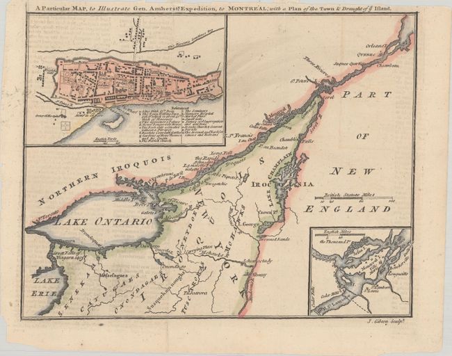
After the fall of Quebec, Montreal was the sole remaining French power center in Canada. The British general, Jeffery Amherst, occupied Fort Ticonderoga and Crown Point in the fall of 1759. He began a three-pronged offensive converging on Montreal the following spring. When Vaudreuil de Cavagnal surrendered on September 8, 1760, this ended the last major campaign of the French and Indian War. This map shows the St. Lawrence River from Quebec City to Niagara Falls, and east to include the Hudson River, Albany, and Lake Champlain. Details include Drowned Lands, Indian tribes, and several forts. An inset at lower right shows the environs of Montreal Island. At upper left, a plan of the walled city of Montreal portrays individual buildings and has an index of 16 important features including the Arsenal, hospital, the Governor's Palace, and the gardens of Mons Beausou and de Quain.
References: Jolly #GENT-145.
Condition: B+
Issued folding, now flat, with a few short fold separations, including two at top that just cross the neatline and have been closed on verso with archival tape. There is light offsetting from an opposing page of text.